![]()
![]()
![]()

Trip 265 - September 5, 2022 (Monday)
Red Rock Canyon Trail Hike
North of Fort Nelson BC / Near Muncho Lake BC
Page 2 of 2
Liked: Canyon and waterfall views, several fine creek views, few bugs.
Of Note: Extreme fall danger at the top of the waterfall – stay away from the edge, wading for a long distance would be required in high water conditions, several creek crossings are required, steep unbarricaded drop-off for several hundred meters before the waterfall top view, some trail parts are overgrown – long pants and a long-sleeved shirt are recommended, uneven ground, numerous loose rocks, some steep sections, hiking poles and boots are essential.
Northern BC Backroad Mapbook (3rd edition) Approximate Trailhead Coordinates: Page 79 (Muncho Lake) E4.
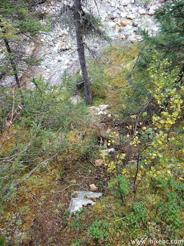
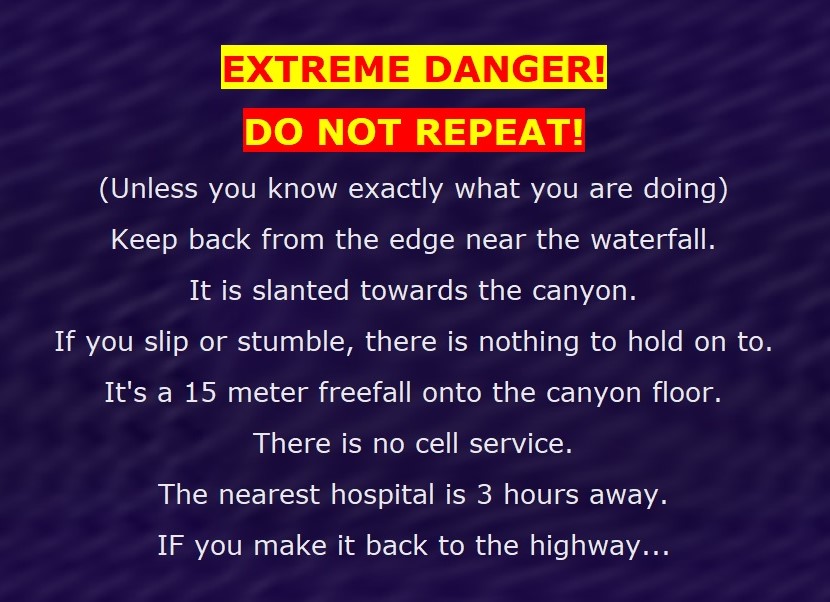
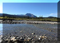
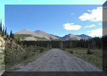
Red Rock Canyon Trail (not to be confused with Red Rock Trail in Lillooet) is located in Northeastern British Columbia by BC Highway 97 (Alaska Hwy) just South of Muncho Lake, which, in turn, is about 245 km North of Fort Nelson. You basically hike up a creek to a small canyon with a rather impressive 15 meter-high waterfall. As we hiked at the end of the season, the water level was low, and we were able to stone-hop in a few locations while crossing the creek and, also, when approaching the bottom of the waterfall at the end of the 200 meter-long canyon. Earlier in the season, or after a heavy rainfall, chances are pretty good that much wading would have to be done while hiking this 2.6 km-long (one way) trail. There are actually three viewpoints: 1) the waterfall view from the path about 100 meter away; 2) the top waterfall view; and 3) the bottom waterfall view via the canyon. Extreme caution must be used when checking out the top waterfall view, as you need to get pretty close to the edge for a better look, and the ground is slanted towards the canyon with nothing to hold on to. It's a very high fall hazard - watch out. There is also a fairly dangerous stretch as you approach the top view, due to a steep unbarricaded drop-off by the path.
Also, there are some overgrown sections, so having a long-sleeved shirt and long pants would save from minor skin damage. The hike steadily gains elevation, but nothing too major as far as steep stretches. It does get very steep as you descend for a few meters towards the top view, but just go past that descent for a minute or so, and you will get to a much easier descent path close to the end of the trail (which is 100 meters past the waterfall top view).
*All trail distances are based on a GPS odometer and are approximate.
31. So, we went to the right at the 2.36 km split, and the path started to climb again. Watch out for steep unbarricaded drop-off after the waterfall viewpoint.
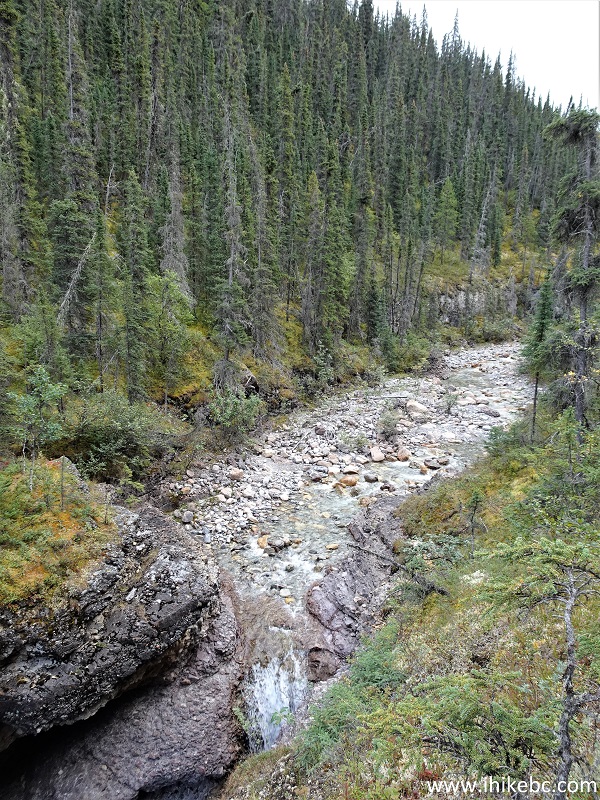
32-34. The waterfall viewpoint is about 100 meters from the split. A plain view, followed by two zoomed views.
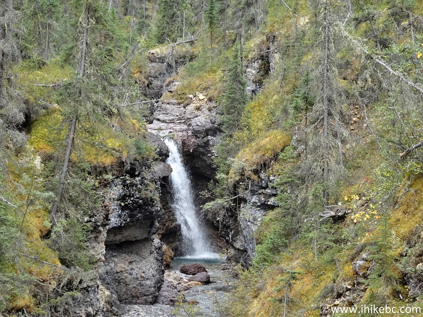
Here is our video of the views from this location.
35-36. Moving on, another 100 meters brings you to the top waterfall view. It's a very steep descent of about 20 meters (photo #35), and it's better to go forward (the path ends in yet another 100 meters) and use another path further on for an easier descent.
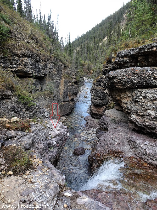
37. Here is the top of the waterfall. The red arrow on the left side shows where we were standing when taking some of the photos and making a video.
38. Even at the end of the season, the volume of water was large enough for a rather impressive waterfall.
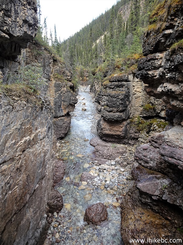
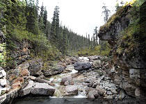
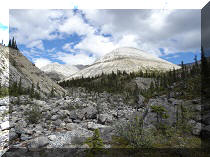
39. The Red Rock Canyon.
40. Do not repeat, seriously. Way too dangerous.
Here is our video of the views from this location.
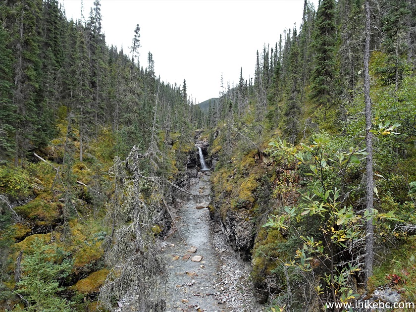
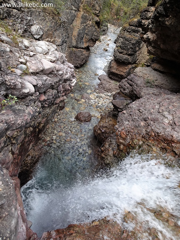
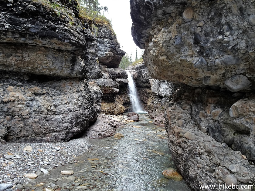
41. After that, we returned to the split seen in photo #29, and went straight. It's about 200 meters from the split to the bottom of the waterfall. Here we are at 60 meters after the split. We were able to stone-hop all the way, but wading would be the only option if the water level would be even a bit higher.
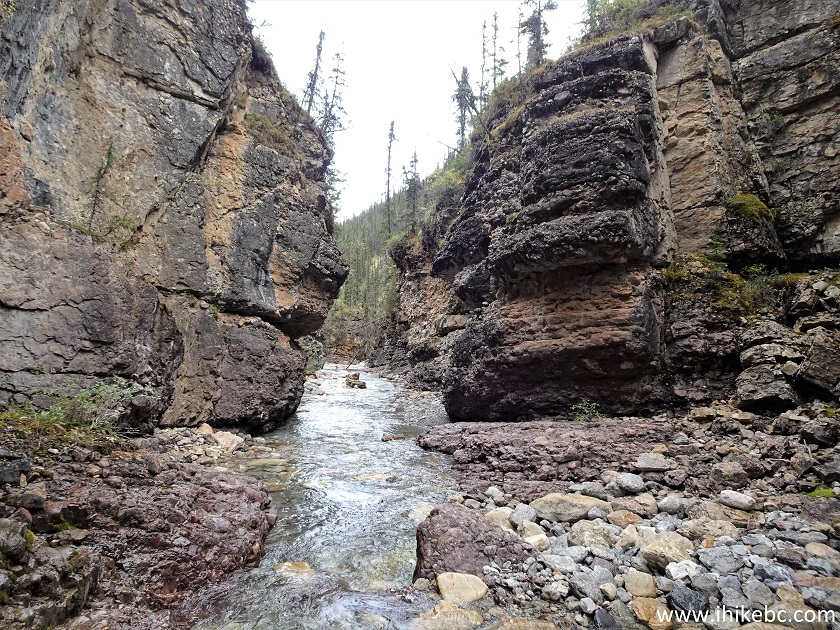
42. At 140 meters from the split, we are already walking through the canyon.
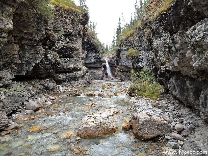
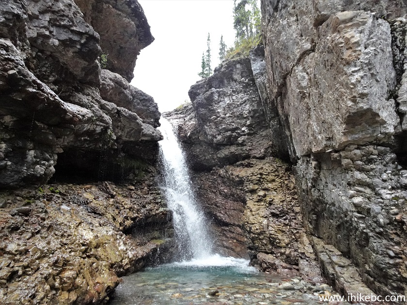
43. The canyon walls provide a different foreground for the waterfall view the closer you get.
44. Almost there.
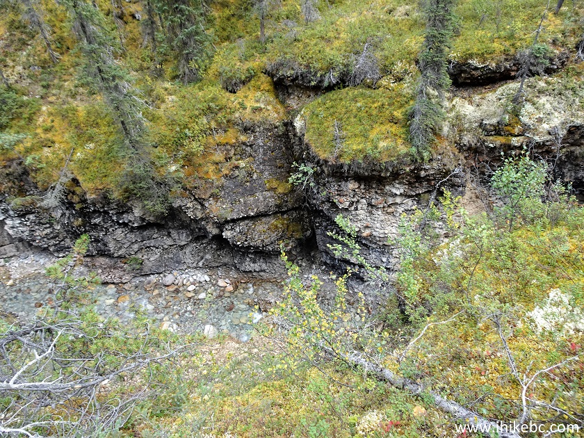
45. Red Rock Canyon wall, looking left.
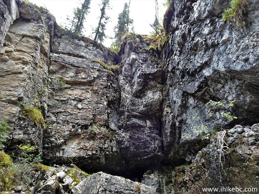
46. There ARE red rocks in this canyon. Here's one.
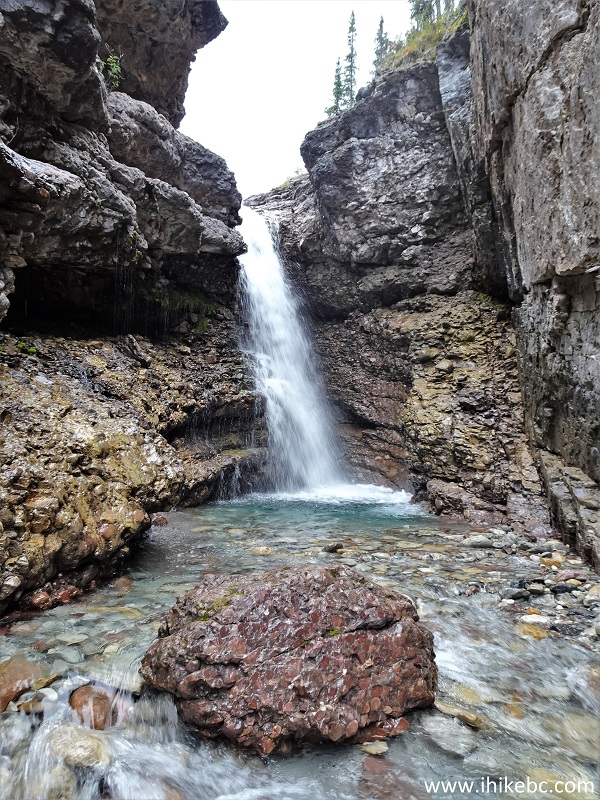
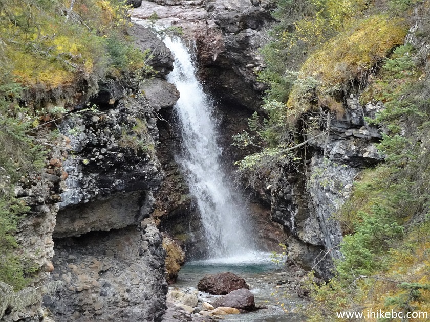
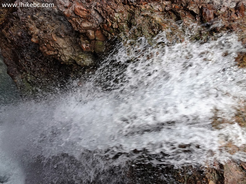
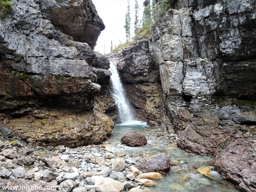
47. Red Rock Falls. Even late in the season the water volume was rather impressive. It must be quite something during the spring runoff.
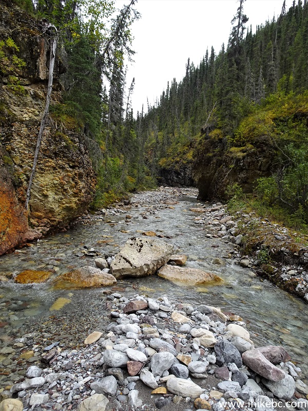
48. Looking back at the Red Rock Canyon.
Here is our video of the views from this location.
More ihikebc videos are on our YouTube Channel.
Aside from the fact that wading-free season here is probably just a few months in a year, and that the top of the falls is a very dangerous area, Red Rock Canyon hike is fairly short and has many fine views. Highly recommended.


|
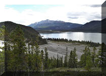 |
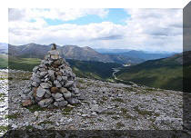
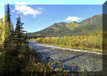
Other Trips in Fort Nelson Area:
|
|
|
|
|
|
|
|
|
|
|
|
|
|
|
|


![]()
![]()
![]()
ihikebc.com Trip 265 - Red Rock Canyon Trail (By Muncho Lake North of Fort Nelson BC) Page 2 of 2