![]()
![]()
![]()

Trip 264 - September 3, 2022 (Saturday)
Peterson Canyon Visit
North of Fort Nelson BC / Near Muncho Lake BC
Page 2 of 2
Liked: Several good mountain and creek views, an old busted shack, a small waterfall, fairly easy biking for most of the way.
Of Note: Tiny vicious/merciless/aggressive/cannibalistic flies attack in hordes and bite off chunks of your flesh, several creek crossings are required - wading is the only option for at least one such crossing, numerous deep cross-ditches, Drogheda Lake may flood the road, impossible to bike all the way (2.5 km remaining if going North to South out of the total distance of about 9 km).
Northern BC Backroad Mapbook (3rd edition) Approximate Trailhead Coordinates: Page 79 (Muncho Lake) E4.
Peterson Canyon, which we biked North-South for 6.5 km (out of the total of approximately 9 km) until stopped by a missing bridge, certainly turned out to be a memorable visit. For starters, despite a very busy hiking season, we have not met a single mosquito on any of our trips. Which is amazing, really. However, Peterson Canyon more than made up for that with hundreds of exceptionally vicious cannibalistic flies. They are about 1/4 the size of a mosquito, but aggressively attack you in large numbers and bite off chunks of your flesh comparable in size to a mosquito bite. The skin then takes 5-7 days to heal and looks rather terrible in the meanwhile. Because the flies make very little noise and are very small, they can successfully attack you before you can even figure out what's going on, and then it's too late. Good thing we had a long-sleeved shirt, carried rain pants, and had a mosquito head net. Otherwise, things could have been much worse. As is, about 50 bites later, we escaped relatively unscathed.
As for the Peterson Canyon itself, the trail is more like a forest service road, hard packed gravel, with lots of loose stones in some stretches, and is an old part of Alaska Highway. There are two ends of this road, both starting off the current Alaska Highway, about 225/236 km North of Fort Nelson and 9/20 km South of Muncho Lake (which has a lodge with an eye-wateringly expensive gas station - about 50 cents per litre more dear than in the Lower Mainland - fuel at Toad River 50 km to the South to save 20 cents or so per litre, if you can. The gas station on the South end of Muncho Lake had broken pumps, so, maybe, it is not as expensive as the lodge).
Aside from the flesh-hungry flies, which may or may not be present during your visit, the main obstacles for this trail are numerous deep cross-ditches, including several containing flowing water. As we biked at the end of the season, the only obstacle requiring wading was the first creek, about 480 meters from the start. We got lazy and did not want to go back to get flip-flops. So, took off boots and socks, took them into the left hand, started crossing the creek, and dropped one boot into the water. Tried to pick it up, but the current was just strong enough to move the boot out of our reach, which then floated around the corner and out of sight. So, got on the bike, rode back to our vehicle, grabbed a spare pair of hiking boots, got back to the creek, started going downstream, and, thank God, found our boot stuck in some branches about 200 meters later.
We then continued with our biking trip, discovered a busted shack and remnants of a burned down house, crossed many cross ditches, crossed a bridgeless Peterson Creek, and were stopped by a missing bridge at about the 6.5 km mark. Hikers might find a way to cross to the other side and proceed for the next 2.5 km or so to the South end of the trail, but the canyon walls were too steep to drag the bike up, so we headed back.
*All trail distances are based on a GPS odometer and are approximate.
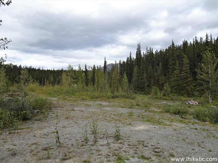
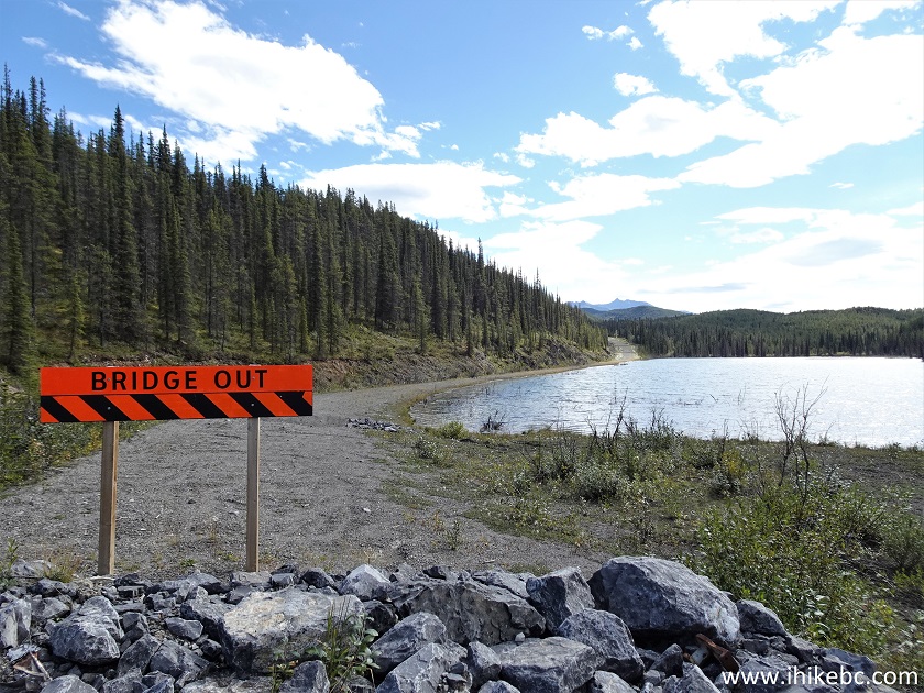
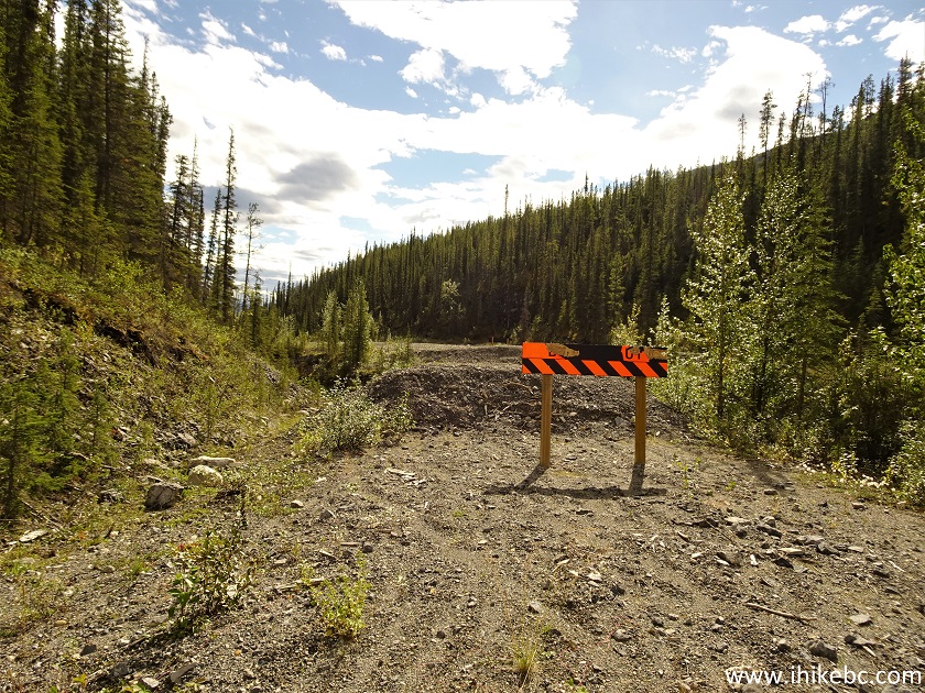
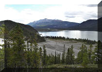
23. At 1.78 km, we have reached Drogheda Lake. A sign says "bridge out", but it refers to a point later on.
.JPG)
Drogheda Lake British Columbia
24. If you want to visit the remnants of a burned down house, as well as a busted shack, turned left before the sign.
25-26. Here is a basement of a burned down house, about 50 meters from the trail.
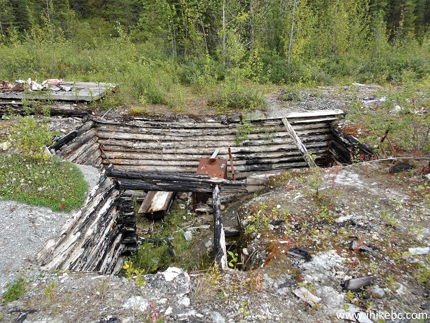
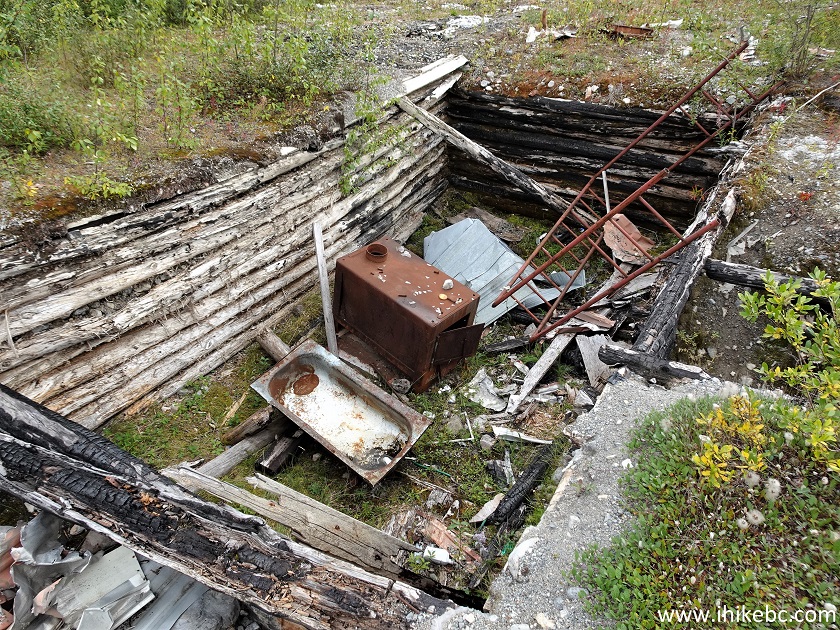
British Columbia Peterson Canyon Busted House
27-28. Just a bit further, there is a busted shack, probably a former workshop of some kind.
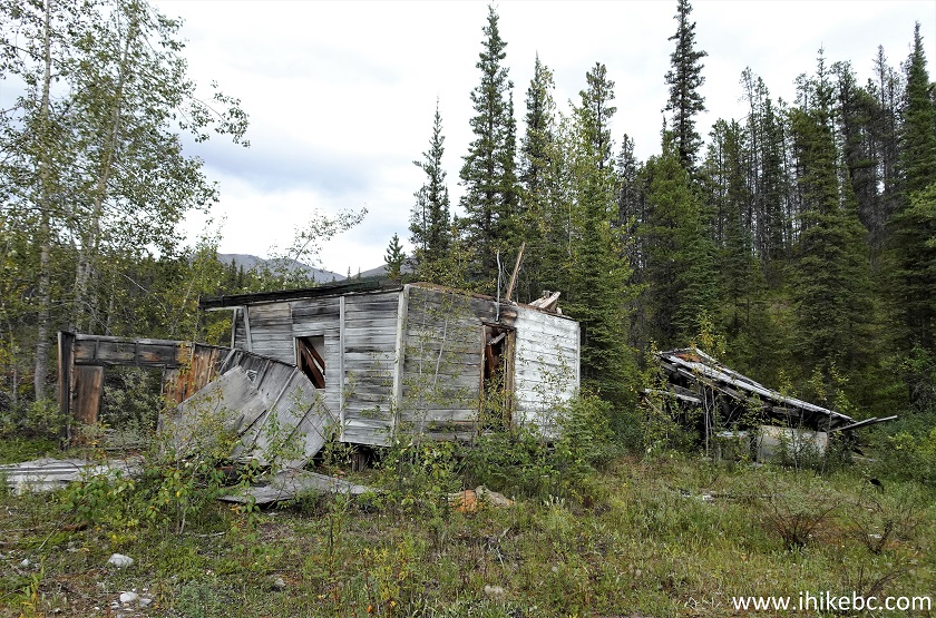
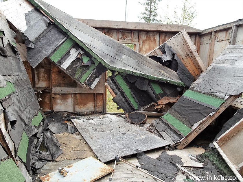
Busted Shack Peterson Canyon near Muncho Lake British Columbia Canada
29. Back on the trail.
Peterson Canyon - Drogheda Lake
30. Drogheda Lake wasn't too bad today, but may become impassable in high water conditions.
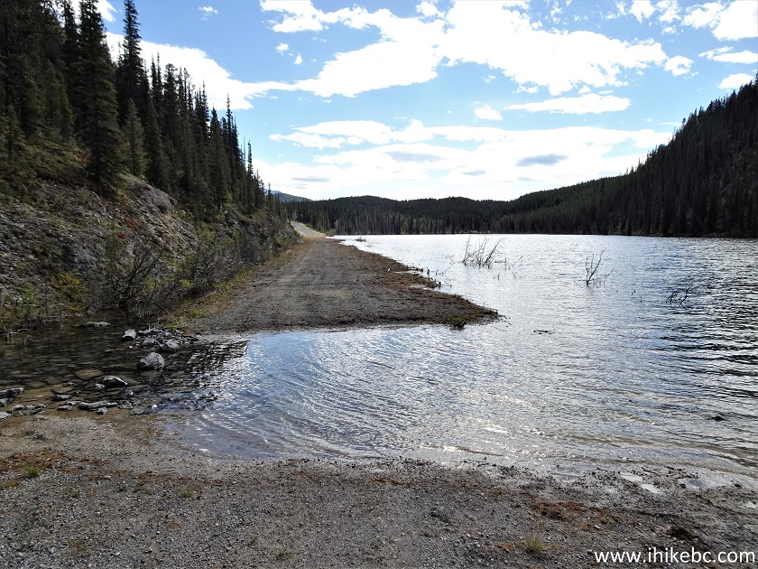
Drogheda Lake British Columbia
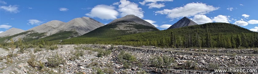
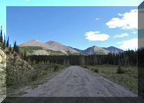
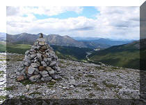
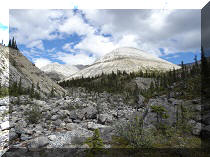
31. Another fine mountain view at 2.74 km of the trail.
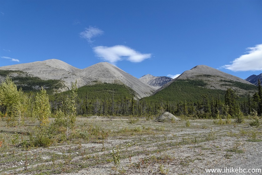
Peterson Canyon Mountains
32. Now a panorama.
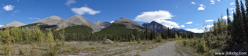
Mountains of Peterson Canyon
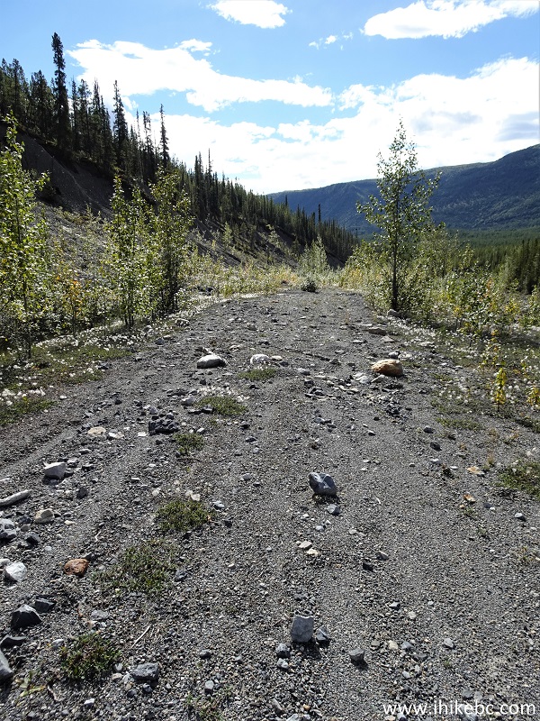
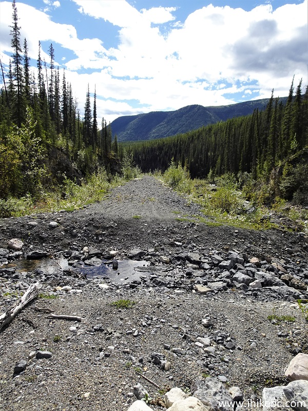
33. At 3.09 km, the trail is still easy to bike. There are no very steep stretches on this road, just a gentle elevation change here and there.
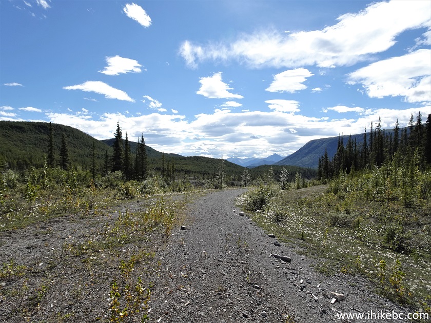
Peterson Canyon BC Canada
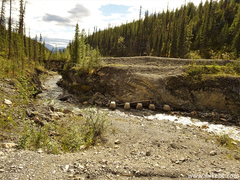
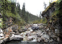
34. At 3.56 km, we arrived to a "bridge out" point of the road. It even showed that on our GPS trail ribbon. Peterson Creek flows here, and it obviously becomes very large during the spring runoff, moving substantial amounts of stones around, which makes it impossible to bike.
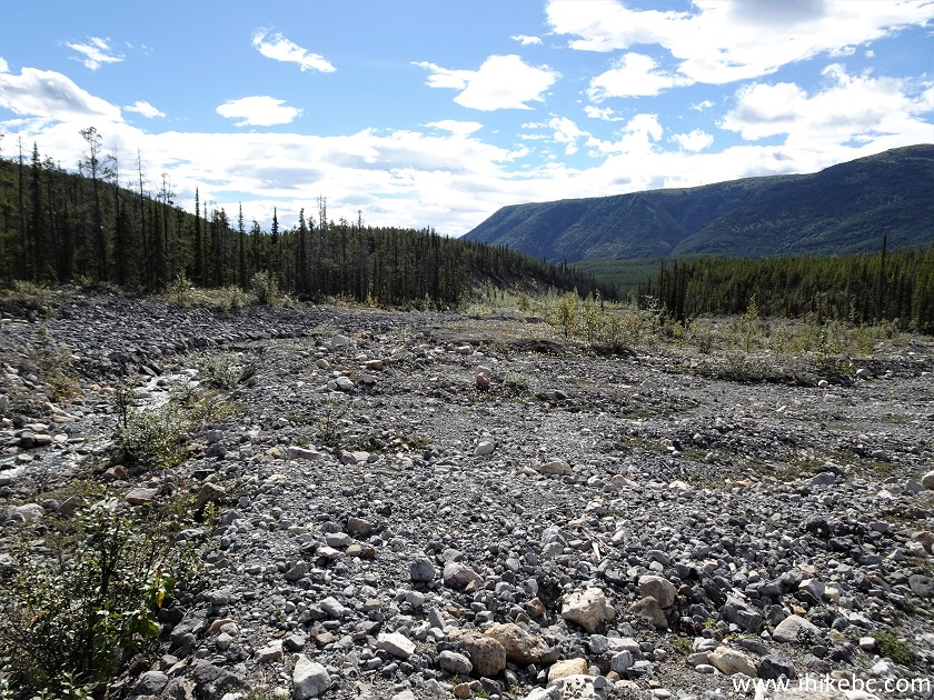
Peterson Creek Flood Plain
35-36. A very fine view to the left (plus a panorama) at this point too.
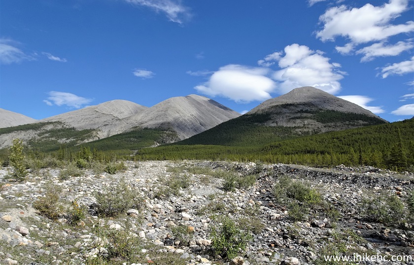
View from Peterson Canyon in Northern British Columbia
Peterson Canyon Mountains Panorama
37. Crossing Peterson Creek. Coordinates: N 58°49.758’ W 125°43.076’. Elevation: 1,095 meters.
Peterson Creek British Columbia
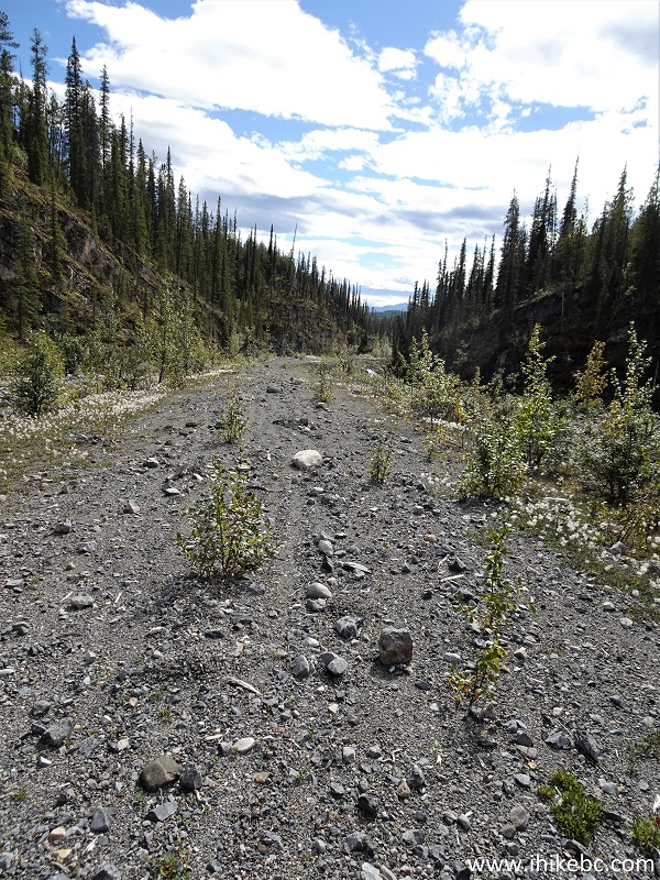
38. After that, the road becomes more difficult for biking, due to frequent stretches of loose stones. At 3.86 km here.
Peterson Canyon
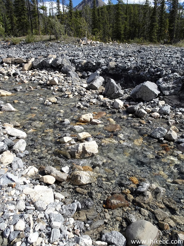
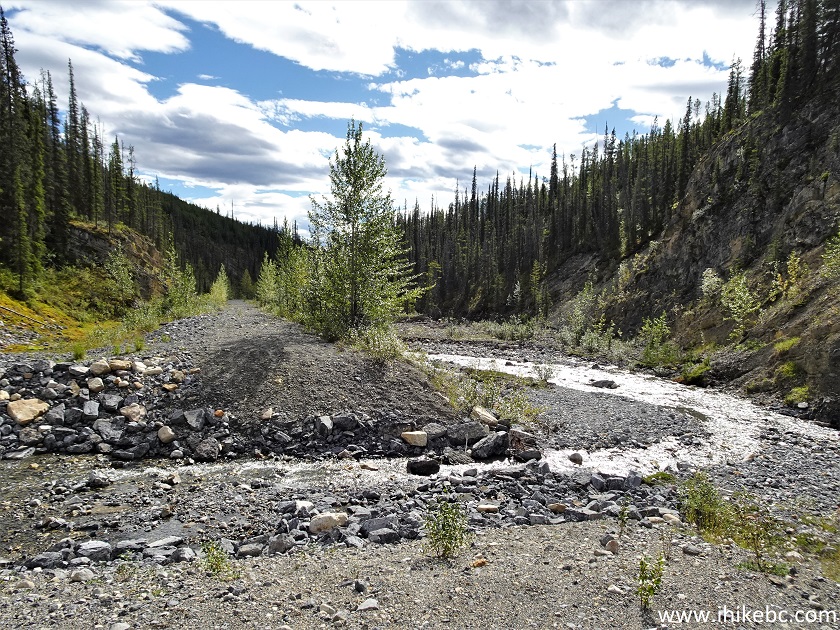
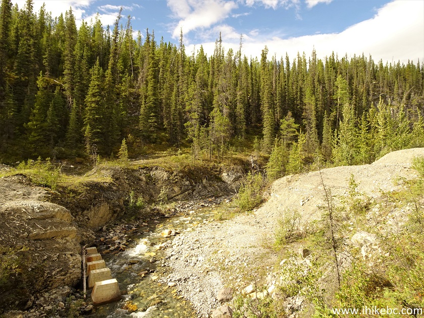
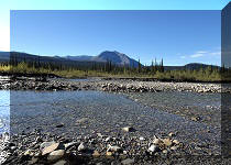
39. Another complicated crossing of Peterson Creek arrived at 4.36 km.
Peterson Creek in Peterson Canyon
40. The cross-ditches were here as well. At 4.52 km now.
Peterson Creek BC Canada
41. It appears there is less traffic after the main crossing of Peterson Creek, as trees are starting to grow in the middle of the road. At 5.06 km here.
Biking in Peterson Canyon British Columbia
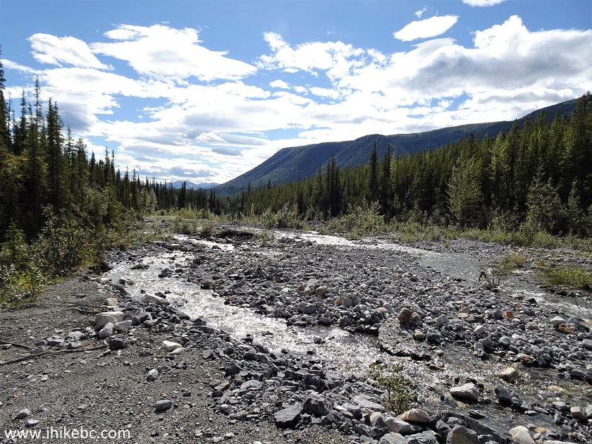
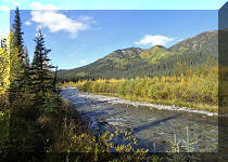
42. A fine view of Peterson Creek at 5.26 km. Looking back.
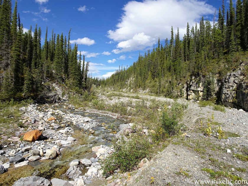
Peterson Creek BC Canada
43. At 5.48 km, a Peterson Creek tributary creates a pleasant-looking scene and another stone-hopping opportunity.
Peterson Canyon Northern British Columbia
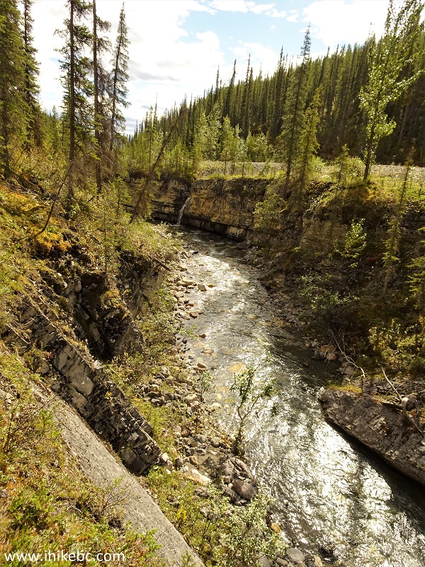
44-46. Our forward progress ended at the 6.42 km mark, where a missing bridge and steep canyon walls made it impossible to proceed with a bicycle. Coordinates: N 58°48.351’ W 125°43.690’. Elevation: 970 meters. Hikers might be able to get through and see the final 2.5 km or so of the trail before reaching the south end of the Peterson Canyon Trail seen in photo #4.
Peterson Canyon Busted Bridge
47. Looking left. There is a small waterfall there.
48-49. Here it is.
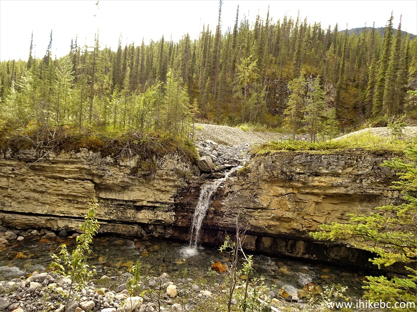
Peterson Canyon Waterfall
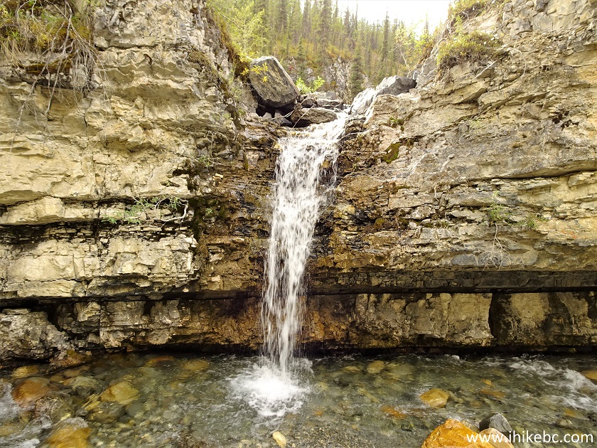
Waterfall Peterson Canyon British Columbia Canada
Here is our video of the views from this location.
More ihikebc videos are on our YouTube Channel.
Peterson Canyon has enough good views to make it a
recommended trip (in low water conditions). But, if the cannibalistic
flies are present (and they attack you right at the parking lot), avoid
like plague. There are plenty of other fine trips in this area.


|
 |
Other Trips in Fort Nelson Area:
|
|
|
|
|
|
|
|
|
|
|
|
|
|
|
|


![]()
![]()
![]()
ihikebc.com Trip 264 - Peterson Canyon Visit (By Muncho Lake North of Fort Nelson BC) Page 2 of 2