![]()
![]()
![]()

Trip 234 - September 10, 2021 (Friday)
Teetering Rock Trail Hike
North of Fort Nelson, BC
Page 2 of 2
Liked:
A fairly easy trail (up to the boulder field) through a pleasant forest, colourful plants, several fine forest scenes, impressive mountain and valley views from the first viewpoint, several interesting large stones / stone formations, shade in the forest, no bugs.Of Note: The trail is badly overgrown at 2.0 km for about 200 meters, occasional noise from Hwy 97 until the campsite with a busted toilet, several muddy sections, extremely dangerous boulder field at the end of the trail. Hiking poles and boots are recommended (up to the boulder field) and are essential for the boulder field and beyond. Rain/long paints and a long-sleeved shirt would be very useful as well, especially for the overgrown part of the trail. A GPS with a trail ribbon highly recommended for the boulder field, and for the overgrown part of the trail.
Northern BC Backroad Mapbook (3rd edition) Trailhead Coordinates: Page 80 (Steamboat) E5.
Other Trips in Fort Nelson Area: Dunedin Trail, Fort Nelson BC Visit, Summit Peak Trail, Summit Ridge Trail, Stone's Sheep Trail.
Teetering Rock Trail is located in Northeastern British Columbia, off Highway 97, approximately 95 kilometers North of the town of Fort Nelson. It's mostly an easy-to-moderately difficult trail, until a very complicated boulder field closer to the end of the hike. This trail is named after a large rock, "teetering" on top of a mountain and appearing ready to fall down in the foreseeable future. The rock itself is not very appealing, but there are other decent rock views in that area. A very impressive First Viewpoint could be a good destination, if you want to have a shorter hike.
Teetering Rock Trail is about 12 km long one-way, and has four distinctive stretches. Trailhead to First Viewpoint - 4.75 km. First Viewpoint to Camping Area - 3.0 km. Camping Area to Boulder Field - 2.7 km. Boulder Field to end of trail - about 1.2 km. The trail is mostly easy to follow, though a 200-meter-long stretch at around the 2.0 km mark is badly overgrown, and a GPS with a trail ribbon might prove very helpful.
Today, we made it all the way to the boulder field, and even went forward for about 300 meters, when we realized that this field is a disaster waiting to happen, turned around, went back, and then the disaster did happen before we cleared from the boulder field. We stumbled, slipped from a stone, and fell down head first for about 2 - 2.5 meters, landed on our left hand with a heavy backpack pushing from above, and briefly dislocated the shoulder. It popped back in by itself within a minute, but it sure was not a pleasant feeling standing in the middle of nowhere, surrounded by huge stones, with a sharp shoulder pain, and figuring out what to do next. The SOS button in our Inreach satellite device was pretty close to being used for the first time, but we managed to walk out, and headed to Fort Nelson hospital, where it was determined that it wasn't all that bad. A serious shoulder sprain all it was, and we lived to hike another day.
22. Now hiking from the first viewpoint to the camping area, which is three kilometers away.
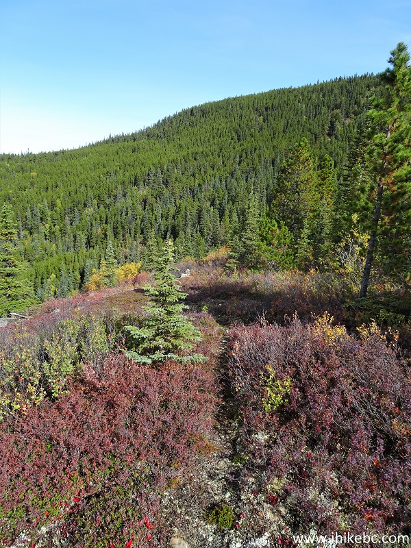
Teetering Rock Trail in Fort Nelson BC Area
23. 185 meters from the viewpoint, we are entering the forest again.
Northern British Columbia Hiking - Teetering Rock Trail
24. At 890 meters, there is a split. Coordinates:
N 58⁰42.630' W 123⁰54.967'. Elevation: 1,224 meters. To the right is a shorter trail, apparently up a mountain. The main trail is left/straight. In our GPS with Backroad Mapbook software, both trails were indicated by trail ribbons, and both were called "Teetering Rock Trail."
Hiking Teetering Rock Trail in Northern British Columbia Canada
25. We continued on the main trail (never explored the trail on the right), and here it is at 2.9 km from the first viewpoint, where it got muddy for a short bit. This being the end of a fairly dry season, chances are pretty good that Teetering Rock Trail is substantially muddier than this in the middle of the Summer.
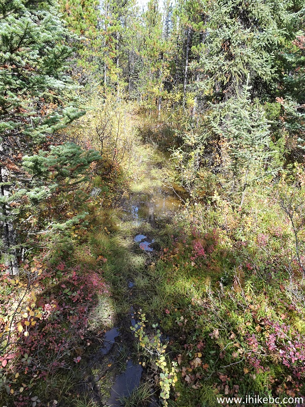
Muddy Teetering Rock Trail British Columbia Canada
26-27. At 3.0 km from the first viewpoint (7.75 km from the trailhead), we have reached the camping area. There are two picnic tables here, a metal fire ring, and a busted outhouse.
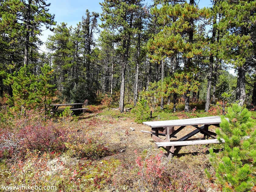
Teetering Rock Trail Camping Area
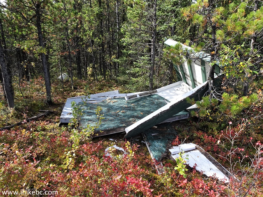
Teetering Rock Trail Busted Outhouse
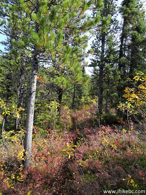
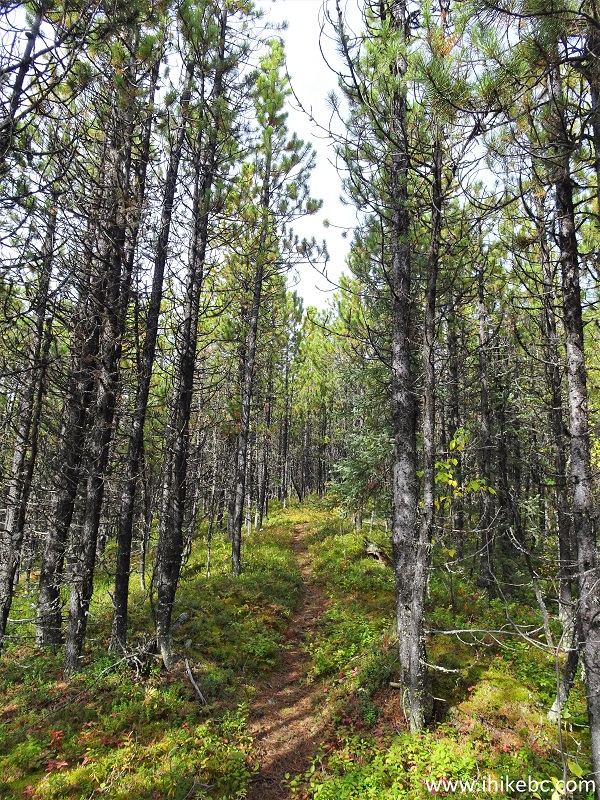
28. From the camping area, it's 2.7 km to the end of the obvious trail and the start of that challenging boulder field. At 340 meters past the camping area here.
Hiking in Fort Nelson BC Area - Teetering Rock Trail
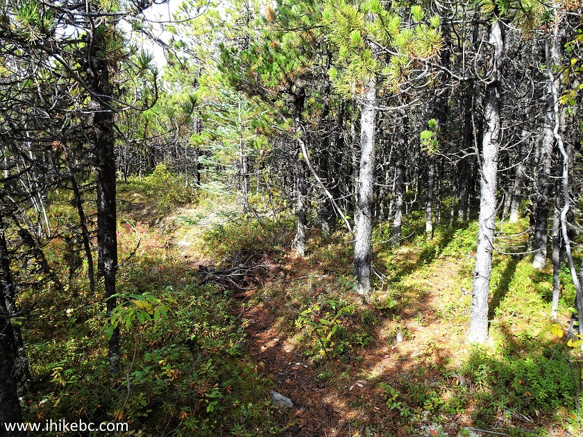
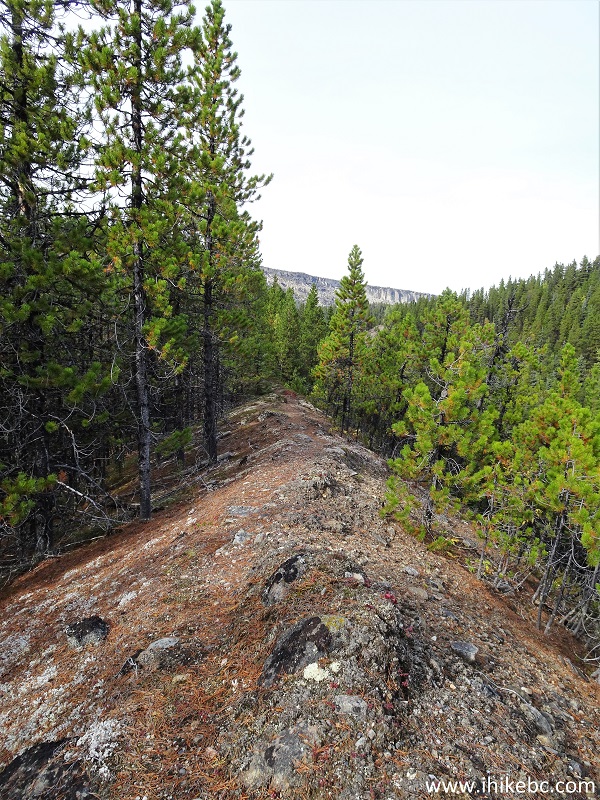
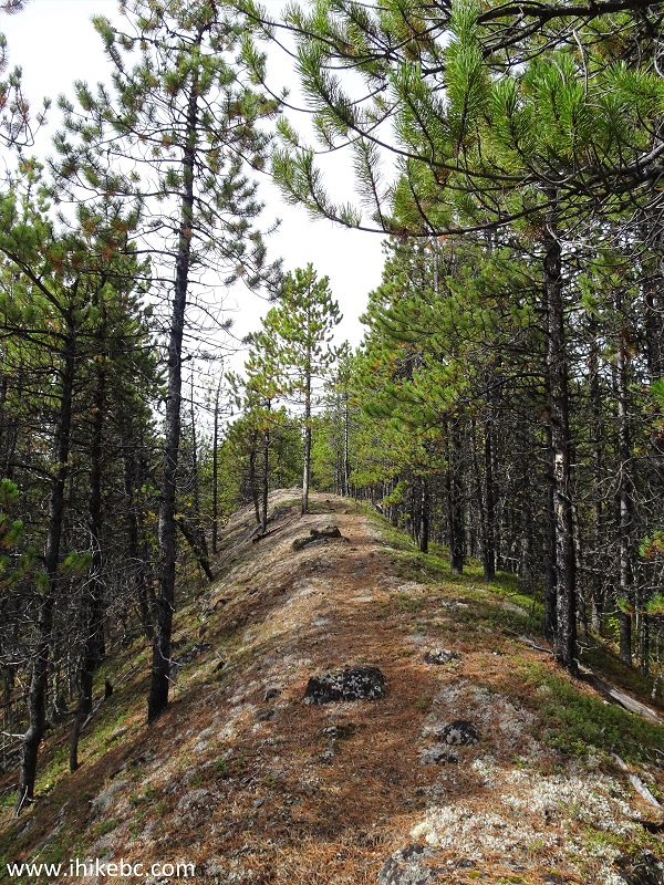
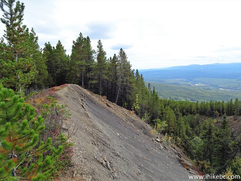
29. Another fine ridge hike begins at 980 meters.
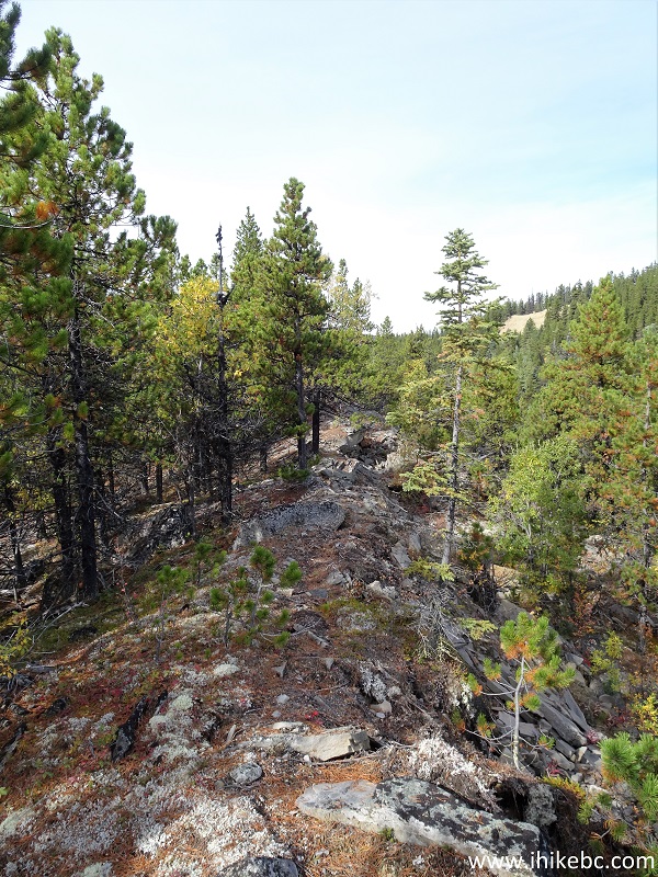
Teetering Rock Trail in Fort Nelson BC Area
30. At 1.35 km from the camping area now.
British Columbia Hiking - Teetering Rock Trail
31-32. A fine view to the right at 1.58 km. Plain and zoomed. Teetering Rock is to the left, soon to be seen.
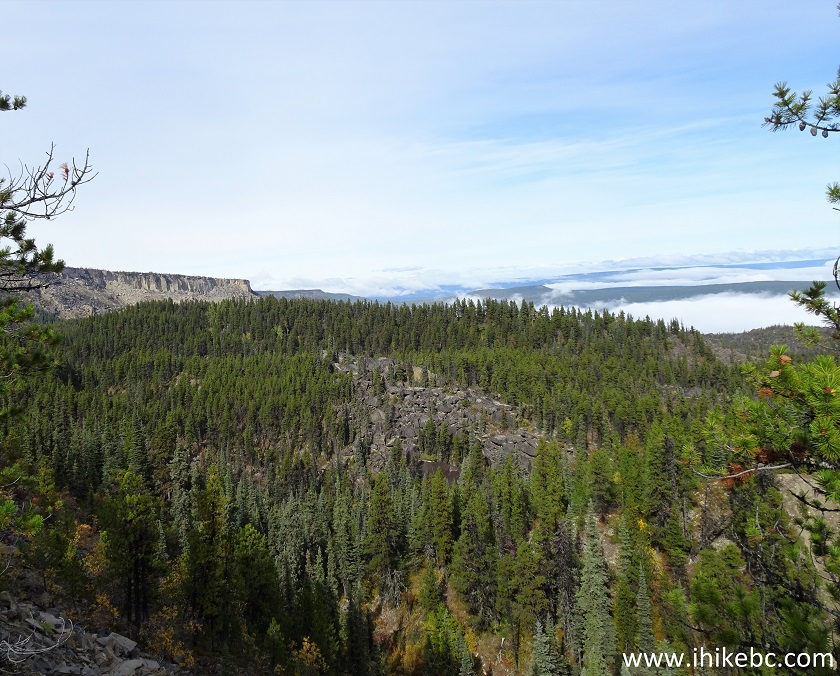
View from Teetering Rock Trail on Northern British Columbia Canada
Teetering Rock Trail View
33. At 1.69 km, you reach a T-junction with a barely standing sign. Turn to the right.
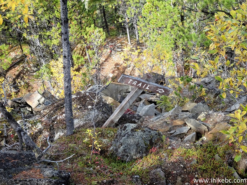
Hiking in British Columbia - Teetering Rock Trail
34. The ridge hike continues. At 2.20 km from the camping area now.
Teetering Rock Trail
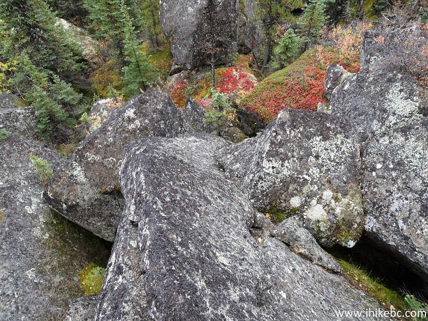
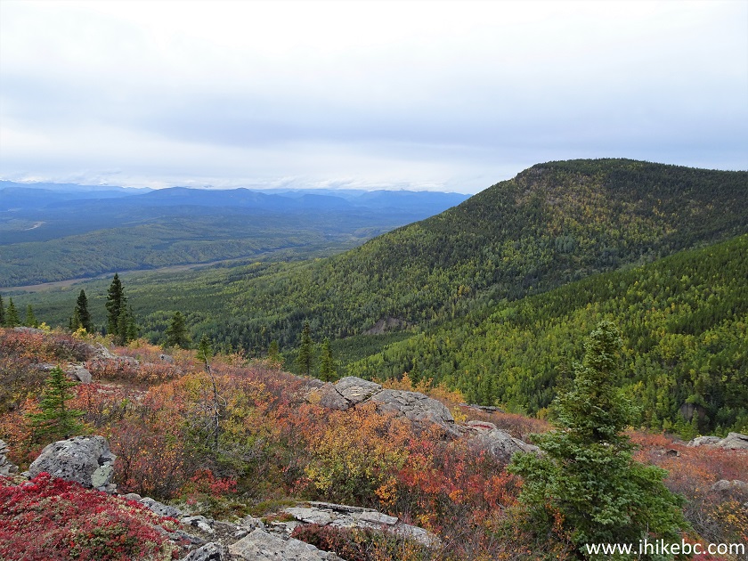
35. Colours. At 2.68 km.
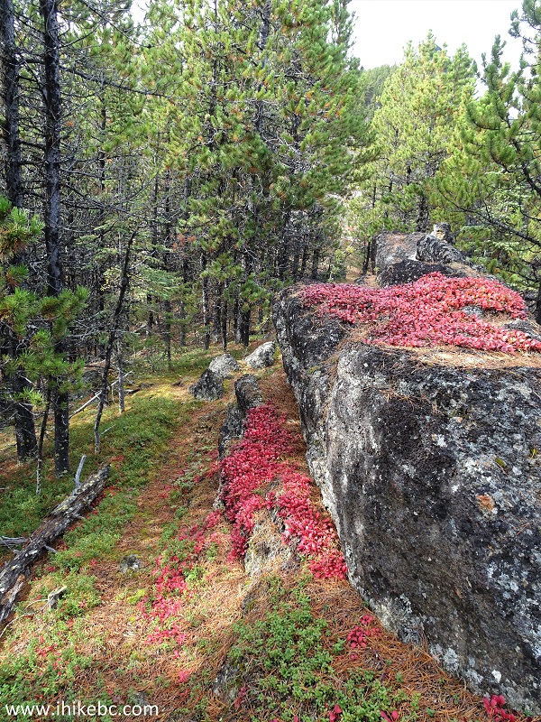
Canada Hiking - Teetering Rock Trail - Northern British Columbia
36. At 2.70 km from the camping area (10.45 km from the trailhead), the obvious trail ends at this very obvious ridge. Coordinates:
N 58⁰44.486' W 123⁰57.890'. Elevation: 1,311 meters.
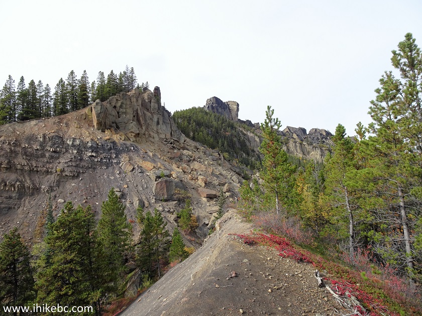
Teetering Rock Trail Hike
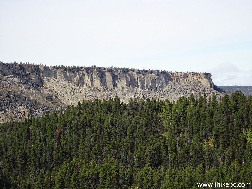
37-38. Neat stone formations straight ahead.
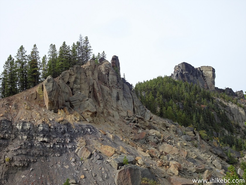
View from Teetering Rock Trail
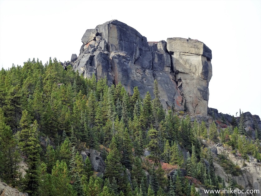
Teetering Rock Trail View British Columbia
39. From here, it's a boulder field of about one kilometer long, and then a scramble up to the Teetering Rock. It's a nasty boulder field, full of huge stones and much vegetation in-between. There is no trail, no markers, and the GPS trail ribbon is of little use. You jump off a stone only to have one or both of your feet fall through mossy ground up to the knee. It's not very often that we turn around before reaching the end of the trail, but this was one such time. We went forward for about 300 meters, turned around, went back for 100 meters or so, fell down, got substantially hurt. This is the beginning of the boulder field. It's not too bad, but then things get complicated in a hurry.
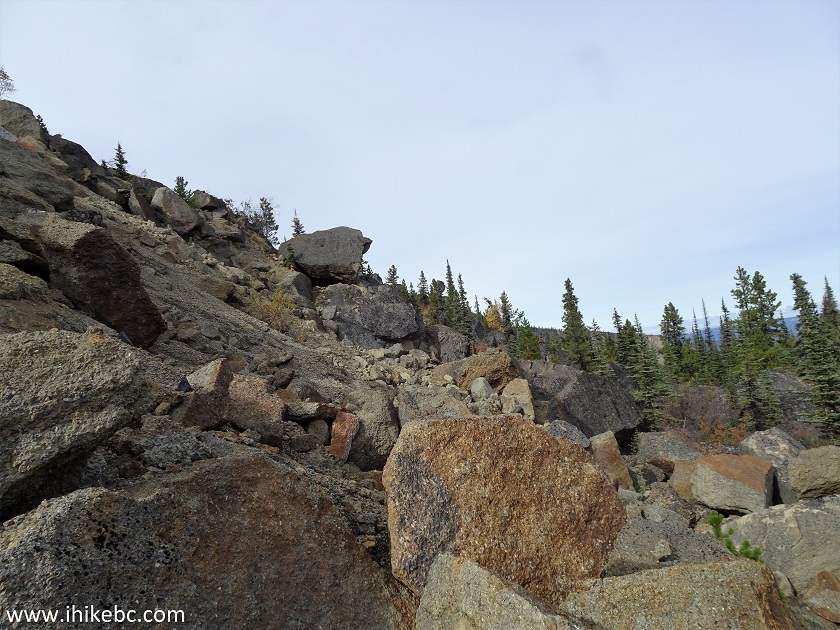
Teetering Rock Trail Boulder Field
40. We might have fallen from this stone, or another one like that, but boy was it ever not fun. Falling for 2-2.5 meters face forward for several seconds trying not to hit the rock-strewn ground below with your face, smacking into the ground with left hand stretched forward and feeling the shoulder joint pop out, getting a sharp pain and trying to figure out what to do next, was definitely not the highlight of this hike. Fortunately, the joint went back to its place by itself within a minute, and we were able to hike out before heading to Fort Nelson hospital.
Boulders on Teetering Rock Trail in Northern BC Canada
41-42. Before the nasty fall, took a photo of the Teetering Rock (slight zoom, and a lot of zoom).
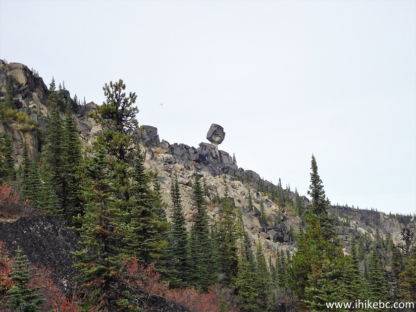
Teetering Rock in Northern British Columbia
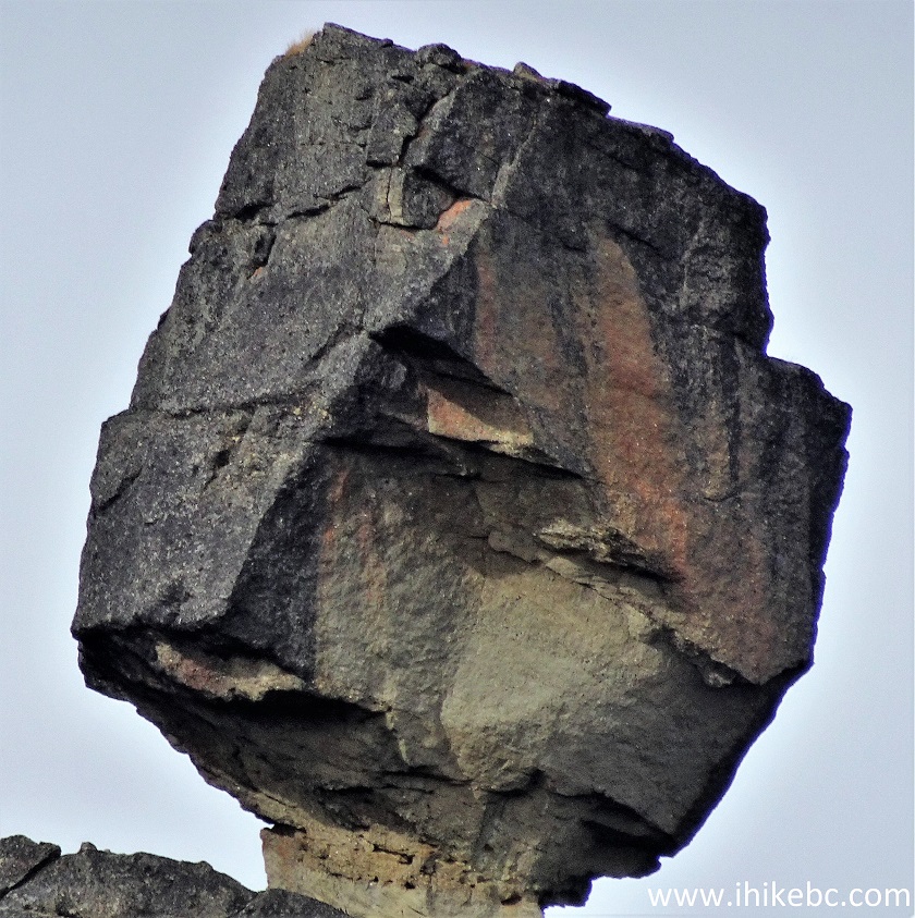
Teetering Rock
43. A neat view to the right.
View from Teetering Rock Boulder Field
45. And we are back at the ridge seen in photo #36, looking back now.
Teetering Rock Trail in Fort Nelson British Columbia Canada Area
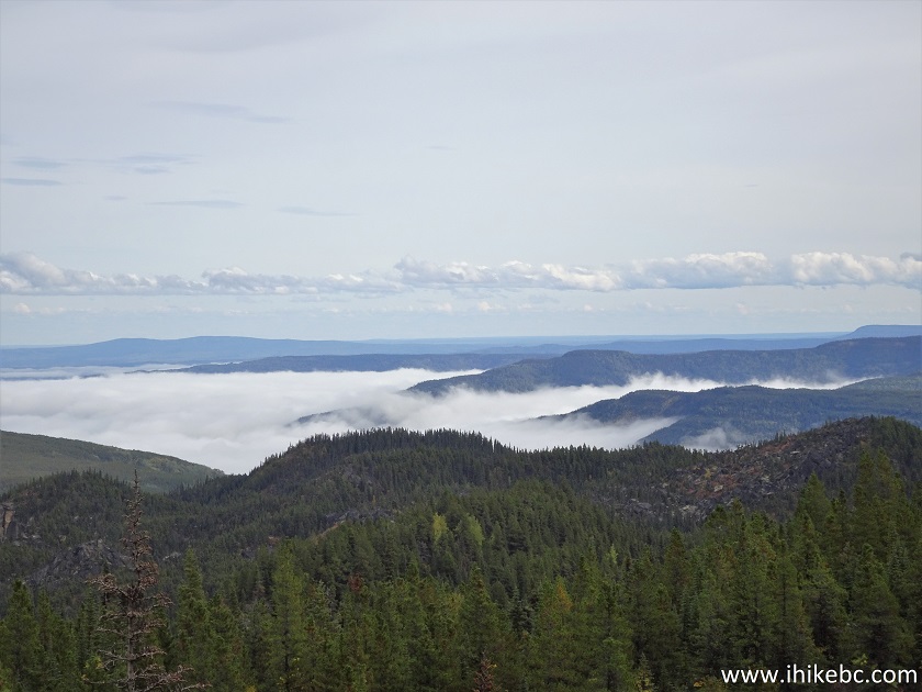
46-47. To wrap things up, a few more photos of the fine views from the first viewpoint, taken on the way back.
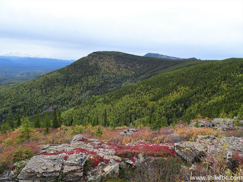
View from Teetering Rock Trail First Viewpoint
Teetering Rock Trail has numerous fine views, especially from the first viewpoint. Highly recommended up to the boulder field, but not recommended further than that due to very dangerous conditions even when it's completely dry.


|
 |
![]()
![]()
![]()
ihikebc.com Trip 234 - Teetering Rock Trail Hike (North of Fort Nelson BC) Page 2 of 2