![]()
![]()
![]()

Trip 162 - July 19, 2019 (Friday)
Odegaard Falls Trail Hike
Near Bella Coola / Hagensborg
British Columbia
Liked: Odegaard Falls, Nusatsum River Falls, a neat forest.
Of Note: Nusatsum FSR is very rough - high-clearance vehicles only, 2WD vehicles may not make it all the way. Creeks are damaging the road at 21.2 and 21.5 km of the FSR. The bridge is out at 21.5 km – creek crossing is required. Logging trucks may be present. Vegetation is too close to the road in some spots – your vehicle would likely get scratched. Some bugs. Hiking poles and boots are recommended.
Cariboo Chilcotin Coast BC Backroad Mapbook (4th edition) Trailhead Coordinates: Page 23 (Turner Lake) B3.
>>> British Columbia Waterfalls Visits.
Odegaard Falls cascades several hundred meters down the mountain face. It is a very impressive sight. But, to get to it, one would have to navigate a complicated Nusatsum Forest Service Road, which may get washed out at any moment. The logging operation is taking place before the spots where the creeks are eroding the FSR, so, chances are, if the road goes, it won't be fixed any time soon. If you do manage to get to the trailhead, you would be treated to a short (20 minutes) and uncomplicated path through a neat forest. The waterfall then could be easily observed from a bridge. Or, you may proceed to the end of the trail, though that would require navigating a steeper terrain. An additional 25 minutes is all it would take to get to the top viewpoint, and the total hike would hardly be much longer than 1.5 hours round trip time. You would definitely spend more time driving on Nusatsum FSR to and from the trailhead.
1. We are Eastbound on BC Highway 20, with Bella Coola about 23 kilometers behind us, and Hagensborg about 5 kilometers behind. Getting ready to make a right turn (immediately before the bridge) onto Nusatsum Forest Service Road. Coordinates: N 53⁰23.292' W 126⁰27.670'. Elevation: 121 meters.
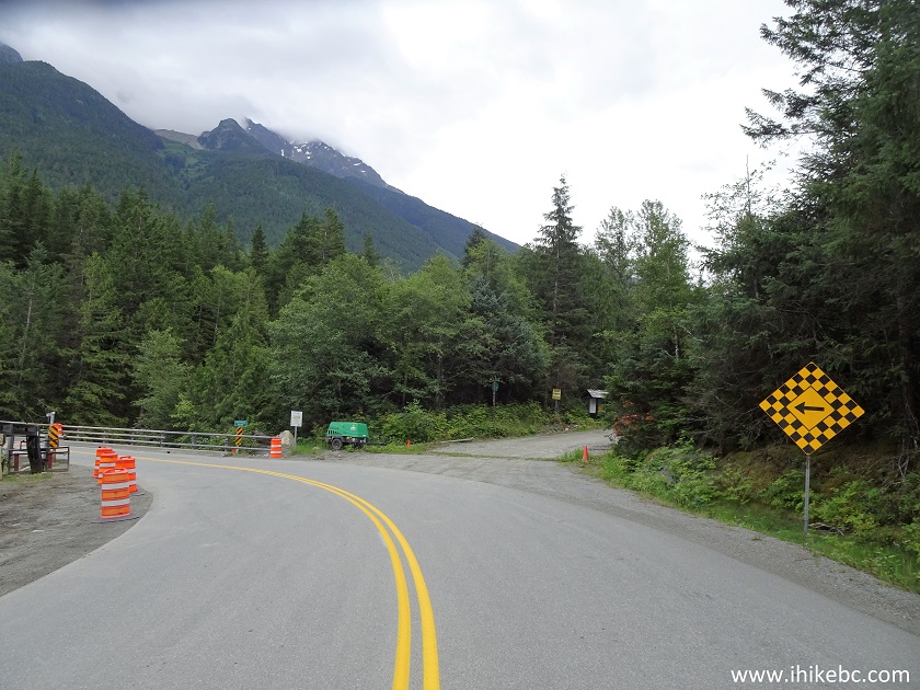
BC Highway 20 East at Nusatsum FSR Turnoff
2. The start of Nusatsum FSR. The slides have been cleared, but a washout can happen at any moment. Zero your odometer at the start of the FSR, if you want to follow the mileage markers in this trip report.
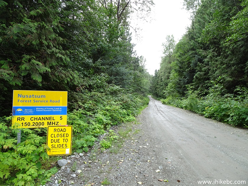
Nusatsum FSR start
3. Nusatsum Forest Service Road is very rough, and driving at speeds exceeding 25 km/h is unlikely. Stay right at the split at the 13.5 km mark, pictured below. The sign would say "13 km" very shortly, but it's off by a few hundred meters.
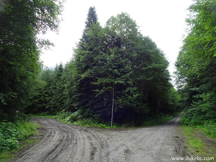
Nusatsum Forest Service Road near Bella Coola and Hagensborg British
Columbia
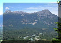
4. There are not too many good views for the first 20 or so kilometers of Nusatsum FSR, but here is a good view from one of the several bridges.
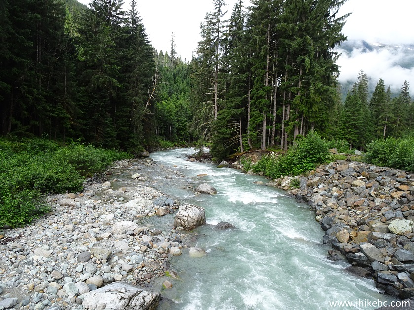
River view from Nusatsum FSR by Hagensborg BC Canada
5. Beware of logging trucks. As of the time of writing, there was a logging operation ongoing at about the 11 km mark of Nusatsum FSR. Also, note, that this forest service road is brushed in here and there, so your vehicle would likely get scratched.
Nusatsum FSR near Bella Coola British Columbia Canada
6. There is an especially nasty spot, at about the 20 km mark, and it lasts for close to 500 meters - it's very steep there, with loose stones. Here is a photo of an ATV we met on the way back - it's on top of that hill, which we are about to descend. Note the loose stones behind the ATV - the entire hill is made of those, and this is where some 2WD vehicles may not be able to go any further.
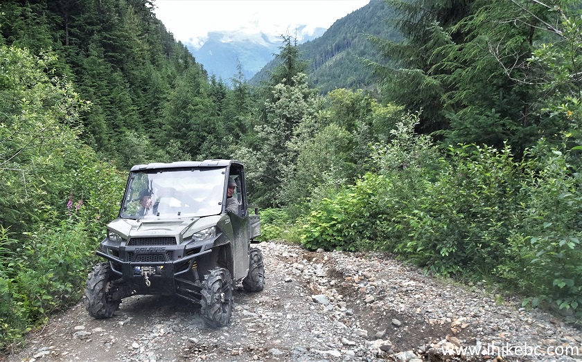
Nusatsum Forest Service Road British Columbia Canada
7. Things start to get really interesting at the 21.2 km mark. First, a creek is actively eroding the road surface.
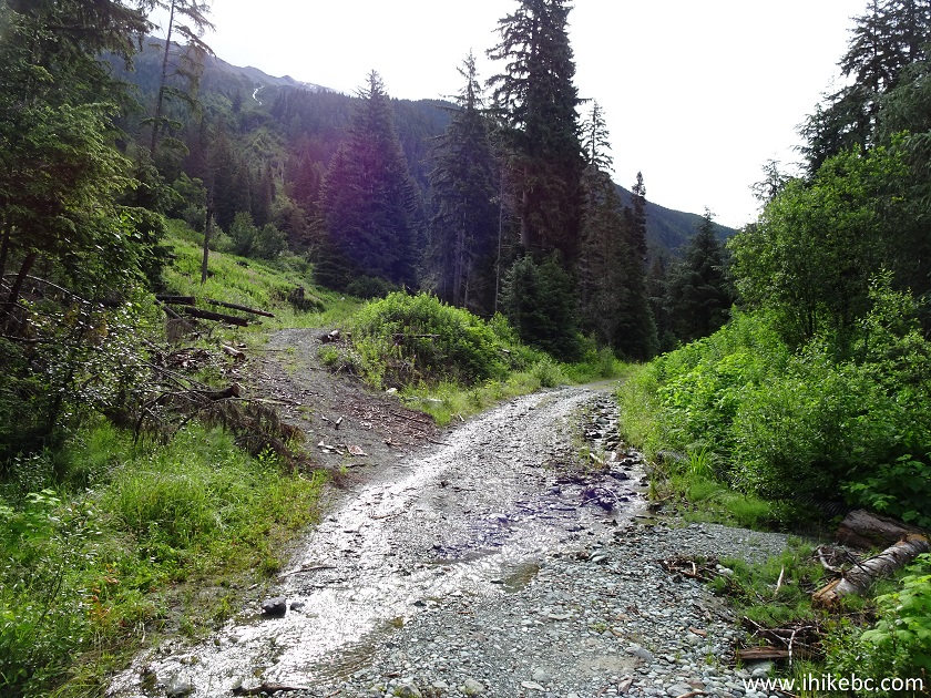
Creek eroding Nusatsum FSR
8. And, just 300 meters later, the bridge is out! Coordinates: N 52⁰15.839' W 126⁰18.696'. Elevation: 741 meters.
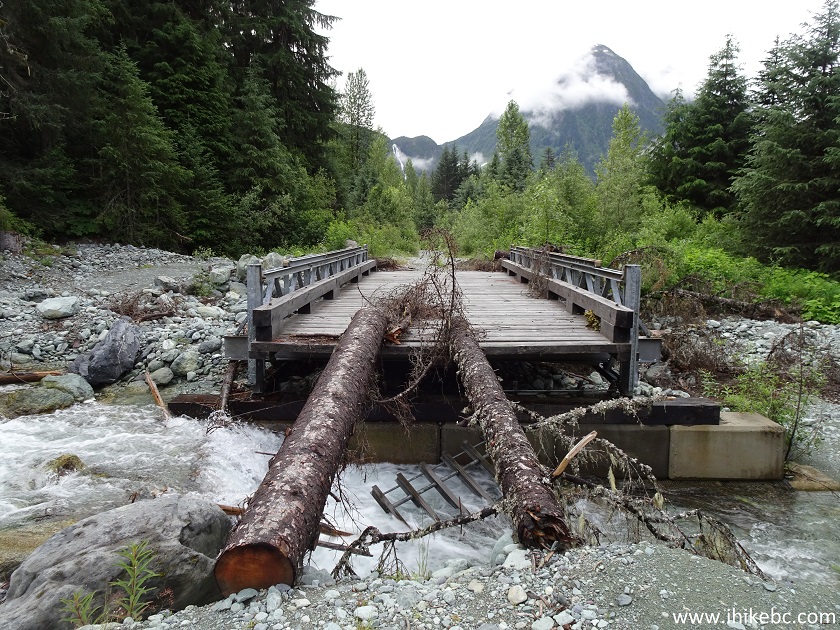
Nusatsum Forest Service Road Bridge Out
9. It is still possible to cross the creek to the left of the bridge, but watch out for the water level and the speed of the flow.
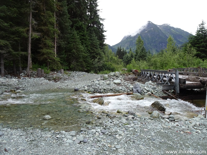
Nusatsum FSR near Hagensborg BC
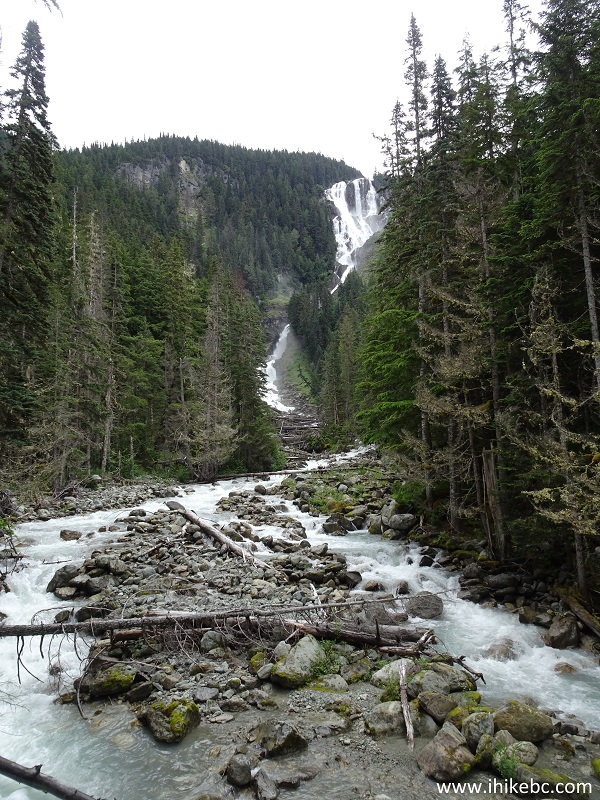
10-11. At the 24.3 km mark, Odegaard Falls viewpoint offers a good view of the waterfall. Coordinates: N 52⁰14.732' W 126⁰18.414'. Elevation: 795 meters.
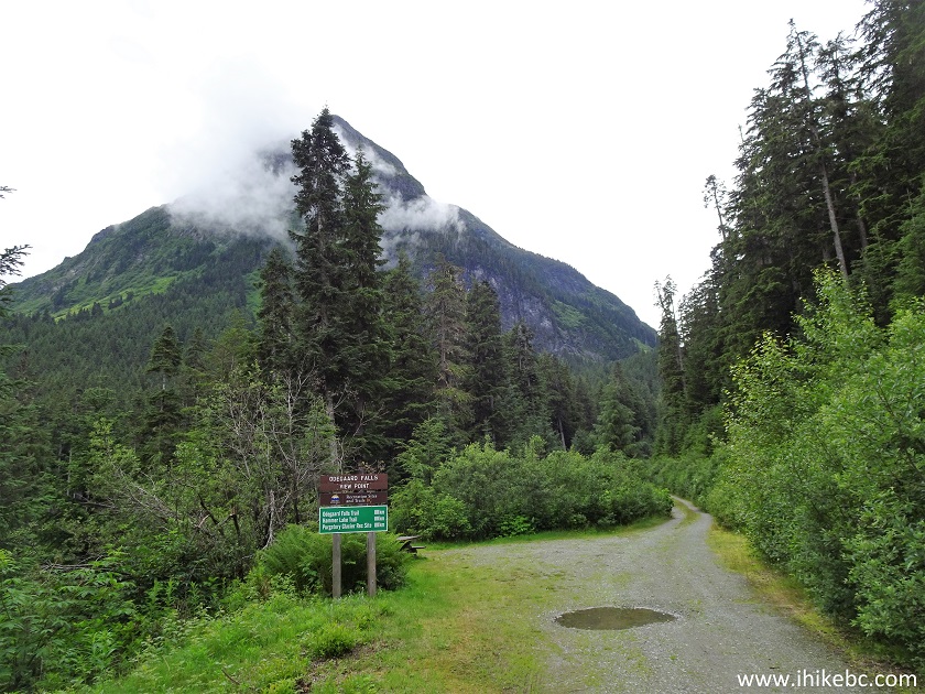
Nusatsum FSR near Bella Coola and Hagensborg British Columbia Canada
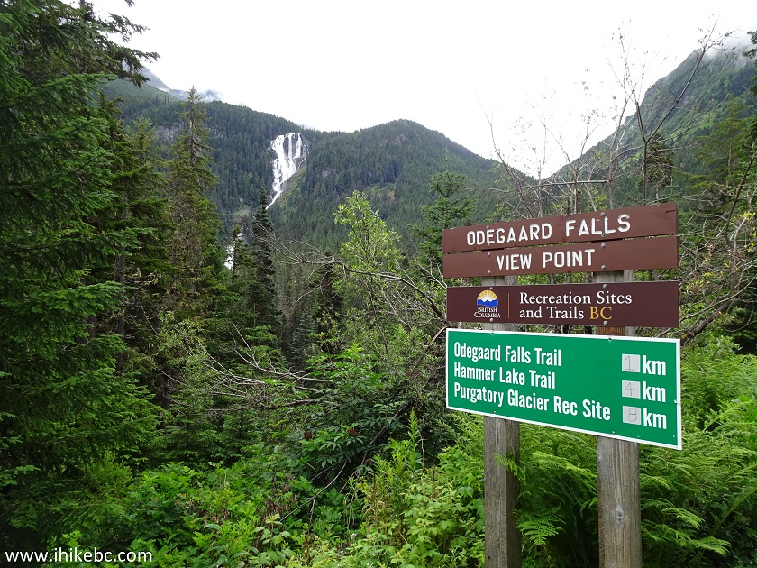
Odegaard Falls Viewpoint on Nusatsum FSR
12. A close-up of Odegaard Falls from the viewpoint.
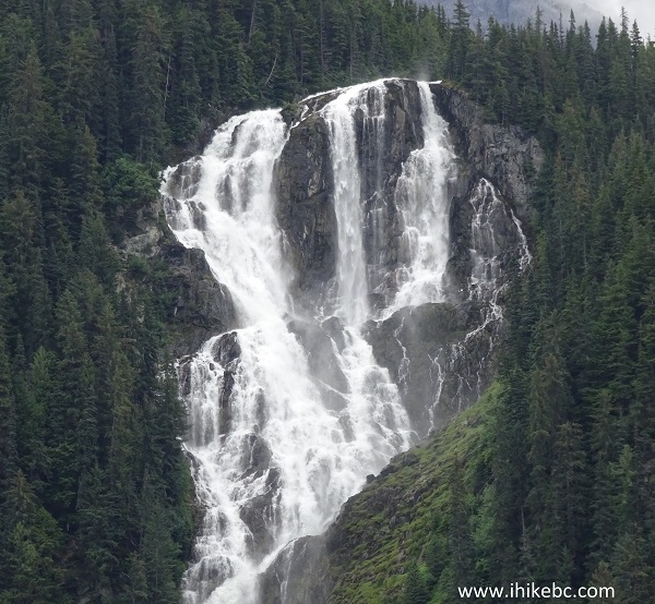
Odegaard Falls British Columbia Canada
Here is a video of the views from this location.
13. Proceeding on Nusatsum FSR. It turned out to be a pretty busy road for a Friday, in a remote part of the province. We have met one vehicle on the way in, and three vehicles plus two ATVs on the way out. As you can see, the road is very narrow, and backing up would certainly be in order, should two vehicles meet here.
Nusatsum FSR near Bella Coola / Hagensborg British Columbia
14. At the 25.0 km mark, 700 meters past the Falls viewpoint, there is a bridge across Nusatsum River.
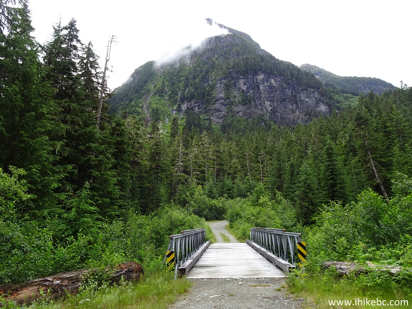
Bridge Across Nusatsum River on Nusatsum FSR near Bella Coola BC Canada
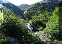
15. The view from the bridge, looking left. See the trunk across the river? That's where a surprisingly good Nusatsum River Falls can be observed 100 meters after starting the trail.
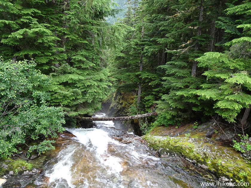
Nusatsum River British Columbia Canada
16. Nusatsum River Recreation Site, as well as Odegaard Falls trailhead, are located immediately after the bridge. Coordinates: N 52⁰14.451' W 126⁰18.578'. Elevation: 838 meters. Hammer Lake Trail / Ape Lake Route are three kilometers further up Nusatsum FSR - we did not go there and do not know the condition of the road beyond this point.
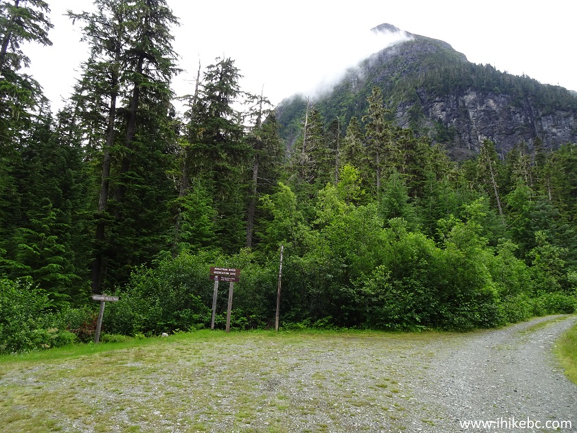
Nusatsum River Recreation Site
17. Odegaard Falls trailhead is located by the bridge.
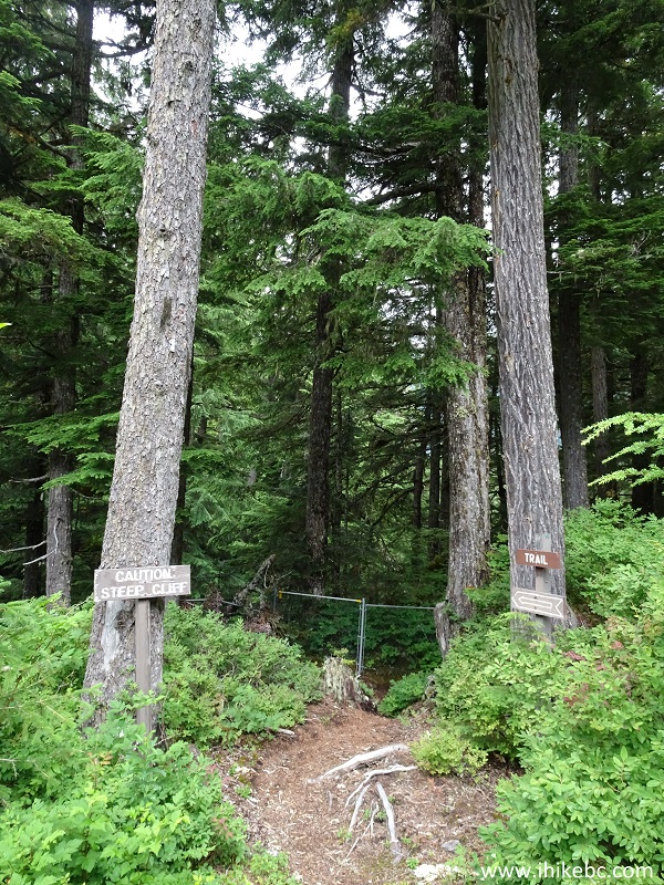
Odegaard Falls Trailhead - Bella Coola Hiking
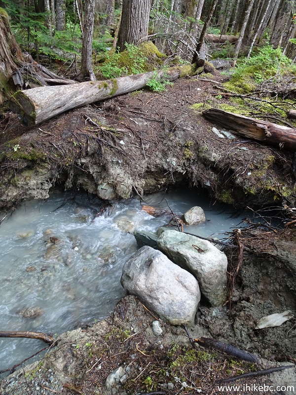
18. As mentioned above, Nusatsum River Falls is just a hundred meters down the trail. It's a fenced-off area.
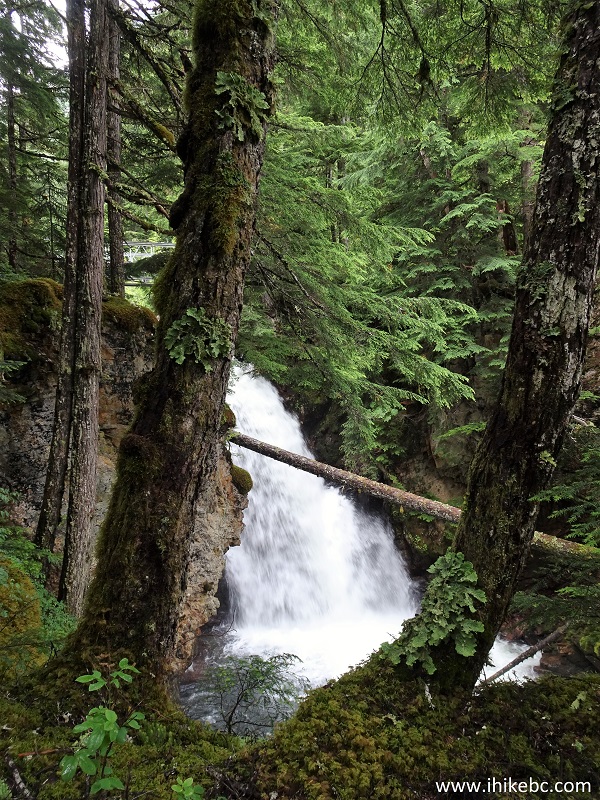
Nusatsum River Falls
Here is a video of Nusatsum River Falls.
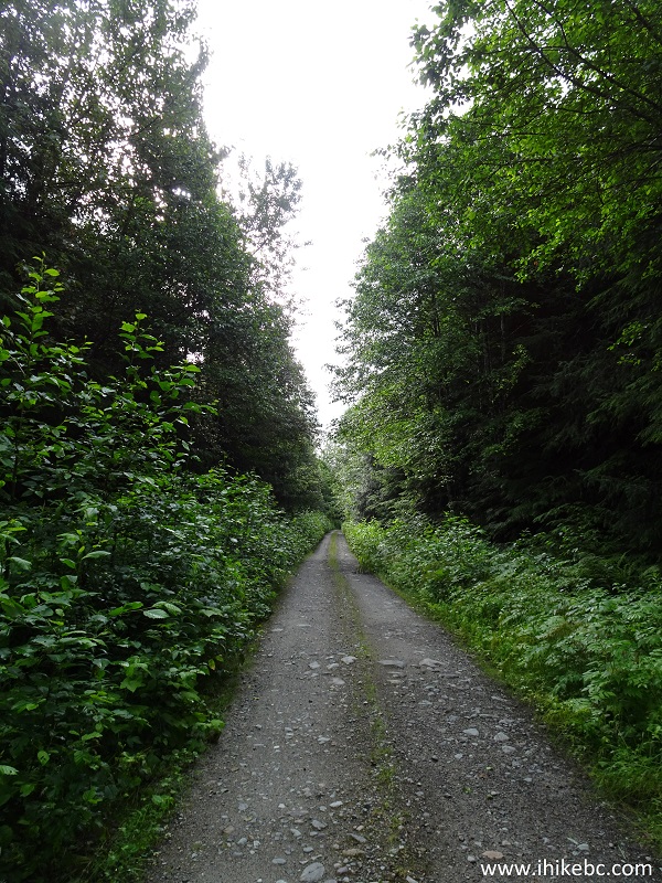
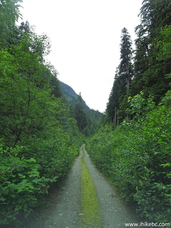
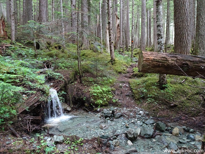
19. Odegaard Falls Trail goes through a cool rainforest, which has many pleasant scenes, such as this.
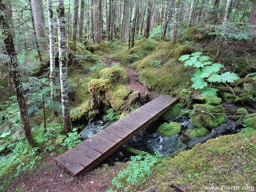
Odegaard Falls Trail - Hagensborg Hiking
20. Moss is all over the place. Some bugs are present too.
BC Hiking - Odegaard Falls Trail near Bella Coola and Hagensborg
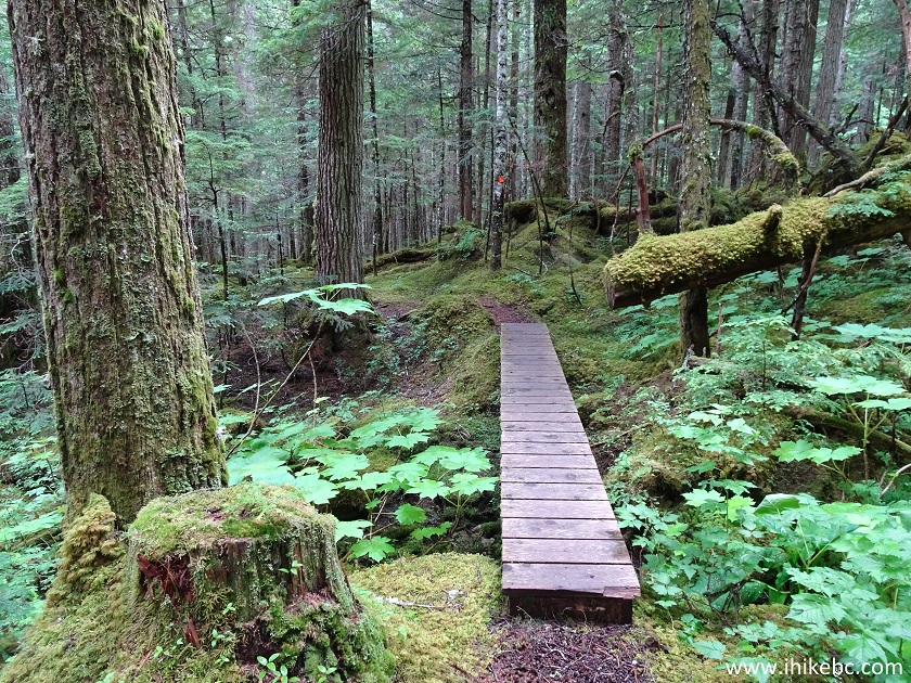
21. Elevation change is minimal, and you actually lose altitude by the time of arrival to the observation bridge.
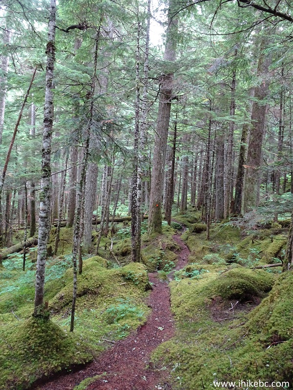
Odegaard Falls Trail - Hiking in British Columbia
22. Within 20 minutes, here is the bridge. Coordinates: N 52⁰14.647' W 126⁰17.995'. Elevation: 811 meters (27 meters elevation loss from the start of the trail).
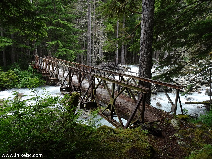
Odegaard Falls Observation Bridge - Hiking in Bella Coola Area
British Columbia Canada
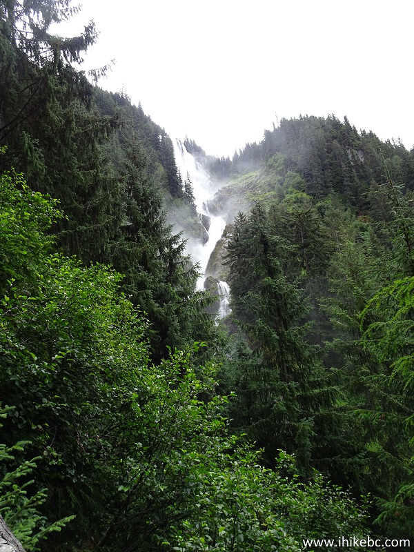
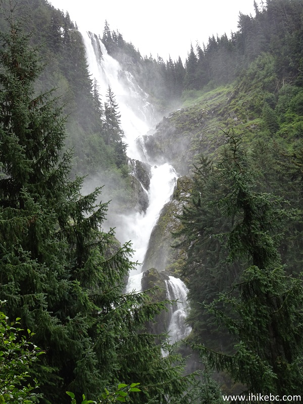
23. Odegaard Falls view from the bridge.
Odegaard Falls British Columbia Canada
24. Zooming in.
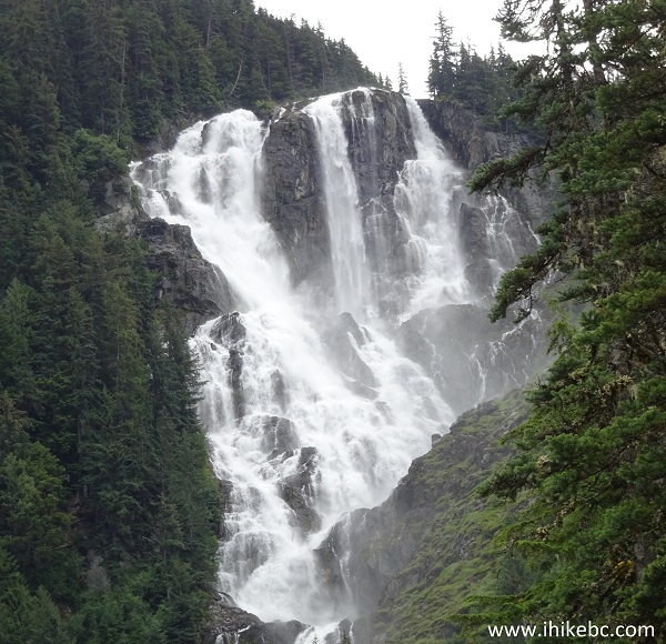
Odegaard Falls
Here is a video of Odegaard Falls from the bridge.
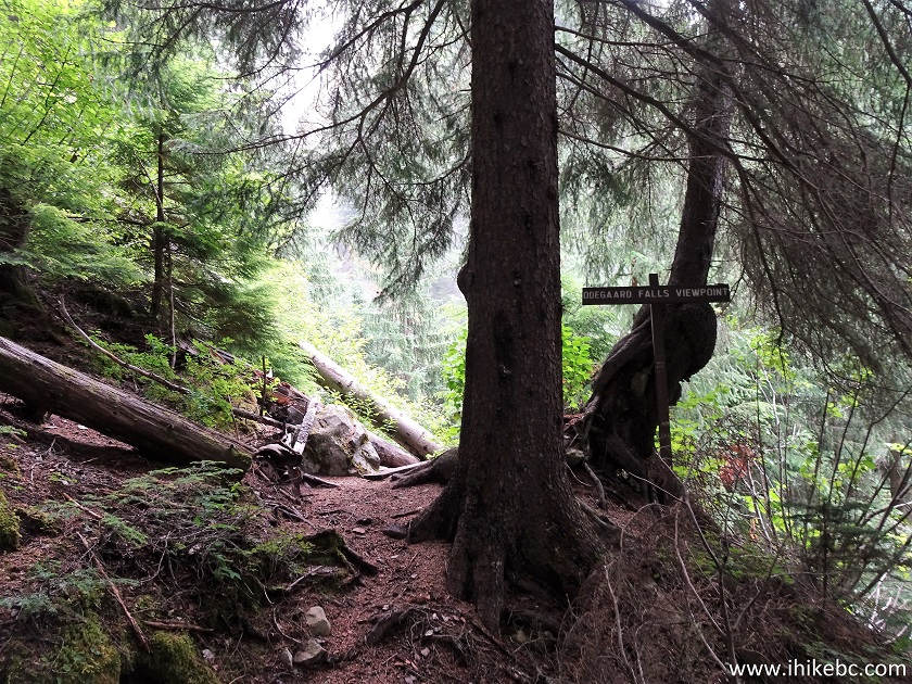
25. If you want to hike for another 25 minutes or so, and are prepared for steeper terrain, it is possible to proceed to the upper viewpoint. The path after the bridge is somewhat washed out, but is quite passable.
Bella Coola Trail - Odegaard Falls Trail
26. A mini-waterfall on the side of the trail.
Hagensborg Trail - Odegaard Falls Hike
27. Arriving at the final viewpoint, and the end of the trail. Coordinates: N 52⁰14.609' W 126⁰17.721'. Elevation: 879 meters (68 meters elevation gain from the bridge).
Odegaard Falls Trail - BC Hike
28. Here is the view. It's actually not as good as from the bridge, as you can't see the bottom of the Falls from the upper viewpoint.
Odegaard Falls
29. Now with a zoom.
Odegaard Falls near Bella Coola BC Canada
Here is a video of Odegaard Falls from the end of the trail.
More ihikebc videos are on our YouTube Channel.
The condition of Nusatsum Forest Service Road and the capability of your vehicle would determine whether you would be able to drive up to the trail, or would have to stop short of the trailhead, and extend your hike by many kilometers. That said, Odegaard Falls is quite impressive, and the short and easy path in the forest is an attraction by itself. Highly recommended.


|
 |
Other Trips in Bella Coola Area:
|
Schoolhouse
Falls East
|

|
|
|
 |
|
|

![]()
![]()
![]()
ihikebc.com Trip 162 - Odegaard Falls Trail Hike (Near Bella Coola / Hagensborg BC)