![]()
![]()
![]()

Trip 194 - July 24, 2020 (Friday)
Perkins Peak Trail Hike
Near Tatla Lake BC
Page 2 of 2
Trailhead Location: About 265 kilometers West of Williams Lake via BC Highway 20 and Miner Lake FSR. Close to the settlement of Tatla Lake.
Liked: Mountain views, lake views, several fine views from the access road (Miner Lake FSR), few bugs when windy, the ability to bike (or, even, drive) for most of the trail.
Of Note: Remote wilderness area, high altitude hike, lots of mosquitoes when no wind, the trail is windy, especially in the alpine. No shade. Motorized traffic on the trail. Access road is rough in several places and not every vehicle would make it to the alpine. Uneven ground on the trail – hiking poles and boots are highly recommended. Steep terrain with loose stones in the alpine beyond the lakes – hiking poles and boots are essential. Miner Lake FSR could be closed due to the crews cutting burned trees.Cariboo Chilcotin Coast BC Backroad Mapbook (4th edition) Trailhead Coordinates: Page 13 (Tatlayoko Lake) A2.
Related Trip Report: BC Highway 20 (Williams Lake to Bella Coola).
Follow @ihikebc
Tweet
Perkins Peak is a fine-looking mountain located close to other
fine-looking mountains in the remote Chilcotin region of British
Columbia. BC Highway 20 starts in Williams Lake off BC Highway 97 (check
out our
BC Highway 20 trip report for more details). About 245 kilometers
later, shortly past the unincorporated settlement of Tatla Lake, Miner
Lake Forest Service Road begins on the left side. Just under 30 km after
that, a series of back roads lead to the foot of Perkins Peak.
Another two hours or so, from what we have read, would be required to
get to the top, located at the altitude of 2,819 meters, as per the
Backroad Mapbook.
Your vehicle's ability would determine how far down Miner Lake FSR you
would be able to get before having to hike or bike. We've made
it to 11.7 kilometers, where a makeshift bridge over a washout made it
too risky for our high-clearance 2WD vehicle to proceed. One small SUV
made it much closer, while a pickup truck drove to the end of the access
road, where a pipe prevents further vehicular access.
We thus ended up hiking and biking for over 18 km to the foot of Perkins
Peak, and had neither time nor desire to climb that mountain. That said,
there were plenty of great views to be had, and, even if you don't end
up at the top of the peak, this trail is one neat hiking / biking / driving
adventure.![]()
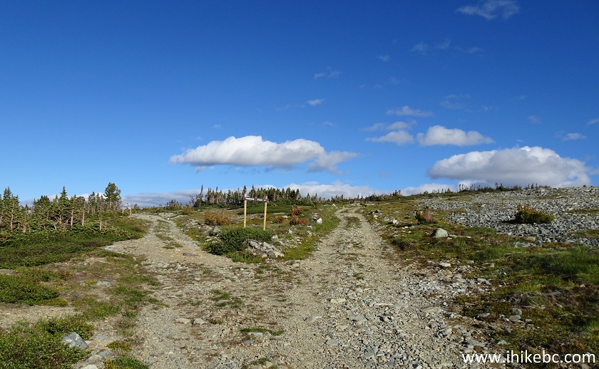
31. Perkins Peak Trail after the second sign.
Perkins Peak Trail - British Columbia Trail
32. The third and final sign arrives at 25.9 km. Coordinates: N 51⁰49.538’ W 125⁰01.924. Elevation: 1,954 meters. Take the road on the right. The road on the left, apparently, leads to another trail, as 100 meters later there is a sign which says: "Chromium Cr. Emerald Lk. recreation trail".
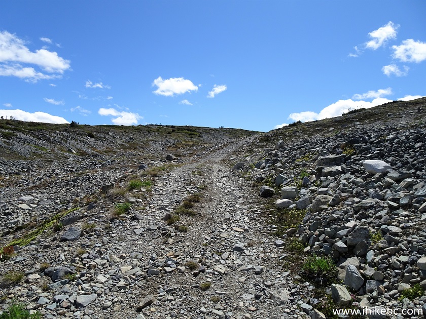
British Columbia Hike - Perkins Peak Trail
33. Having taken the road on the right, we are now in the alpine. The ground became full of loose stones, so we left the bicycle behind.
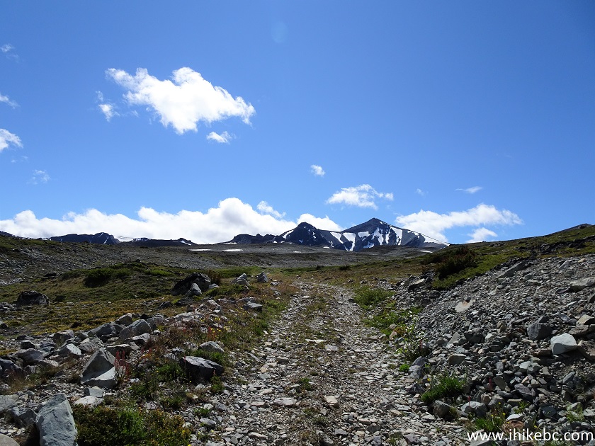
Perkins Peak Trail
34. At 26.5 km, Perkins Peak starts rising for real.
Perkins Peak Trail - British Columbia Hiking
35. With some zoom.
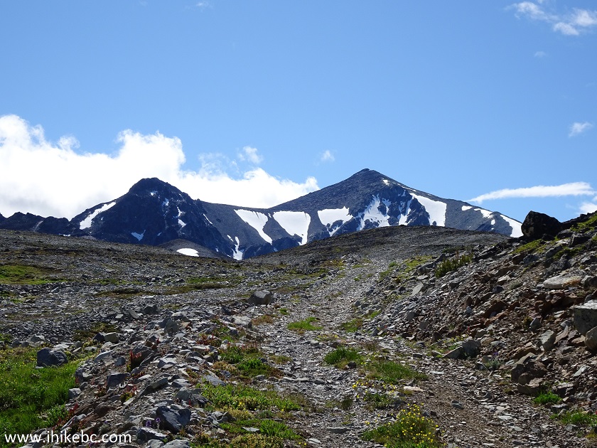
Perkins Peak Trail in British Columbia Canada
36. Yet more zoom. The ridge on the right can be climbed to the peak in two hours, from what we understood.
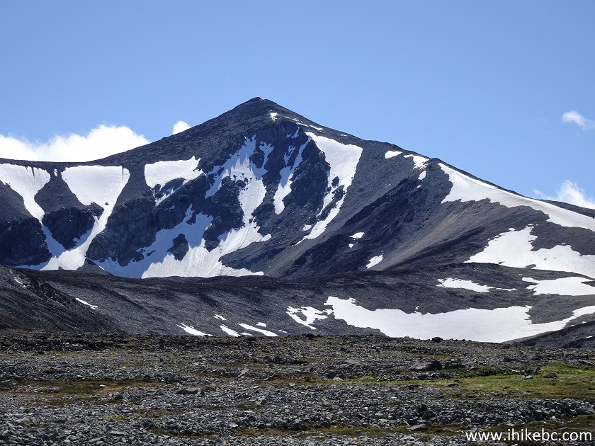
Perkins Peak British Columbia Canada
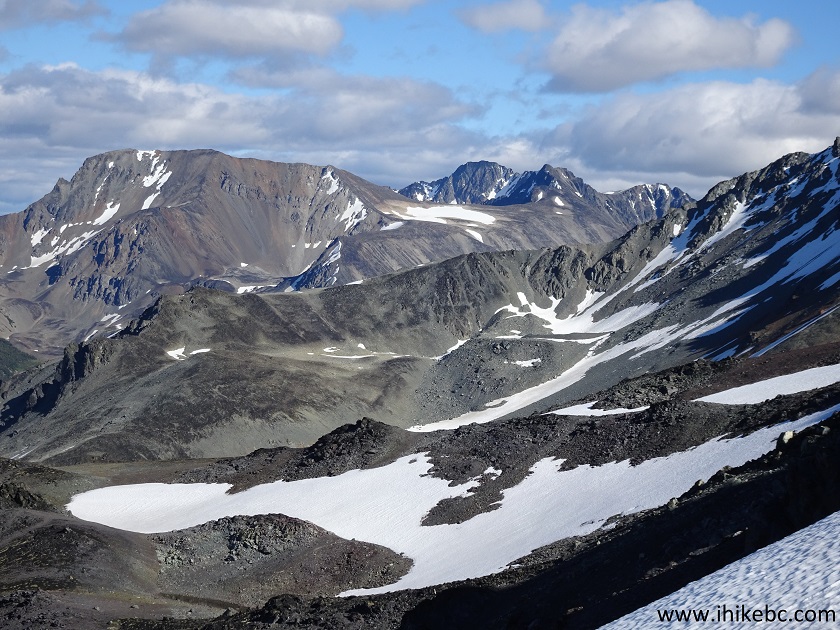
37. A look to the left reveals a glimpse of very impressive mountains, which we saw in full glory later in the hike.
Hike in British Columbia - View from Perkins Peak Trail near Tatla Lake BC
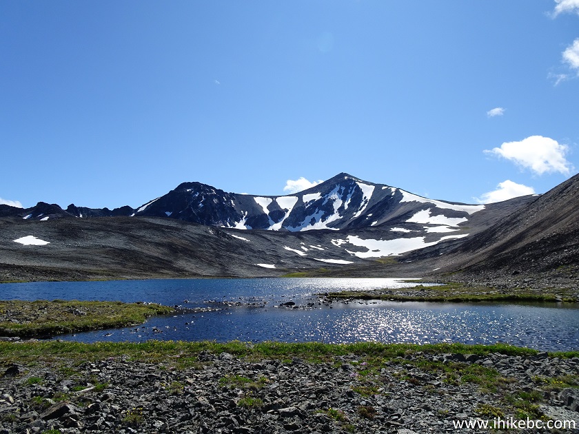
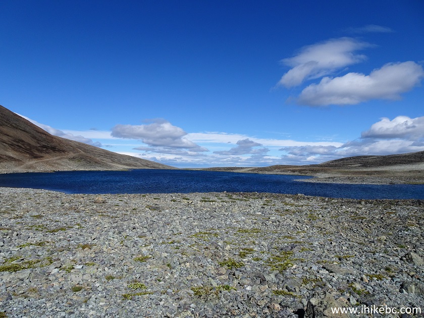
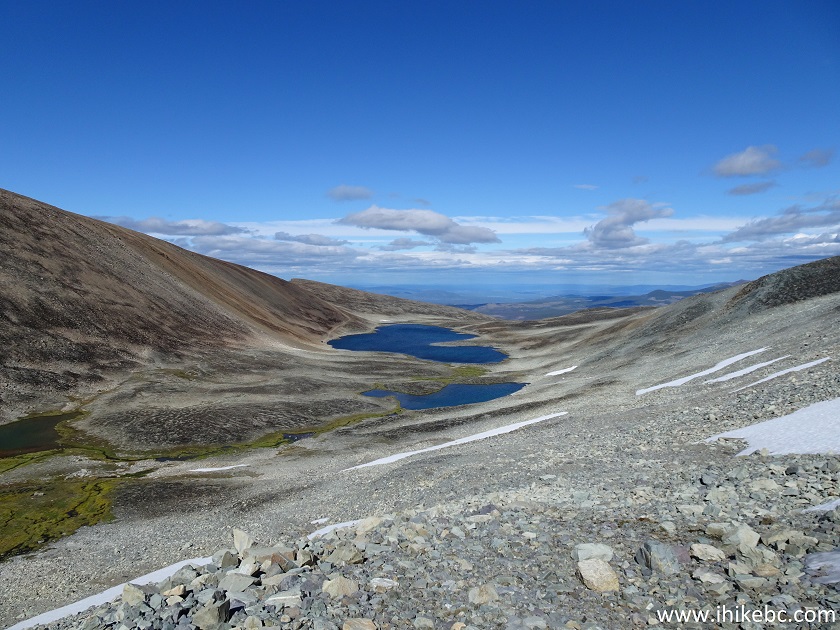
38. Another very cool feature of this trail are several small lakes. Here is the first one, looking back.
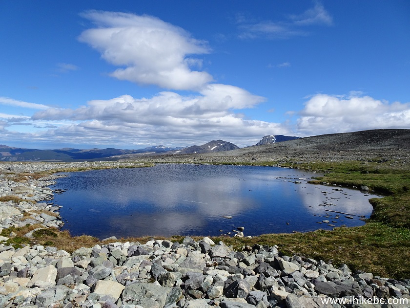
A Lake Near Perkins Peak - Hiking in British Columbia
39. And here is another one, looking forward. Coordinates: N 51⁰49.198’ W 125⁰03.435’. Elevation: 2,187 meters.
Perkins Peak near Tatla Lake British Columbia
40. The trail then goes by the side of the lake. Vehicles can still drive here.
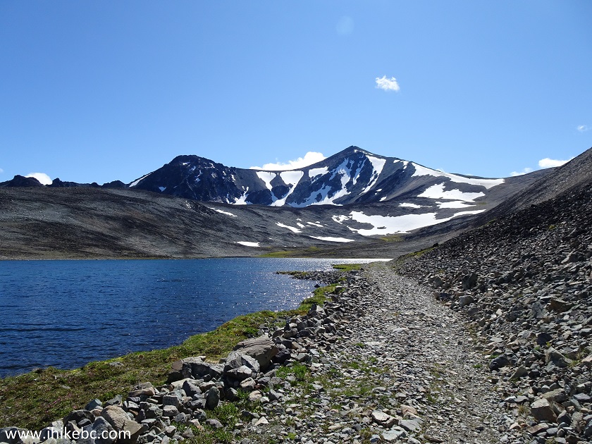
Perkins Peak Hike
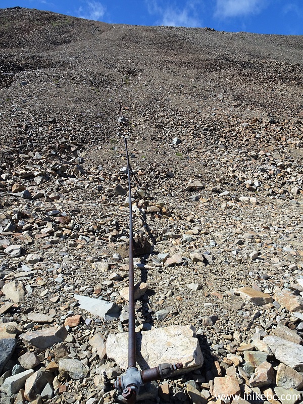
41. And this is where motorized access ends, at 28.4 km. There is a long pipe coming down all the way from the top of the mountain to the right (there is a road leading there as well), and this pipe blocks further vehicular progress, unless one is interested in partially driving into the lake.
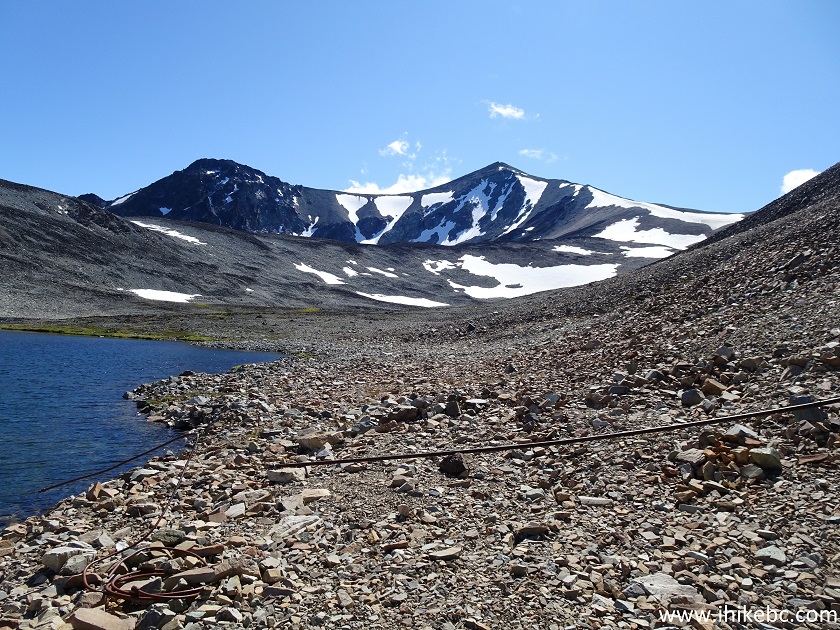
Hiking to Perkins Peak Mountain
42. A very mysterious pipe indeed.
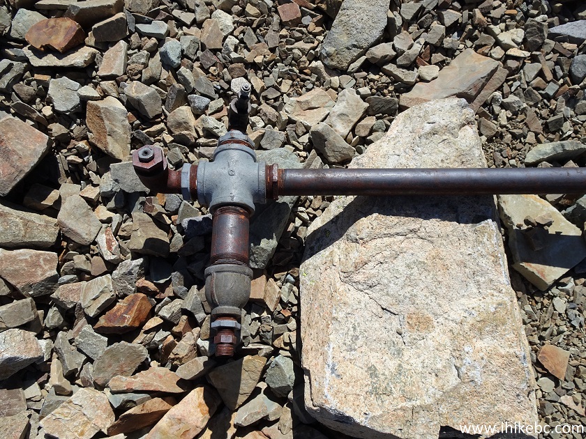
Pipe near Perkins Peak
43. Here it is going all the way to the top - you can see it veering to the left.
A long pipe near Perkins Peak Trail
44. We are now past the second lake and are looking back.
Lake near Perkins Peak Trail
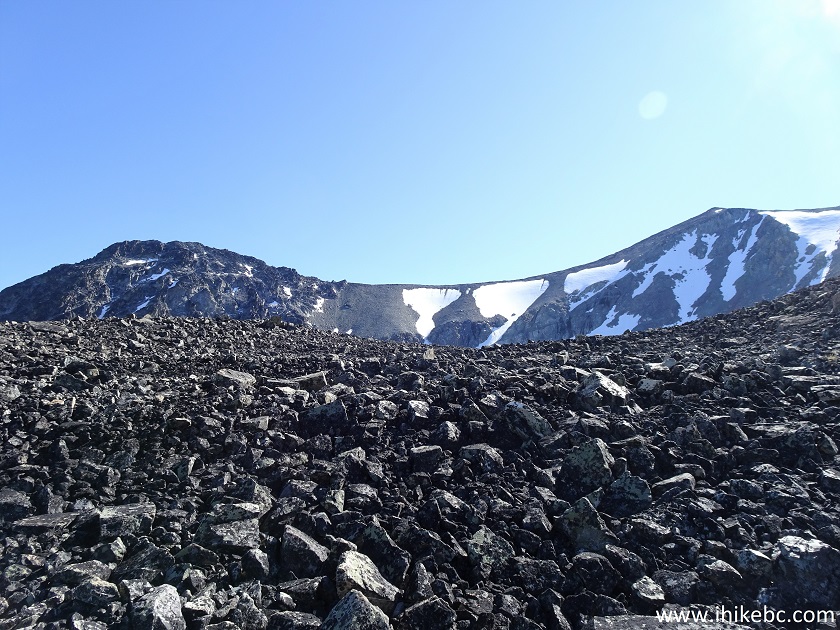
45. And, looking forward, we see Perkins Peak, and a small ridge in front of it. We decided to climb up that ridge head on. Hiking poles and boots would be essential here, as it's quite steep, with loose stones.
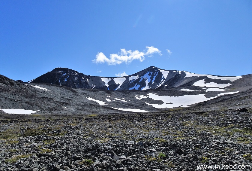
BC Hiking - Perkins Peak
46-47. The lakes look better and better the higher you climb.
Lakes by Perkins Peak British Columbia Canada
48. Almost there.
BC Hiking
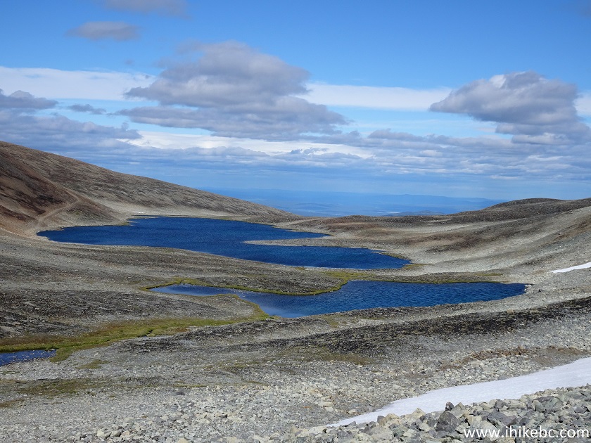
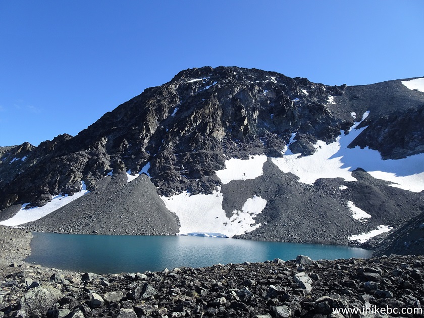
49. And here we are, with another lake right under Perkins Peak. Coordinates: N 51⁰48.763’ W 125⁰04.311’. Elevation: 2,333 meters.
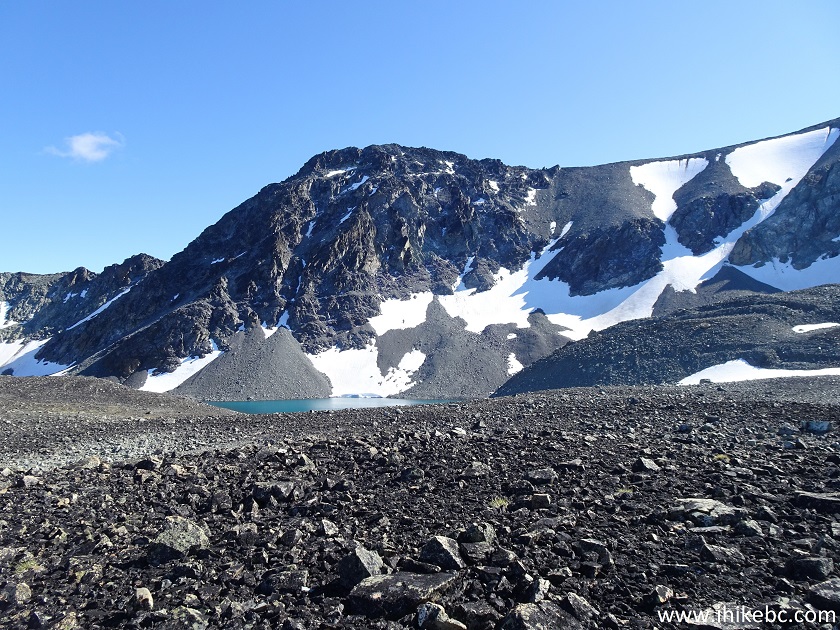
Hiking in British Columbia
50. A bit to the right.
Perkins Peak near Tatla Lake BC
Here is our video of the views from this location.
More ihikebc videos are on our YouTube Channel.
51. And then we got closer.
Lake at the foot of Perkins Mountain
52. After that, we went left and back, to parallel the way we hiked to the base of the mountain, but at the distance of about 400 meters, in order to check out the mountains hiding on the left side during the hike to Perkins Peak.
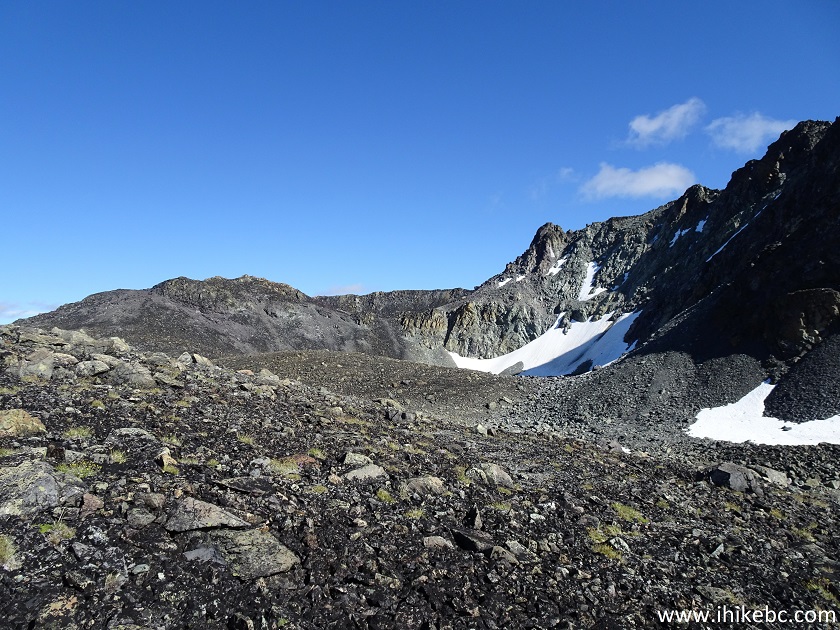
Hike near Tatla Lake by Perkins Peak
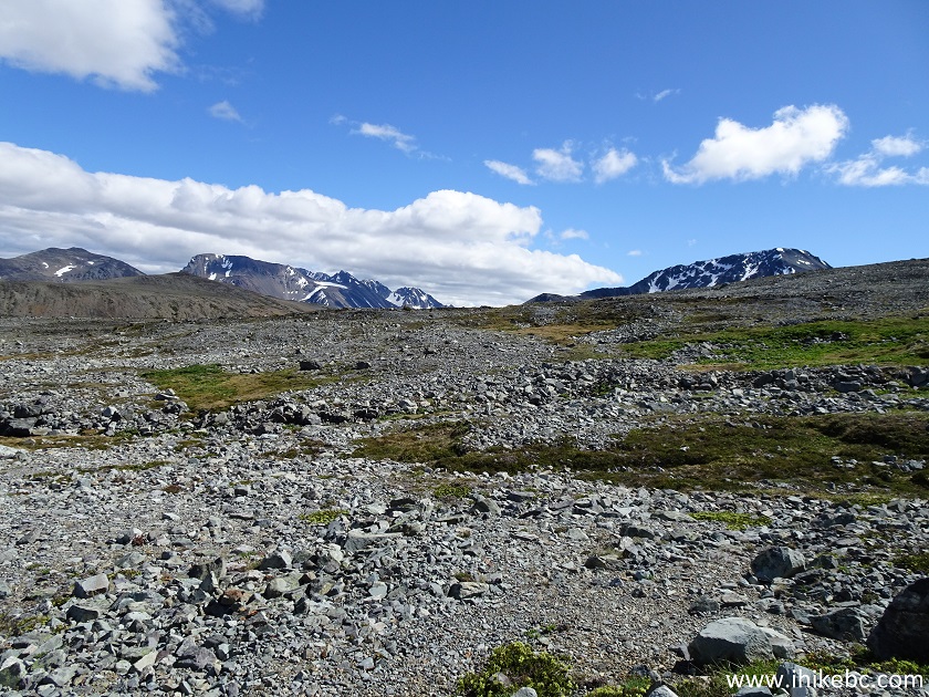
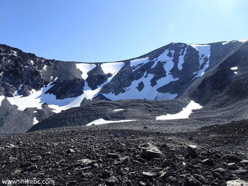
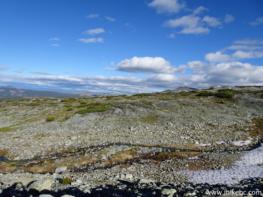
53. The terrain is still very challenging here.
Canada Hiking
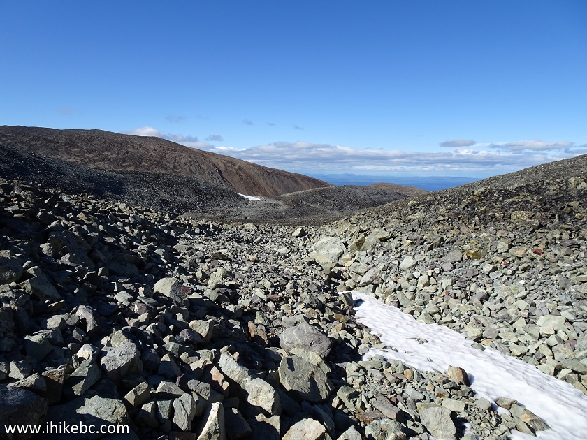
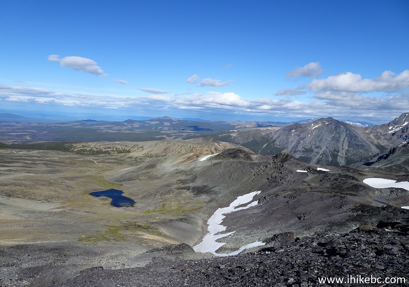
54. It took 900 meters from the base of Perkins Peak to get to this cool view. Coordinates: N 51⁰48.545’ W 125⁰03.751. Elevation: 2,357 meters.
Hiking in Canada
55. Zooming in. Very neat. Backroad Mapbook shows hiking routes to that area, and it does appear that it's possible to hike much further.
British Columbia Mountains
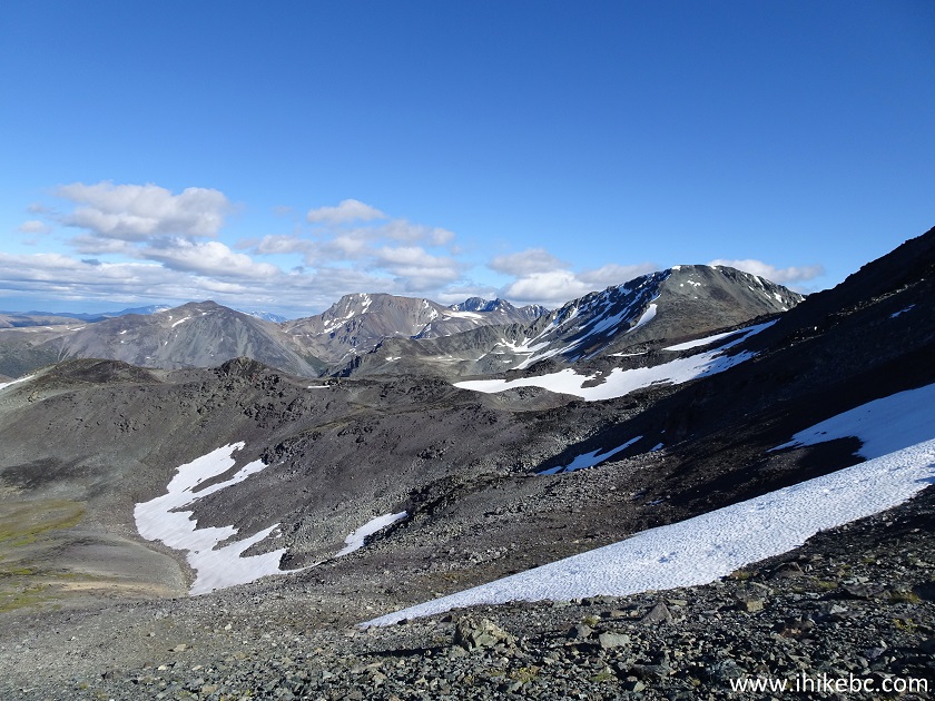
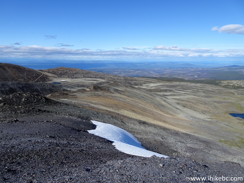
56. Looking left.
Hiking in British Columbia
57. And then we went left to rejoin the original trail.
BC Hiking
58. Approaching one of the lakes. You can see the pipe from photos #41-43 going to the top of that mountain, as well as a road (on the right side) to go up.
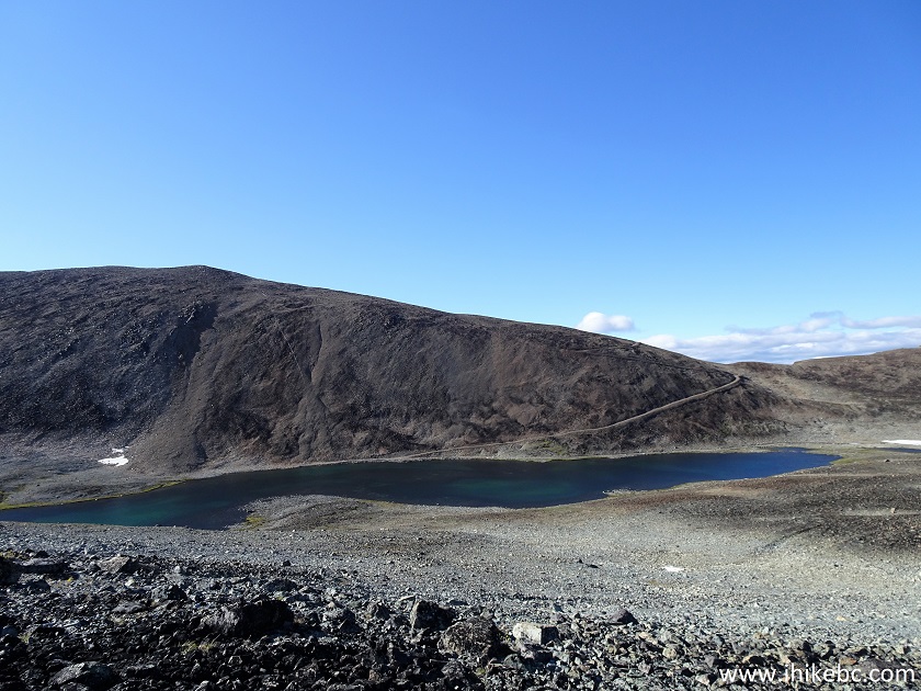
Hike BC
59. Now hiking along the lake.
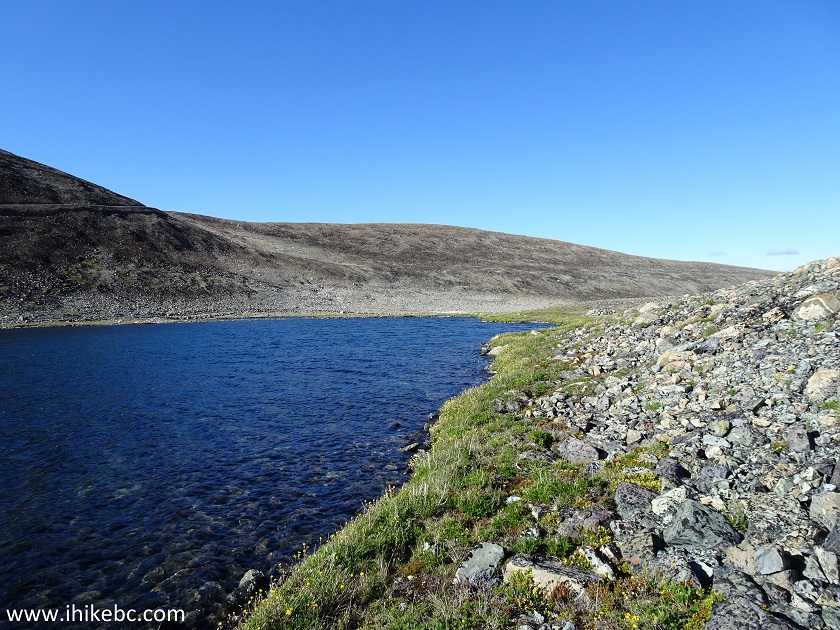
BC Hike
60. Once back on the trail, the views kept impressing.
View from Perkins Peak Trail British Columbia Canada
Perkins Peak Trail and its access road, Miner Lake FSR, have many great views to offer, and the hike can be extended even further. Highly recommended.


|
 |
Other Trips in Tatla Lake BC Area:
|
|
|
|


![]()
![]()
![]()
ihikebc.com Trip 194 - Perkins Peak Trail Hike (near Tatla Lake BC) Page 2 of 2