![]()
![]()
![]()

Trip 164 - July 20, 2019 (Saturday)
Schoolhouse Falls EAST Trail Hike
Near Bella Coola / Hagensborg
British Columbia
Liked: The waterfall, valley and mountain views, very few bugs.
Of Note: Highway noise for much of the trail. Steep unbarricaded drop-off at one viewpoint. Several very steep sections. Hiking poles and boots are highly recommended.
Cariboo Chilcotin Coast BC Backroad Mapbook (4th edition) Trailhead Coordinates: Page 22 (Bella Coola) F1.
Related Trip Report: Schoolhouse Falls WEST Trail Hike.
>>> British Columbia Waterfalls Visits.
Unlike its West cousin, East Falls Trail is much steeper, and definitely appears to be less used. East Falls Trail does feature better waterfall, valley and mountain views, as they are not as obstructed by vegetation. At only 2 kilometers long, the East Trail is almost twice as long as the West Trail, and could certainly be challenging at times. Check out our previous trip report (West Falls) for directions on getting to the trailhead.
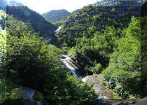
Also, while it is possible to observe the most, if not all, of the West Falls from the end of the trail, one can only see bits and pieces of the East Falls while hiking. To see the most of the East waterfall, it is necessary to stand by the trailhead and look up the mountain, as seen in photo #1.
1. Standing by the trailhead and looking up the mountain with much zoom, we see Schoolhouse Falls East waterfall.
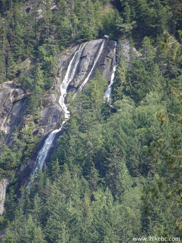
Schoolhouse Falls EAST near Hagensborg and Bella Coola BC Canada
2. Now at the trailhead.
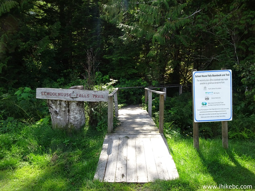
Trailhead for Schoolhouse Falls East and West Trails - BC Hiking
3. The boardwalk ends about 270 meters later. Make a left turn.
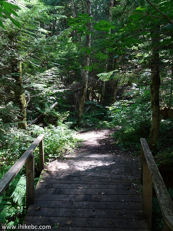
End of Boardwalk - Schoolhouse Falls East Trail - British Columbia
Hiking
4. Schoolhouse Falls EAST Trail shortly after the boardwalk.
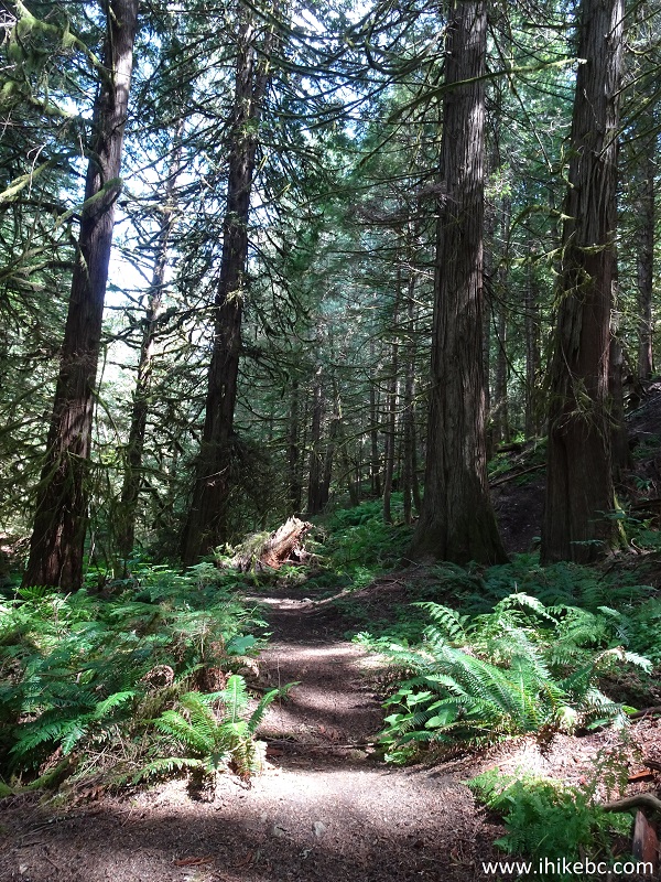
Hagensborg Hiking - Schoolhouse Falls East Trail
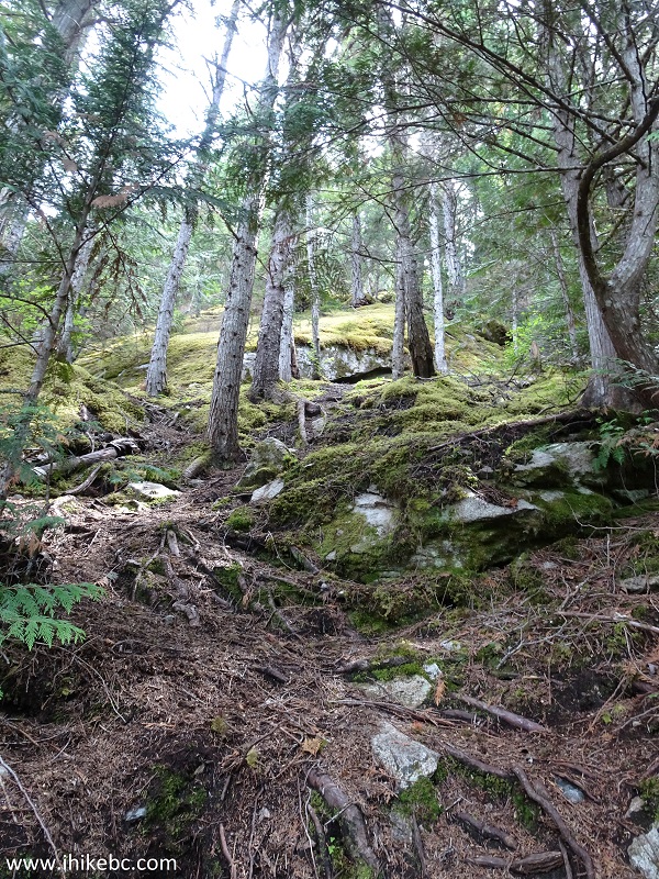
5. This trail is short but difficult, with lots of rocks and exposed roots.
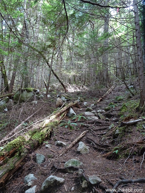
Hiking in Hagensborg Area - Schoolhouse Falls East Trail British
Columbia Canada
6. The forest is quite pleasant, though no match to the one by Odegaard Falls.
Bella Coola Hiking - Schoolhouse Falls East Trail
7. There is a split at the 1.6 km mark. Coordinates: N 52⁰23.072' W 126⁰32.291'. Elevation: 56 meters. To the left, within 100 meters, is the first waterfall view, as well as a valley lookout.
Hiking in Bella Coola Area - Schoolhouse Falls East Trail by Hagensborg
BC Canada
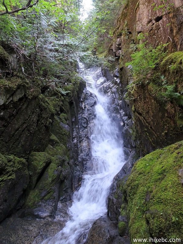
8. We took the path to the left, and here is a small part of Schoolhouse Falls EAST that could be observed from this location.
Schoolhouse Falls EAST by Hagensborg British Columbia
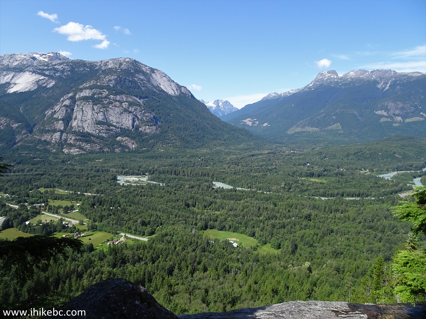
9. Bella Coola valley and mountain views are very good too.
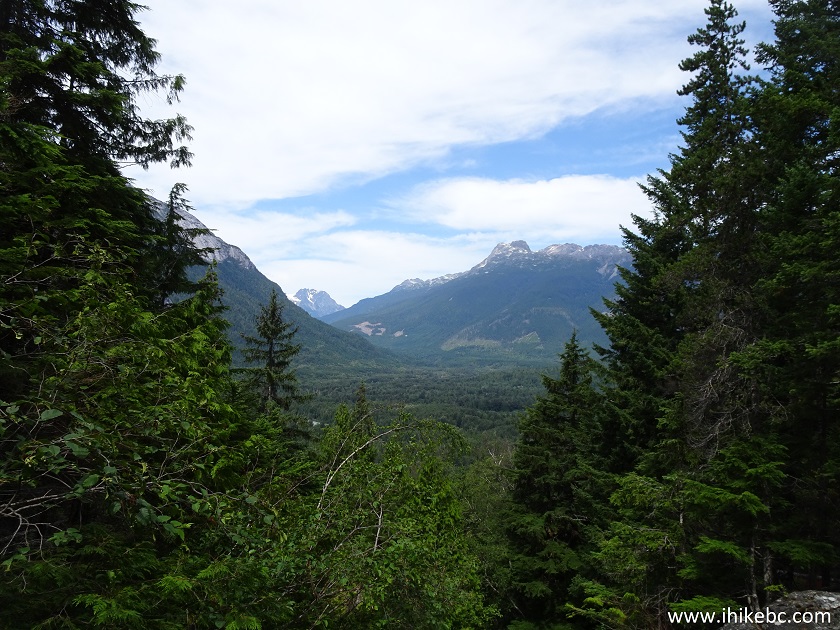
Bella Coola Valley seen from Schoolhouse Falls EAST trail
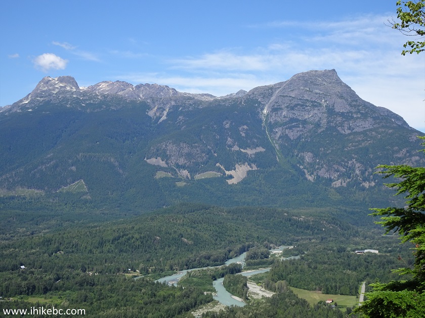
10. With a slight zoom.

Bella Coola Valley British Columbia Canada
Here is our video of the waterfall and the valley.
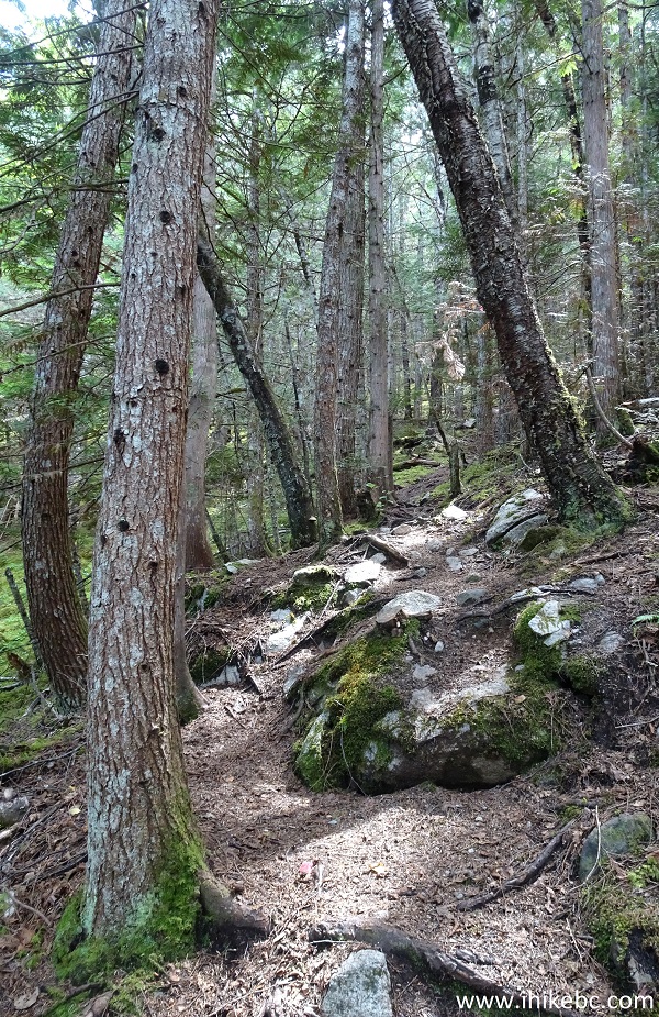
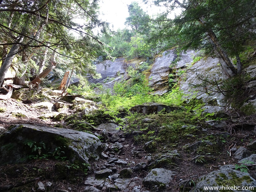
11. We then returned to the main trail and kept going. After the split, it gets even steeper.
Trail in Bella Coola Area - Schoolhouse Falls EAST Trail
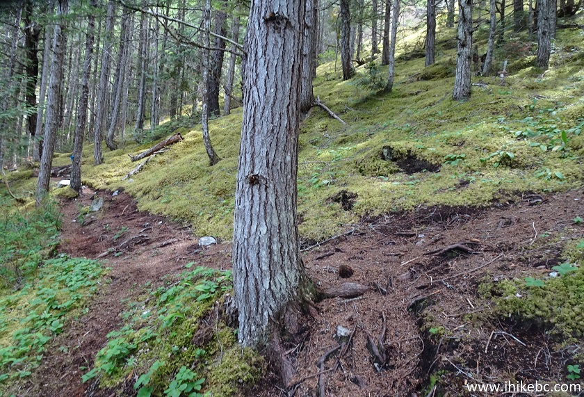
12. The good news is that there are very few bugs.
Schoolhouse Falls EAST Hiking Trail near Bella Coola and Hagensborg
British Columbia
13. The bad news is that it's so steep that you would need to use an attached rope, as seen in this photograph.
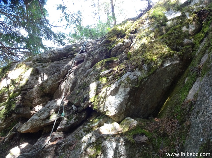
Schoolhouse Falls EAST Hike - Trail in Hagensborg Area
14. Just a few hundred meters after the split, at about the 1.8 km mark, slightly to the left of the trail, there is an excellent valley viewpoint. WARNING - DANGEROUS AREA - the viewpoint is very close to flowing water and a very steep unbarricaded drop-off. Beware of slippery conditions, lest you repeat our slide at the West waterfall, with far worse consequences.
Hike in British Columbia
15. So, yeah, Bella Coola valley.
Bella Coola Valley - Schoolhouse East Trail - Hagensborg Trail
16. Looking to the right.
Bella Coola Valley seen from Schoolhouse Falls EAST near Hagensborg BC
Canada
17. Zooming in.
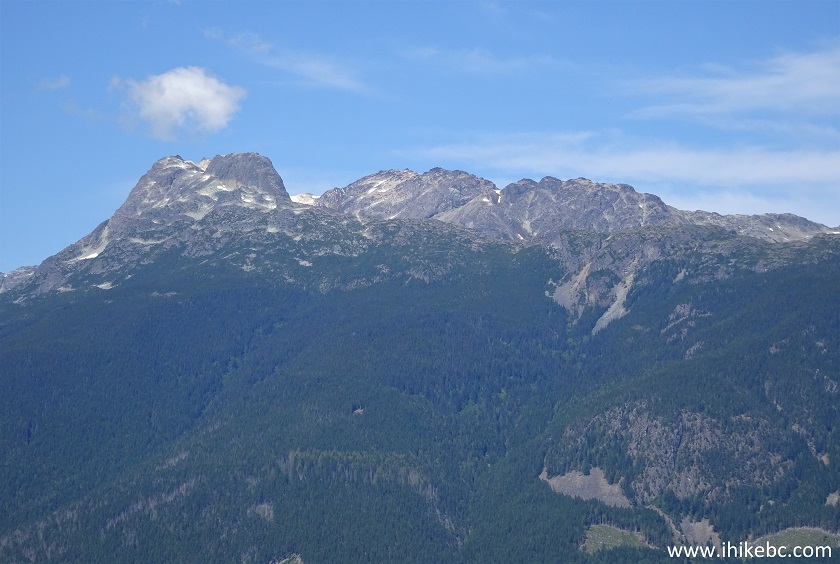
Bella Coola Valley Mountain View - Canada Hiking
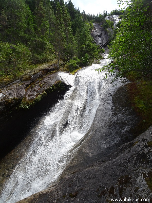
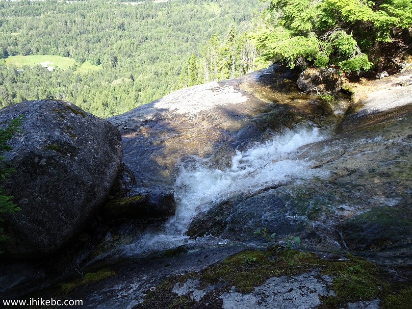
18. Moving on, several hundred meters later, at the 2.0 km mark, is (what we believe to be) the end of the waterfall trail, with this fine view of another part of Schoolhouse Falls EAST. Coordinates: N 52⁰22.851' W 126⁰31.527'. Elevation: 350 meters. You would need to walk for about 50 meters off the main trail, which continues steeply up the mountain. We did hike it further for another 500 meters or so, where the trail disappeared for no apparent reason. Perhaps, there are some views further on, or the trail continues for folks who simply like to hike on the mountain.
Schoolhouse Falls EAST by Hagensborg and Bella Coola British Columbia
Canada
Here is a second video of the waterfall.
More ihikebc videos are on our YouTube Channel.
While substantially steeper than WEST Falls Trail, EAST Falls Trail has better waterfall and mountain/valley views. Recommended.


|
 |
Other Trips in Bella Coola Area:
|
|
|

|
|
Schoolhouse
Falls West
|

![]()
![]()
![]()
ihikebc.com Trip 164 - Schoolhouse Falls EAST Trail Hike (Near Bella Coola / Hagensborg BC)