![]()
![]()
![]()

Trip 240 - April 28, 2022 (Thursday)
Mount Killam Trail Hike
Gambier Island BC Off Sunshine Coast Near Langdale Ferry Terminal
Page 2 of 2
Liked: Ocean and islands views from the main viewpoint, several fine forest scenes, no bugs, meeting a turkey buzzard.
Of Note: A moderately challenging trail with several steep stretches - hiking poles and boots are highly recommended. Substantial industrial noise for most of the trail. Access road to the trailhead may be closed due to industrial activity. Steep unbarricaded drop-offs at the viewpoint. The views from the viewpoint are likely going to be hazy due to south-facing viewpoint. The signage to the trailhead is inadequate and confusing. A GPS with a mapped trail is highly recommended.
Vancouver, Coast & Mountains Backroad Mapbook (5th edition) Gambier Island Coordinates: Page 10 (Gibsons) E5.
103 Hikes in Southwestern British Columbia (2008 edition): hike #33.
Related Website: Gambier Island Ferry Schedule.
Mount Killam Trail is located on Gambier Island, a short ferry ride from BC Sunshine Coast (Langdale Terminal). Upon disembarking from the ferry, you get to the trailhead after 4.4 km of hiking on easy gravel roads. The trail itself is substantially more difficult, and leads 2.6 km later to a panoramic viewpoint of the ocean, Gambier Island itself, Lower Mainland, Bowen Island, Keats Island, and BC Sunshine Coast, including Langdale Ferry Terminal. In fact, it is possible to observe a Horseshoe Bay to Langdale ferry for most of its 40 minute route.
Unless you know exactly where you are going, Mount Killam trailhead can be difficult to find due to several splits and inadequate and even confusing signage. There is a (relatively) new gravel road at 3.4 km where you need to make a right turn, but, only 200 meters later, there is another right turn road, and it actually has a Mount Killam sign with an arrow high up a tree. A few hundred meters later you end up in a gravel pit, and "103 Hikes in Southwestern British Columbia" (2008 edition) says just that - that the trail starts at the gravel pit. But it's a very serious and rather dangerous obstacle course down there for several hundred meters, which is completely avoidable if you make a right turn 200 meters earlier.
While the main view is quite panoramic and fairly impressive, because you are looking straight South the sun is always going to shine at you at least at some angle, and create haze. Also, if you are taking a ferry to Gambier Island, remember that the last sailing is fairly early in the day (check out the schedule link above), lest you be stuck on Gambier overnight or be forced to call for a water taxi.
Take a look at our previous trip report for directions on getting to Gambier Island from Langdale Ferry Terminal. This trip report picks up with us walking on a logging road past the community centre located at 600 meters from the dock. All distances in this trip report are based on a GPS odometer and are approximate.
Note: there appears to be another trailhead (or two) elsewhere on Gambier Island, but we do not know where they are located, and if it is possible to get there from New Brighton Dock. If it is, then it could be a solution in case the way we went would be blocked by a gate seen in photo #7.
Finally, as the main viewpoint is at the elevation of less than 700 meters, Mount Killam makes a good (snow-free) hike for most of the year.
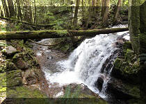
29. At 250 meters cross Whispering Creek.
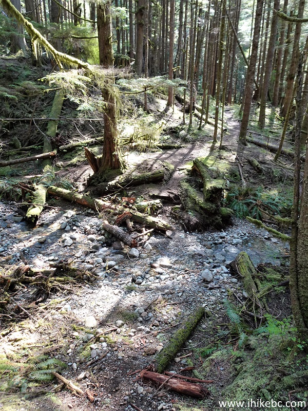
Whispering Creek Mount Killam Trail Gambier Island BC
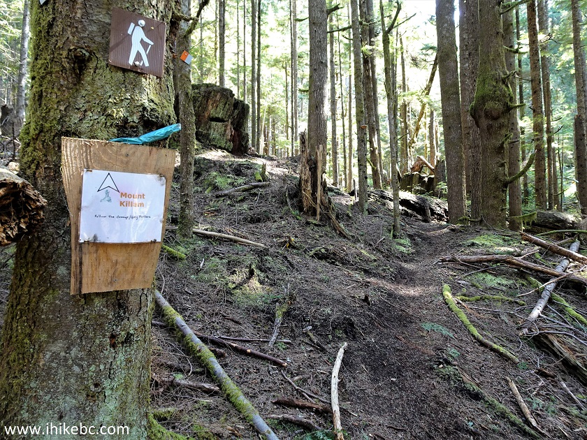
30-31. Less than a hundred meters later, there is a split. Make a sharp left turn (a sign is present). Unknown where the trail on the right eventually goes.
Hike on Gambier Island - Mount Killam Trail
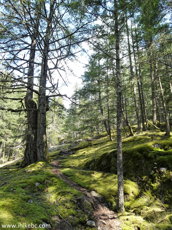
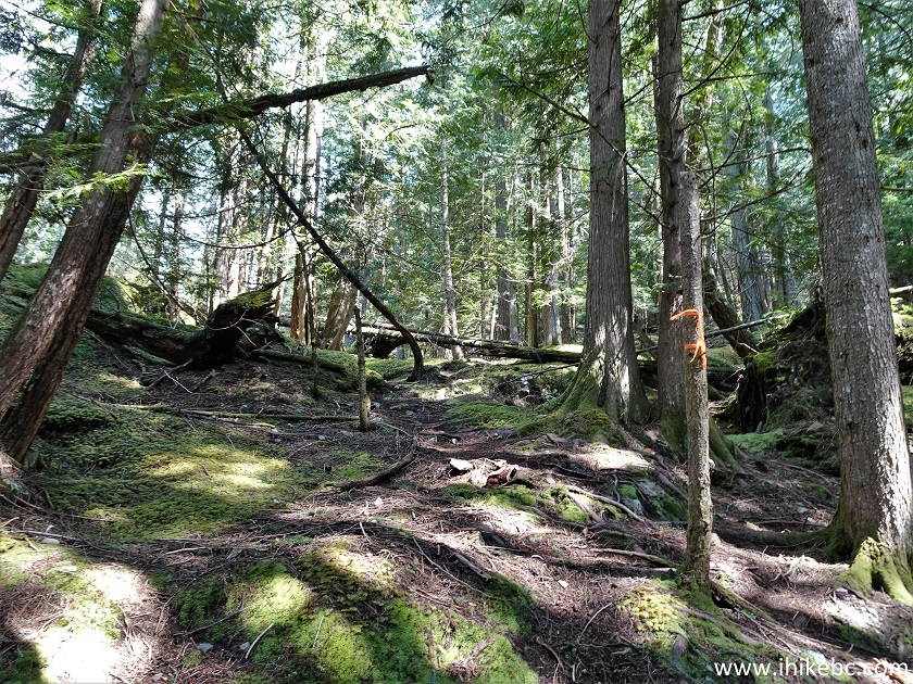
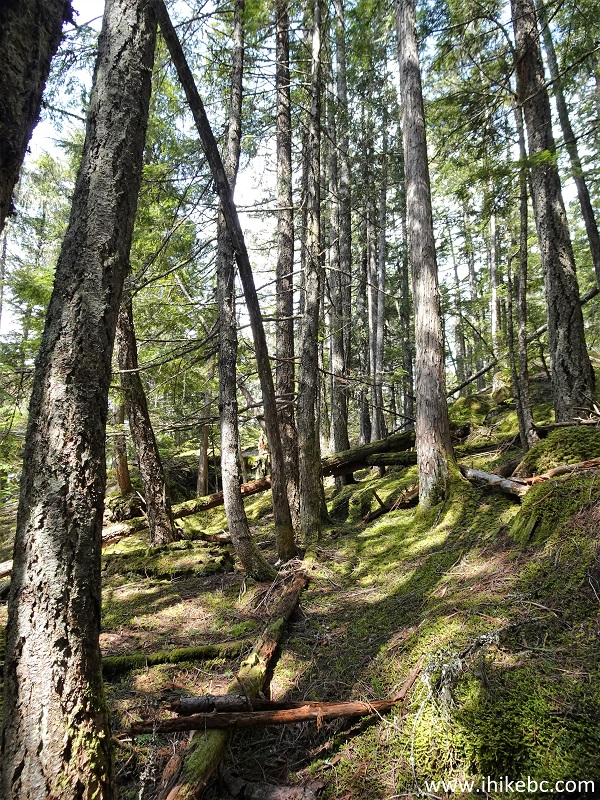
32. Fine moss on both sides of the trail at 1.10 km from the trailhead.
Mount Killam Trail - Gambier Island - British
Columbia Canada
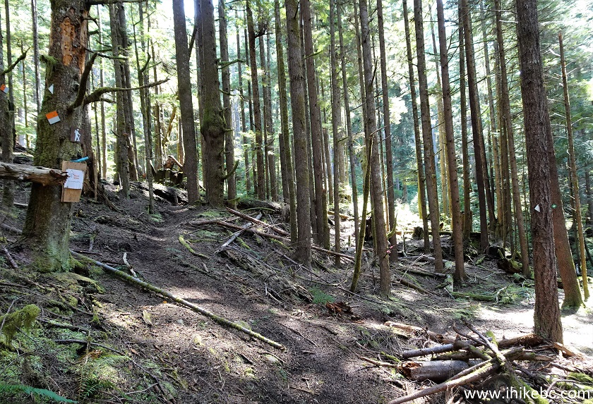
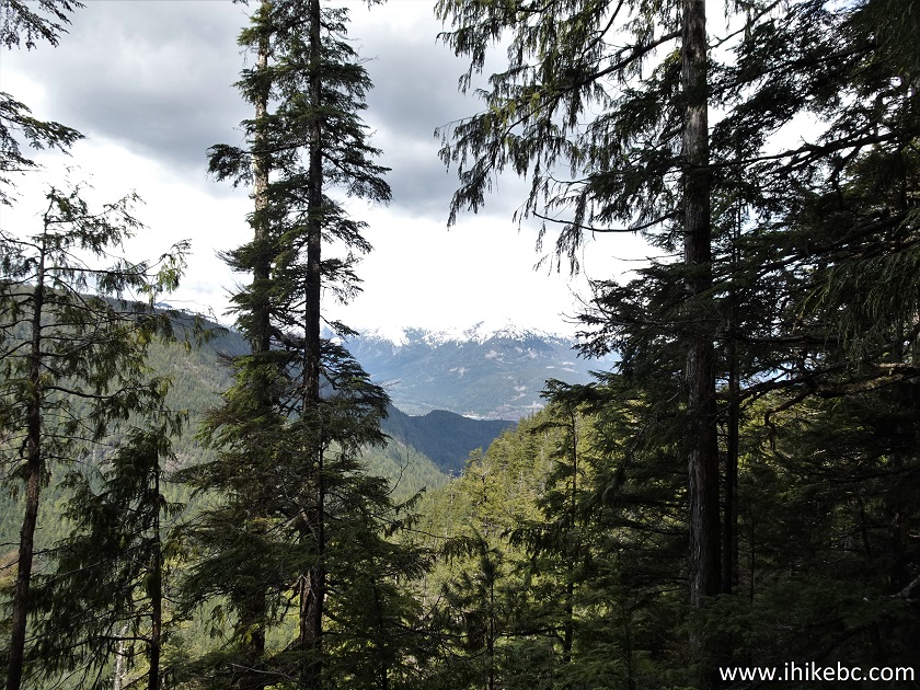
33. At 1.20 km there is a major split. Coordinates: N 49⁰28.862' W 123⁰25.643. Elevation: 400 meters. The trail continues straight ahead, but there is also a prominent flagged trail on the left side. We hiked on it for several hundred meters, and couldn't figure out where it was going. Perhaps, to another Mount Killam trailhead? The main trail becomes especially steep after this split.
Mount Killam Trail - Gambier Island BC Hiking
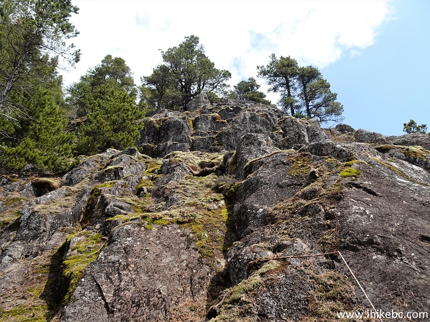
34. At 2.40 km there is this bluff. We thought this is where the viewpoint is, but the trail continues on the left side. If you would decide to check out the bluff and whatever views it has, be extremely careful, as there are enormous drop-offs and very little foot support there.
Gambier Island, BC
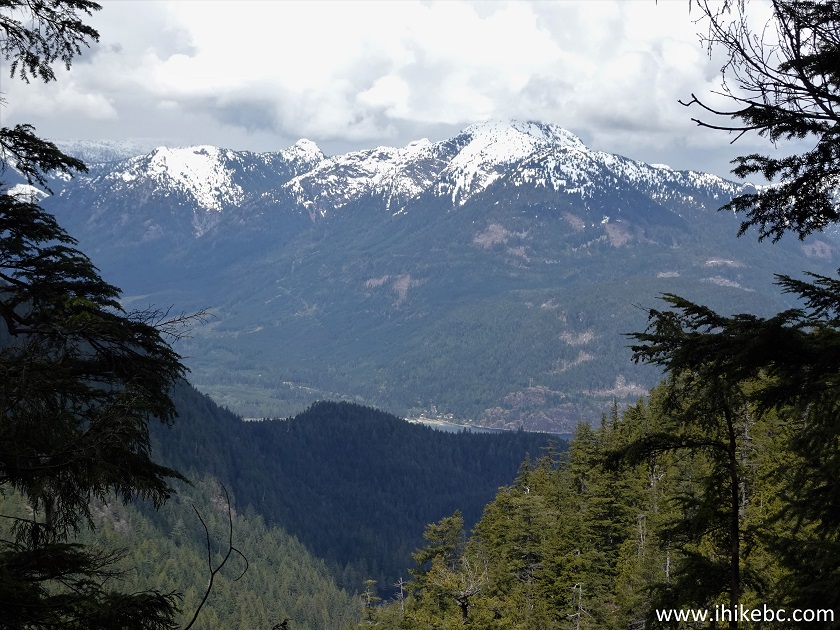
35. A view we got from the bluff.
View from Mount Killam Hike, Gambier Island BC
36. You can safely ignore the bluff, as the path continues just a bit further to the main viewpoint. Still at 2.40 km here.
Mount Killam Trail
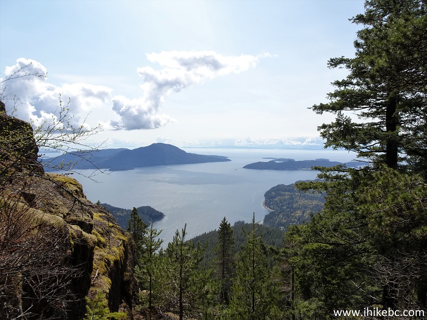
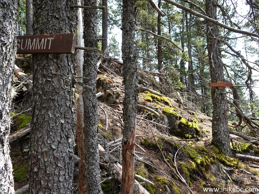
37. At 2.60 km, there is a split. Coordinates: N 49⁰29.087' W 123⁰24.738. Elevation: 693 meters (467 meters elevation gain from the trailhead, for an average grade of about 18%). The treed summit with virtually nothing to see is a further 700 meters up the mountain. And a viewpoint is just to the right.
British Columbia Hiking - Mount Killam Trail
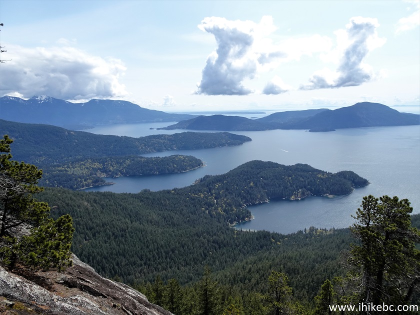
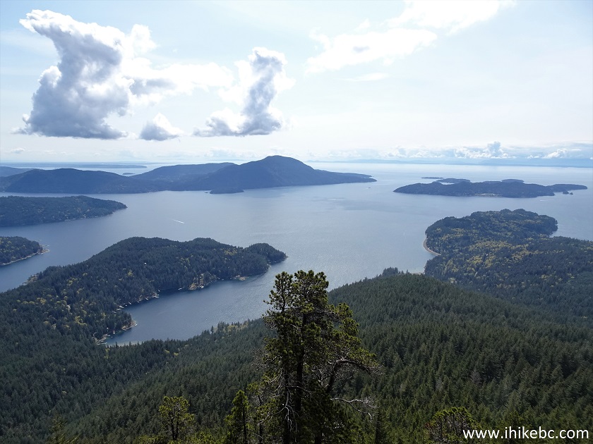
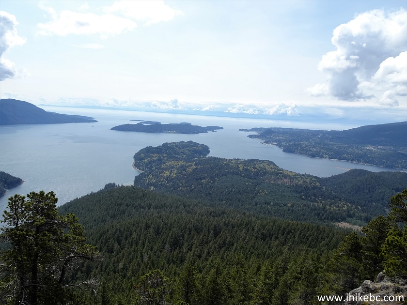
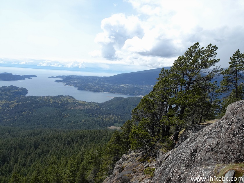
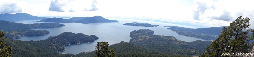
38-42. The views from the main viewpoint are impressive, albeit not spectacular. As you are looking straight South, sun haze is likely to be present all day long. Left to right. Far left is Lower Mainland, background are various peninsulas of Gambier Island, far ahead next to Lower Mainland is Bowen Island, to the right of it is a much smaller Keats Island, and, on the very right, is Sunshine Coast (Langdale/Gibsons).
Here is our video of
the views from this location.
More ihikebc videos are on our YouTube Channel.
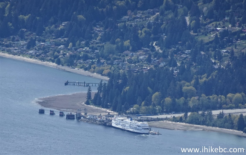
43. BC Ferry Queen of Surrey docked at Langdale Ferry Terminal, where we took the ferry to get to Gambier Island.
Langdale Ferry Terminal Seen from Mount Killam on Gambier Island
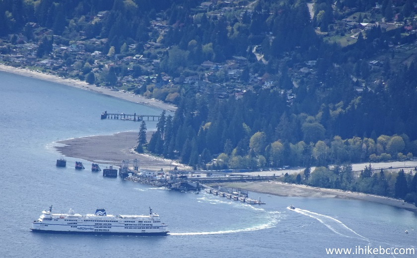
44-45. Now en route to Horseshoe Bay.
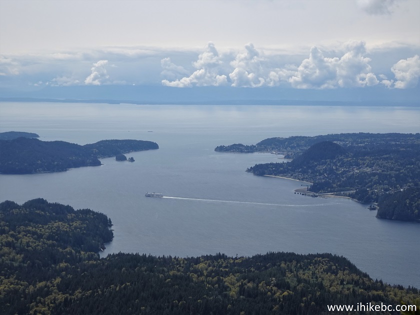
BC Ferry Seen from Gambier Island - Mount Killam
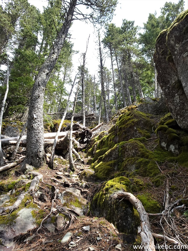
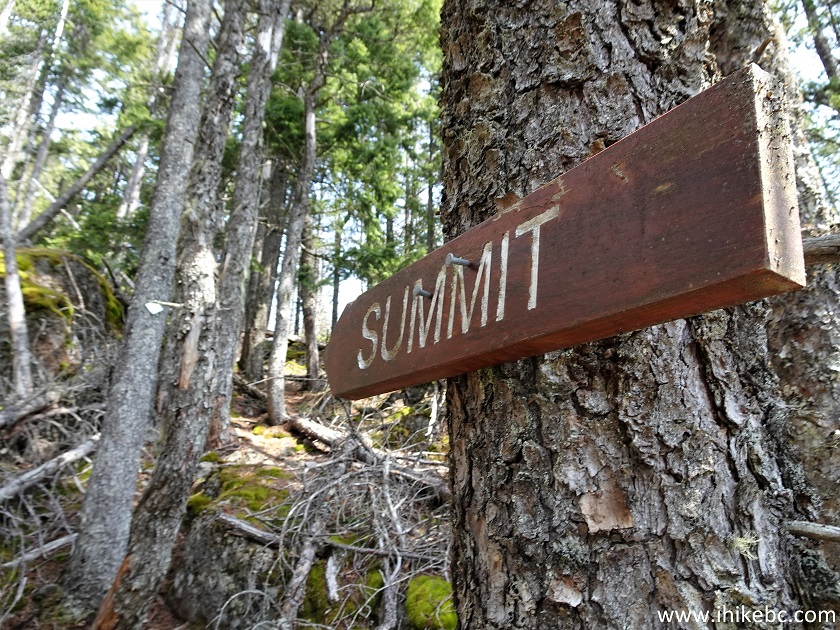
46. We then headed to the summit of Mount Killam.
Mount Killam Trail
47. It's another 700+ meters and 15 minutes of hiking.
Mount Killam Trail on Gambier Island - Hiking in British Columbia Canada
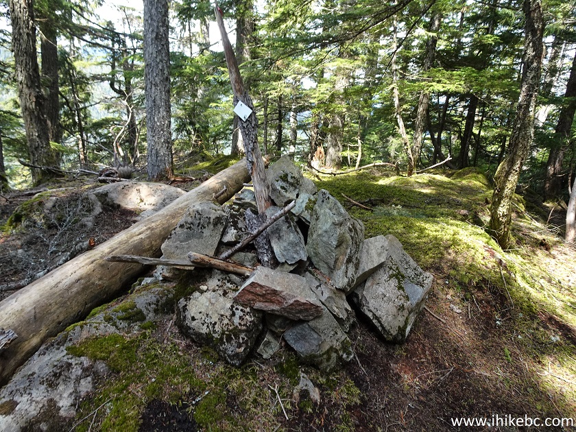
48. Here is the summit of Mount Killam. Coordinates: N 49⁰29.331' W 123⁰24.589. Elevation: 826 meters.
Mount Killam Summit - Gambier Island BC
49-50. As the summit is heavily treed, there is nothing to see here aside from this semi-decent view. Plain and zoomed.
Zoomed View from Mount Killam Summit, British Columbia
The constant industrial sledge hammer-like noise made for a less than serene hike, and the views were a bit hazy, but it's a good trail overall, and the main view is quite decent. Recommended.


|
 |
![]()
![]()
![]()
ihikebc.com Trip 240 - Mount Killam Trail Hike (Gambier Island BC Off Sunshine Coast) Page 2 of 2