![]()
![]()
![]()

Trip 233 - September 7, 2021 (Tuesday)
Two Sisters Trail Hike
Near Barkerville and Wells, BC
Page 2 of 2
Liked: Mountain and valley views, hut/shack at the end of the trail, shade in the forest, no bugs.
Of Note: T
he trail to the shack is open to motor vehicles. Uneven ground to the shack – hiking poles and boots are recommended. Very windy by the shack. Climbing the nearby mountain is much more difficult and is for experienced, well-equipped hikers only.Cariboo Chilcotin Coast BC Backroad Mapbook (4th edition) Trailhead Coordinates: Page 58 (Barkerville) A5.
Other Trips in Wells and Barkerville Area: Barkerville National Historic Site, Mount Murray Hike
.Two Sisters Trail is in the Cariboo region of British Columbia, near the communities of Wells and Barkerville. The main trail starts by a forest service road and goes for 6.5 km to a neat shack on top of a mountain. It's mostly an easy trail with a few moderately challenging sections, and can be tackled by just about anyone. Shortly before the shack there is a split, and experienced, well-equipped hikers may be interested in also hiking a much tougher route for just over one kilometer to the peak of the "Second Sister", where two communication towers are located.
Just about any vehicle would make it from Highway 97 near Quesnel to the trailhead 104 km later: Highway 26 is paved, Bowron Lake Park Road is packed dirt, and 2400 Road is packed gravel. There are no especially challenging stretches along the way.
There are a few impressive valley views by the trailhead right across the 2400 Road, and that's the last good thing you would see for a long time, as the trail at first goes through an absolutely featureless forest for over 5 km, before opening up with all kinds of fine views for the last 1.5 km of the hike.
Do note that Two Sisters Trail is open to motorized traffic all the way to the shack (but not to the Second Sister). The shack has a bed frame, a locked cabinet with equipment for the local search-and-rescue team, and a 12 volt outlet to recharge your gadget(s).
We first hiked this trail on July 18, 2020, but encountered inclement weather at the top, and did not see much because of low clouds. A few photos in this trip report, as well as one short video, are from that hike.
36. Inside the Two Sisters Trail hut/shack, there is a table, a bed frame....
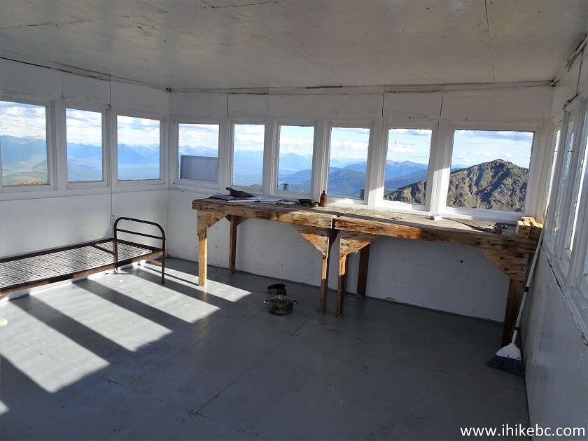
Inside Two Sisters Mountain Hut
37...a good view...
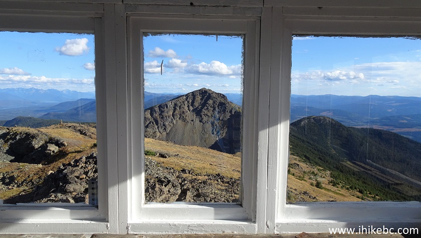
View from Two Sisters Mountain Shack near Wells BC Canada
38...and a cabinet with equipment for a local search-and-rescue team.
Two Sisters Mountain Hut Interior
39-40. Attached to the cabinet is a free-to-use 12-volt outlet.
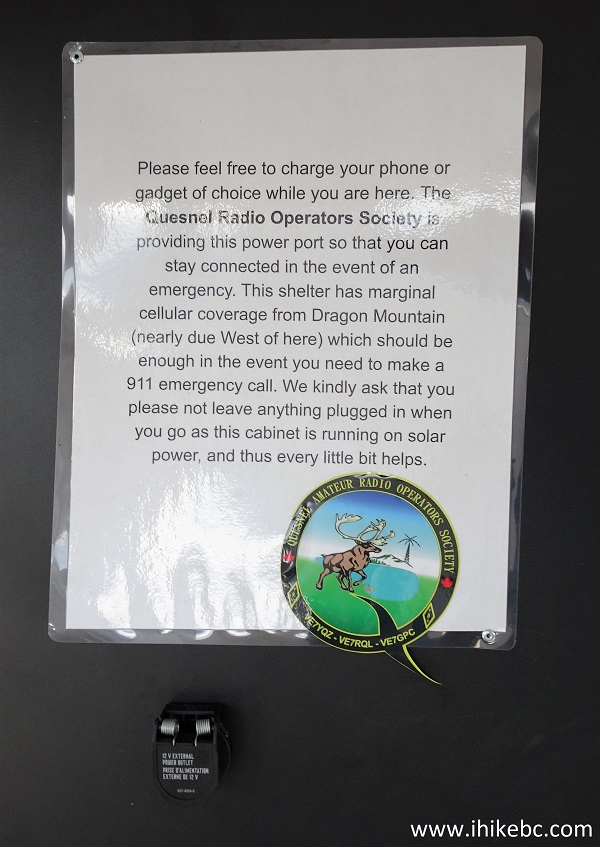

Two Sisters Hut 12 Volt Free to Use Outlet
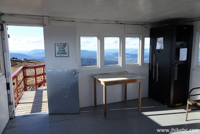
41. The view from the hut's front door. Today and last year.
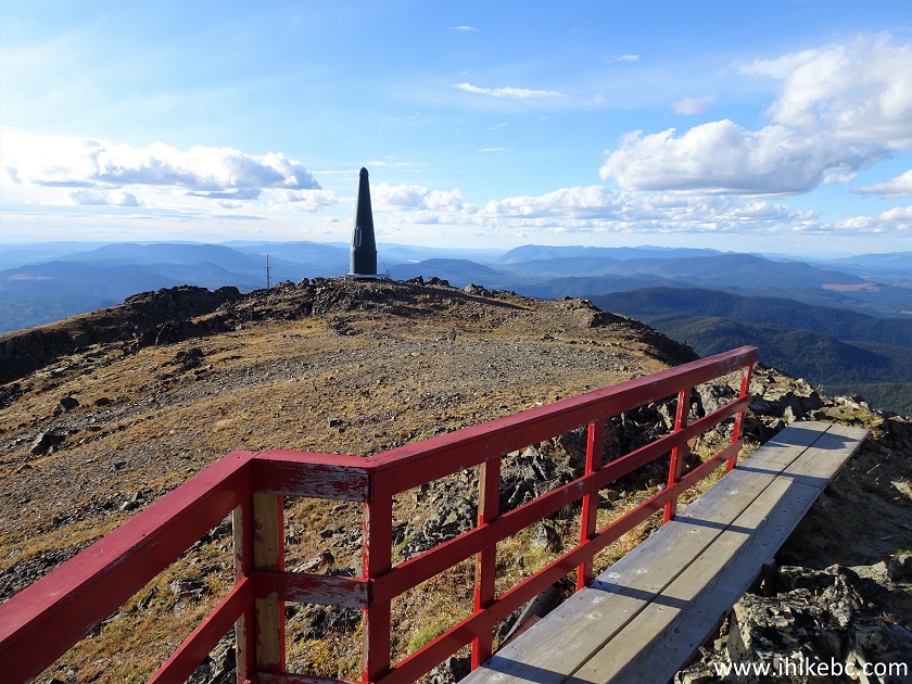
View from Outside of Two Sisters Hut near Barkerville British Columbia
Canada
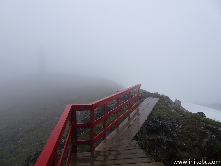
View from Outside of Two Sisters Hut in Fog
Here is our video of the weather here in 2020.
42-43. There are good views to the right of the hut's front door as you exit. Left to right.
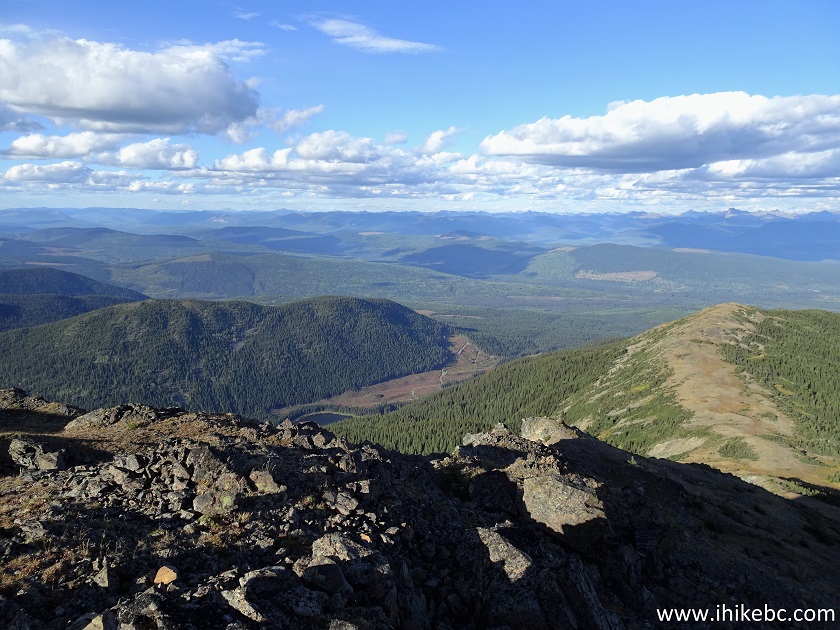
View from Two Sisters Mountain - Hiking in Wells BC Area
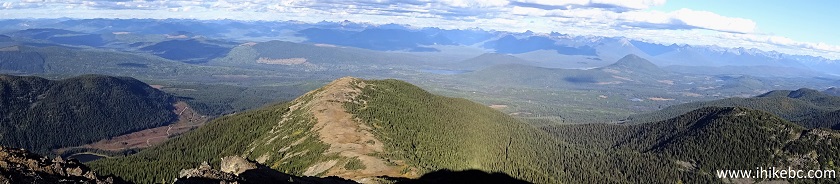
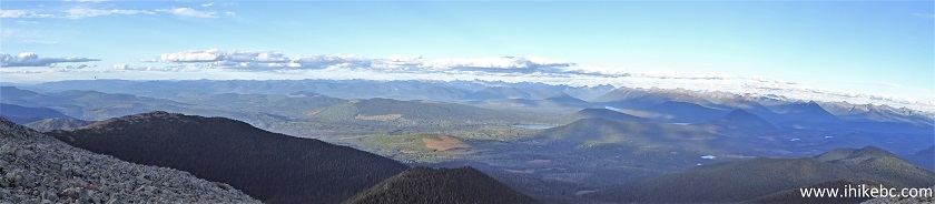
44. And a panorama.
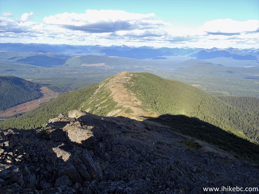
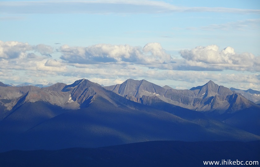
45. Even more to the right, we see the peak of the Second Sister.
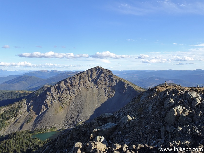
View from Two Sisters Trail near Barkerville BC Canada
46. With much zoom, here are the two communication towers at the top of that mountain.
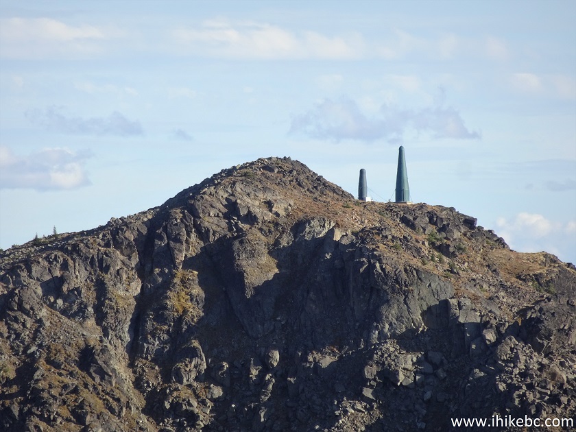
Communication Towers on Top of the "Second Sister" Mountain near Wells
BC
Here is our video of the views from this location.
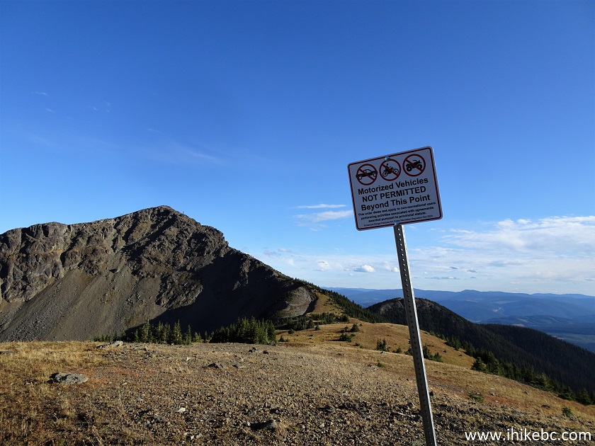
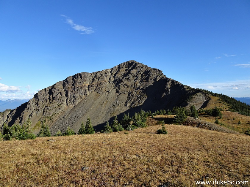
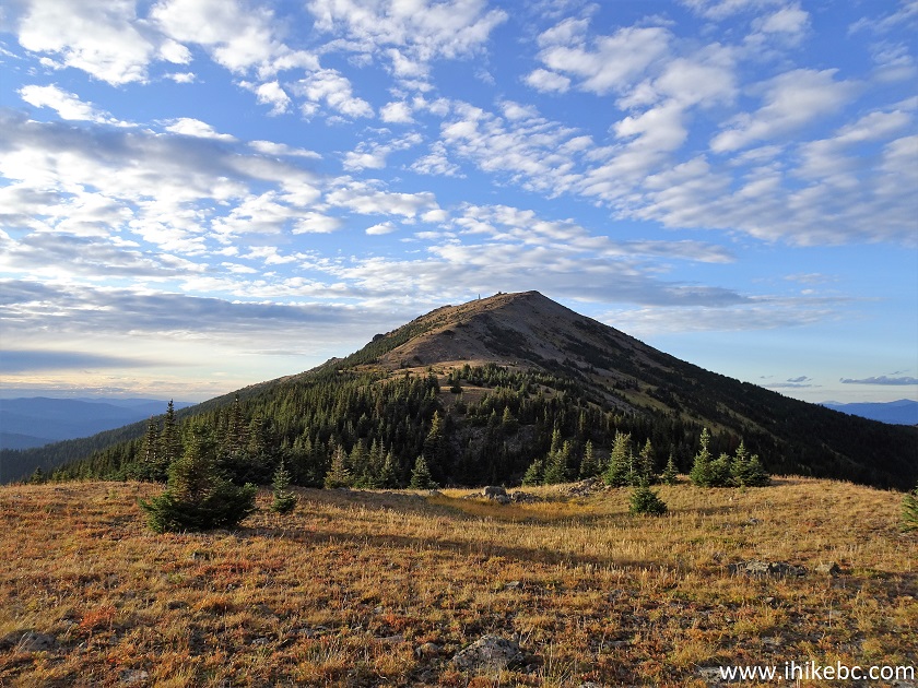
47. We are now back at the split seen in photo #26, ready to hike to the top of the Second Sister. By the way, we have no idea what that mountain is actually called. But it made sense that, since the main trail is called "Two Sisters", it might have been so named because of two mountains/peaks close to each other, with the First Sister being the mountain/peak housing the shack.
British Columbia Hiking
48. Now on the Second Sister trail/route (there isn't a defined trail there, but the ridge route is very obvious). Unlike a (relatively) easy main trail, this trail is only suitable for experienced, well-equipped hikers only.
Hike in British Columbia
49-50. The first real challenge is just past the trees seen in the photo above, as a steep descent is in order.
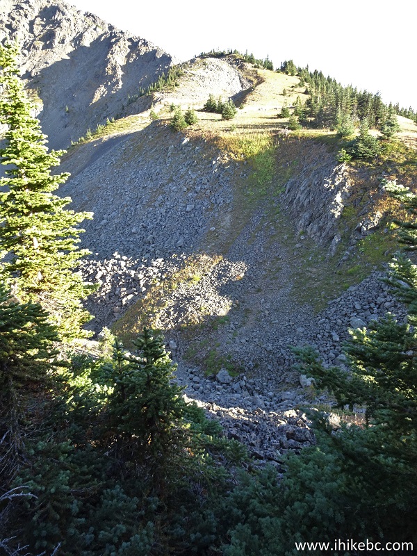
Hiking in British Columbia
Hike in British Columbia Canada
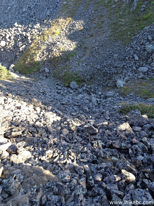
51. And then it's just walking up the ridge, with all of its numerous obstacles. At 434 meters of the hike here.
Canada Hiking
52-53. There is a neat lake to the left of the route.
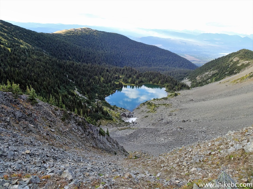
Hike in Canada
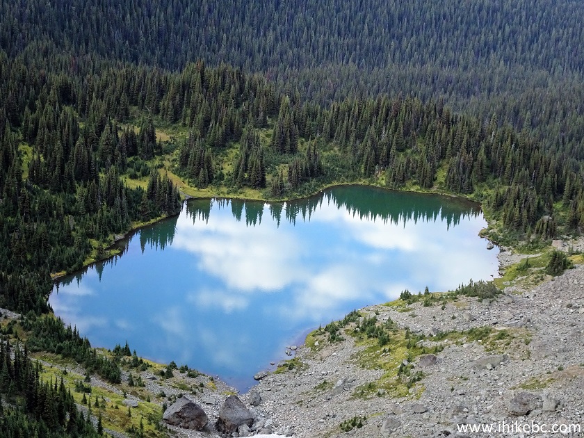
Lake by Two Sisters Mountain Trail in Barkerville BC Canada Area
54. Looking back, we see the First Sister peak far in the distance.
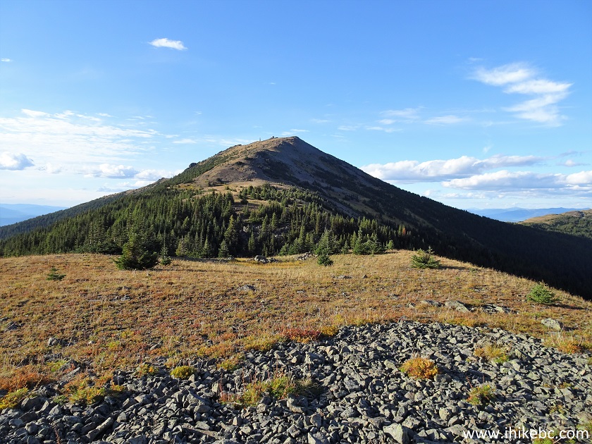
Two Sisters Mountain British Columbia Canada
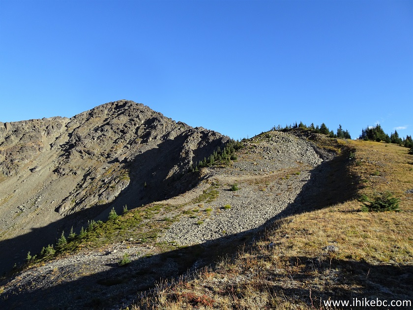
55. A good view to the right as well. At 917 meters of the route here.
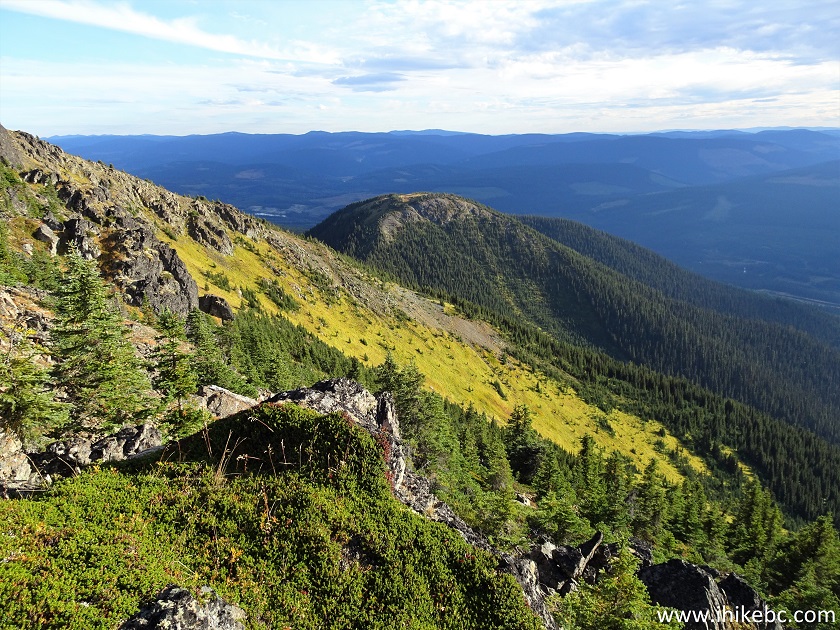
Canada Hiking in British Columbia
56-57. And we are there. Coordinates:
N 53⁰12.326' W 121⁰32.590'. The total distance to the top from the split seen in photo #26 is 1.15 km. Elevation: 2,098 meters.
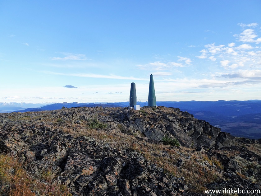
Communication Towers on Top of a Mountain in British Columbia Canada
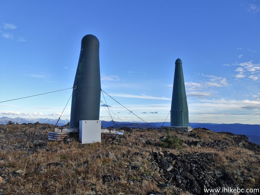
Communication Towers British Columbia
58. A fine view from the top of the Second Sister.
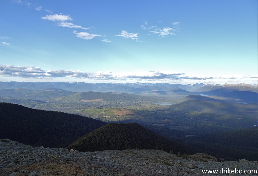
View from "Second Sister" Mountain in Cariboo Region of British Columbia
Canada
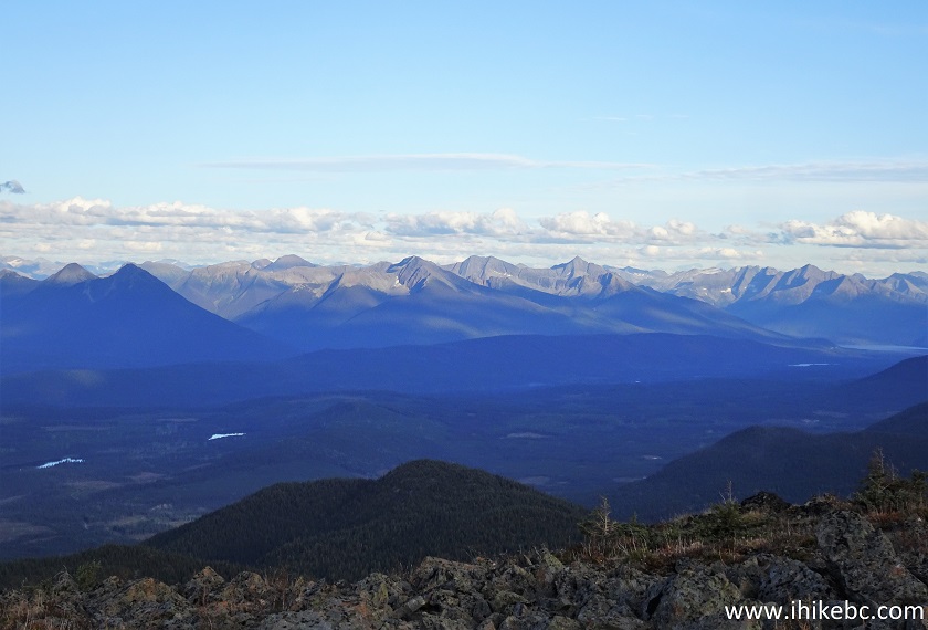
59-60. A bit more to the right. Plain and zoomed.
61. A panorama of the place.
Here is our video of the views from this location.
More ihikebc videos are on our YouTube Channel.
62. On the way back, observed the First Sister in the rays of the setting sun.
Two Sisters Mountain near Wells BC Canada
Two Sisters Trail to the hut is fairly easy and features very fine views. The strenuous climb to the top of the Second Sister is pretty good too. Highly recommended.


|
 |
![]()
![]()
![]()
ihikebc.com Trip 233 - Two Sisters Trail Hike (near Wells and Barkerville BC) Page 2 of 2