![]()
![]()
![]()

Trip 222 - July 13 & August 31 2021 (Tuesday)
Wild Pacific Trail Hike
Ancient Cedars Loop to Rocky Bluffs (Eastern end of the trail)
Near Ucluelet BC Canada
Page 2 of 3
Liked:
Fine ocean and coast vistas, an easy trail with lots of shade, no bugs, numerous benches with views.Of Note: Tsunami hazard zone.
Caution required for rock-hopping on the coastline. The trail is very popular.Vancouver Island Backroad Mapbook (9th edition) Trailhead Coordinates: Page 6 (Ucluelet) B2.
Related Websites: Wild Pacific Trail - Official Website, Wiki - Ucluelet, Google Maps - Ucluelet.
Wild Pacific Trail is quite easy, with only a few small hills, and features numerous fine views of the rugged coastline of Western Vancouver Island. This trail is located by BC Highway 4, near the town of Ucluelet. Highway 4 starts near the East coast of the Island, goes through Port Alberni, and then, at Pacific Rim Visitor Centre, makes a right turn towards Tofino. At that same intersection / T-junction, a left turn leads to Ucluelet (pronounced You-CLUE-Let) in 8 kilometers, where the Lighthouse Loop of Wild Pacific Trail is located. A longer trail (also called Wild Pacific Trail), which is not connected to the Lighthouse Loop, goes from Ancient Cedars Loop (5.5 km from Pacific Rim Visitor Centre) to Brown's Beach / Big Beach (Western end) and Rocky Bluffs (Eastern end).
On July 13th, we started at Ancient Cedars Loop and hiked to Rocky Bluffs (eastern end of the trail) 1.2 km later. There is no parking or any further progress available at that end, so you need to double back. On August 31st, we returned to hike the remaining 2.8 km to the western end of this part of Wild Pacific Trail (to Brown's Beach / Big Beach). If you start at Big Beach or Brown's Beach parking lots, it's 4-5 km one way to Rocky Bluffs past Ancient Cedars Loop (you can bypass it, as there isn't much to see on that short trail, as it's a connector to the highway).
Also on August 31st we also hiked the Lighthouse Loop of Wild Pacific Trail, located even further West than Brown's Beach / Big Beach. It's actually a stand-alone trail separated from the Rocky Bluffs - Brown's Beach/Big Beach Trail by several kilometers of Ucluelet town streets, but it's also called Wild Pacific Trail, so we included the Lighthouse Loop into Wild Pacific Trail trip report on Page 3.
On July 13th, after hiking to Rocky Bluffs (eastern end) we planned on heading West from Ancient Cedars Loop towards Brown's Beach/Big Beach, and actually hiked for over a kilometer in that direction, but mist rolled in from the ocean, making the views rather unappealing. Considering the dark-coloured, gloomy rocks of the Vancouver Island coastline in this area, sunshine makes the views so much better. Do note that going West (towards Brown's Beach / Big Beach) from Ancient Cedars Loop is a but more challenging that going East (towards Rocky Bluffs), though not by much, and there are "Artists' Loops" (so called because there is an occasional small piece of art installed there) spurs through slightly more complicated parts of the trail, which lead to very fine views. Those with strollers or otherwise wishing to have an easier hike have an option to bypass the loops (and the views).
This particular stretch of Wild Pacific Trail is, apparently, especially popular with storm watchers (of which Ucluelet gets about 10 per season, according to an info board), and there are numerous benches and a few platforms with benches to do just that.
To summarize:
Page 1 of Wild Pacific Trail trip report covers Ancient Cedars Loop Trail to Rocky Bluffs (Eastern end of the trail).
Page 2 (this page) - Ancient Cedars Loop Trail to Brown's Beach/Big Beach (Western end of the trail).
Page 3 - Lighthouse Loop Trail even further West (it's technically a separate trail, but is also called Wild Pacific Trail, so we included it in this trip report).
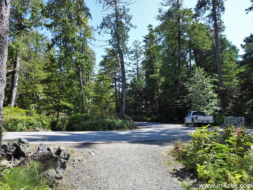
29. It's now August 31st, and we are back at the Ancient Cedars Loop trailhead right by Tofino-Ucluelet Highway. Ancient Cedars Loop has two entrances separated by about 30 meters. This time, we used the entrance to our left (West entrance) to save a few hundred meters. The arrow pointing to Ancient Cedars Loop points to the Eastern entrance 30 meters to the right, and it would be the shortest way to Rocky Bluffs (eastern end) covered on Page 1 of this trip report.
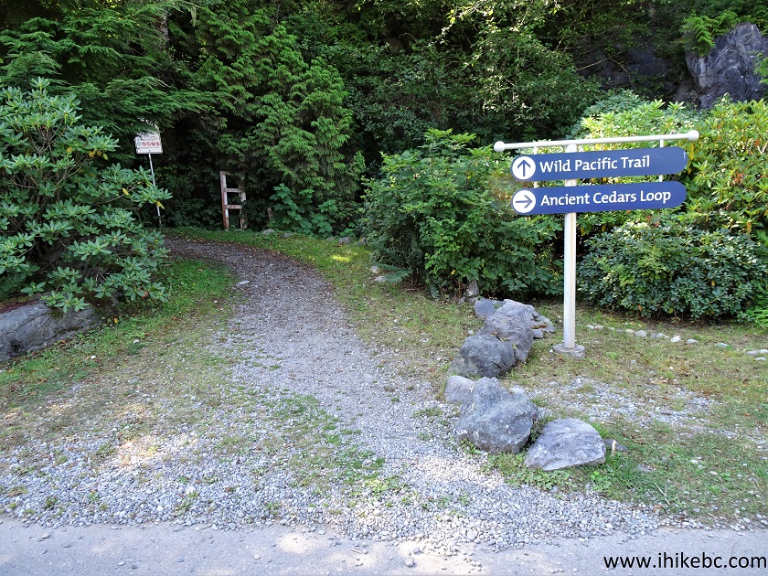
Ancient Cedars Loop Trailhead at Tofino-Ucluelet Highway
30. Now on Ancient Cedars Loop (western side) 25 meters from the trailhead. All the distances in this trip report are based on a GPS odometer, are calculated from the Ancient Cedars Loop trailhead, and are extremely approximate, given the "Artists' Loops" deviations, and the fact that, for some views, you have to get off the main trail for 20-30 meters in order to reach the viewpoint (frequently with a bench). According to signs, it is 2.8 km from Ancient Cedars Loop intersection with Wild Pacific Trail to Brown's Beach (we estimate another kilometer to Big Beach after that).
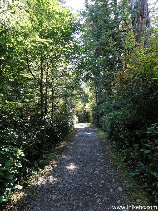
Ucluelet Hike - Ancient Cedars Loop Trail
31. At 370 meters, we have reached Wild Pacific Trail. Turning right at this point would lead to Rocky Bluffs (and/or to completion of Ancient Cedars Loop and exiting at the Eastern trailhead, located 30 meters from the Western one we took to get here). And, turning left, which is what we did, is the way to the western end of Wild Pacific Trail at Brown's Beach/Big Beach.
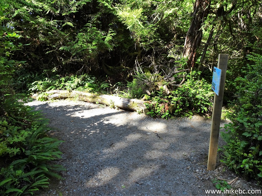
Ancient Loops Trail West at Wild Pacific Trail - Ucluelet Hiking
32. A neat staircase shortly thereafter.
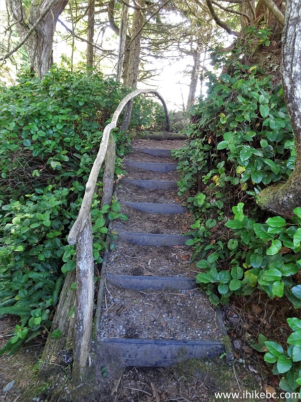
Ucluelet Trail - Wild Pacific Trail
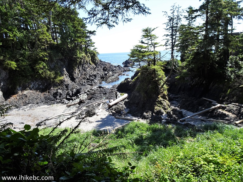
33. The first impressive view comes off a very short spur at 500 meters from the trailhead. A slight zoom used.
-a-little-zoom.JPG)
View from Wild Pacific Trail near Ucluelet British Columbia Canada
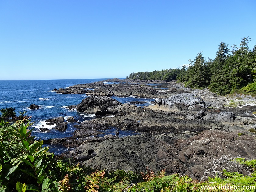
34. At 750 meters, another good view.
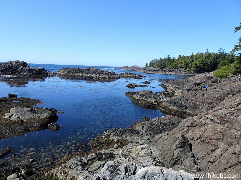
View from Wild Pacific Trail Hike in Ucluelet BC Area
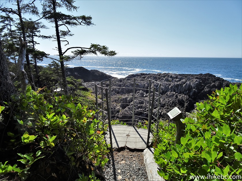
35. A fine-looking drop-off fence at 850 meters.
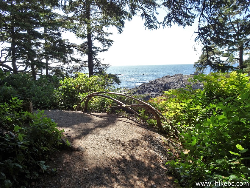
Wild Pacific Trail - Hiking in Ucluelet British Columbia Area
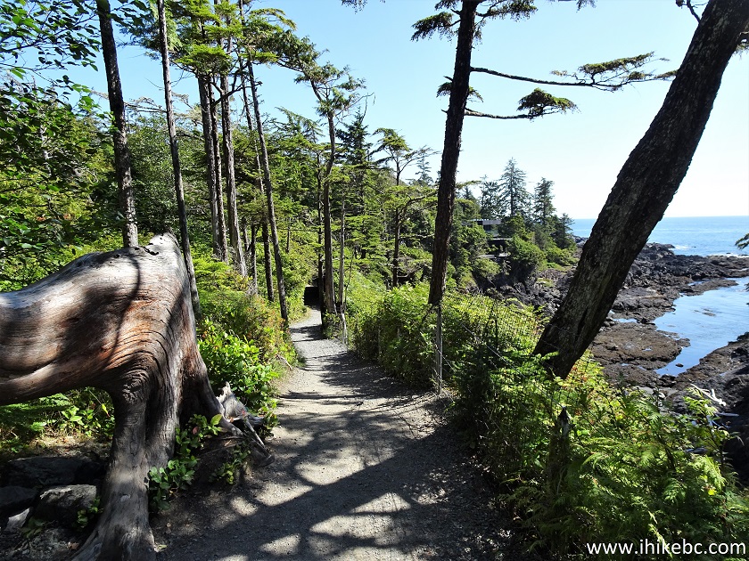
36. There are about four or five "Artist's Loops" spurs which lead to very good views, but are somewhat more challenging (steeper and rougher) than bypasses. Here is one example of such a split, with an Artist Loop being to the right, and the bypass to the left.
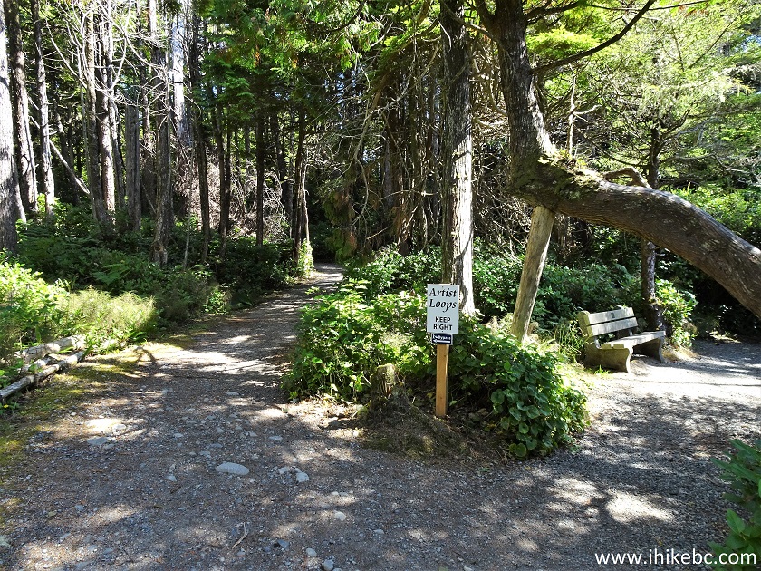
Wild Pacific Trail - British Columbia Trail
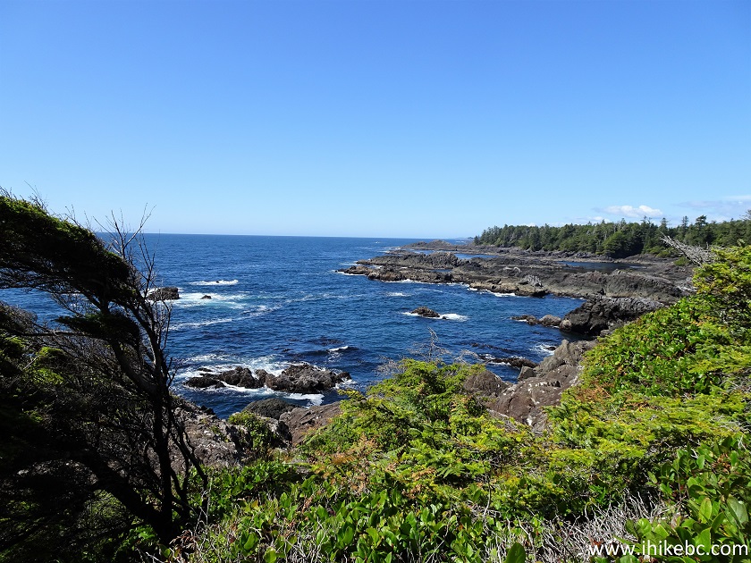
37-38. Now at 1.2 km from the trailhead.
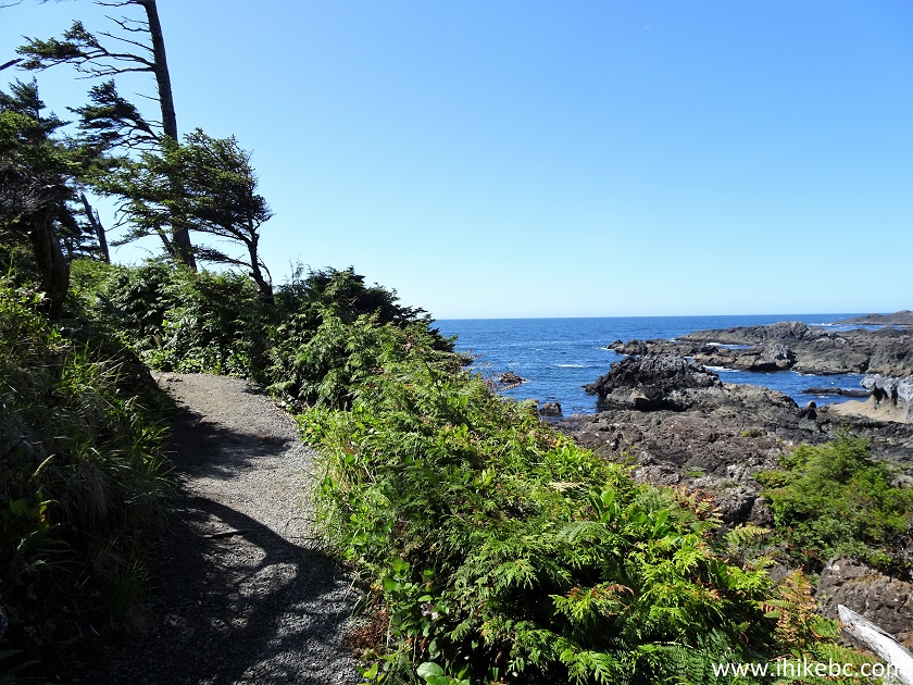
British Columbia Hiking - Wild Pacific Trail near Ucluelet
View from Wild Pacific Trail - Hiking in British Columbia Canada
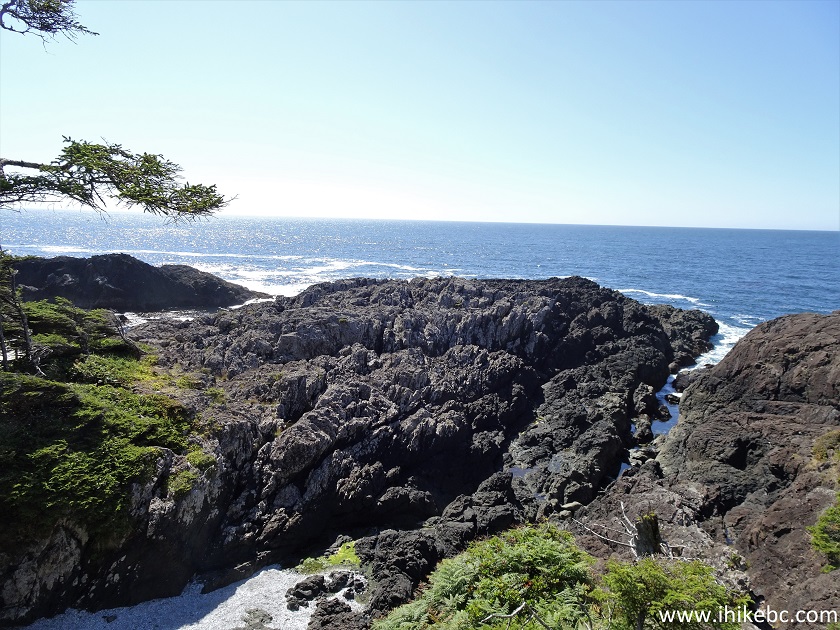
39. It sure gets windy down here.
Hike in British Columbia - View from Wild Pacific Trail near Ucluelet
40-41. "Crow's Nest" piece of art, and the view from the nest.
Wild Pacific Trail - Crow's Nest Viewpoint
Hike in British Columbia Canada - View from Wild Pacific Trail by
Ucluelet BC
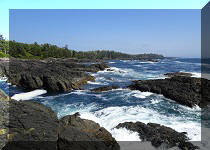
42. And here is how a similar view looked on July 13th after the sun was gone.
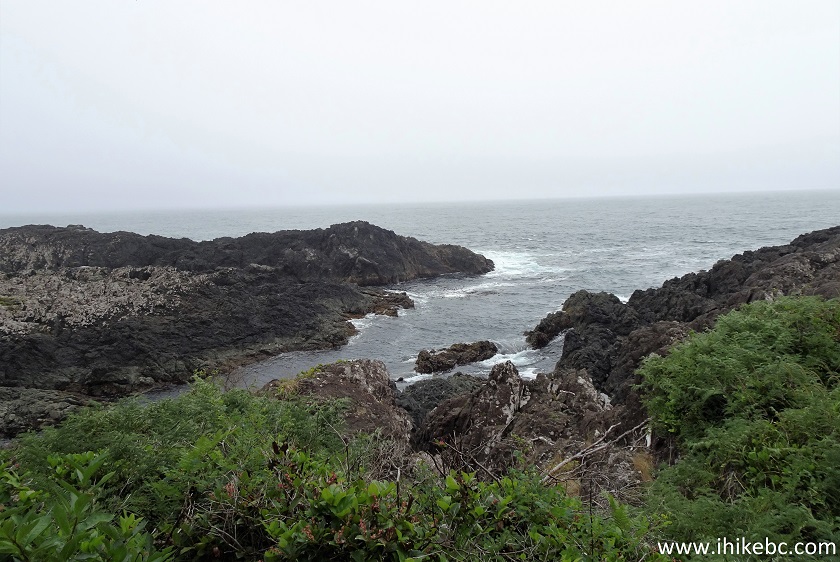
Vancouver Island Hike - View From Wild Pacific Trail
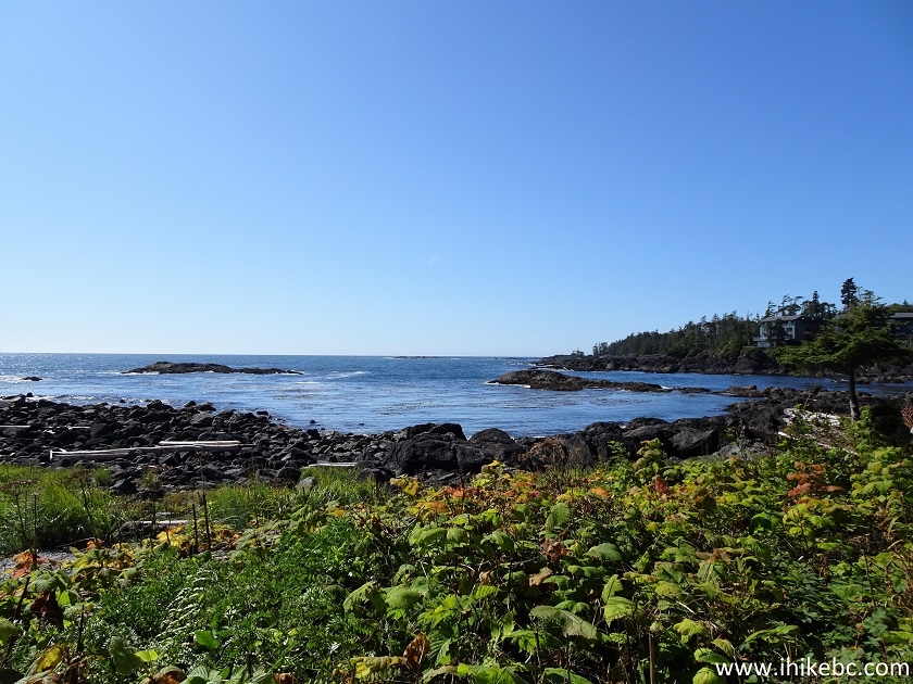
43. Definitely much better with the sun out. At 1.75 km here.
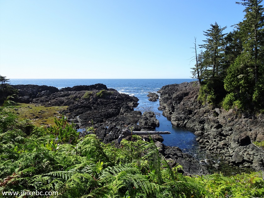
View from Wild Pacific Trail near Ucluelet - British Columbia Vancouver
Island Hiking
44-45. A neatly-shaped tree at 3.0 km
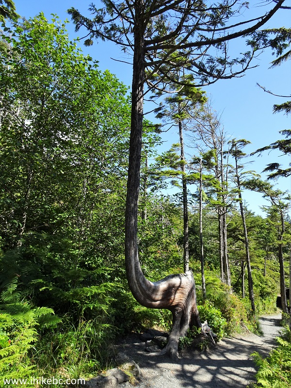
Wild Pacific Trail
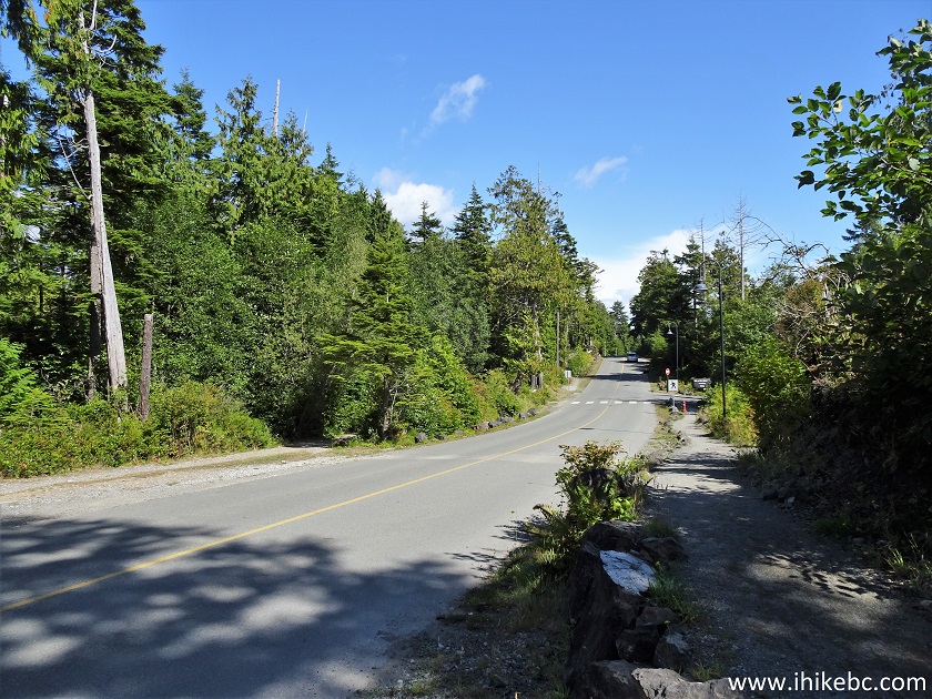
46. A quick road crossing at 3.30 km.
47. A small bridge crossing follows shortly.
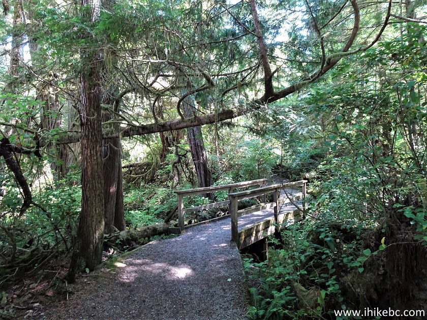
Wild Pacific Trail Hike in Ucluelet British Columbia Area
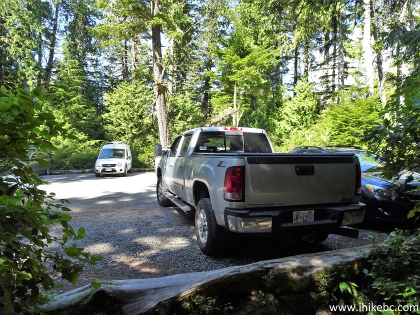
48. Finally, we are at Brown's Beach parking lot. Coordinates:
N 48⁰56.301' W 125⁰33.472'. Elevation: 1 meter. A pit toilet is available just like at Ancient Cedars Loop trailhead. It's a fairly small parking lot, not very suitable for medium-size or big RVs. The entrance is off Marine Drive just before Black Rock Resort. By the way, Brown's Beach does not appear to be a beach, at least we couldn't find any. Big Beach, about 1 km further West, does have a beach.
Brown's Beach Parking Lot Ucluelet BC Canada
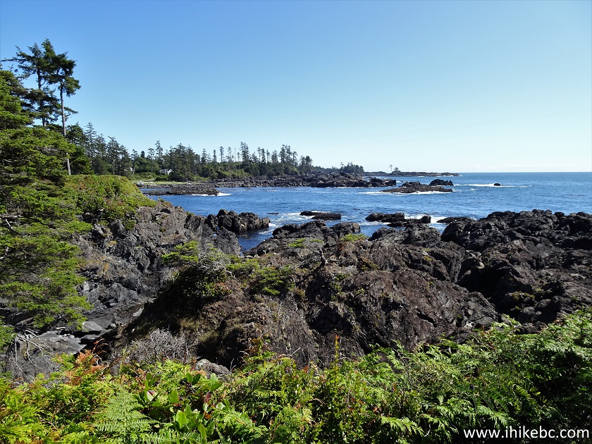
49. A good view a few hundred meters later.
Wild Pacific Trail View
50-51. At approximately 4.10 km, there are two benches overlooking the rugged coast of Western Vancouver Island.
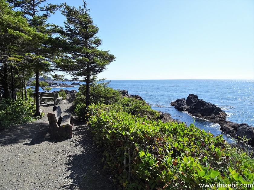
View from Wild Pacific Trail
52. Less than a hundred meters later, Wild Pacific Trail passes by this building...
Ucluelet BC - Wild Pacific Trail
53...and reaches Marine Drive.
Marine Drive Ucluelet BC
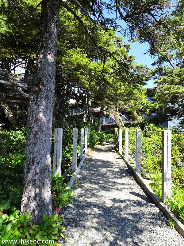
54-56. Now you have two options. Option #1 - go through Black Rock Resort, located a hundred meters further West, and try to locate a not-very-obvious Wild Pacific Trail continuation at the back of the parking lot on the left side. Hiking through the resort is permitted.
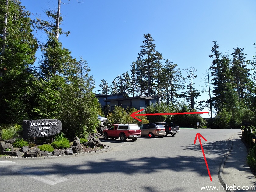
Black Rock Resort Entrance Ucluelet British Columbia Canada
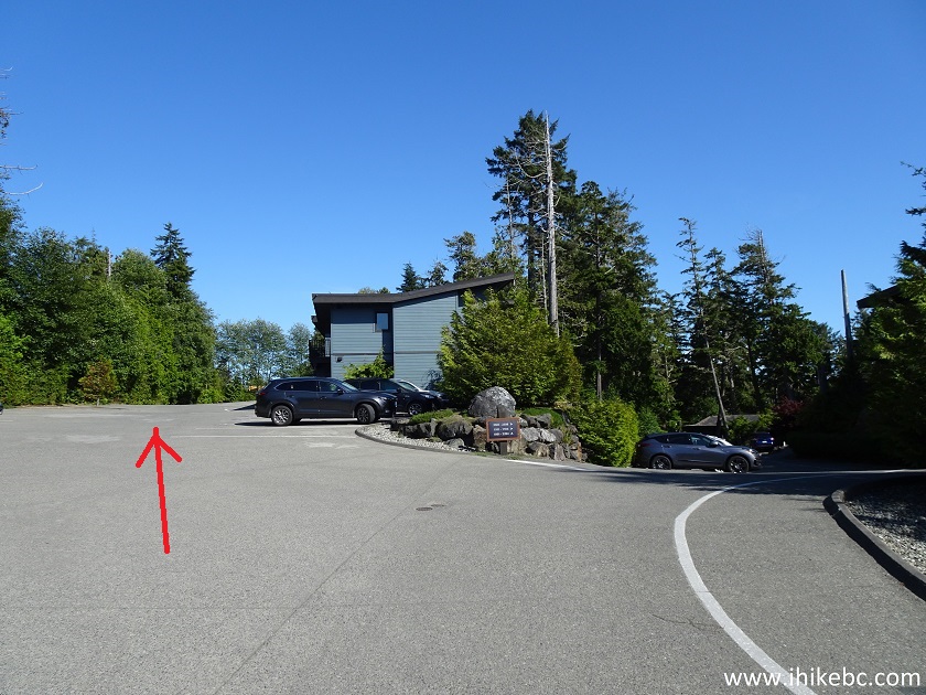
Black Rock Resort Ucluelet BC
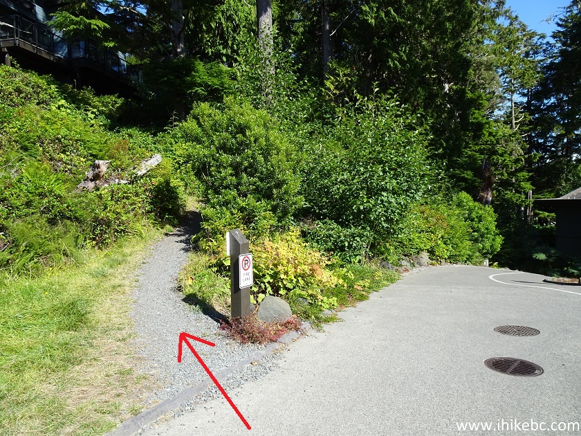
Wild Pacific Trail Entrance at Black Rock Resort Ucluelet British
Columbia Canada
57-58. Or, walk down Marine Drive for several hundred meters and look for a bit more obvious trail re-entry on the right side, located across from The Ridge building (515 and 545 Marine Drive). Coordinates:
N 48⁰56.084' W 125⁰33.024'. Elevation: 8 meters.
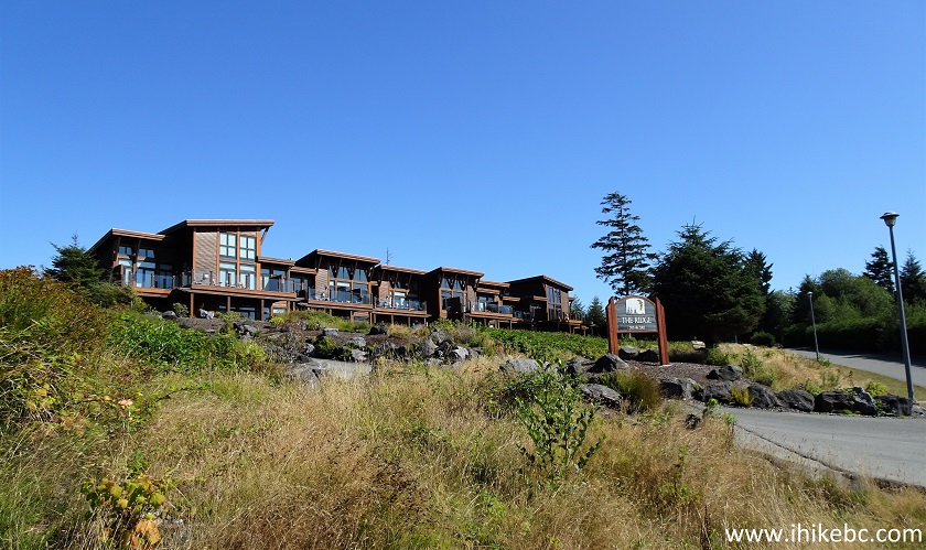
The Ridge Ucluelet BC

Ucluelet BC - Wild Pacific Trail Entrance off Marine Drive
59. Either way, within 5-10 minutes you would reach the western end of Wild Pacific Trail (Lighthouse Loop notwithstanding) at Big Beach. Coordinates for Big Beach Parking Lot:
N 48⁰56.190' W 125⁰33.090'. Elevation: 3 meters. There is a picnic shelter, pit toilet, interpretive signs, parking, and an actual beach there.
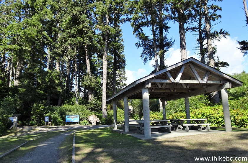
Big Beach Picnic Shelter in Ucluelet BC
60. Here are the interpretive signs.
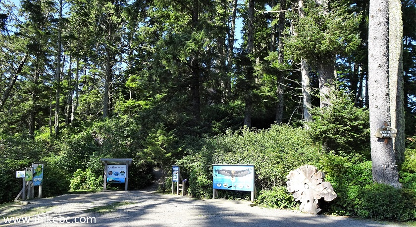
Ucluelet Big Beach Interpretive Signs
61. A very cool bald eagle interpretive sign at Big Beach.
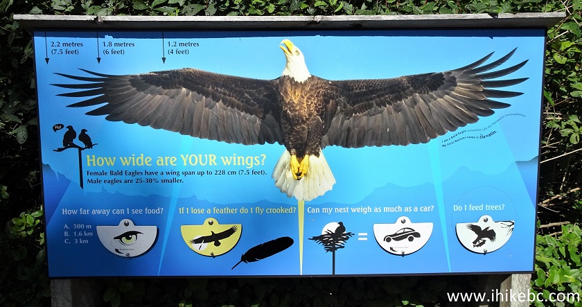
Bald Eagle Interpretive Sign - Big Beach Ucluelet BC Canada
62. The actual Big Beach.
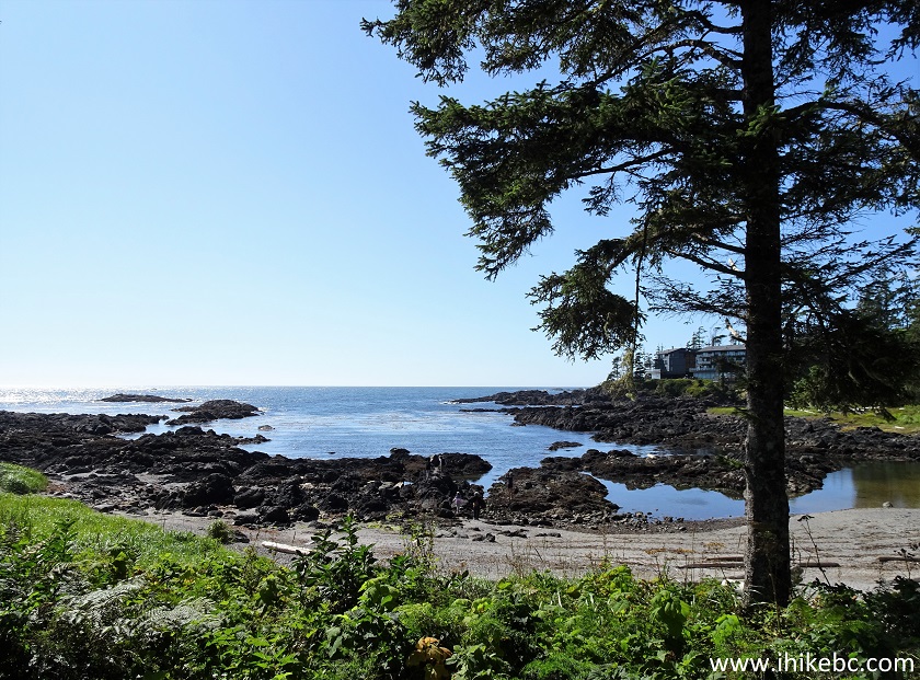
Big Beach Ucluelet British Columbia
63. And a neat view of Big Beach to wrap things up.
Ucluelet Big Beach
This part of Wild Pacific Trail is a bit more challenging to navigate than the stretch from Ancient Cedars Loop to Rocky Bluffs, but has the views which are even more impressive. Highly recommended.
Our Wild Pacific Trail Hike Trip Report Continues on Page 3.


|
 |
![]()
![]()
![]()
ihikebc.com Trip 222 - Wild Pacific Trail Hike (Ancient Cedars Loop to Rocky Bluffs) Page 2 of 3