![]()
![]()
![]()

Trip 182 - May 14, 2020 (Thursday)
Red Rock Trail Hike
Lillooet BC Canada
Page 2 of 2
Location: Town of Lillooet, approximately 250 km North of
Vancouver, if via Highway 1 West and Highway 99 (Sea-to-Sky) North.
Liked: Easy access to the trailhead. Excellent views of Lillooet, Fraser River, mountains, and the valley. Very few bugs.
Of Note: Limited parking by the trailhead, trail is accessible by motorized vehicles, steep unbarricaded drop-offs at the end of the trail, no shade for most of the trail (+35⁰C in Lillooet is not unusual), some traffic noise all trail long, several steep sections - hiking boots and poles are highly recommended.
Vancouver, Coast & Mountains BC Backroad Mapbook (2nd edition) Approximate Coordinates: Page 44 (Lillooet) C7.
Related Websites: Lillooet BC - Official Site, Lillooet BC - Wikipedia.
Red Rock Trail, so called because it leads to the top of a red-coloured rock above Lillooet, is not listed in the 2nd edition of Backroad Mapbook for this region, but, perhaps, is shown in the more recent Mapbook. We found this trail in Lillooet Visitor's Guide, as well as in "Canyon to Alpine" second edition book, which lists trails in the Lillooet area. There are no signs leading you to this trail, and it starts in a residential neighbourhood, at the end of a cul-de-sac. The trail might get busy on a weekend, so parking could be a slight issue. Despite the lack of signs pointing in the trailhead's direction, it's very easy to find, and leads to great views.
There are two ways to get to Lillooet from Vancouver - either via Highway 1 West, then Highway 99 (Sea-to-Sky) North, through West Vancouver-Squamish-Whistler-Pemberton. Or, which will take 100 km more, but about the same time due to the higher speed limits, via Highway 1 East, then Highway 97 North, then Highway 12, through Fraser Valley-Hope-Lytton. If you are a bit further North, get off Highway 1 in Cache Creek and take Highway 97, then turn left 10 km North of Cache Creek onto Highway 99, and take it to Lillooet 73 kilometers later, which is what we did today.
To find the trailhead, drive down Main Street (Lillooet's main thoroughfare) for 1.6 km after entering the town, then turn left onto 6th Ave. 600 meters after that, turn left onto Victoria Street, and, 200 meters later, at the end of the street, the trail begins just beyond the cul-de-sac where you would park, provided there is enough space (please, don’t block driveways).
The trail is moderately challenging, but fairly short. If you don’t feel like hiking 3.4 km to the end, there are two very good viewpoints within the first 650 meters of the trail, with the third viewpoint at the 1.3 km mark. The views from the 2nd and 3rd viewpoints are almost as good as from the top. The trail ground is, mostly, packed dirt, but there are a few quite steep stretches with loose rocks and dirt, so hiking poles and boots would be very helpful.
26. That's one neat sign.
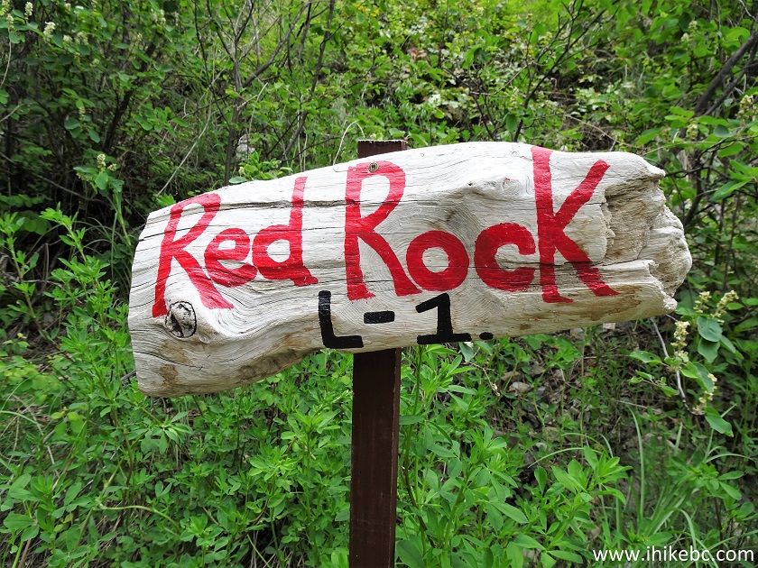
Red Rock Trail Sign Lillooet British Columbia Canada
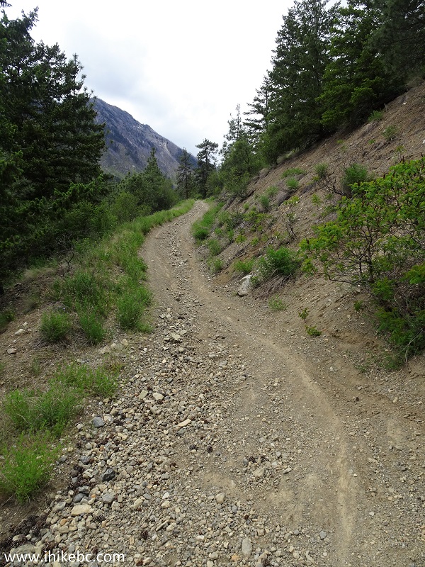
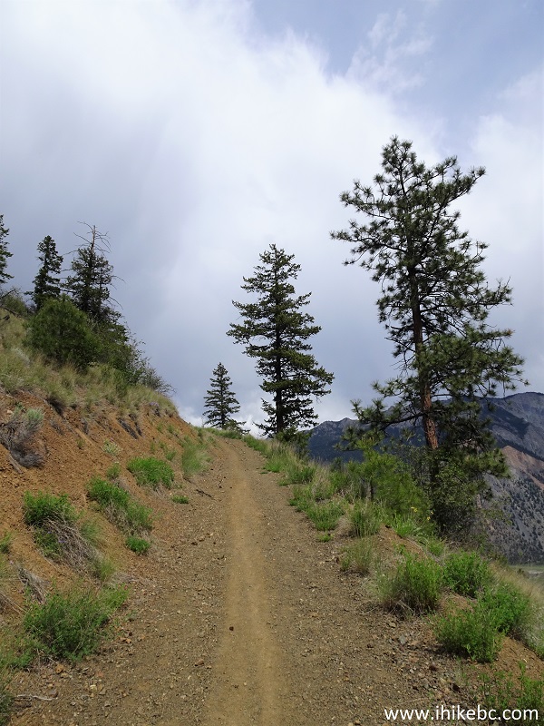
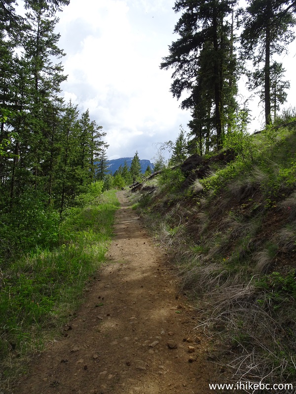
27. The trail looks like that most of the time, with varying levels of steepness.
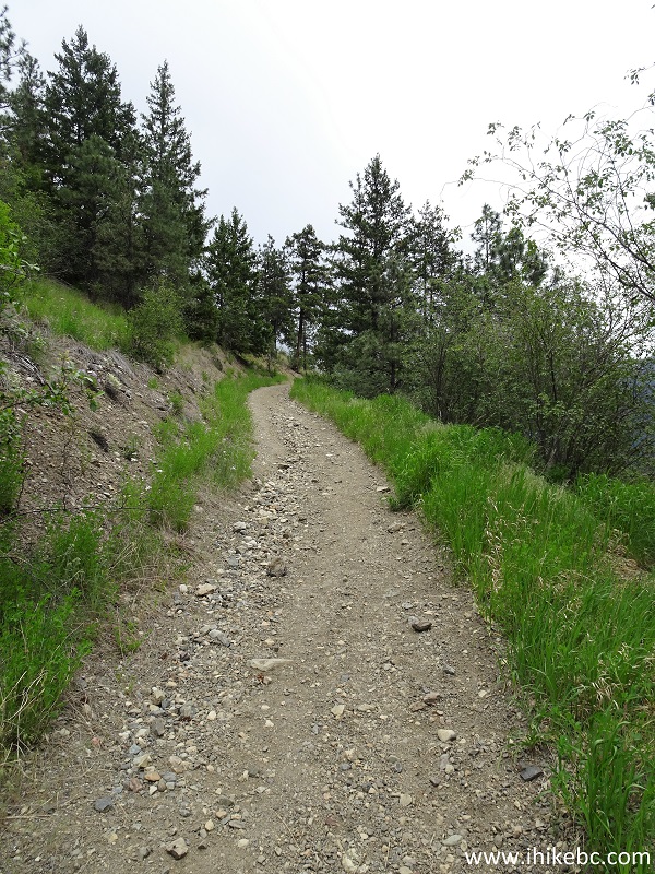
Lillooet Trail - Red Rock Trail
28. The first viewpoint arrives only 450 meters from the start of the hike.
Hike in Lillooet - Red Rock Trail
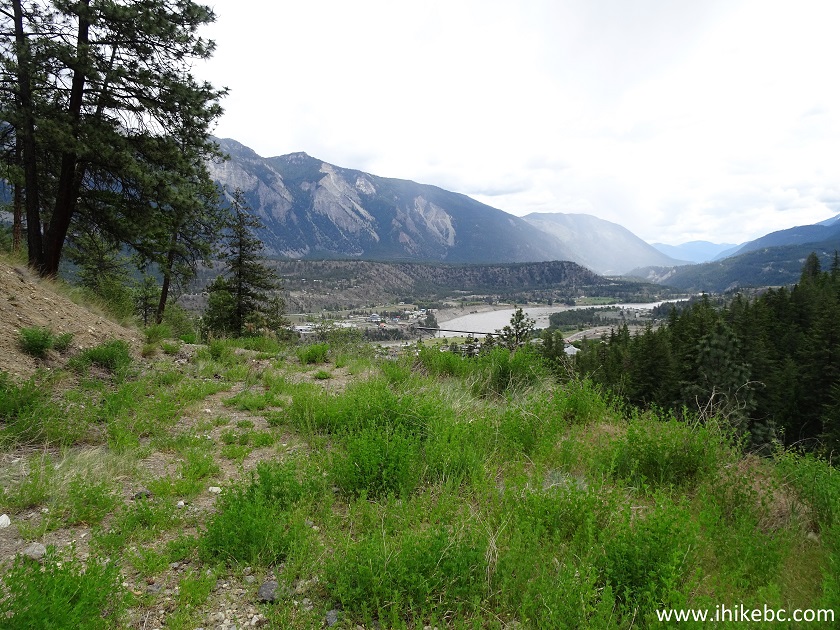
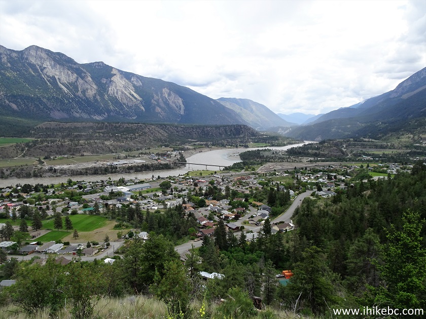
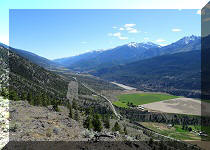
29. Lillooet BC seen from Red Rock Trail.
Lillooet BC seen from Red Rock Trail
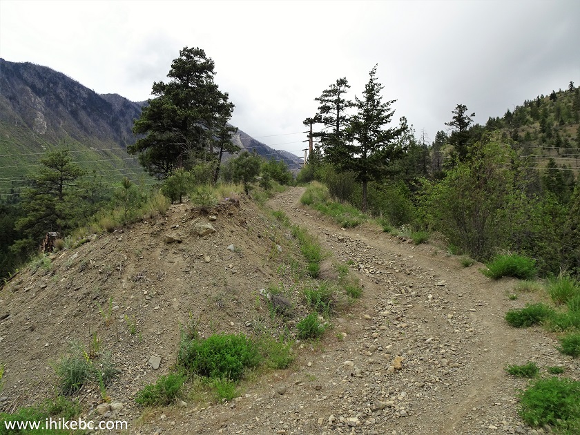
30. The hike continues. We have seen motorcycle tracks on the trail, so motorized vehicles do come here as well.
Lillooet Hike - Red Rock Trail
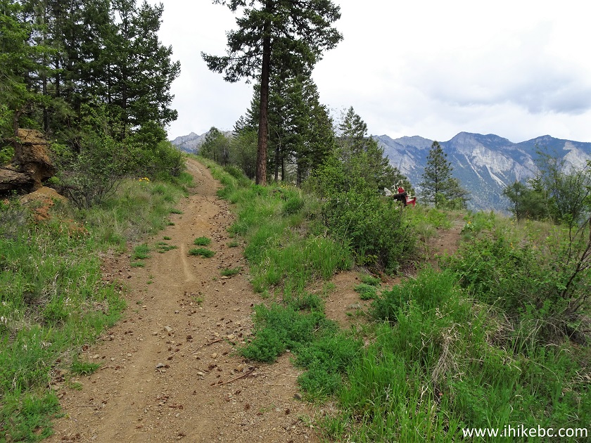
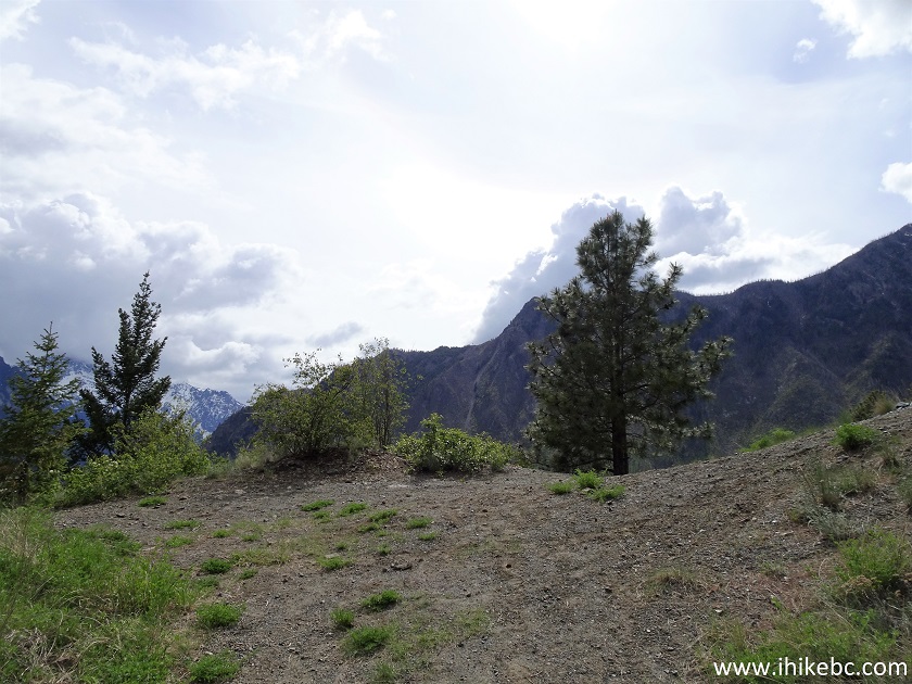
31. Only 200 meters from the first viewpoint, the second one arrives, also on the right side. The views won't get much better, so this might be a good hike destination, if you are pressed for time or don't have hiking poles or boots.
Lillooet BC
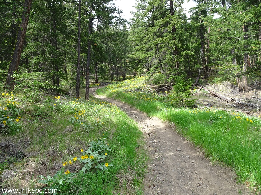
32. Moving on.
Red Rock Trail - Lillooet Hiking
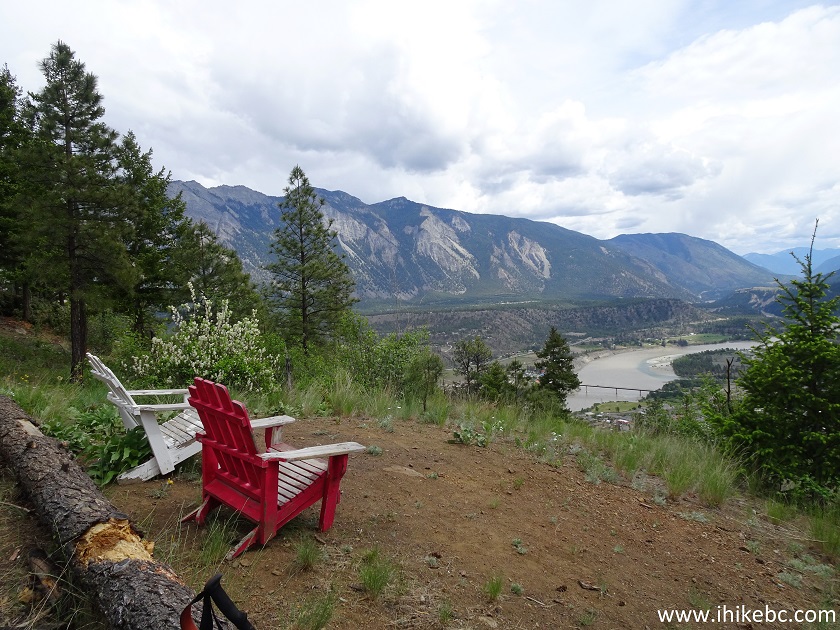
33. The third viewpoint is at the 1.3 km mark, and features two wooden chairs.
Trail in Lillooet - Red Rock Trail
34. Here they are.
British Columbia Hiking in Lillooet
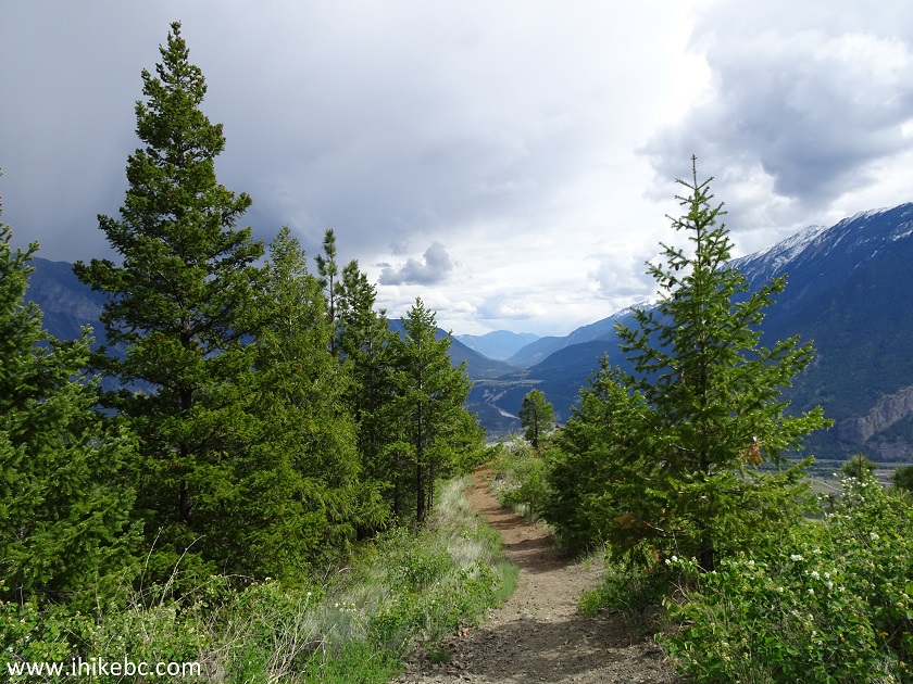
35. There are some trees slightly obstructing the view at the third viewpoint, but hike just a few meters further to get an unobstructed view.
Red Rock Trail Hike in Lillooet BC
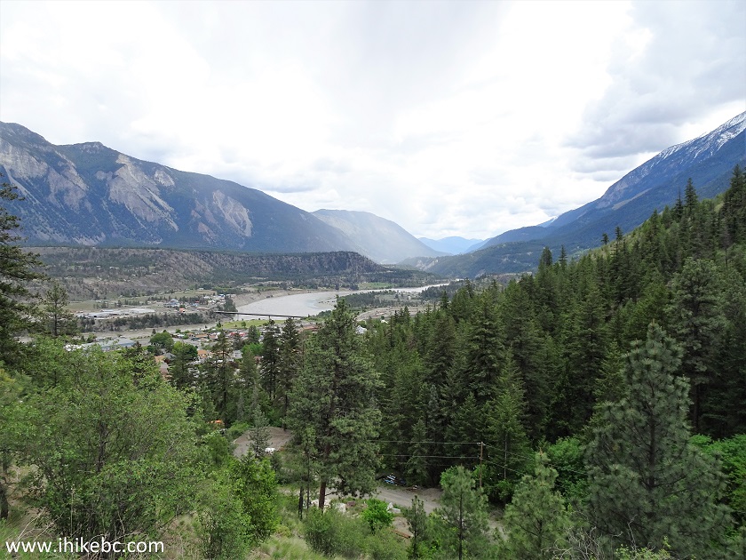
36. The unobstructed view.
Lillooet BC Canada
Here is our video of the views from this location.
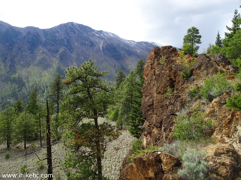
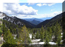
37. There is no shade until you enter into a forest at some point.
Lillooet Hiking - Red Rock Trail
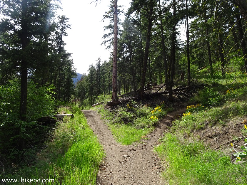
38. Stay left at a fork which arrives at approximately 2.7 km mark of the trail.
Lillooet Hike - Red Rock Trail
39. Getting close to the end of the hike.
Hike in Lillooet BC - Red Rock Trail
40. And we are almost there. Turn left when you come to this T-junction, at about the 3.3 km mark. There is a trail on the right going further up the mountain, but away from Lillooet, if you are interested in further hiking.
British Columbia Hike
41. Having turned to the left, we are about 100 meters away from the end of Red Rock Trail.
Red Rock Trail Lillooet BC Canada
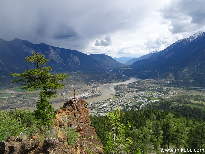
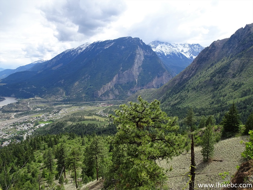
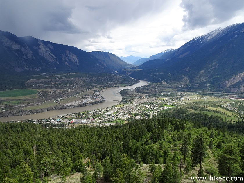
42. And here it is, with a great view being your reward. Coordinates: N 50⁰42.105’ W 121⁰57.202’. Elevation: 816 meters (499 meters elevation increase from the start if the trail, for an average grade of about 15%). Beware of steep unbarricaded drop-offs at this location.
Lillooet BC Canada seen from Red Rock Trail
43. Looking right.
Hiking in British Columbia
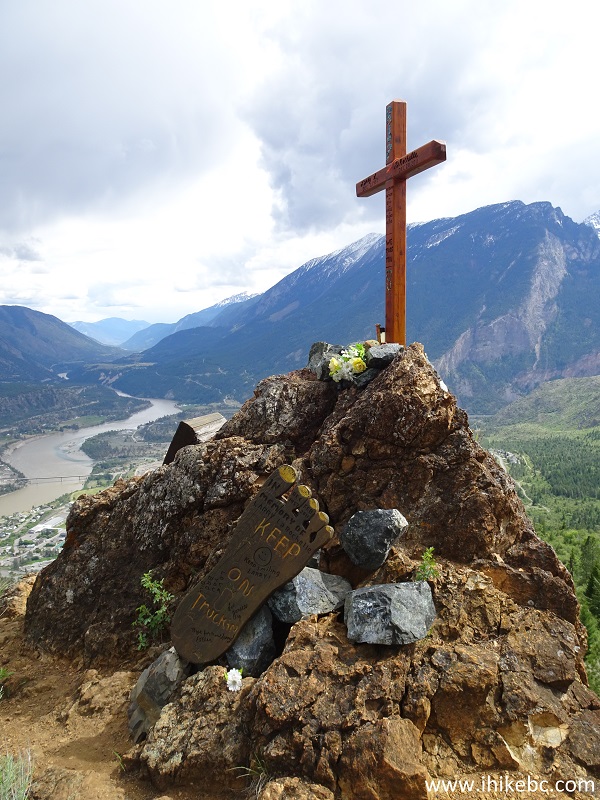
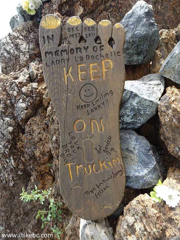
45-46. A short path leads to a cross and a plaque, commemorating Larry LaRochelle.
47. Looking right from near the cross location.
BC Hiking in Lillooet
48. And, looking straight, is the best view of the hike.
Lillooet British Columbia
Here is our video of the views from the end of Red Rock Trail.
More ihikebc videos are on our YouTube Channel.
Red Rock Trail is easy to get to, fairly easy to hike, and features several great views. Highly recommended.


|
 |
Other Trips in Lillooet Area:
|
|
|


|
|
McGillivray Creek Trail |
|

![]()
![]()
![]()
ihikebc.com Trip 182 - Red Rock Trail Hike (Lillooet BC) Page 2 of 2