![]()
![]()
![]()

Trip 212 - May 29, 2021 (Saturday)
BC Highway 12 Valley Lookout Trail Hike
Off BC Highway 12 Between Lytton and Lillooet
Liked: A panoramic view of BC Highway 12 valley from the end of the hike.
Of Note: Very steep, if rather short, trail with loose dirt and rocks. Very little shade. The trail is suitable for experienced and well-equipped hikers only. Hiking poles and boots are essential.
Vancouver, Coast & Mountains Backroad Mapbook (5th edition) Approximate Trailhead Coordinates: Page 45 (Spences Bridge) A4.
Another Trip off McGillivray Creek FSR: McGillivray Creek Trail Hike.
We were in the area on another business, and discovered a new trail. It appears no one hiked it before, and a few short paths here and there were likely made not by humans, but by goats. The trail is very steep, but it's the loose dirt and rocks which make it such a struggle. This is definitely not a trail for novice and/or ill-equipped hikers, as the injury potential is high. After sweating for just over a kilometer, you are treated to a panoramic view of a valley located alongside BC Highway 12 just about half-way between Lytton (35 km to the South), and Lillooet (30 km to the North). Thus, the name of the trail.
For the best views when the sun is out, try hiking in the morning or early afternoon. Later in the afternoon, the sun is starting to shine in the eyes at the viewpoint area.
The trail is well-flagged now, and should be pretty easy to follow. There might be a less complicated way to get to the lookout point, but we followed what seemed to be the most obvious route, so here it is.
1
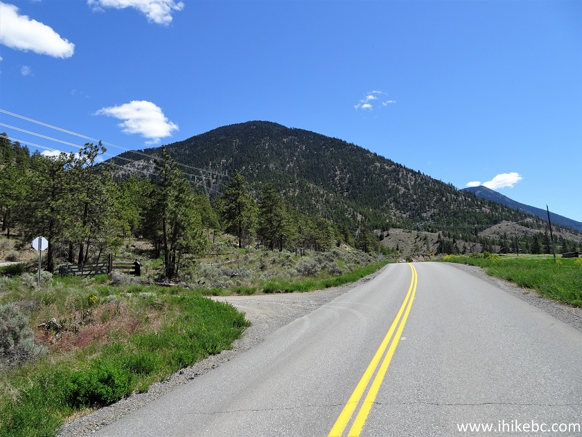
. We are Southbound on BC Highway 12, driving from Lillooet (about 30 km behind) towards Lytton (about 35 km ahead), and are getting ready to turn left onto McGillivray Forest Service Road. It's a very obscure turnoff.
BC Highway 12 at McGillivray FSR
Here is our 2024 video of driving on Hwy 12 from Lytton to Lillooet.
2. The view of the beginning of McGillivray FSR from BC Highway 12. Coordinates: N 50⁰29.797' W 121⁰42.462'. Elevation: 370 meters.
McGillivray Forest Service Road Start
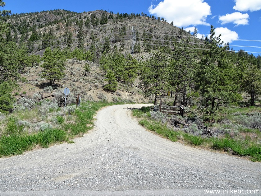
3. The name of the road can't be seen from the highway, as the sign is hiding behind a corner seen in the photo above.
McGillivray FSR Sign
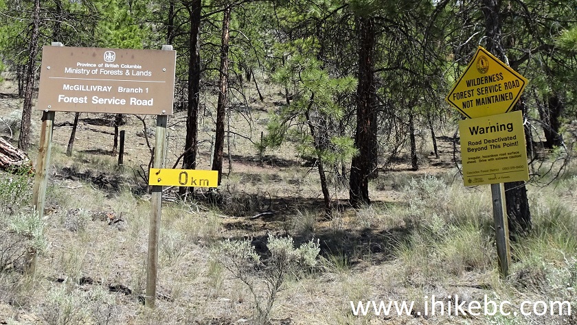
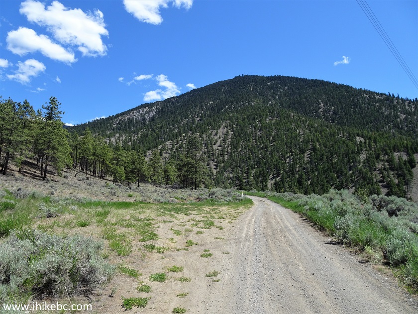
4. Despite the FSR not being maintained, it's in a decent shape to the trailhead, which is just over 1 km away.
McGillivray FSR near Lytton BC
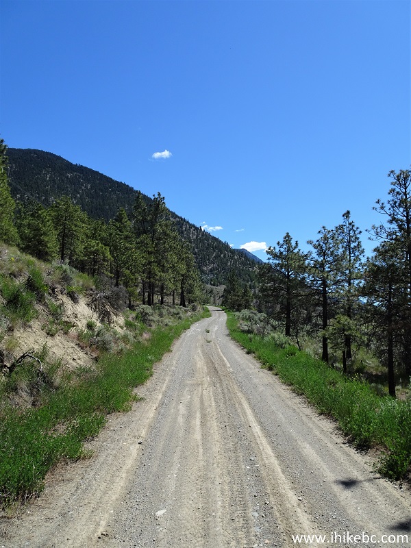
5. There is a tricky spot at about the 1 km mark. So, if your vehicle's clearance would be insufficient, park at this large pullout on the left side 400 meters from Highway 12, seen in the photo below.
McGillivray Forest Service Road near Lillooet British Columbia Canada
6. Here is that rough, tricky spot, between 900 m and 1.0 km of McGillivray Forest Service Road. Most vehicles should be ok here, though.
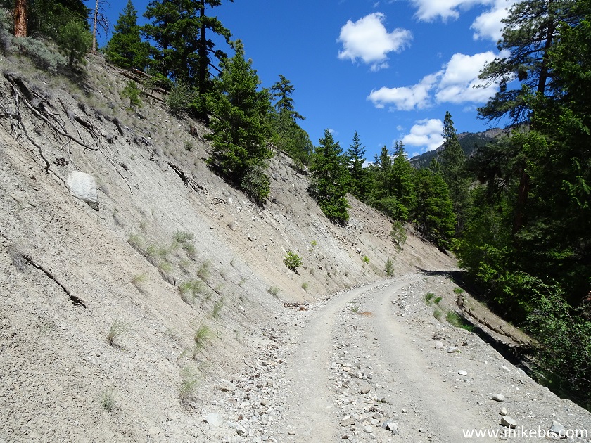
McGillivray FSR between Lytton and Lillooet British Columbia Canada
7. Just after the 1 km marker, there is a cattle guard ahead.
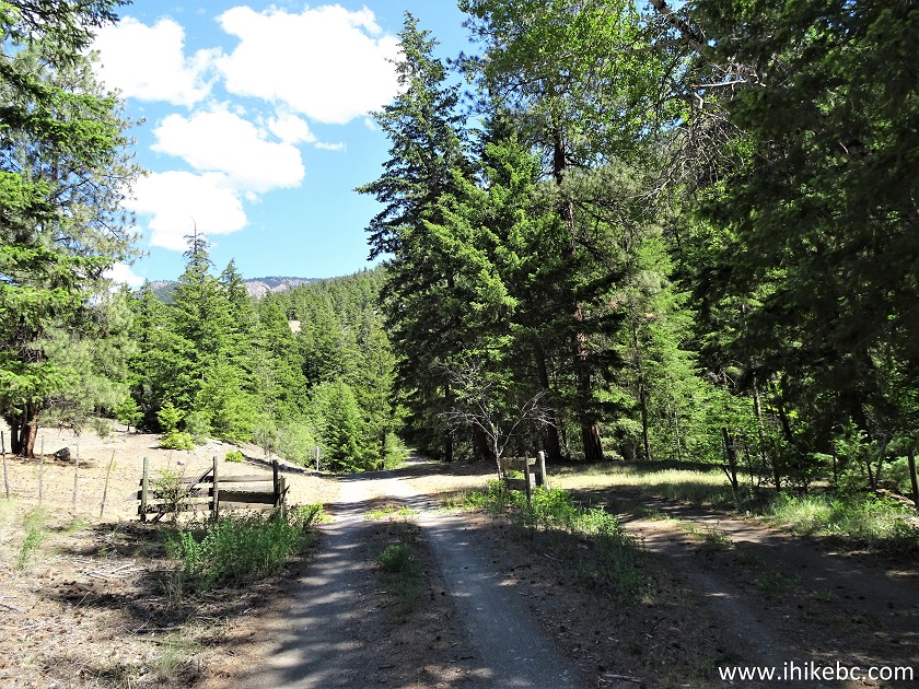
McGillivray Forest Service Road British Columbia Canada
8. The path to the trailhead is on the left side immediately past the cattle guard. Plenty of parking available on the side of the FSR, or on the rough road on the left side, where the arrow is pointing towards the eventual trailhead. Coordinates: N 50⁰29.875' W 121⁰41.726'. Elevation: 433 meters.
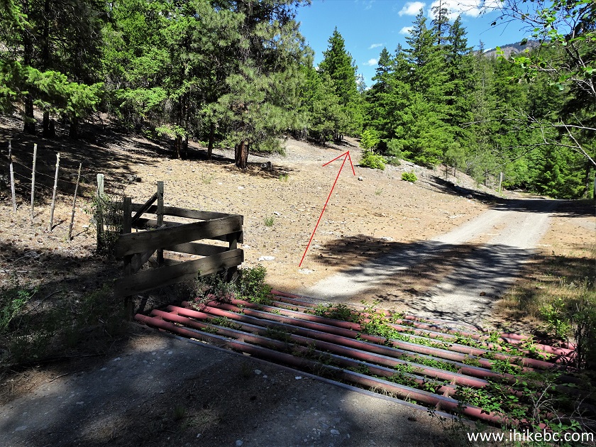
McGillivray FSR at BC Highway 12 Valley Lookout Trail Access Path
9. It's 300 meters from the cattle guard to the trailhead. Just go between the trees (they are widely spaced), keeping as close to the FSR on your right as you can.
Lytton Hiking - BC Highway 12 Valley Lookout Trail Access Path
10. Here we are by the trailhead (on the left side), 300 meters from the cattle guard (all distances are based on a GPS odometer and are approximate).
BC Highway 12 Valley Lookout Trail Access Path - Lillooet Hiking
11. BC Highway 12 Valley Lookout Trailhead. Coordinates: N 50⁰29.974' W 121⁰41.550'. Elevation: 473 meters.
BC Highway 12 Valley Lookout Trailhead - Lytton Hike
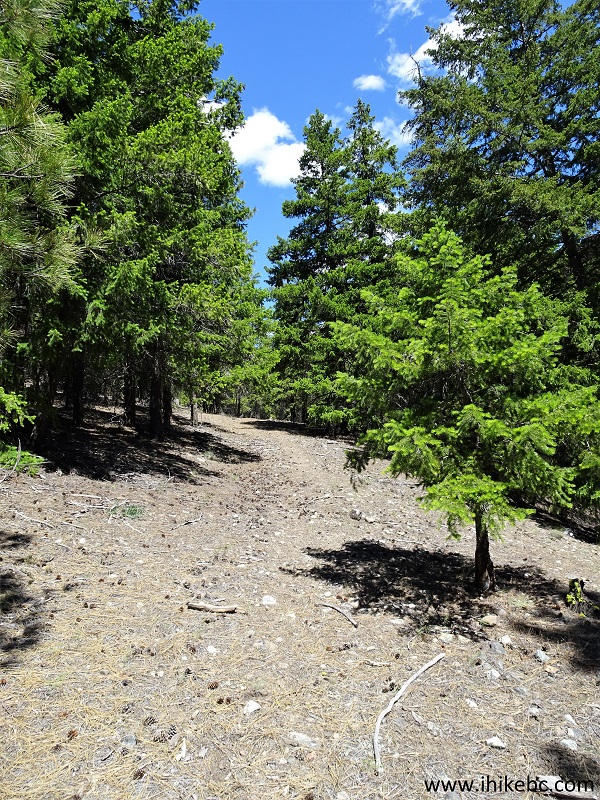
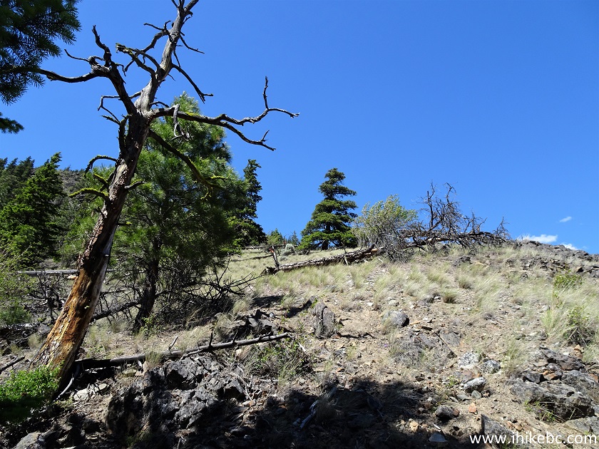
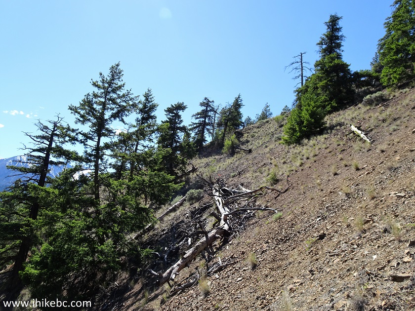
12. The trail is steep from the get-go, with loose dirt and stones making the going tough.
Lillooet Hike - BC Highway 12 Valley Lookout Trail
13. Good views start appearing very soon. Here is looking left at the 200 meter mark.
View from BC Highway 12 Valley Lookout Trail near Lytton BC Canada
14. BC Highway 12 Valley Lookout Trail at 230 meters.
BC Highway 12 Valley Lookout Trail near Lillooet British Columbia
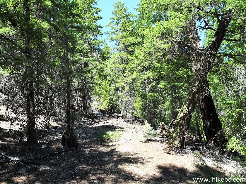
15. Looking right as we climb.
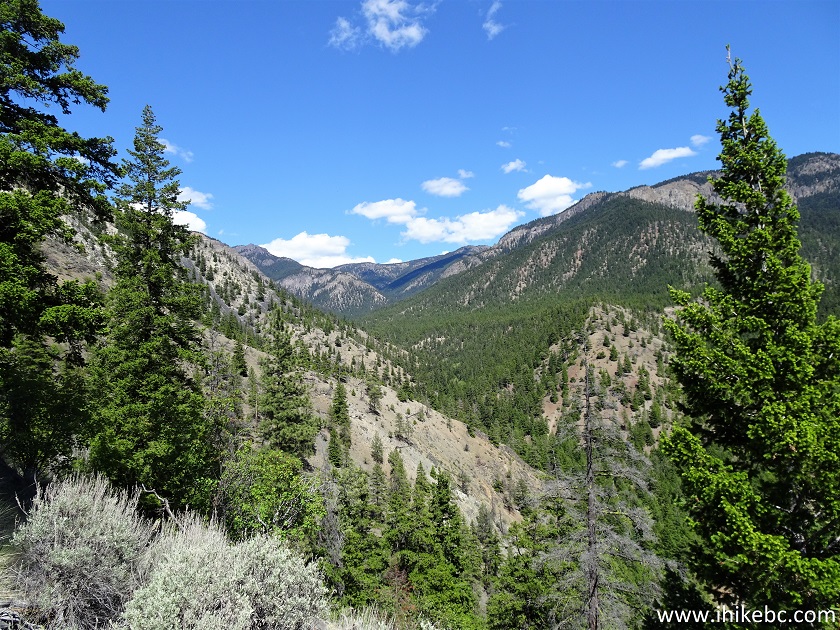
View from BC Highway 12 Valley Lookout Hiking Trail British Columbia
Canada
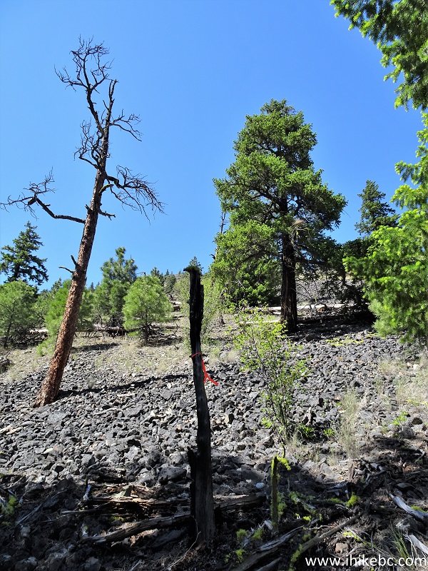
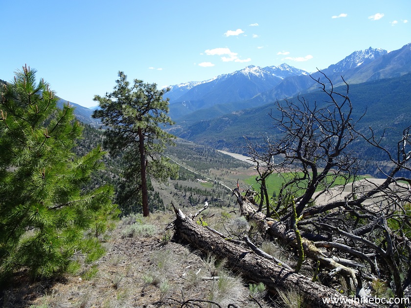
16. Looking behind us at the 630 meter mark.
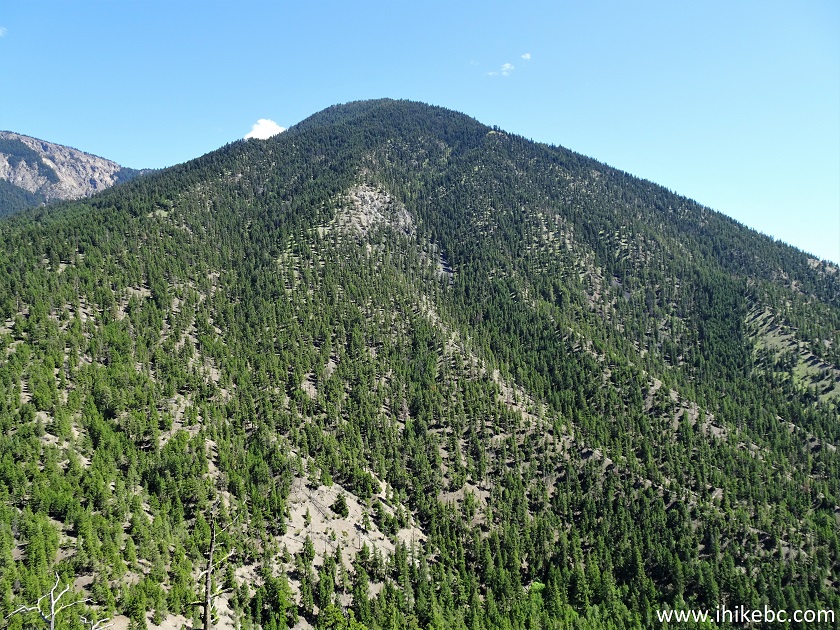
View from BC Highway 12 Valley Lookout Hike near Lytton BC Canada
17. Having climbed up for about 800 meters, the tough part is over, and a left turn makes the trail much less steep. Approximate Coordinates for the Left Turn: N 50⁰30.146' W 121⁰21.029'. Elevation: 701 meters. Estimated grade from the trailhead to the left turn: 28%.
British Columbia Hiking - BC Highway 12 Valley Lookout Trail
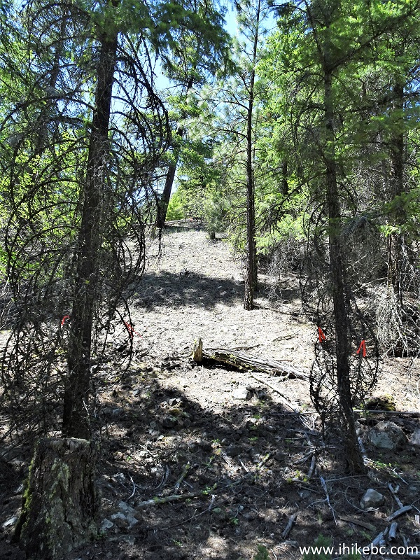
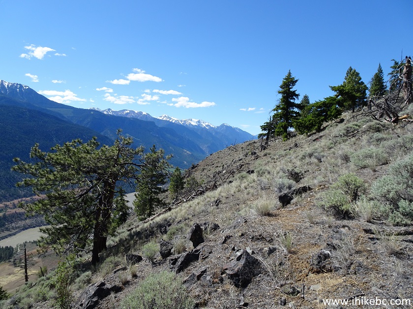
18. The end is near!
Trail in Lillooet Area - BC Highway 12 Valley Lookout Hike
19. And here we are, 1.15 km from the trailhead. Coordinates: N 50⁰30.040' W 121⁰42.029'. Elevation: 729 meters.
British Columbia Highway 12 Valley Between Lytton and Lillooet
20. The above view is quite good, but 150 more meters of hiking to the right is in order for a true panorama.
BC Highway 12 Valley Lookout Trail
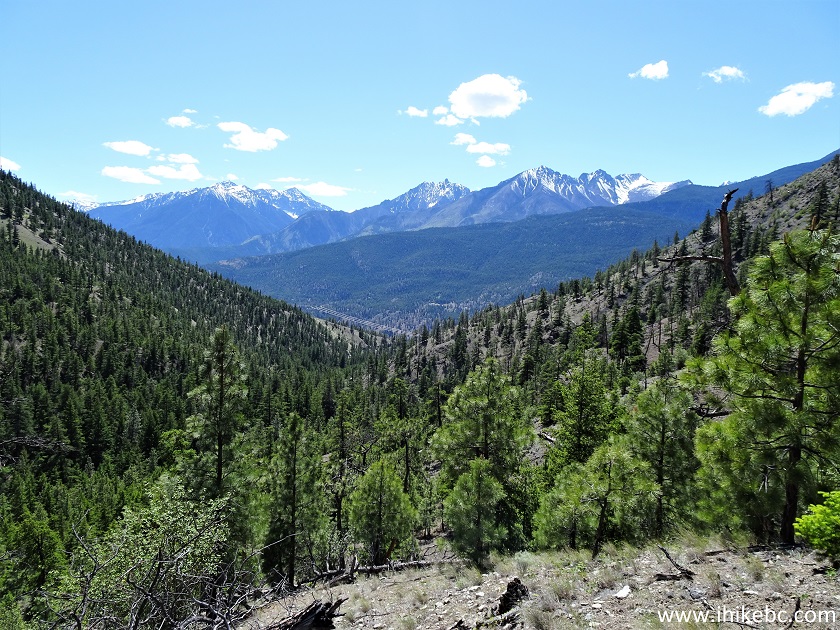
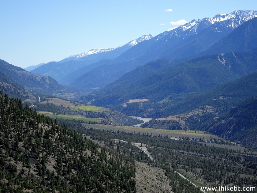
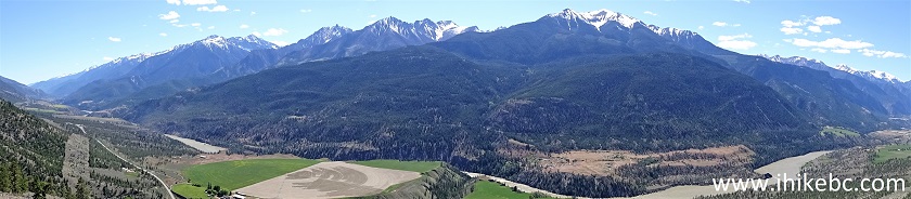
21-24. And now BC Highway 12 Valley is in front of us in all of its glory. The highway and Fraser River can be seen below. Left to right.
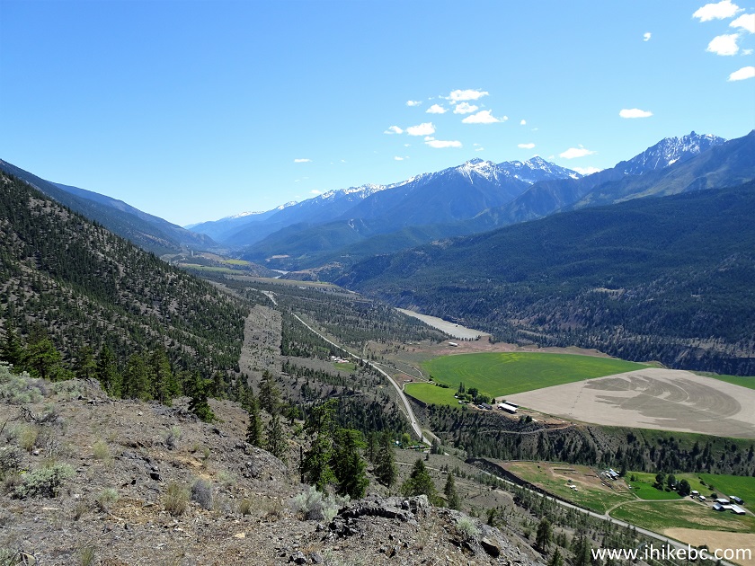
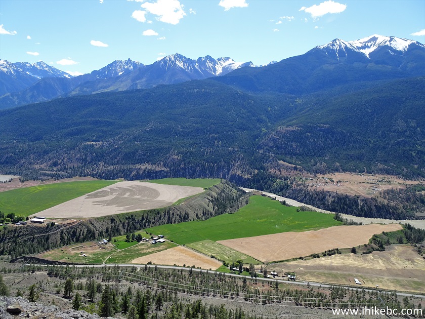
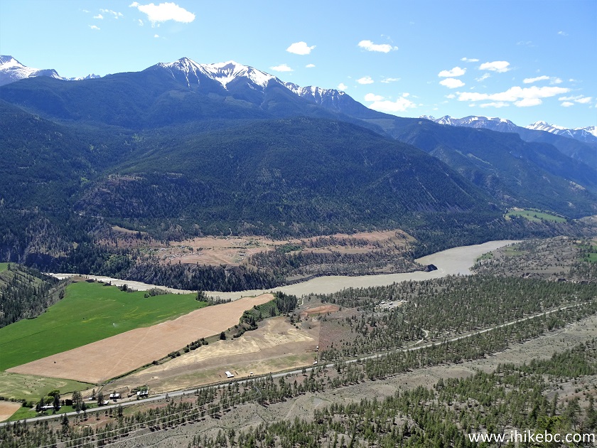
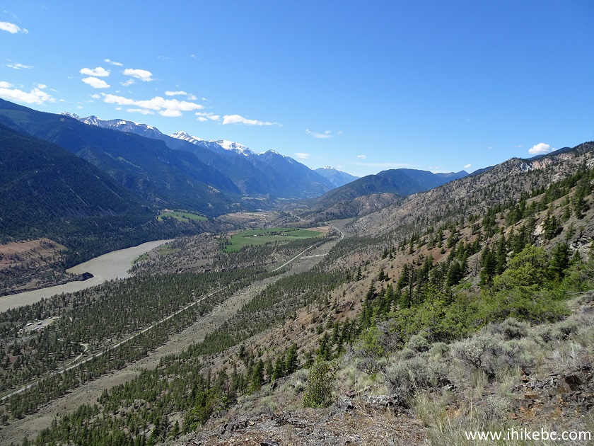
BC Highway 12 Valley
25. Here is a panorama.
And here is our video of the views from this location.
More ihikebc videos are on our YouTube Channel.
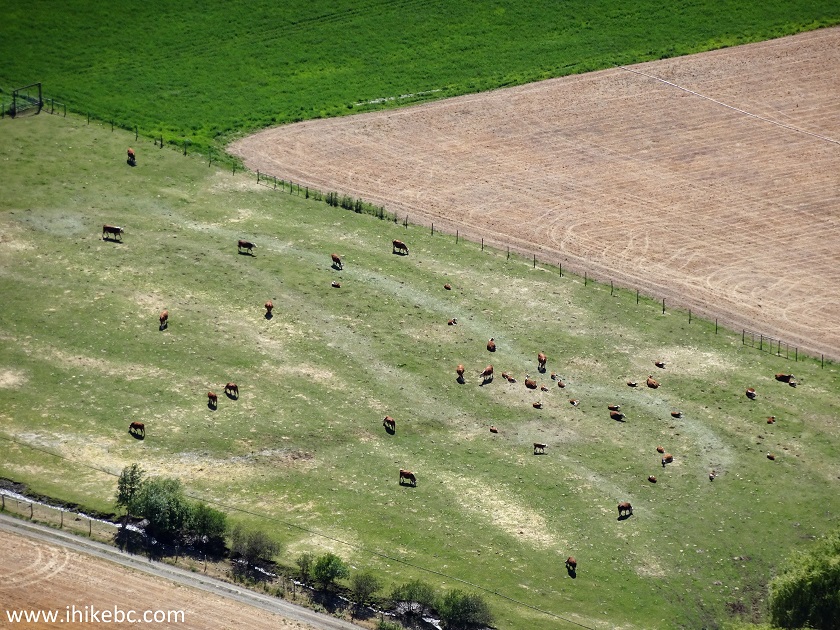
26. Zooming in to check out a herd of cows.
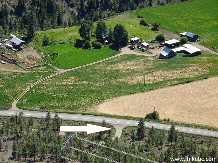
27. And this is the spot where McGillivray FSR begins off Highway 12.
As a newly discovered hike, BC Highway 12 Valley Lookout Trail is quite rough, but short enough to be a good outing for experienced, well-equipped hikers. Recommended.


|
 |
Other Trips in Lillooet Area:
|
|
|


|
|
McGillivray
Creek Trail |
|

![]()
![]()
![]()
iihikebc.com Trip 213 - BC Highway 12 Valley Lookout Trail Hike (Between Lytton and Lillooet BC)