![]()
![]()
![]()

Trip 105 - May 23, 2016 (Monday)
Ghost Mountain Trail Hike
Via Old Baldy Mountain Trail
Near Chetwynd BC
Location of the trailhead:
Town of Chetwynd
in Northeastern British Columbia.
Liked: Shade on Old Baldy Mountain Trail, a sea of green on Ghost Mountain Trail, panoramic view of Chetwynd from Old Baldy Mountain Trail. It is potentially possible to hike in a loop.
Of note: The trail is popular, traffic noise on Baldy Mountain Trail, and gunfire noise from a gun club in the vicinity of Ghost Mountain Trail. No shade for much of Ghost Mountain Trail. The short dirt road leading to the trailhead is not marked. There are confusing arrow signs on Old Baldy trail. Hiking poles and boots are recommended (especially for the final climb of Ghost Mountain Trail). Some of the numerous wood carvings on the streets of Chetwynd are potentially objectionable and inappropriate for children.
Northern BC Backroad Mapbook (3rd edition) Coordinates: Page 57 (Chetwynd) B2.
Related Website: Chetwynd Trail System Map (PDF file).
This turned out to be a pleasant surprise. Who knew Chetwynd harboured such a neat trail. Yet, there it was. It looked like most of the fifteen or so folks we have met today hiked to the peak of Old Baldy, and did not continue further onto Ghost Mountain. The map at the trailhead also showed that it is possible to hike in a loop and even see a waterfall, but we paid little attention to that map until after the hike, so did not realize that it was possible to do that. Somewhat confusing wooden arrows at some trail splits came with yellow or purple diamond-shaped carvings in them - the main trail to Old Baldy summit follows arrows with purple diamonds.
1. Chetwynd is located three hours North of Prince George by car, and has awesome welcome signs. If driving on Highway 97 from Prince George, get ready to turn left onto 52nd Street right after this sign.
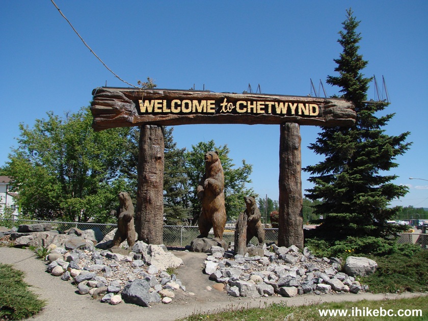
Welcome to Chetwynd sign
2. Another clue is this lumberjack, located just behind the welcome sign. That's 52nd Street and Old Baldy Mountain in the background. Speaking of wood carvings, Chetwynd holds an annual international competition, so every year new carvings are added to the streets of this city. While most of the carvings are quite tasteful, a few could be scary and/or inappropriate for children.
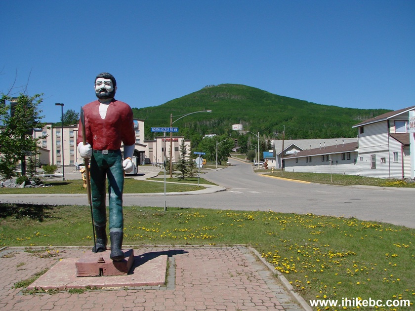
Lumberjack carving Chetwynd BC Canada
3. We are now driving up 52nd Street, with Pomeroy Hotel to our left, and Mount Baldy in the background.
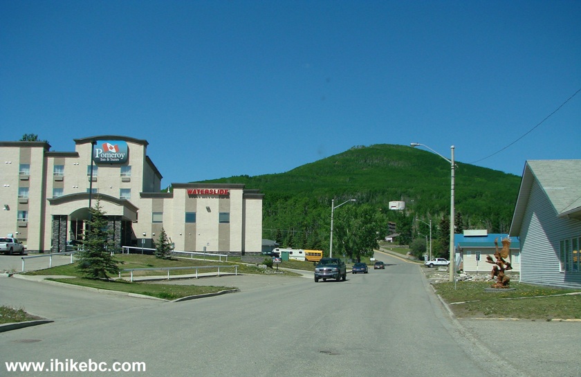
52nd Street Chetwynd British Columbia
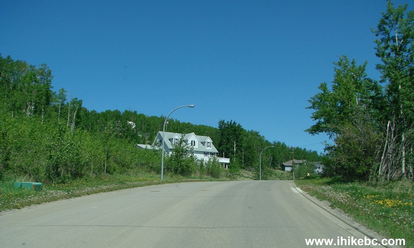
4. After 47th Avenue, 52nd Street becomes Hillside Avenue NW, so you would be turning right onto 45th Avenue from Hillside Avenue at the intersection pictured below. There is a sign to Old Baldy Trail at that intersection.
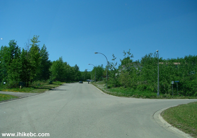
Hillside Avenue NW at 45th Avenue Chetwynd BC
5. Now things get a bit tricky. Once you turn onto 45th Avenue, within 100 meters you would pass this house, and then turn left onto a dirt road located just past this house. There is no sign there, and we had to drive around for a bit and then ask a local for direction. The good news is that 45th Avenue is quite short, so there is no chance of getting lost. So, here is the house. The dirt road you need to take is between the blue house, and the dark-coloured house seen further on 45th Avenue.
45th Avenue Chetwynd BC Canada
6. And here is the dirt road immediately after you turn left from the 45th Avenue.
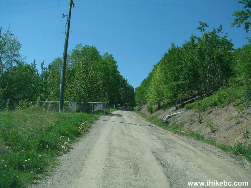
Dirt road leading to Old Baldy Mountain parking area Chetwynd BC
7. Two hundred meters later, we are at the parking lot. Coordinates: N 55⁰42.148' W 121⁰38.313'. Elevation: 686 meters.
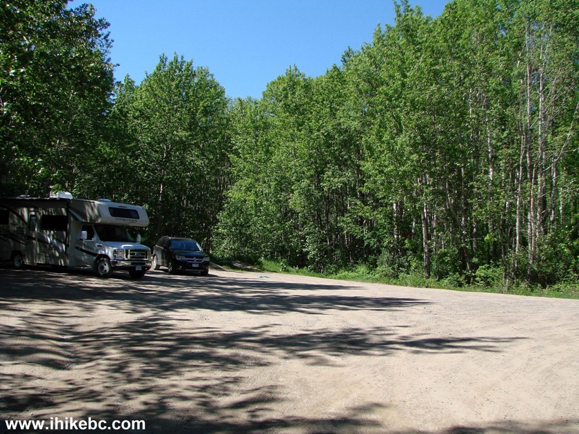
Old Baldy Mountain trailhead parking area Chetwynd British Columbia
8. The trailhead is on the right side of the lot, and it has this map, which we should have definitely studied in more detail before the hike. The parking lot is a letter P in a green circle. 1 - Old Baldy Mountain Trail, 2 - Ghost Mountain Trail, 3 - Muskwa Trail, 4 - Powerline Trail. The yellow arrow points at Widmark Falls. As the map shows, by taking Old Baldy - Ghost Mountain - Muskwa - Powerline trails, it is possible to hike in a loop, and see a waterfall in the process. Today we only went to the summit of Ghost Mountain and back, and did not find out the trail conditions for the rest of the loop. The "trail closure" notice on the left side of the information board refers to the "community forest connector trail," which is not a part of the loop.
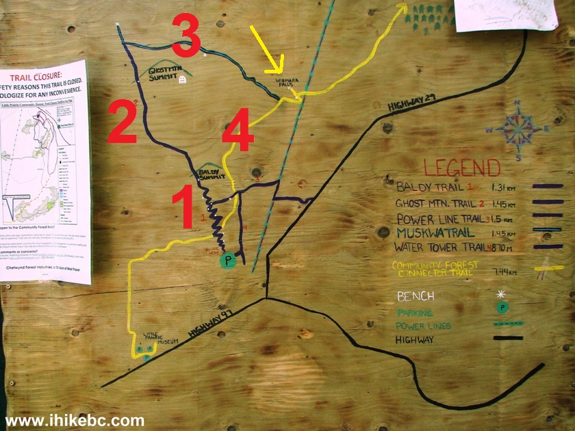
Map of Chetwynd BC hiking trails
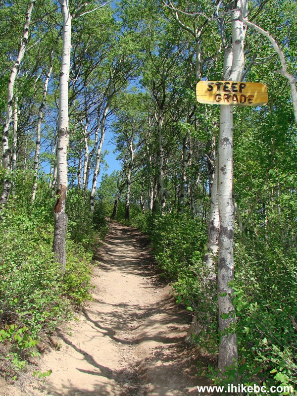
9. We start with Old Baldy Mountain Trail. It's wide and the grade is gentle, though (closer to the first viewpoint) there is this "steep trail" sign. There are also several side trails, to which some wooden arrows point, and the arrows also point towards the main trail, so it's somewhat confusing. That said, the main trail is fairly obvious and is easy to follow.
Old Baldy Mountain trail - Chetwynd Hiking BC
10. It takes 20 minutes from the trailhead to the first viewpoint, pictured below.
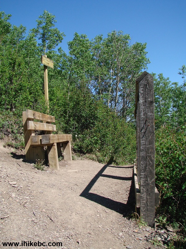
Photo of Mount Baldy trail - Hike in Chetwynd British Columbia
11. The town of Chetwynd seen from the first viewpoint.
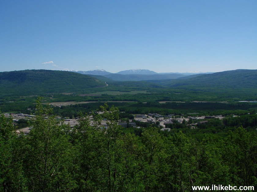
Chetwynd BC seen from Old Baldy Mountain
12. Continuing towards the summit.
Old Baldy Mountain trail - Chetwynd Trail BC Canada
13. Here it is, 30 minutes from the trailhead.
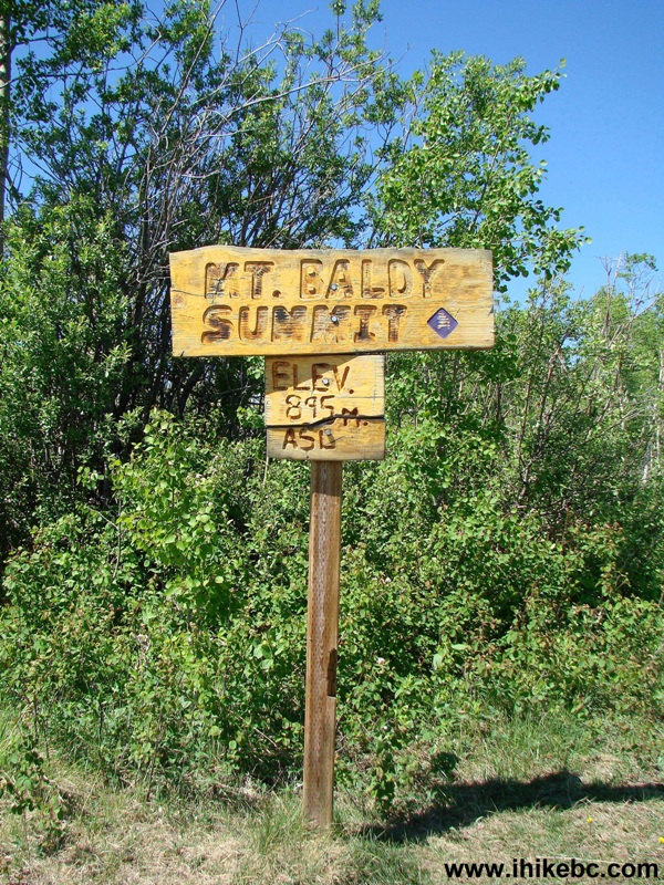
Mount Baldy summit by Chetwynd BC
14-15. A view of Chetwynd from the summit of Mount Baldy. Left to right.
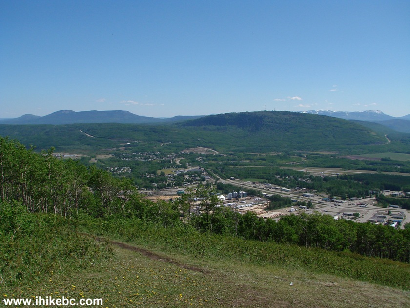
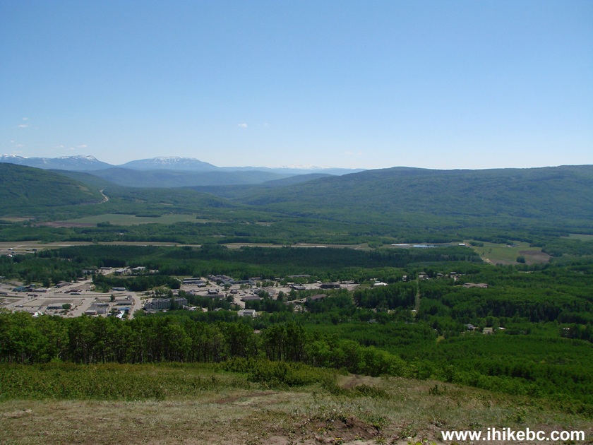
Chetwynd BC
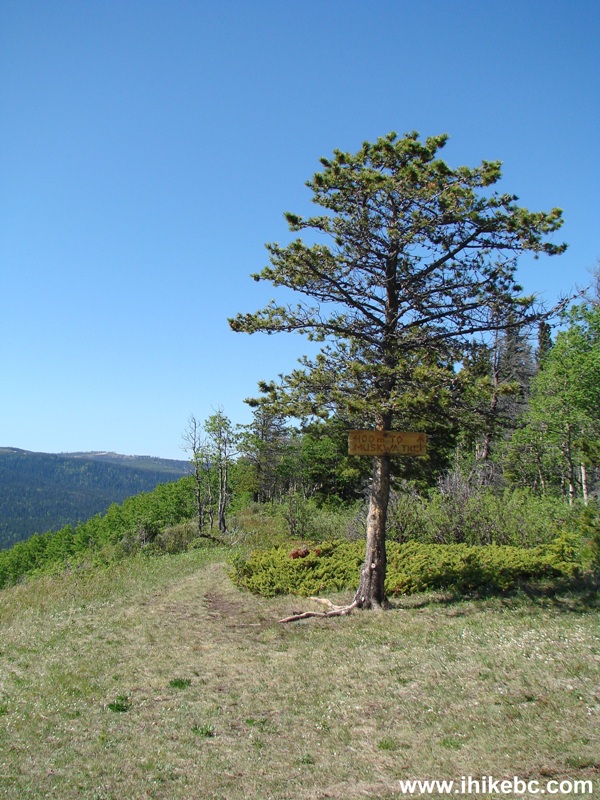
16. The trail then continues towards Ghost Mountain.
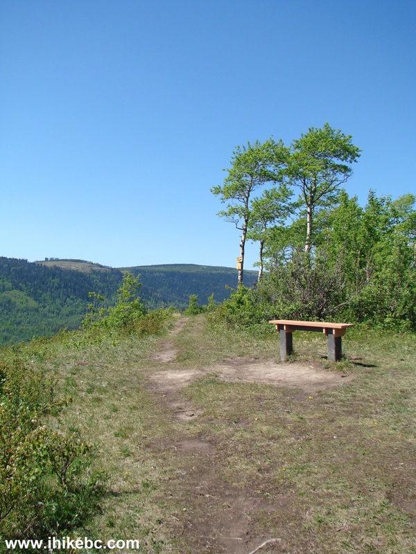
Trail in Chetwynd - Ghost Mountain trailhead
17. Soon after the beginning of the Ghost Mountain Trail, the traffic noise from Chetwynd all but disappears, and only train whistles can be heard quite clearly. That and gunfire from the nearby gun club, which we discovered on the way back.
Ghost Mountain trail - Hike Chetwynd BC
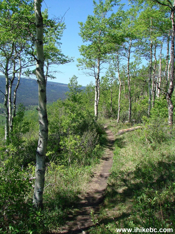
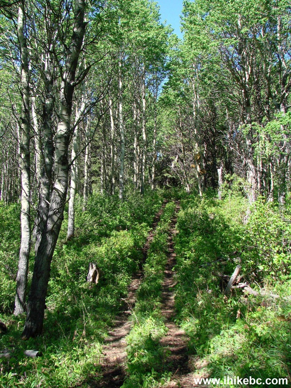
18. But, for now, there was no gunfire, and it was almost tranquil, with a sea of green around us.
Ghost Mountain trail - Chetwynd - Hike in British Columbia
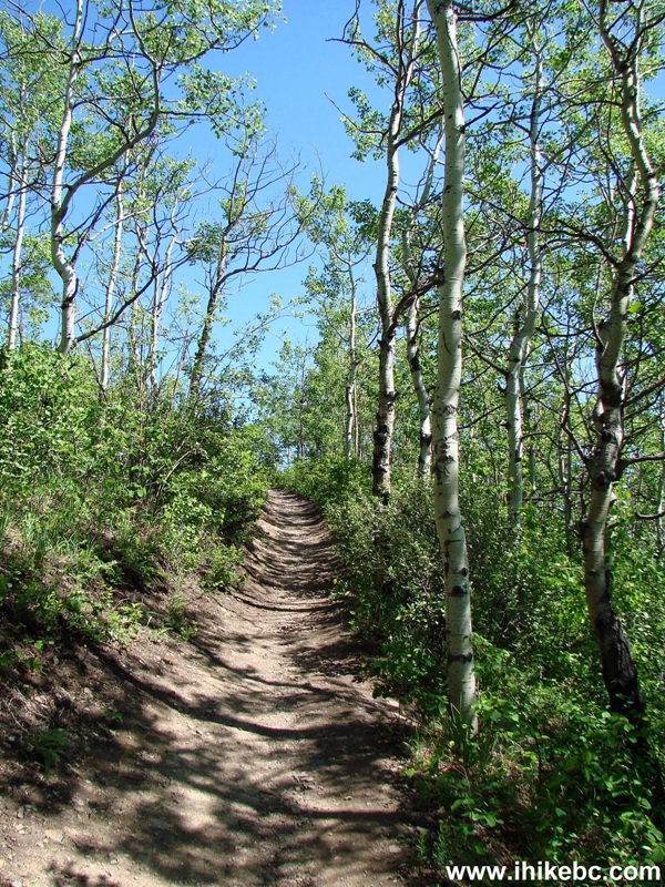
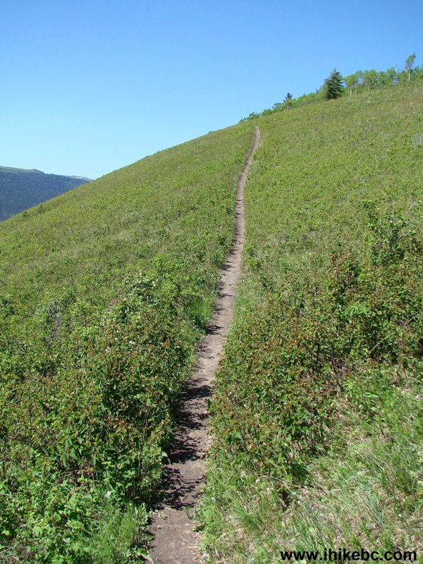
19. The trail gently gained altitude until the very end, when it got steep.
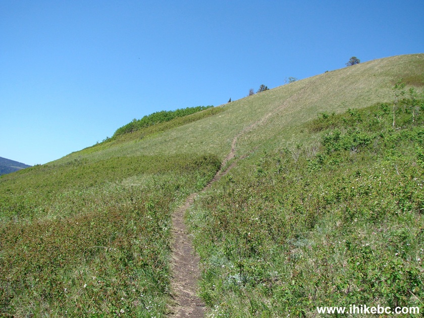
Ghost Mountain trail near Chetwynd British Columbia - Canada Hike
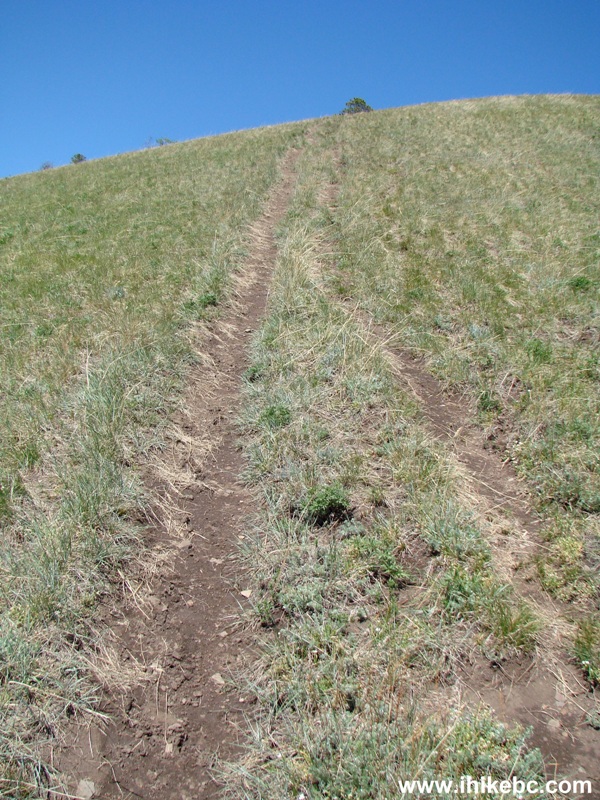
20. And then very steep. You would be thankful for hiking poles and boots on the way down.
Steep Ghost Mountain trail by Chetwynd BC Hiking
21. The summit of Ghost Mountain. Coordinates: N 55⁰43.117', W 121⁰39.050'. Elevation: 956 meters. It takes half an hour to get here from the summit of Old Baldy (and an hour from the trailhead).
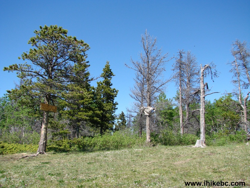
Summit of Ghost Mountain in the vicinity of Chetwynd BC
22. A sea of green seen from the top of Ghost Mountain.
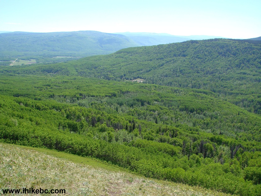
View from the summit of Ghost Mountain by Chetwynd British Columbia
23. Our 3rd edition of Backroad Mapbook Northern BC showed this as the end of the trail, but, to our surprise, a sign indicated 400 meters to Muskwa Trail.
Connector trail from Ghost Mountain to Muskwa trail
24. And that's where we went.
Ghost Mountain to Muskwa trail - connector trail - Chetwynd hike
25. Four hundred meters later.
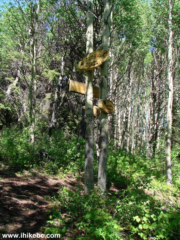
Muskwa trail - BC Trail near Chetwynd
26. Quite a neat sign.
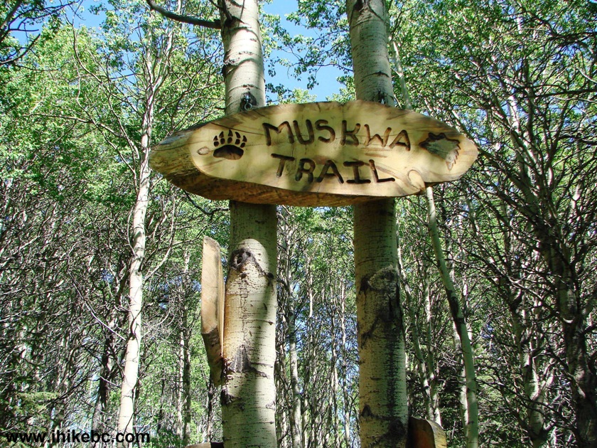
Muskwa trail sign
Another sign at the intersection pictured above promised a viewpoint in 80 meters, if we were to turn left. We went there, and it wasn't much of a viewpoint. We then went the other way, and travelled on Muskwa Trail for a few minutes, but, since we didn't read the map at the trailhead and did not realize we could hike in a loop, we turned back and retraced our steps to the trailhead, accompanied by loud echoes from numerous gunshots. Provided you don't mind the guaranteed traffic noise on the Old Baldy Mountain Trail, and the possibility of the gunshot noise on the Ghost Mountain Trail, hiking in this area is a fine way to spend several hours of your time.


|
 |
![]()
![]()
![]()
ihikebc.com Trip 105 - Ghost Mountain Trail Hike (near Chetwynd BC)