![]()
![]()
![]()

Trip 090 - July 10, 2015 (Friday)
Butler Ridge Hiking Trail
Butler Ridge Provincial Park
Near Hudson's Hope BC
Location: Northeastern British Columbia, about 37 kilometers from
Hudson's Hope.
Liked: Easy access to the trailhead, shade in the forest, several rock views, (potentially) good views of Williston Lake.
Of note: (Almost) no signs to the trail, remote wilderness area, no cell phone signal, mosquitoes, several long steep stretches, the trail is getting overgrown, no tree cover in the alpine area (sun protection required), hiking boots and poles are recommended.
Northern BC Backroad Mapbook (3rd edition) Coordinates: Page 65 (Hudson's Hope) E5.
Related Website: Butler Ridge Provincial Park - BC Parks Official Site.
Other trips in Hudson's Hope area: Battleship Mountain Trail Hike, Bullhead Mountain Trail Hike, W.A.C. Bennett Dam Visit.
Follow @ihikebc Tweet
Butler Ridge Trail starts near the Williston Lake boat launch, and offers great views of Williston Lake. Except today haze made those views much less appealing. However, it was still a memorable hike, as the ridge offers several fine rock views and, if nothing else, a good exercise. ATV access is permitted all the way up to the alpine area, if you don't feel like sweating through a featureless forest for the first two and a half hours of the hike.
1. We are Southbound on Highway 29 in Hudson's Hope, following the arrow to W.A.C. Bennett Dam. On the far left is Fas Gas (the last chance to fuel up). Turning left before the gas station and continuing South on Highway 29 would, eventually, lead to Chetwynd, but we need to drive straight onto Canyon Drive to get to Butler Ridge Provincial Park.
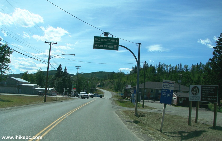
Hudson's Hope BC Canada
2. About 15 kilometers later, there is a split. Coordinates: N 56⁰01.743' W 122⁰07.991'. Going straight would lead to the dam in a few kilometers. Turning right onto Twelve Mile Road would lead to Butler Ridge Provincial Park.
Canyon Road at Twelve Mile Road Near Hudson's Hope British Columbia
Canada
3. Twelve Mile Road just after the turn.
12 Mile Road by Hudson's Hope BC
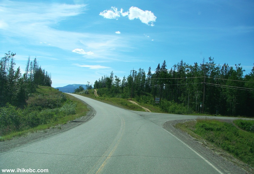
4. In about three kilometers, the asphalt ends, and gravel begins. This has to be the smoothest gravel road we have ever driven, with no potholes or uneven surface. Beware, though, as gravel is slippery even when dry, and skidding is a real possibility, if you go too fast, especially in corners.
Twelve Mile Road Near Williston Lake BC Canada
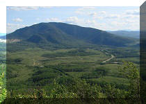
5. A decent view of Williston Lake (which was formed when W.A.C. Bennett Dam was built on Peace River) appears on the left as you drive towards Butler Ridge Provincial Park.
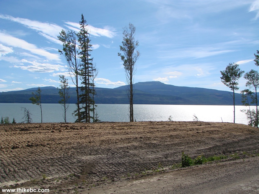
Williston Lake British Columbia Canada Seen from Twelve Mile Road
6. Closer to the park, there is a split. Turn right.
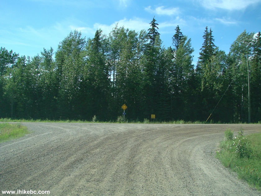
Photo of Twelve Mile Road by Hudson's Hope BC Canada
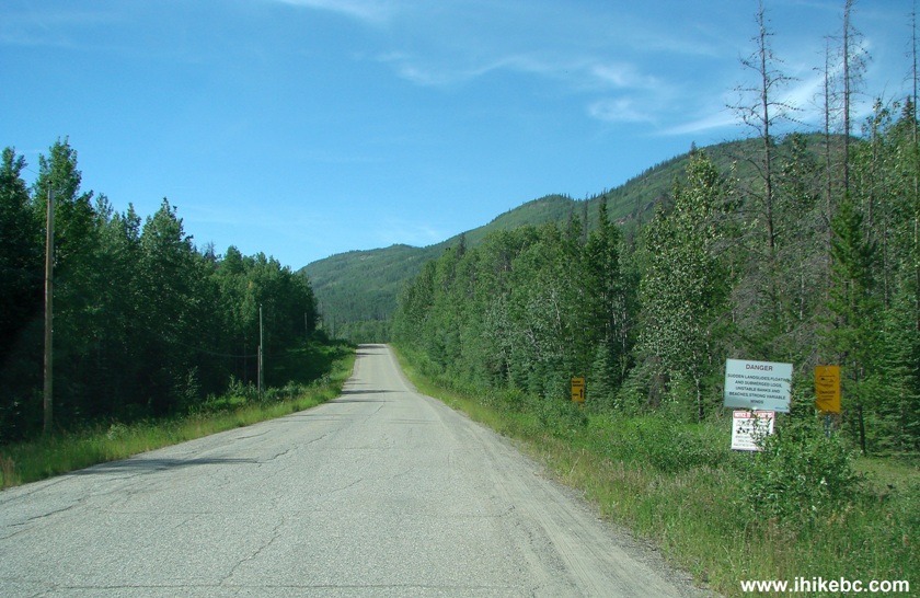
7. Just over 22 kilometers after we turned onto Twelve Mile Road, we are at another split. Going left here would very shortly lead to Williston Lake boat launch and parking. And going right (Dunlevy Road, which the GPS navigator insisted on calling Strain Road) would take you around some part of the lake towards residential properties and numerous vacant lots awaiting their buyers. Also, Butler Ridge trailhead is immediately after you turn right onto Dunlevy Road.
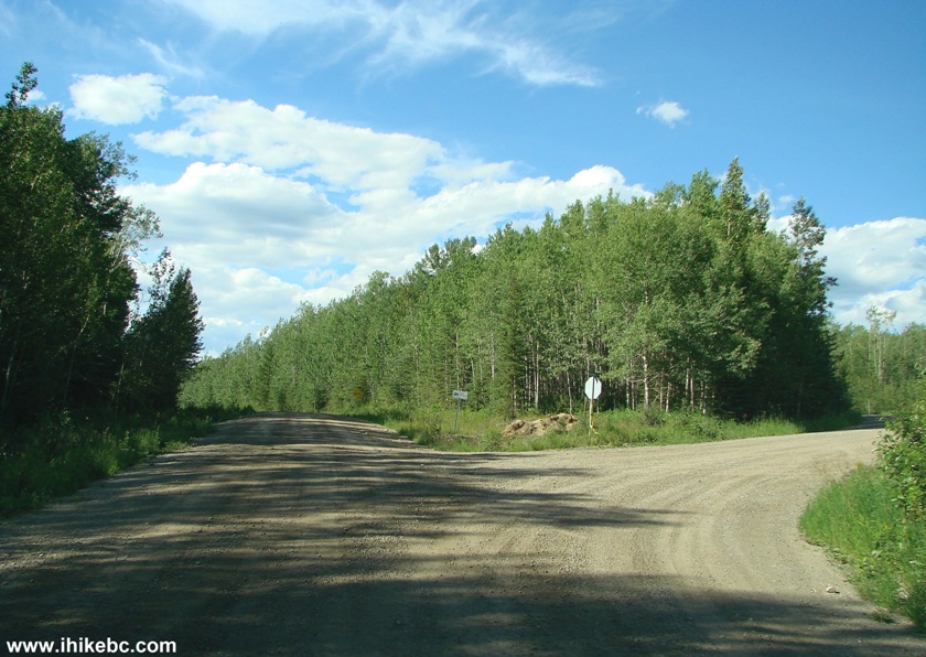
Twelve Mile Road at Dunlevy Road Butler Ridge Provincial Park BC Canada
8. We will return to our hike coverage shortly, but, for now, here is a photo of Williston Lake Boat Launch area.
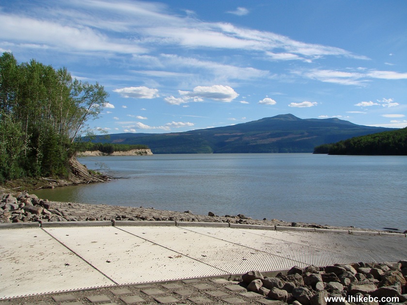
Williston Lake Boat Launch Area Butler Ridge Provincial Park by Hudson's
Hope BC Canada
9. In case you ever need it, the emergency numbers are posted nearby.
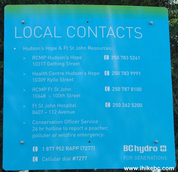
Emergency Services Phone Numbers for Fort St. John and Hudson's Hope
10. So, if you would turn right onto Dunlevy Road at a split seen in photo #8, Butler Ridge trailhead would be right there. Coordinates for the trailhead: N 56⁰08.646' W 122⁰21.270'. Elevation: 733 meters. There is but one small sign there, which consists of a figure of a hiker. You can see the leaning metal post hosting that sign on the left side of the trail just before the forest entrance. ATVs are permitted on Butler Ridge Trail up to the alpine area.
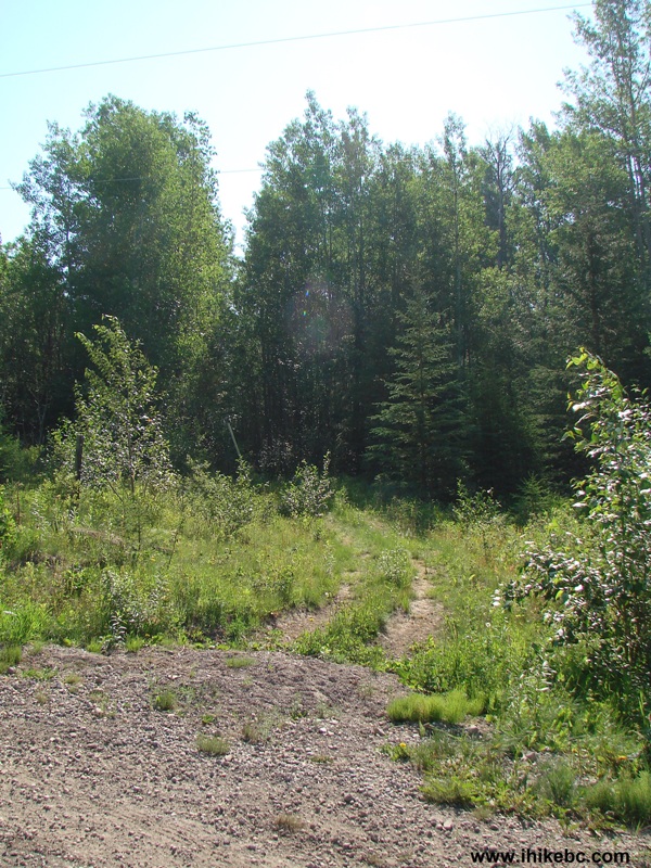
Butler Ridge Trailhead
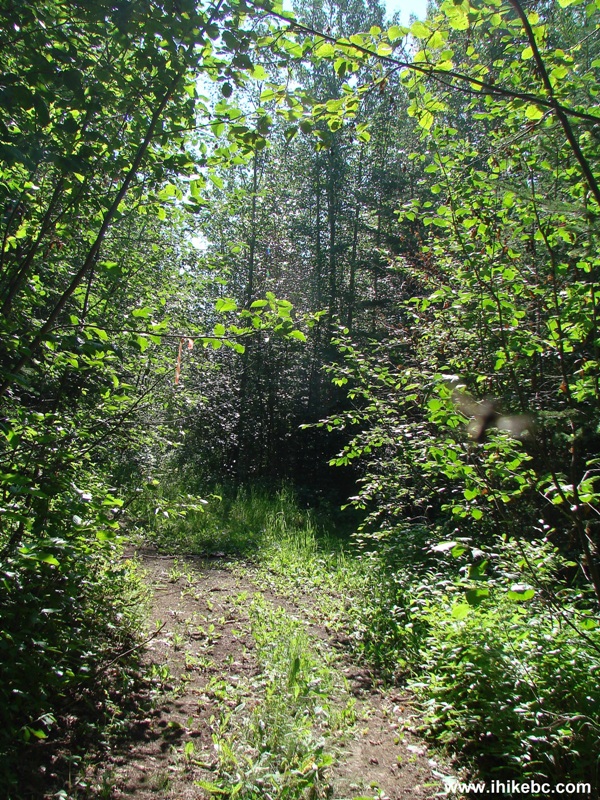
11. At first, the trail is easy enough, and actually loses altitude, as the path descends towards a small creek. It was possible to do stone-hopping to cross it. However, during the spring runoff the volume of water might require getting your feet wet.
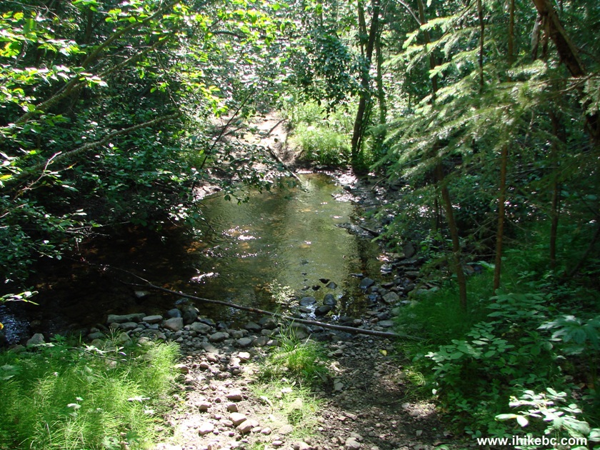
Butler Ridge Trail Creek Crossing
12. And, then, the most difficult part of the hike begins - a very long steep stretch which makes you gain over two hundred meters of altitude prior to somewhat levelling off at coordinates N 56⁰08.488' W 122⁰19.641', elevation 950 meters.
Hudson's Hope Hiking -
Butler Ridge Trail - Butler Ridge Provincial Park British Columbia
Canada
13. Fifty minutes into the hike, we arrived to a three-way split. Turn left.
Hike in Hudson's Hope Area -
Butler Ridge Trail BC Canada
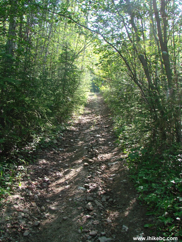
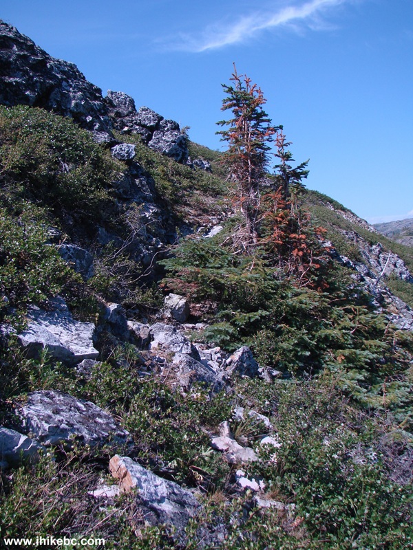
14. Butler Ridge Trail is quite overgrown in some places.
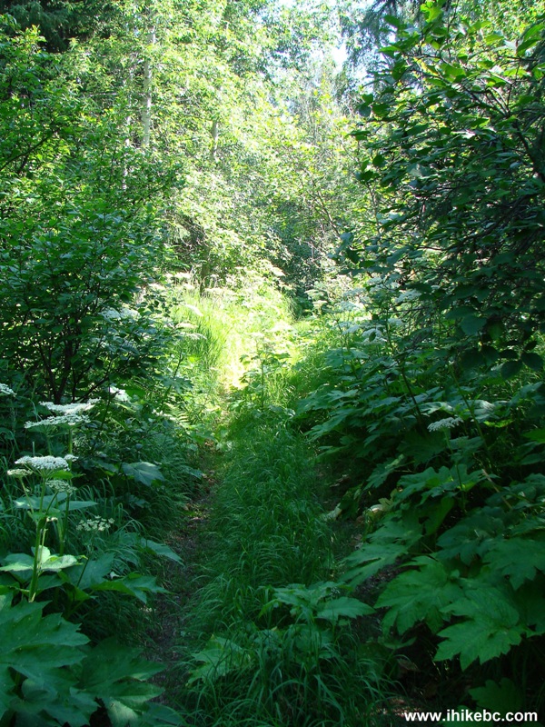
Overgrown Butler Ridge Trail
15. Two and a half hours into the hike, we have reached the alpine area at the elevation of approximately 1,400 meters. Coordinates: N 56⁰09.229' W 122⁰16.240'. A sign prohibits further motorized vehicles access.
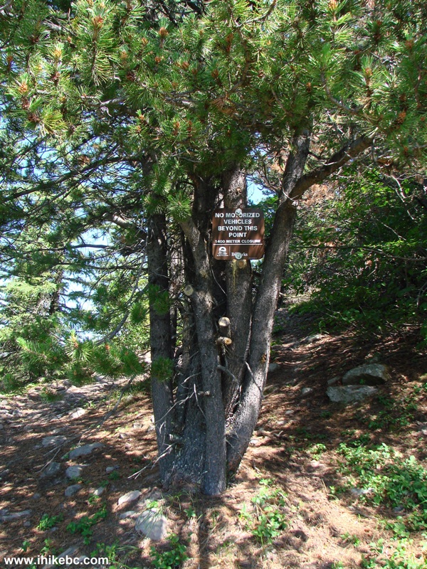
Butler Ridge Hiking Trail End of Motorized Vehicles Access
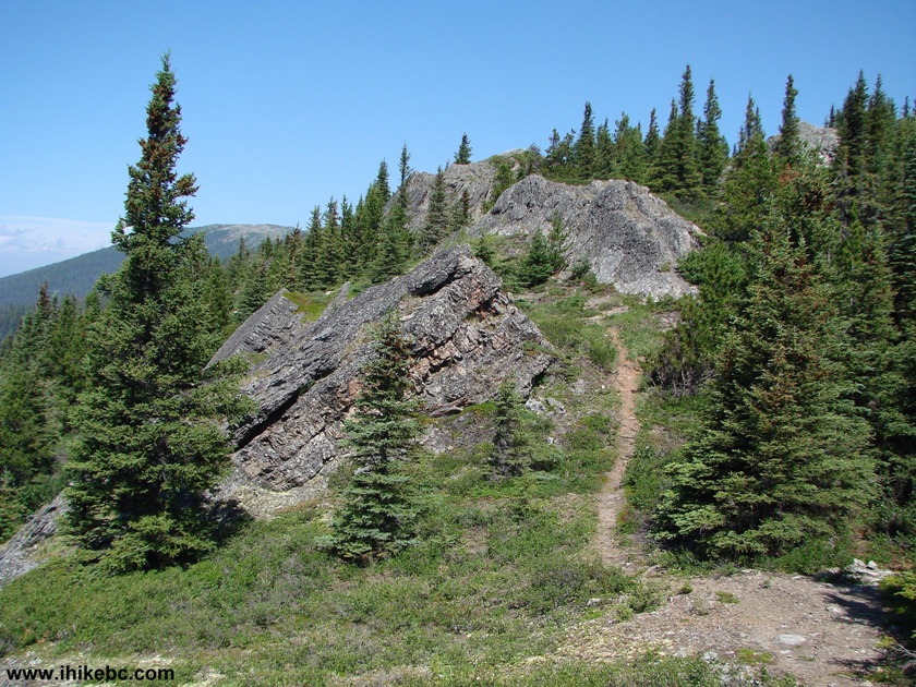
16. Very soon, you get to see the beginning of the actual Butler Ridge part of the hike...
Butler Ridge Trail - Butler Ridge Provincial Park - Hiking in British
Columbia
17. ...and a very hazy (today, anyway) Williston Lake. Darkened the image quite a lot to be able to see even this much.
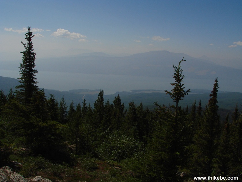
Williston Lake Seen from Butler Ridge Trail British Columbia Canada
18. At first, the path is easy to see, and leads through a pleasant area of short trees.
Butler Ridge Hiking Trail - BC Hiking Canada
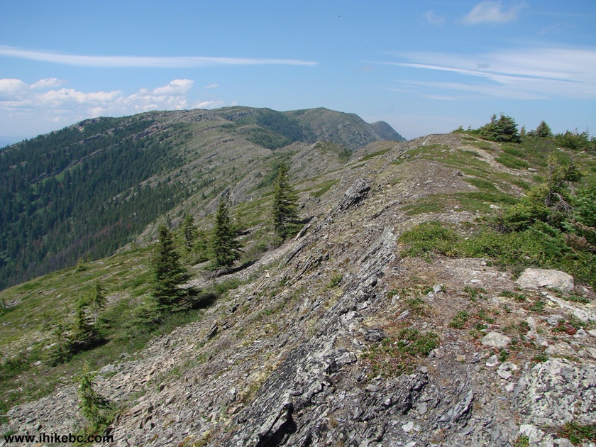
19. After that, the path disappears and reappears all the time, as this trail is probably rarely used. However, the ridge is very obvious, and all you do is keep walking towards what looks like the end of the ridge.
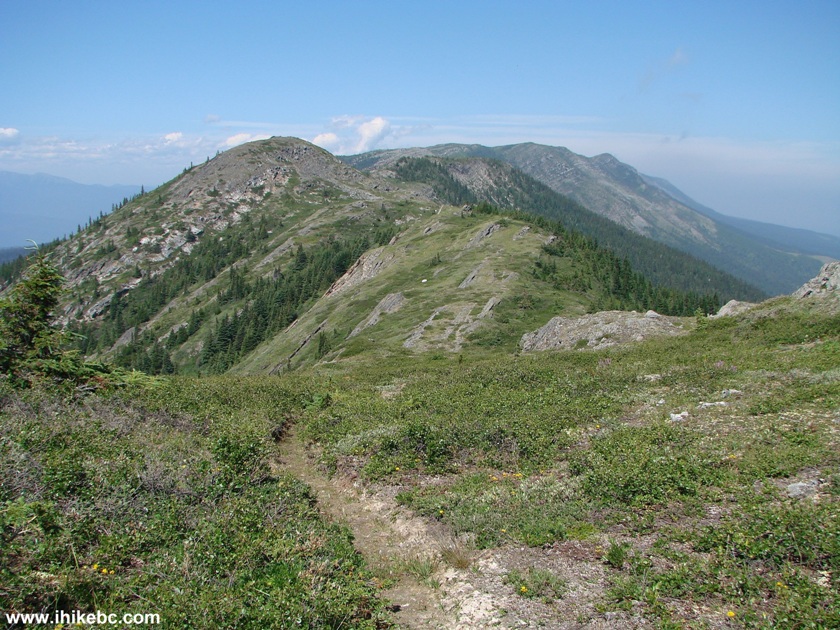
Butler Ridge - British Columbia Hiking Canada
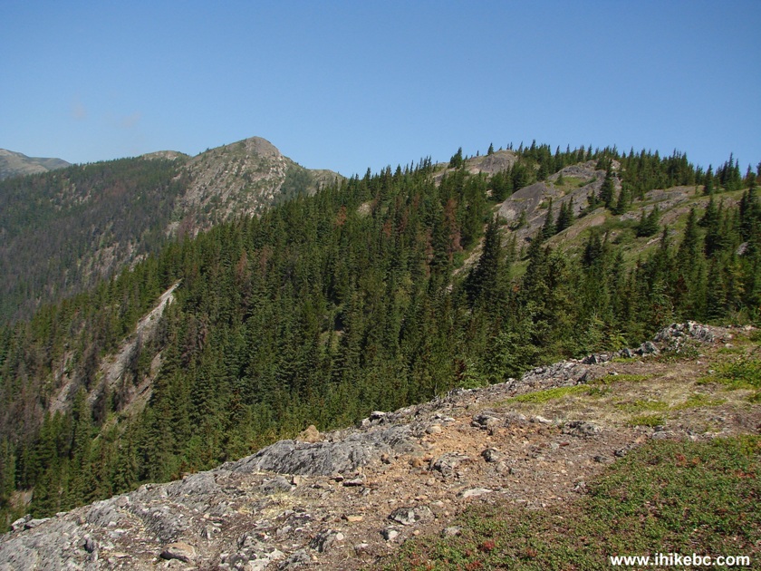
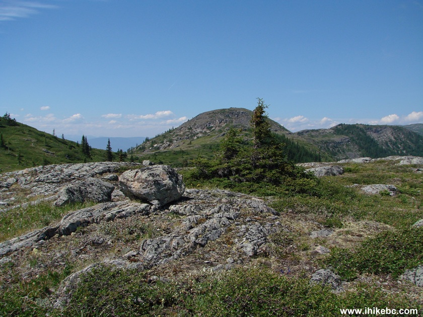
20. There are a few good rock views here and there, though this (sub-)alpine area is definitely far from spectacular.
Butler Ridge Provincial Park
21. No tree cover in the alpine, so have sun protection ready.
Butler Ridge Provincial Park Province of BC Canada
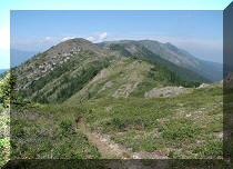
22. The ridge kept going and going with no end in sight.
Butler Ridge British Columbia Canada
23. Williston Lake is always to your left, and would be quite a treat to look at without all this haze.
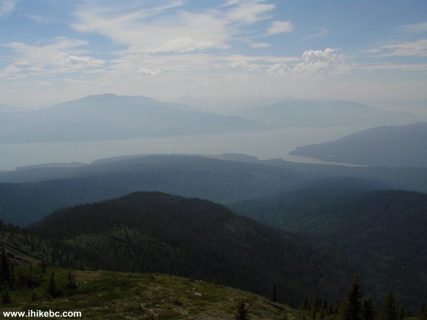
Williston Lake View From Butler Ridge
24. Eventually, we have had enough of Butler Ridge, reached this cairn, and went back. The ridge, as you can see, can be hiked much further. Coordinates of the cairn: N 56⁰10.726' W 122⁰16.935'. Distance from the "No motorized vehicles beyond this point" sign seen in photo #15: 2.9 kilometers as the crow flies.
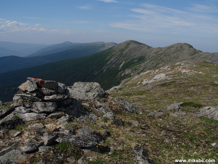
Cairn on Butler Ridge
Here is our video of Butler Ridge and Williston Lake from this point:
More ihikebc videos are on our YouTube Channel.
Provided there is no haze over the lake, this could be a worthwhile hike for sure.


|
 |
Other Trips in Hudson's Hope BC Area:
|
|
|
|

![]()
![]()
![]()
Follow @ihikebc Tweet
ihikebc.com Trip 090 - Butler Ridge Trail Hike (near Hudson's Hope BC)