![]()
![]()
![]()

Trip 308 - May 9, 2024 (Thursday)
Mount Erskine Trail Hike
Mount Erskine Provincial Park
Salt Spring Island, BC
Liked: A fairly short and uncomplicated trail to excellent views of Salt Spring Island, Vancouver Island, and a passage between them. Views of remote islands. Shade in the forest. No bugs.
Vancouver Island, Victoria & Gulf Islands Backroad Mapbook (9th edition) Trailhead Coordinates: Page 11 (Duncan) D2.
Follow @ihikebc TweetMount Erskine Trail in Mount Erskine Provincial Park is located on Salt Spring Island, BC (one of British Columbia's Southern Gulf Islands) which can be reached via a 35 minute-long sailing from Swartz Bay ferry terminal on Vancouver Island near Victoria. There are two other ferry terminals on Salt Spring Island, including at Vesuvius Bay, which we show in this trip report. The trailhead for Mount Erskine is located not far from Ganges (which is "downtown" Salt Spring Island with most services) via Lower Ganges Road - Rainbow Road - Juniper Place - Spring Gold Way - Trustees Trail (it's a road name).
Mount Erskine Provincial Park has many trails (all are numbered), and there are maps at key intersections showing your current location. We took trails 2, 1, and 3, checked out the views, then proceeded via Manzanita Ridge Nature Reserve to Toynbee Road, and then hiking back through the roads to the parking lot on Trustees Trail. In hindsight, it probably would have been better to return the same way, or by hiking one of the several loops in Mount Erskine Provincial Park, as there isn't much to see in Manzanita Ridge Nature Reserve, and hiking back via the roads wasn't all that great.
It took us 1.08 km of hiking to reach viewpoint #1, another 300 meters
to get to viewpoint #2, and 270 meters more to get to the summit and
viewpoint #3, for a total one way distance of about 1.6 km. As the
summit is located at the elevation of only 440 meters, Mount Erskine
hike should be good (snow-free) for most of the year.
* All hiking distances are based on a GPS odometer and
are approximate. 1.
Here is a Google Maps location of Mount Erskine Provincial Park on Salt Spring Island, BC.
Our trailhead is closer to the center of the map.
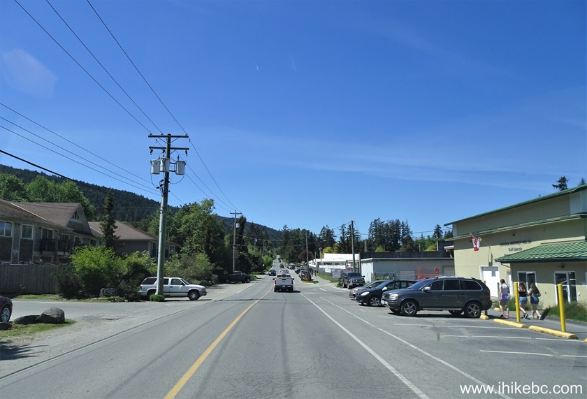
2. We are in Ganges area of Salt
Spring Island, driving on Rainbow Road towards Juniper Place.
3. Turning left from Rainbow Road
onto Juniper Place after about 2.3 km after starting on Rainbow Road
(turned from Lower Ganges Road).
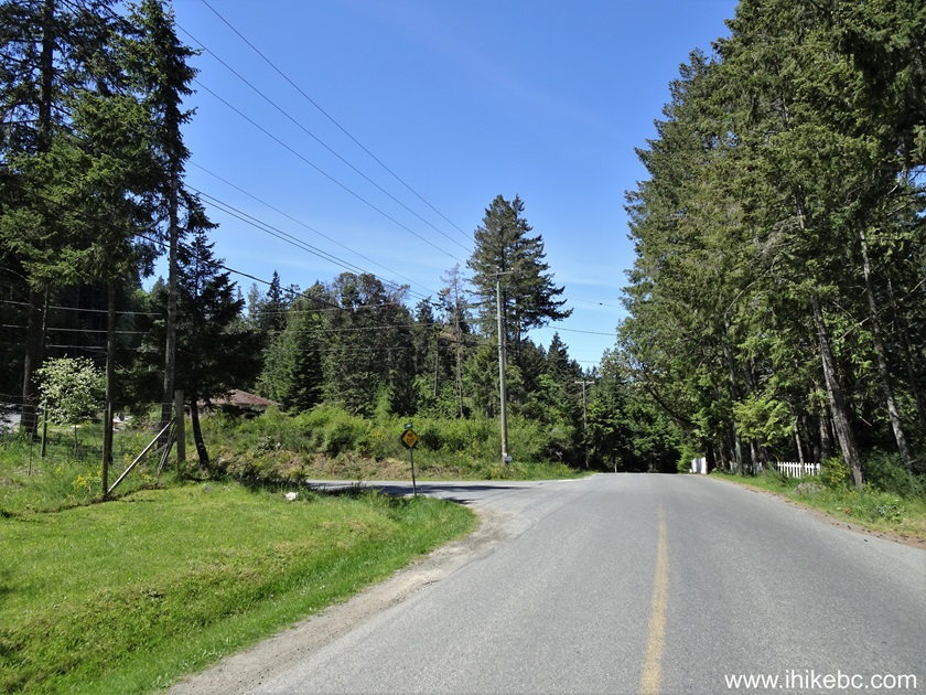
4. After 600 meters, Juniper Place
became Spring Gold Way. We are now 550 meters later on Spring Gold Way.
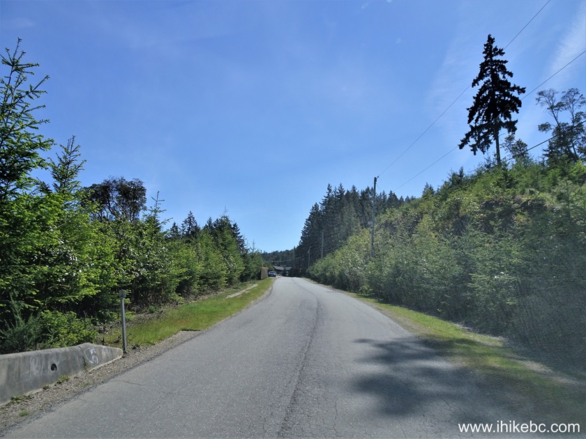
5. After 1.5 km since we turned
from Rainbow Road onto Juniper Place, Spring Gold Way ends at Trustees
Trail (it's a road name), where we turned right.
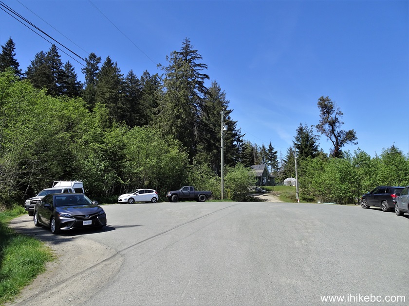
6. 300 meters later, Trustees Trail
ends. Mount Erskine trailhead is just to the left.
Here is our video of driving from Ganges
to this parking lot.
7.
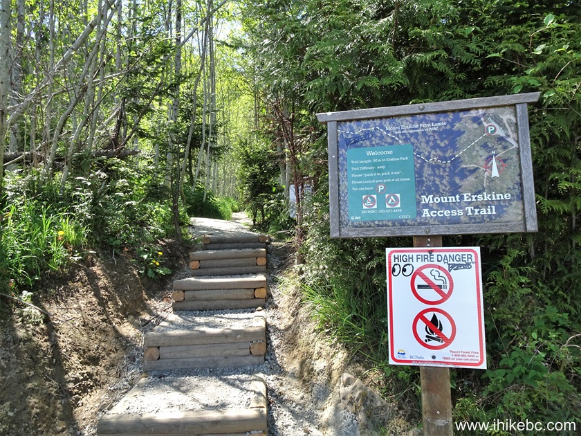
Here it the trailhead. Coordinates:
N 48⁰51.178'
W 123⁰32.460'.
Elevation: 230 meters.
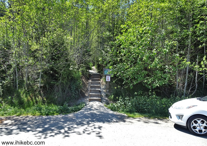
8. Technically, it's Mount Erskine
access trail for 90 meters, but let's count it as the trailhead.
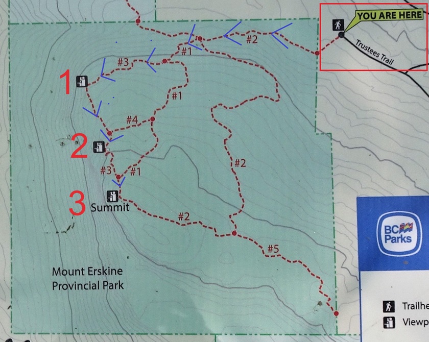
9. Here is a map of Mount Erskine
Trail. You can hike a few loops, and end up at a different trailhead too
(which is what we eventually did), but the quickest way to get to all
three viewpoints is via trails 2-1-3. We have indicated our parking
location at the end of Trustees Trail with a red square in the top right
corner, and marked all three viewpoints of Mount Erskine hike with
corresponding numbers. Blue arrows indicate our route to all three
viewpoints. It's 1.08 km to viewpoint #1, 300 more meters to #2, and 270
meters after that to the summit (viewpoint #3).
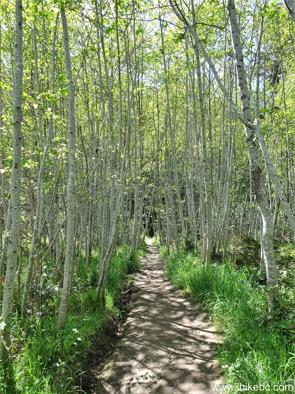
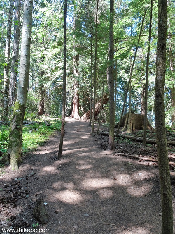
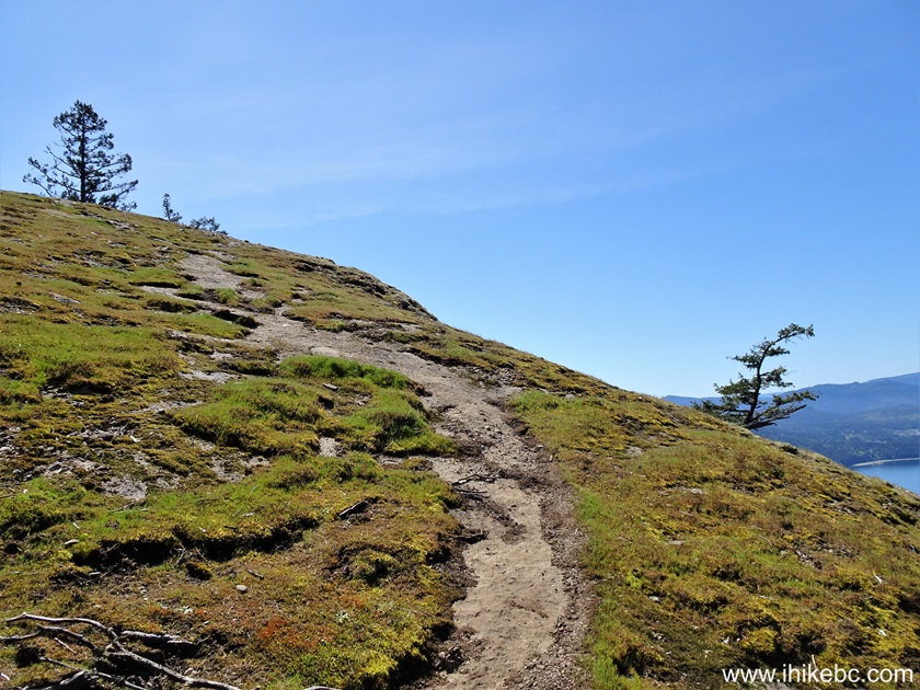
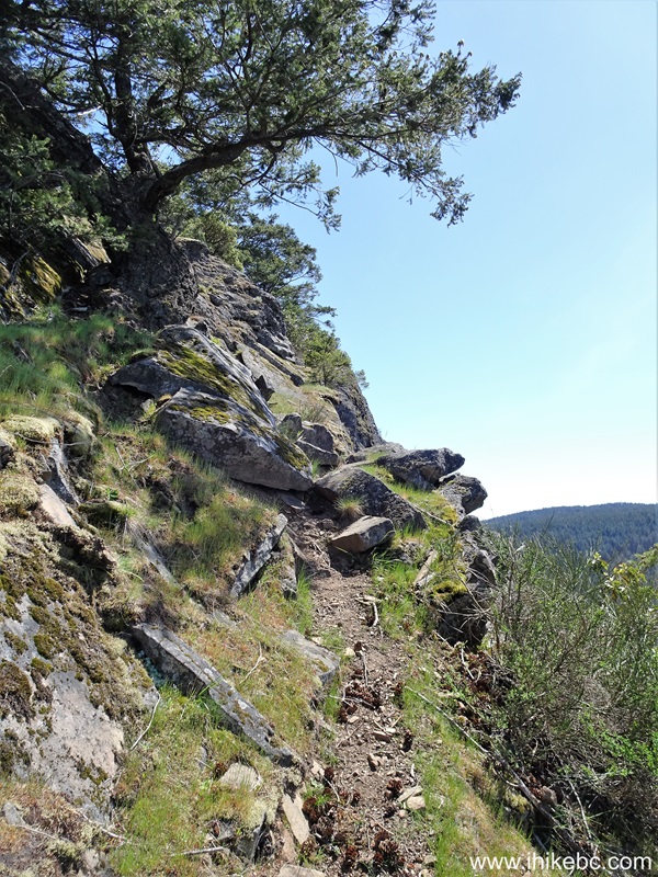
10. Mount Erskine hike begins. At
40 meters here.
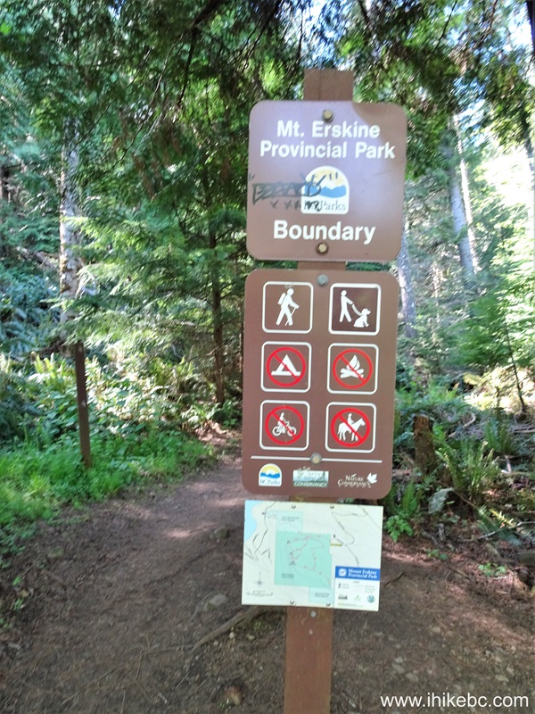
11. The official start of Mount
Erskine Provincial Park at the 90 meter mark.
12. Now at 210 meters of Mount
Erskine Trail.
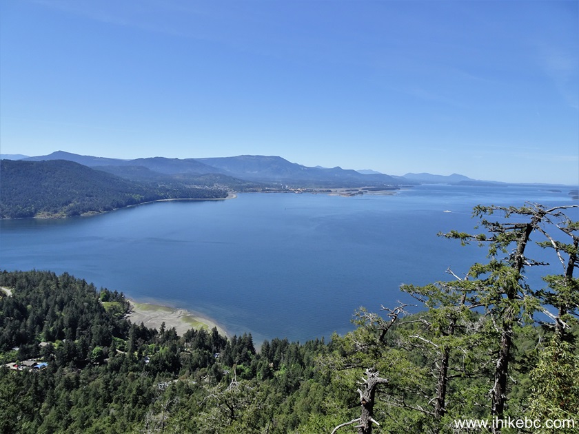
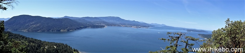
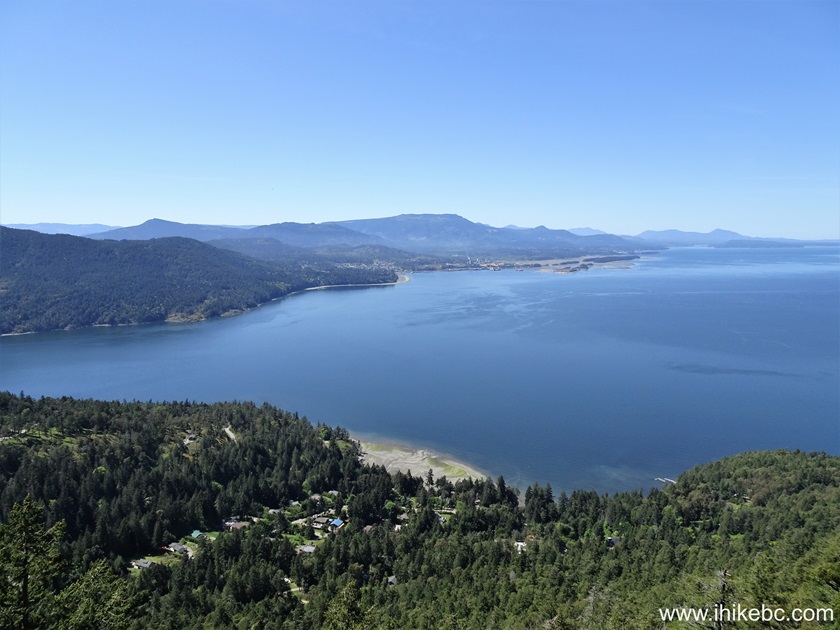
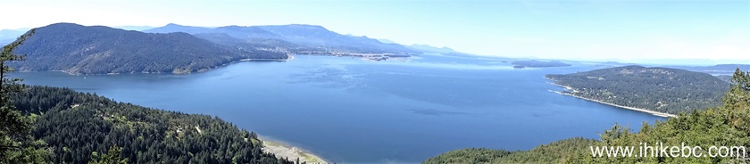
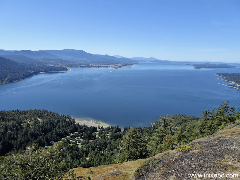
13-14. At 1.08 km, we are at the
first viewpoint of Mount Erskine hike. Followed by a panorama.
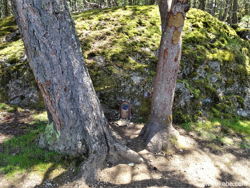
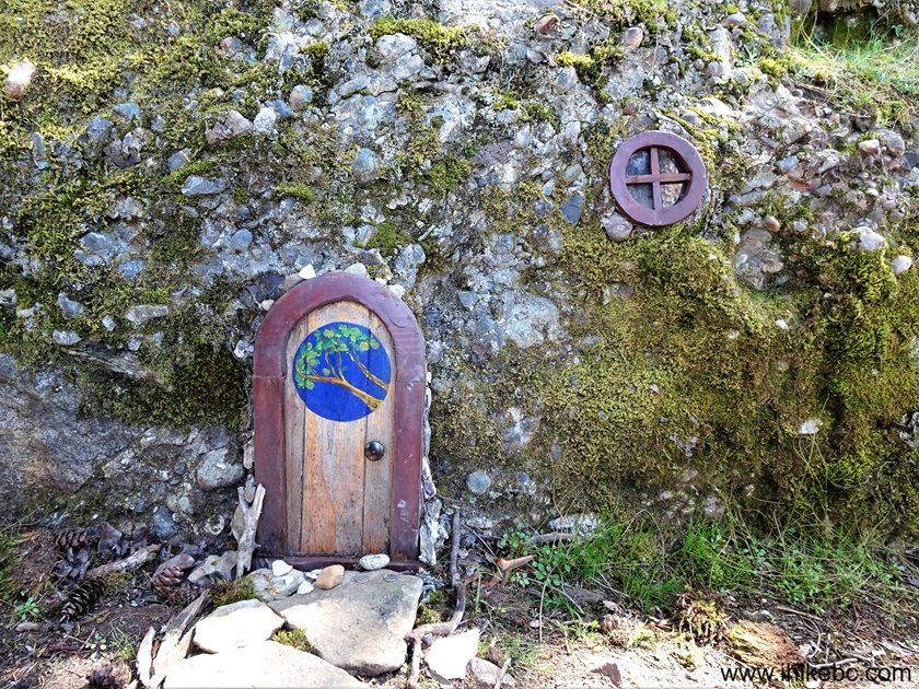
15-16. A fairy house is right
across the viewpoint. Does the door open? Watch the video below and find
out :)
Here is our video of the views from the
first Mount Erskine viewpoint.
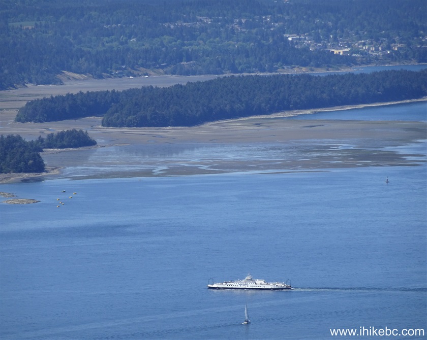
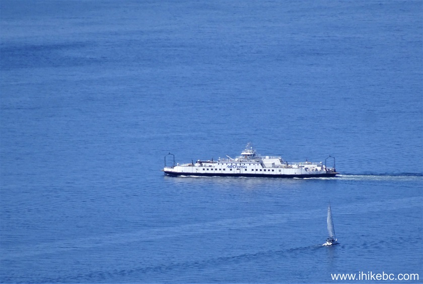
17-18. As you are hiking on Mount
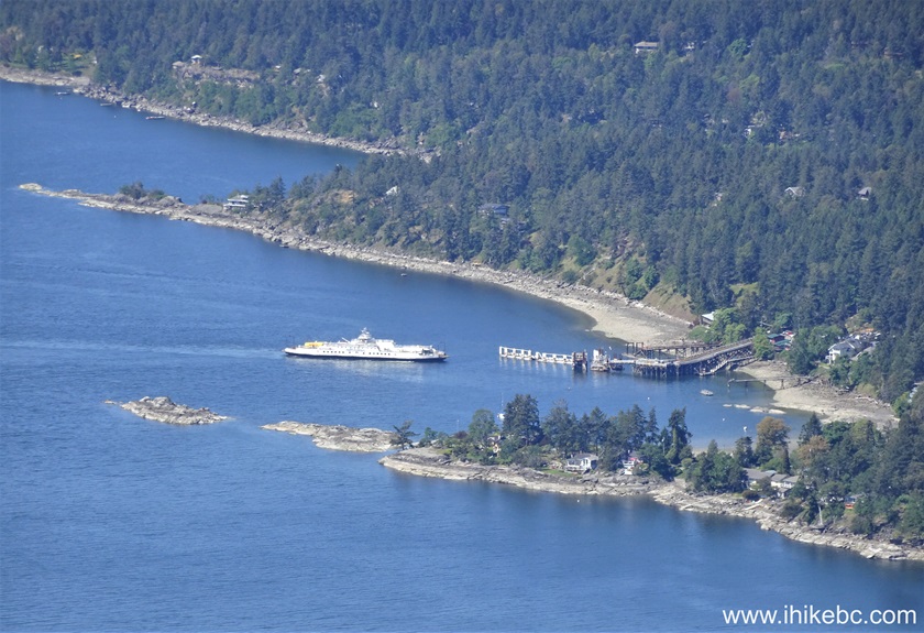
Erskine, BC Ferry Quinsam can be observed going back and forth between
Vesuvius Bay Ferry Terminal on Salt Spring Island, and Crofton Ferry
Terminal on Vancouver Island.
19-20. Here is Quinsam approaching
and docking at Vesuvius Bay Ferry Terminal.
Here is our video of BC Ferry Quinsam and
both ferry terminals.
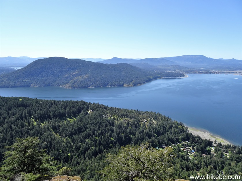
21. En route to the second
viewpoint.
22. The second Mount Erskine
viewpoint arrives 300 meters after the first one.
23-27. Left to right followed by a
panorama.
Here is our video of the views from the
second Mount Erskine viewpoint.
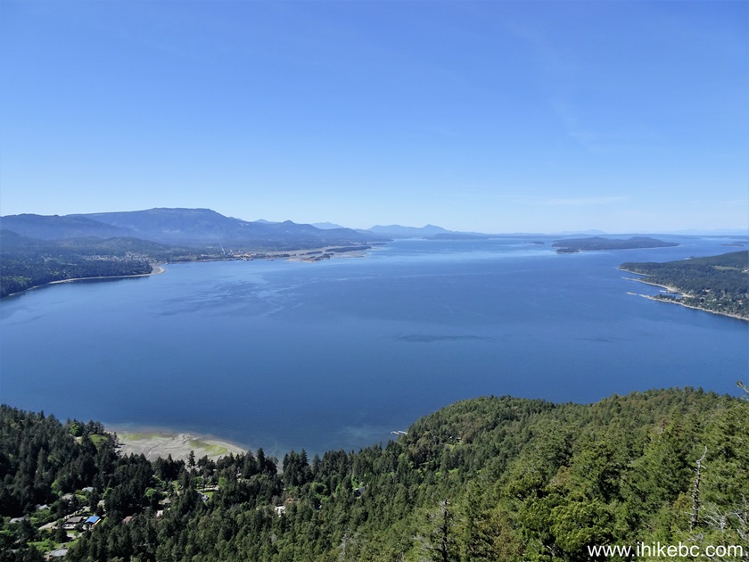
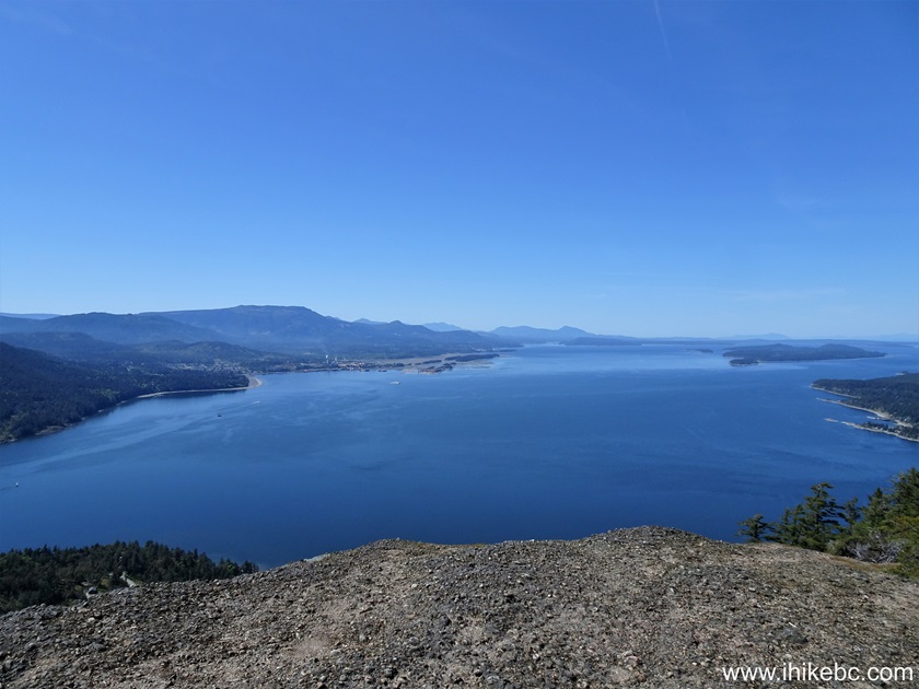
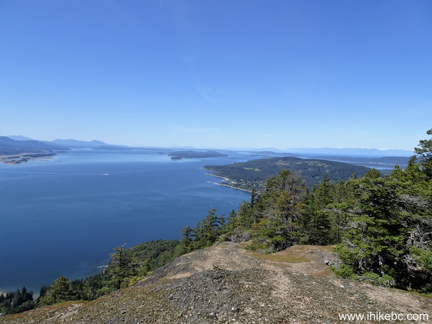
28. 300 more meters of hiking...
29. ...and here is the third Mount
Erskine viewpoint (summit).
Coordinates:
N 48⁰50.901'
W 123⁰33.077'.
Elevation: 440 meters (210 meters elevation gain from the trailhead for
an average grade of 14%).
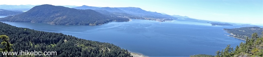
30-34. Left to right followed by a
panorama.
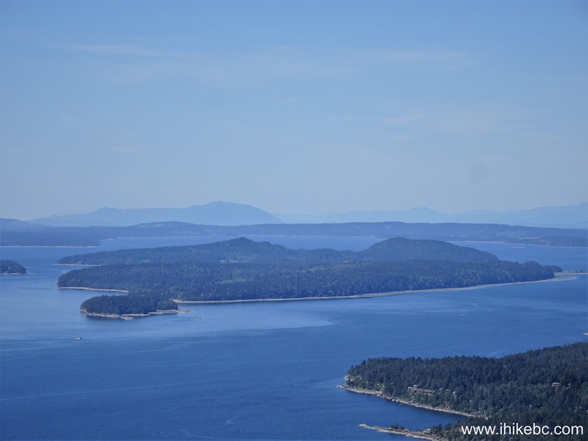
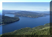
35. A zoomed view of Penelakut
Island from the summit of Mount Erskine on Salt Spring Island.
Here is our video of the views from the
summit of Mount Erskine (third viewpoint).
More ihikebc videos are on
our YouTube Channel.
Mount Erskine hike is rather short and fairly easy, and leads to great
views. Highly recommended.


|
 |
![]()
![]()
![]()
ihikebc.com Trip 308 - Mount Erskine Trail Hike (Salt Spring Island, BC)