![]()
![]()
![]()

Trip 305 - May 6-11, 2024 (Monday - Saturday)
Salt Spring Island Visit
British Columbia, Canada
Page 5 of 5
Liked: The ferry ride to and from Salt Spring Island, several fine hikes, recreation centre with available showers, picturesque waterfront walk in "downtown Salt Spring Island" - Ganges area.
Of Note:
As this is the largest Southern Gulf Island, Salt Spring is home to about 10,000 people, and it shows. You run into people way more often than on Galiano, Mayne, Pender or Saturna islands. Traffic, while laughable by Lower Mainland standards, is substantial compared to other Southern Gulf Islands. The roads on Salt Spring Island are frequently narrow, winding and without shoulders - watch for pedestrians, cyclists and wildlife. Please, walk facing the traffic, especially if there is no shoulder. Salt Spring Island is rather "liberal" even by West Coast standards. This can be a plus or a minus, depending on your perspective.Vancouver Island, Victoria & Gulf Islands Backroad Mapbook (9th edition) Trailhead Coordinates: Page 11 (Duncan) C-G 1-4.
Follow @ihikebc TweetWe have visited Salt Spring Island, located not far from Victoria BC (via a 35 minute ferry ride from Swartz Bay Terminal to Fulford Harbour Terminal), from May 6th to 11th, 2024. A great window of sun between two long stretches of rainy weather allowed for a substantial exploration and several hikes. This main Salt Spring Island trip report will describe our ferry rides, as well as trips which do not have trip reports of their own. Our visit went as follows:
May 6th (Monday) - ferry ride from Swartz Bay to Fulford Harbour, then hiked Coastline Trail in Rucker Provincial Park (trip report).
May 7th (Tuesday) - visit to Ganges ("downtown" Salt Spring Island), and checked out several shore access points elsewhere.
May 8th (Wednesday) - hike to Mount Maxwell observation area (trip report), then hike Reginald Hill and Fulford Harbour trails.
May 9th (Thursday) - Mount Erskine hike (trip report).
May 10th (Friday) - visits to Musgrave Landing Public Dock and Burgoyne Bay Provincial Park.
May 11th (Saturday) - ferry ride from Fulford Harbour to Swartz Bay.
121. Here is a view of Musgrave Landing Public Dock.
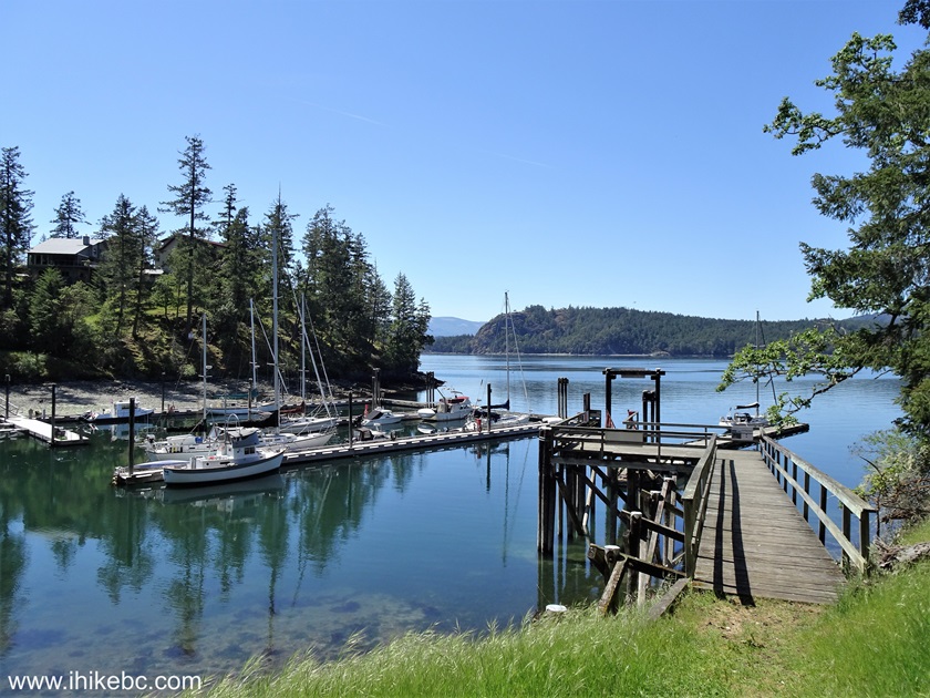
122. Now a view from the dock.

123. A bunch of small jellyfish were chilling by the dock.
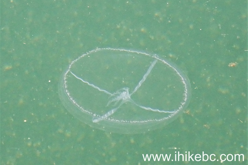
Here is our video of the jellyfish.
More ihikebc videos are on our YouTube Channel.
124. We then went to Burgoyne Bay Provincial Park. Here is the parking lot.

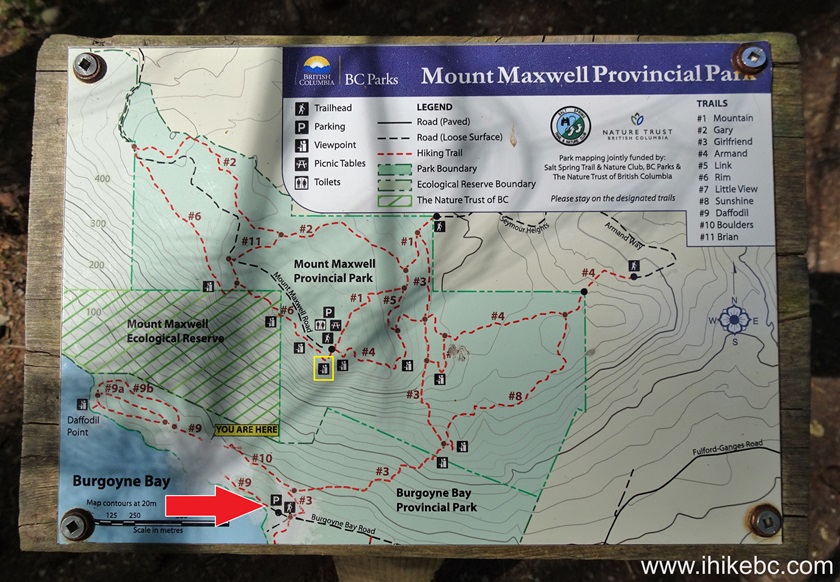
125. There are a few trails in Burgoyne Bay Provincial Park, but the views are not that great and far in-between. So, unless you just want to hike, there are much better destinations on Salt Spring Island. Interestingly enough, you can actually reach Mount Maxwell's fantastic viewpoints by hiking from here. Check out the map below. Red arrow at the bottom is the parking lot seen in photo #124, and the yellow square in the middle is Mount Maxwell's observation area by the parking lot there (here is our trip report). It would be a substantially longer hike compared to starting from Mount Maxwell, but it's there if you want it.
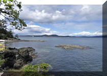
126. One of the better views in Burgoyne Bay Provincial Park.
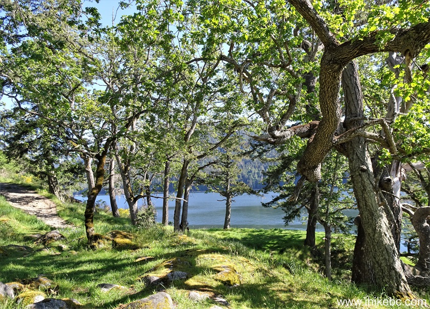
127. One more.

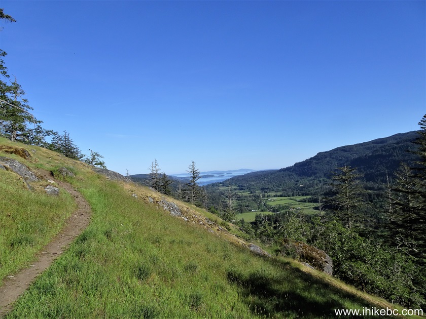
128. And the last one, on trail #8.
May 11, 2024 (Saturday)
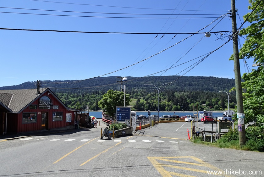
129. This was our last day on Salt Spring Island, and we took the ferry back from Fulford Harbour to Swartz Bay. Here we are at the entrance to Fulford Harbour ferry terminal located at the end of Fulford-Ganges Road.
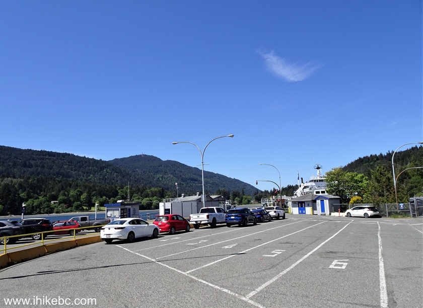
130. Joining the ferry lineup.
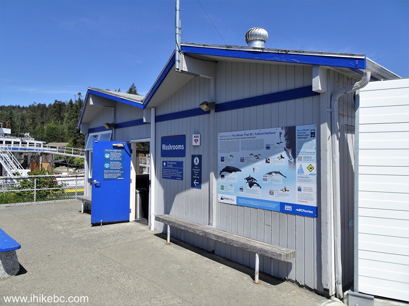
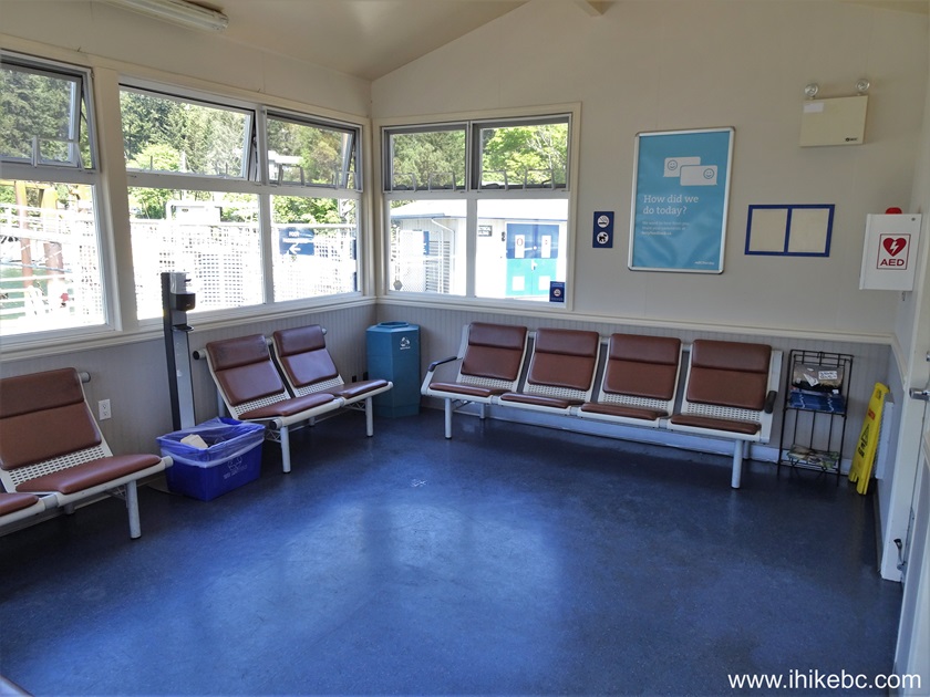
131. Here is the exterior of the passenger waiting area.
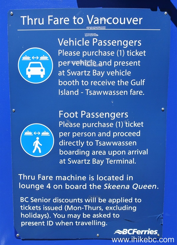
132. If you are heading from Swartz Bay to Tsawwassen on the next available ferry, purchase Thru Fare inside Lounge #4 of "Skeena Queen".
133-134. The interior of the waiting area. Washrooms are available.

135. Salt Spring Island is the only Southern Gulf Island with a transit system, and here is a map.
![]()
136. Salt Spring Island Transit sponsored the painting of the LGBTQ flag on the back of this bus.
![]()
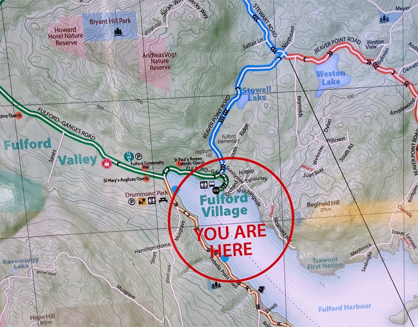
137. A zoomed shot of Salt Spring Island map posted at the ferry terminal shows Fulford Harbour location.
138-139. BC Ferry "Skeena Queen" approaching Fulford Harbour ferry terminal.
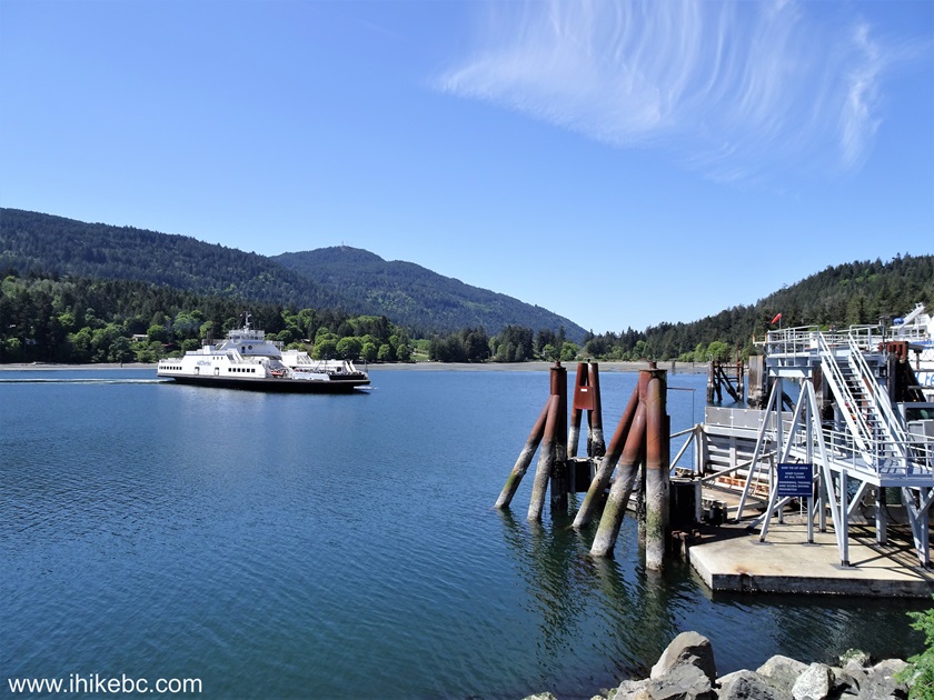
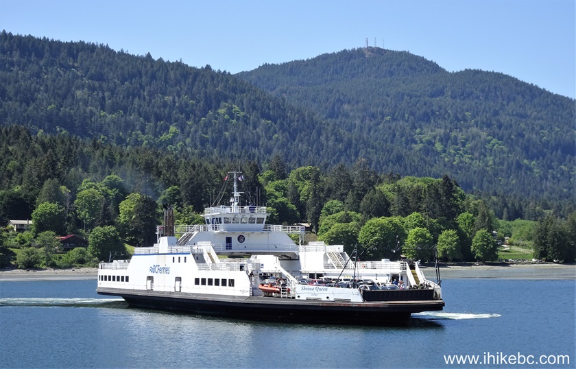
140. "Skeena Queen" has arrived.
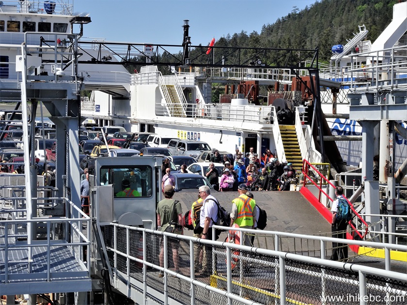
141. Passengers are waiting to disembark.

142. Here they come.

Here is our video of "Skeena Queen" arriving to Salt Spring Island and passengers disembarking.
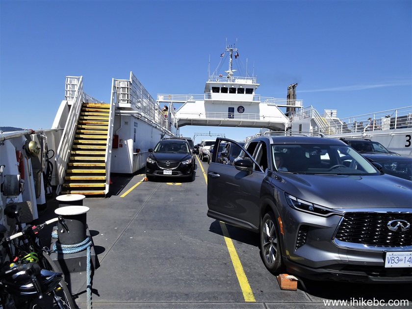
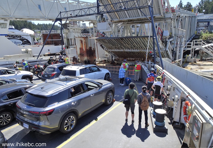
143. Now it's time to board.
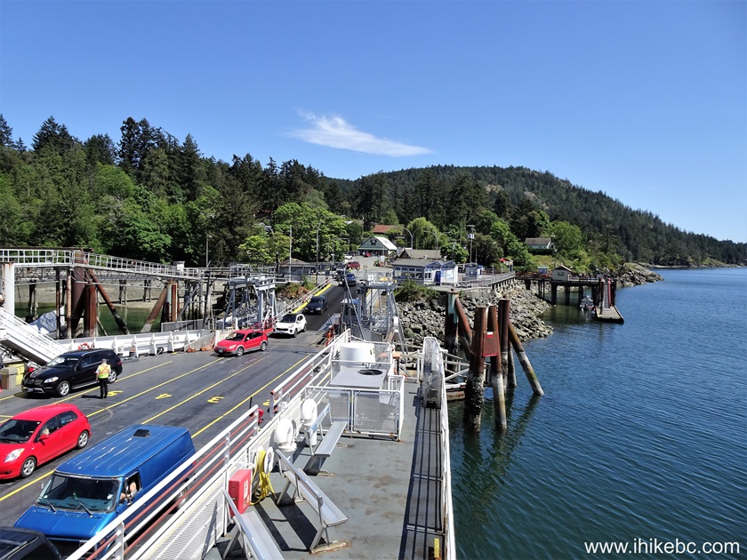
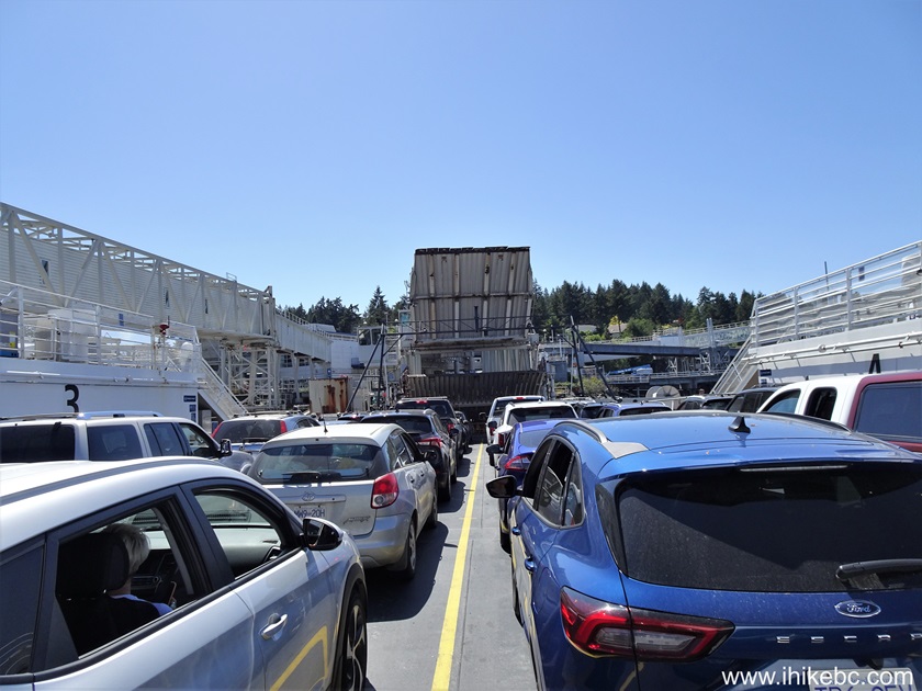
144. After the boarding.

145. Getting ready to depart.
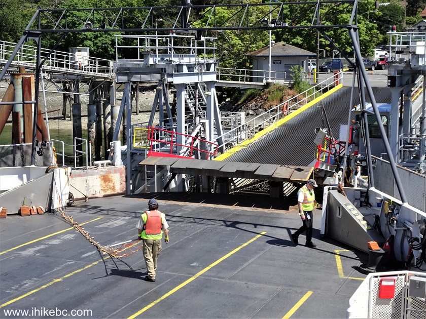
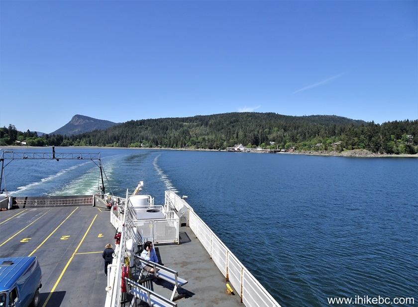
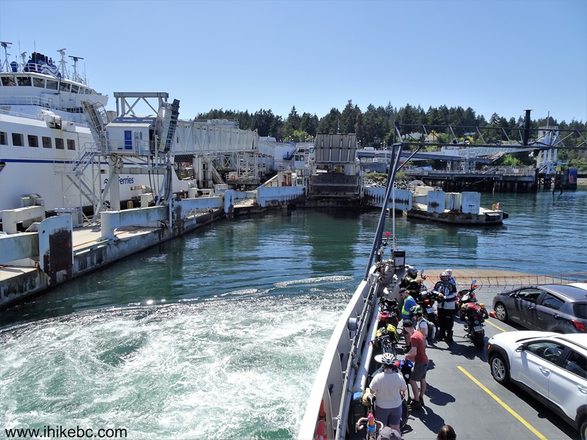
146. Good-bye, Salt Spring Island!
Here is our video of arriving in a vehicle to Fulford Harbour Terminal and boarding "Skeena Queen".
Followed by a video of "Skeena Queen" loading vehicles and departing Salt Spring Island.
147. Inside a lounge on "Skeena Queen".

148. The deck.
149. Approaching Vancouver Island - Swartz Bay ferry terminal.

150-152. "The Spirit of Vancouver Island" was arriving at the same time.
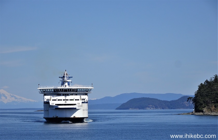
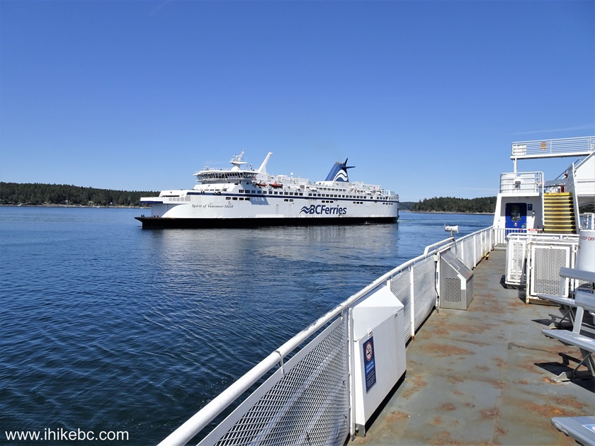

152. Almost there.
153. Ready to dock.
Here is our video of arriving to Swartz Bay ferry terminal aboard "Skeena Queen".
154. And ready to disembark after a 35 minute trip from Fulford Harbour.
Here is our video of disembarking "Skeena Queen" and starting to drive on Highway 17.
More ihikebc videos are on our YouTube Channel.
It was an interesting trip to Salt Spring Island, with several great hikes. Highly recommended.


|
 |
![]()
![]()
![]()
ihikebc.com Trip 305 - Salt Spring Island, BC Visit -
Page 5 of 5