![]()
![]()
![]()

Trip 232 - September 6, 2021 (Monday)
Porcupine Creek Route Hike
Near Clinton, British Columbia, Canada
Page 2 of 2
Liked:
Picturesque trail access road, mountain and valley views, numerous good forest scenes, a fine sub-alpine area, shade in the forest, no bugs, fairly easy trail until the last climb before the sub-alpine.Of Note: A high clearance and/or 4x4 vehicle may be required for trailhead access road, burned trees at the start and closer to the end of the trail could be unstable, several small creek crossings required, the trail could be difficult to follow at times – GPS with a trail ribbon recommended, a few holes in the ground – watch your step, a steep climb is required to reach the sub-alpine - hiking poles and boots are essential.
Cariboo Chilcotin Coast BC Backroad Mapbook (4th edition) Trailhead Coordinates: Page 5 (Big Bar Creek) E4.
Porcupine Creek Route Hike is an easy-to-moderately challenging trail (albeit with a very steep climb closer to the end), and leads to a fairly large sub-alpine area. It's 6 km to the sub-alpine, and then another 4 km to hike a very obvious loop in the sub-alpine, before heading back, for a total round-trip hiking distance of 20 km. The trailhead is found not too far from the town of Clinton, British Columbia, which is located on Highway 97 between Cache Creek (to the South) and 100 Mile House (to the North). It's an interesting hike for several reasons. The views are quite good, but also there are several trail splits with signs indicating that further hiking is also possible to Mt. Soues and Sam's Cabin.
Porcupine Creek Route starts as Porcupine Creek Trail, which is marked as such in our GPS with Backroad Mapbook software. However, a forest fire a few years ago made quite a mess closer to the sub-alpine, so, instead of turning left at about the 5 km mark to follow the trail ribbon in the GPS until the end, we figured it looked much easier to climb on the opposite (right) side, not knowing what to expect. It turned out that very fine views awaited in the sub-alpine area once we got there, so the Porcupine Creek Trail hike would have to wait for another day, and this would be more appropriately named Porcupine Creek Route hike.
Getting to the trailhead is straightforward. Once in Clinton, turn onto Kelly Lake Road from Highway 97. Then, 16.5 km later, turn right onto Jesmond Road, and, 5.5 km after that (22.0 km from Hwy 97), turn right onto Porcupine Creek trailhead access road. Any vehicle would make it to the beginning of the trailhead access road, but the 4.7 km-long access road has some deep ruts, so a medium clearance and, possibly, a 4x4 might be required. We made it to the trailhead in a 2WD medium/high clearance vehicle without any major issues, but the road was quite dry, with only one minor muddy spot.
The trail itself is not too hard, though a nearly 900-meter climb to reach the sub-alpine presents a good challenge. There are also three small creek crossings, which might become a problem during the spring run-off or after a heavy rain. Finally, a few parts of the trail are somewhat overgrown or damaged by fire, so a GPS with a trail ribbon might prove useful. Oh, and there is a large bear running around in that area, but that's to be expected.
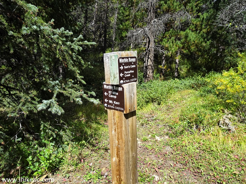
35-36. Yet another split is 200 meters later. To the right is Sam's Cabin. To the left is 57 Mile Camp (didn't see/find it), Mt. Kerr (ditto) and Porcupine Creek. Coordinates:
N 51⁰05.617' W 121⁰47.549'. Elevation: 1,591 meters.
Porcupine Creek Trail in Clinton BC Area
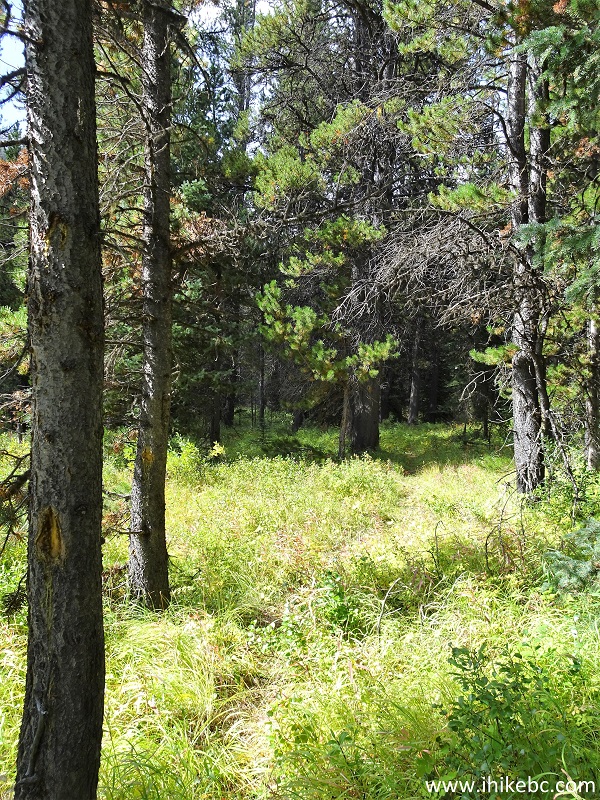
37. Porcupine Creek Trail at 2.1 km, 100 meters past the split seen above.
Porcupine Creek Hike Near Clinton British Columbia
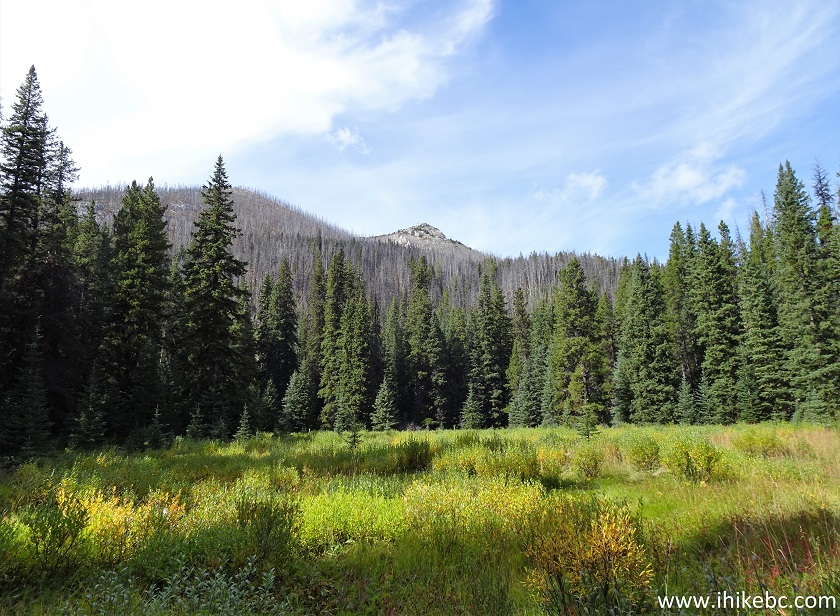
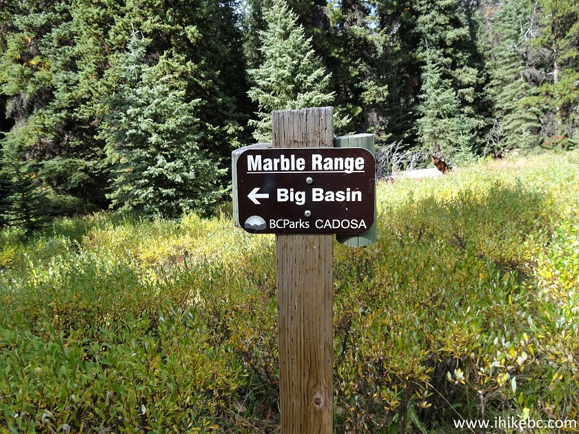
38. A large overgrown meadow (perhaps, this is the Big Swamp referred to by a sign seen in photo #32?) is at the 3.1 km mark of the trail. It's about 400 meters long, and wasn't swampy at all. But, again, late in the season and all that. Pretty much keep going straight towards the trees at the end of the meadow.
Porcupine Creek Trail - Hiking in Clinton BC Area
39. In the middle of the meadow and a bit to the right there is this sign saying "Big Basin" with an arrow pointing in our general direction of travel. And what is CADOSA?
British Columbia Hiking
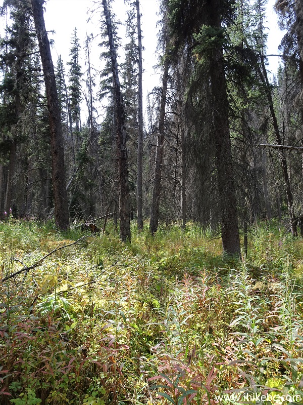
40. After the meadow, the trail is quite overgrown for several hundred meters. This is where a GPS with a trail ribbon would be most helpful.
Porcupine Creek Trail - Clinton BC Trail
41. Things start to get really interesting at the 4.55 km of the trail, as burned trees appear yet again, and make the trail almost impossible to follow, due to all the debris and new growth all over the place. Coordinates:
N 51⁰06.225' W 121⁰48.431'. Elevation: 1,790 meters.
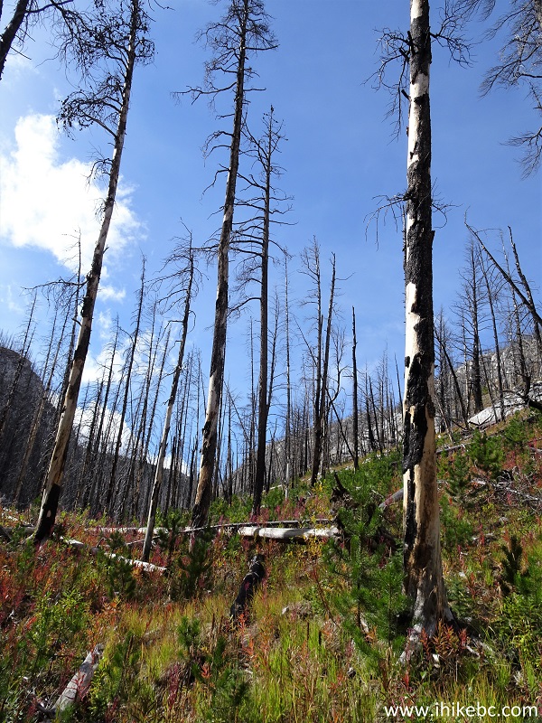
Porcupine Creek Trail - Clinton BC Hiking
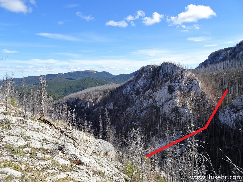
42. We just kept going straight, following the GPS trail ribbon as much as we could, until reaching the 5.05 km mark of the trail, seen in the photo below. Coordinates:
N 51⁰06.270' W 121⁰48.788'. Elevation: 1,826 meters. The GPS ribbon pointed to the left. But it looked very steep in that direction, with a whole lot of fallen trees. Climbing up would have been hard enough, but to tackle the fallen trees to boot would have been a touch too much. On the contrary, to the right, despite being (almost) as steep, the climb was not as long, and the trees were not nearly as numerous. So, we figured let's go right at first, see what's up there, and then decide what to do next.
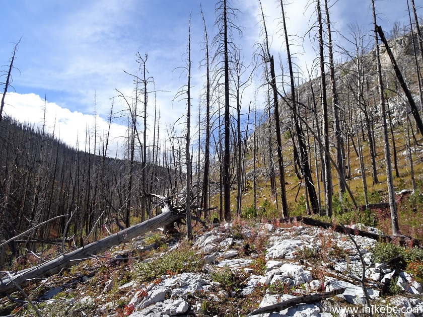
Porcupine Creek Trail British Columbia
43. Here is the view to the right from where we left Porcupine Creek Trail and started hiking Porcupine Creek Route.
Porcupine Creek Hiking Route Near Clinton British Columbia Canada
44. Having climbed up for about 300 meters, we looked back, and here is what we would have had to climb had we continued with Porcupine Creek Trail.
Porcupine Creek Route
45. Those burned trees looked quite interesting.
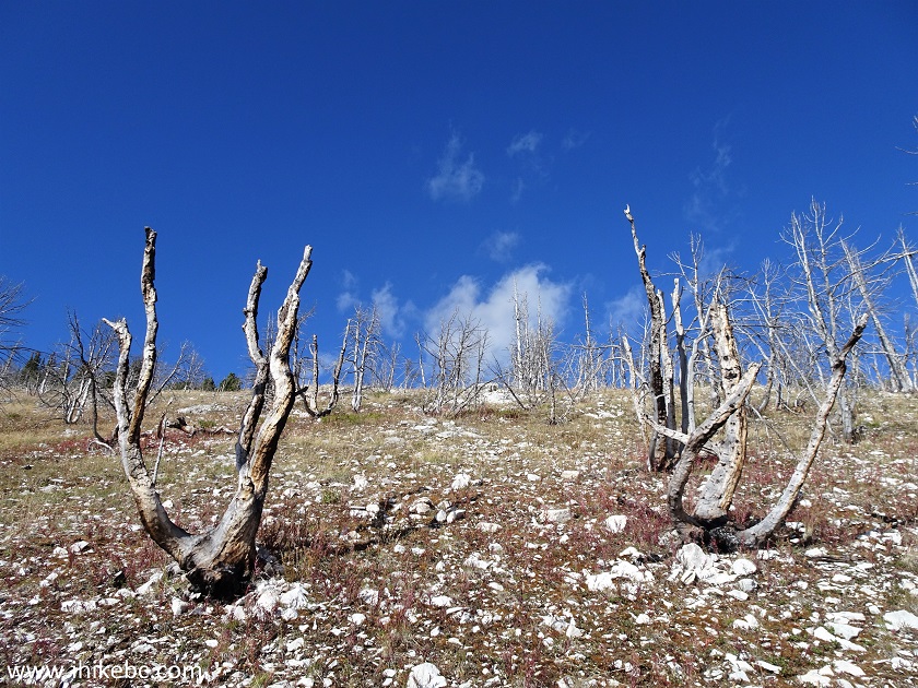
Burned Trees on Porcupine Creek Hiking Route
46. Approaching the sub-alpine.
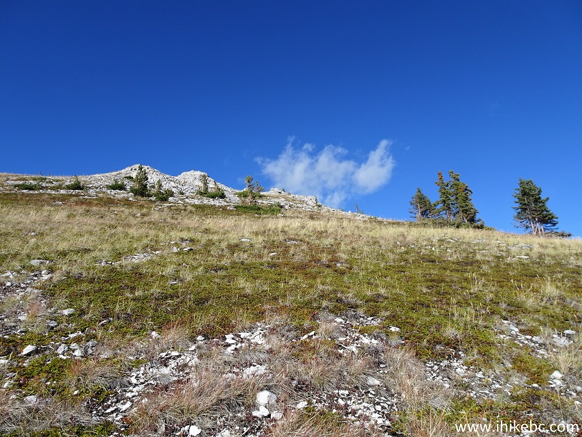
Clinton BC Hiking - Porcupine Creek Route
47. Looking to the right as we climb.
Porcupine Creek Route - British Columbia Hiking
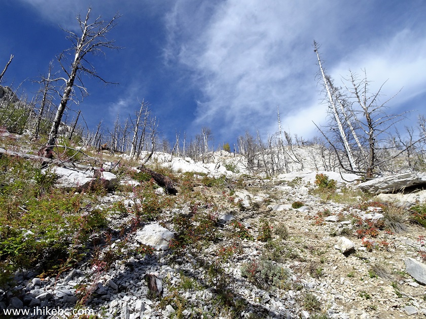
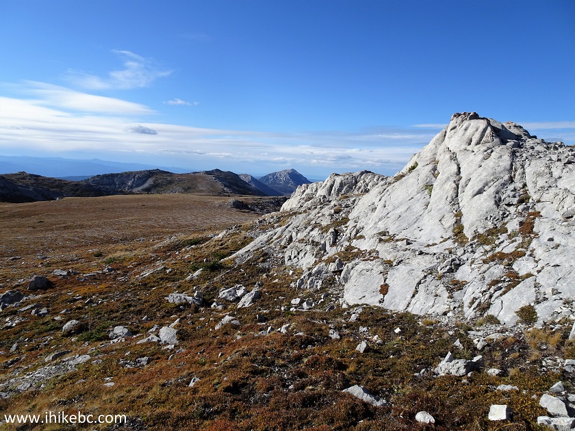
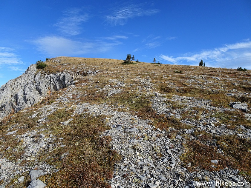
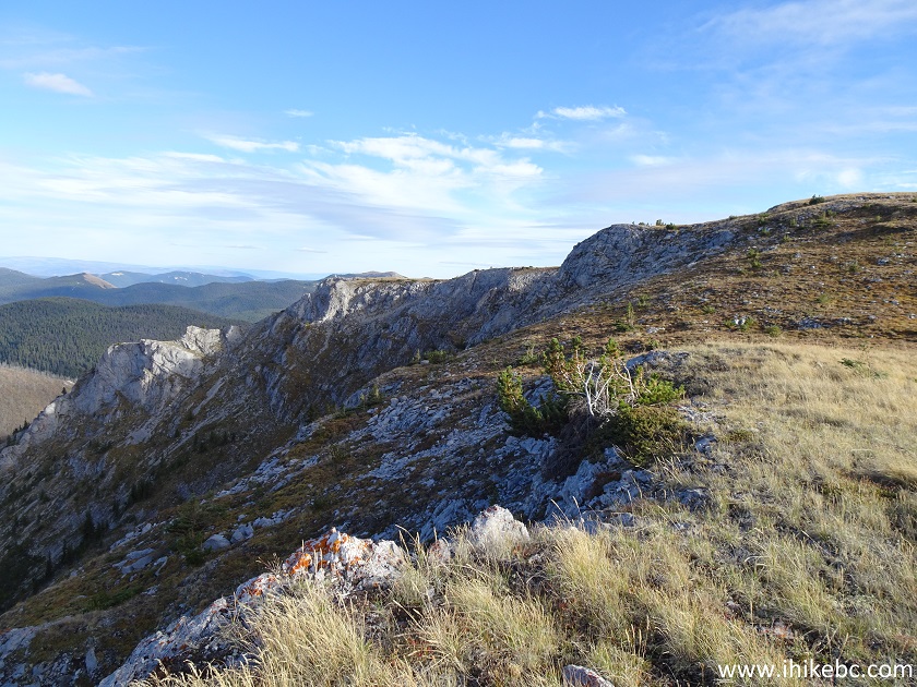
48. The steep hike before the sub-alpine took just under 900 meters. At about 5.9 km from the trailhead, we have reached the top. Looking back here. Approximate coordinates:
N 51⁰06.604' W 121⁰48.711'. Elevation: 2,140 meters.
Porcupine Creek Route - Hiking in British Columbia Canada
Here is our video of the views in this area.
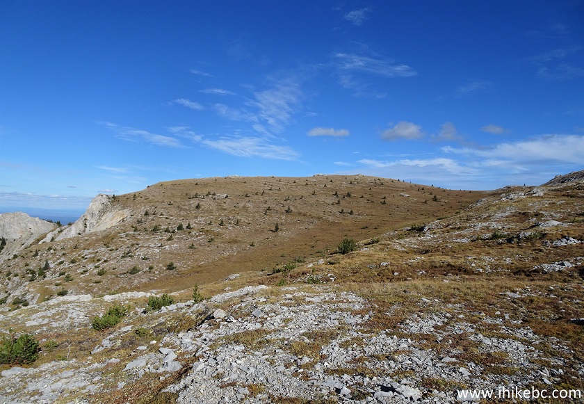
49. We then hiked a clockwise loop around the sub-alpine for close to 4 kilometers. At 400 meters here.
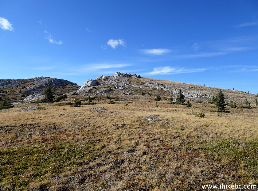
Porcupine Creek Route Sub-alpine Area
50. Having reached the top of a hill seen in the photo above, we looked back at where we came from. We reached the sub-alpine on the far right of the photo below.
Porcupine Creek Route - British Columbia Hike
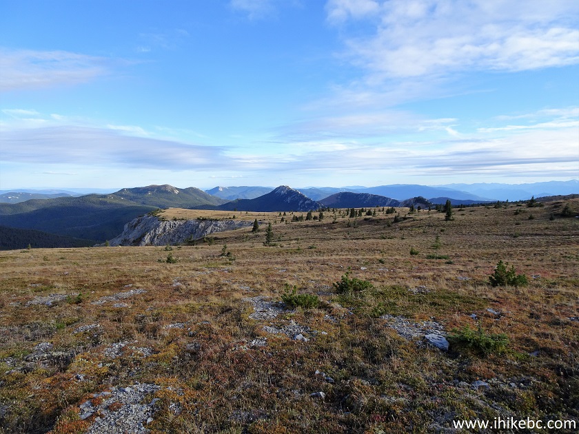
51. The sub-alpine panorama from this spot.
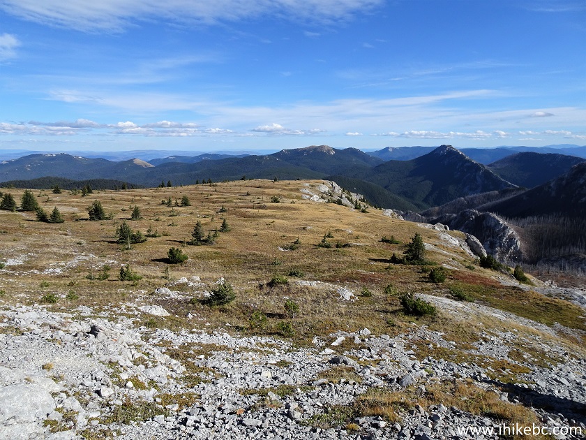
52. Moving on, at 1.2 km of the sub-alpine hike now.
Canada Hiking - Porcupine Creek Route near Clinton BC
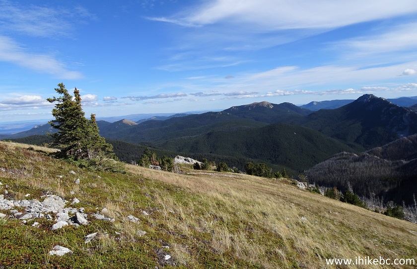
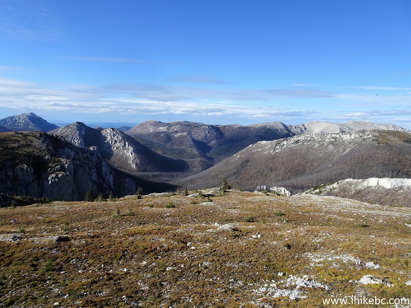
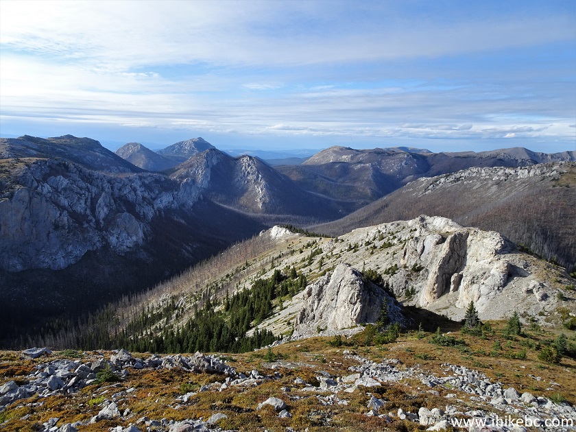
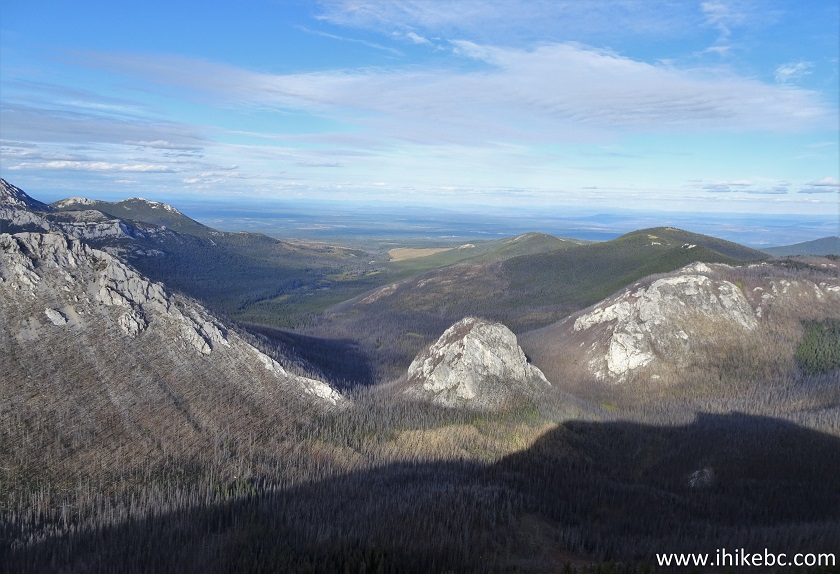
53. At 1.8 km, very fine mountain views appeared straight ahead and to the right. The fire made the views a bit less appealing due to all the burned trees, but the new growth is happening quickly, so it would all look even better as years go by.
Porcupine Creek Route Hike in British Columbia Canada
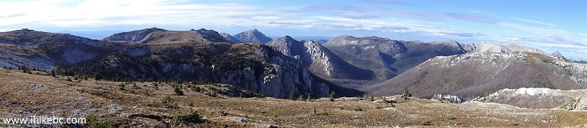
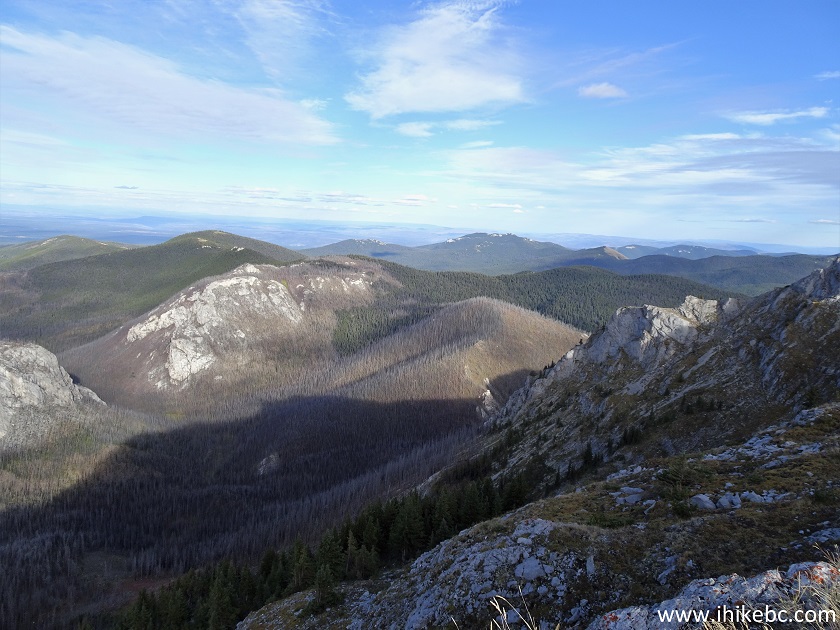
54. Another panorama of the place.
55. Continuing our clockwise sub-alpine hike. At 1.84 km here.
BC Hiking - Porcupine Creek Route
56. Looking left.
Hiking in British Columbia
57. Now at 2.3 km.
Porcupine Creek Hiking Route in Clinton British Columbia Canada Area
58. Another fine view.
View from Porcupine Creek Route
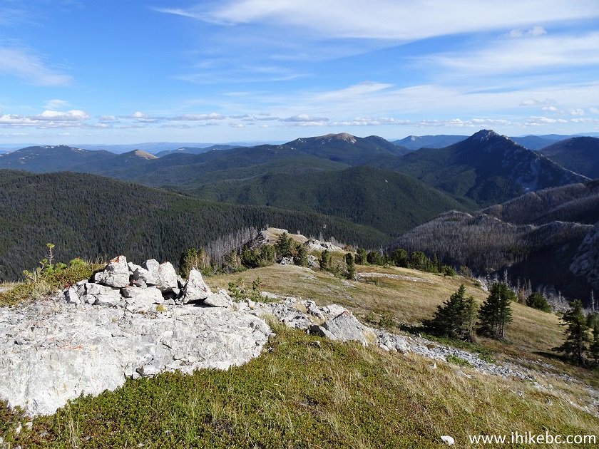
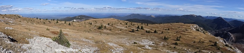
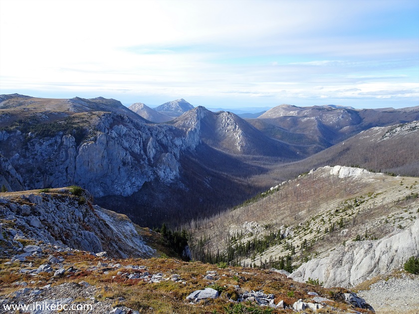
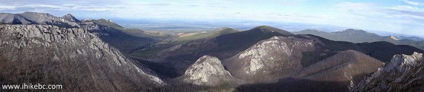
59-63. A very impressive panoramic view is at the 2.83 km mark. Just wait till the green stuff grows back. Left to right.
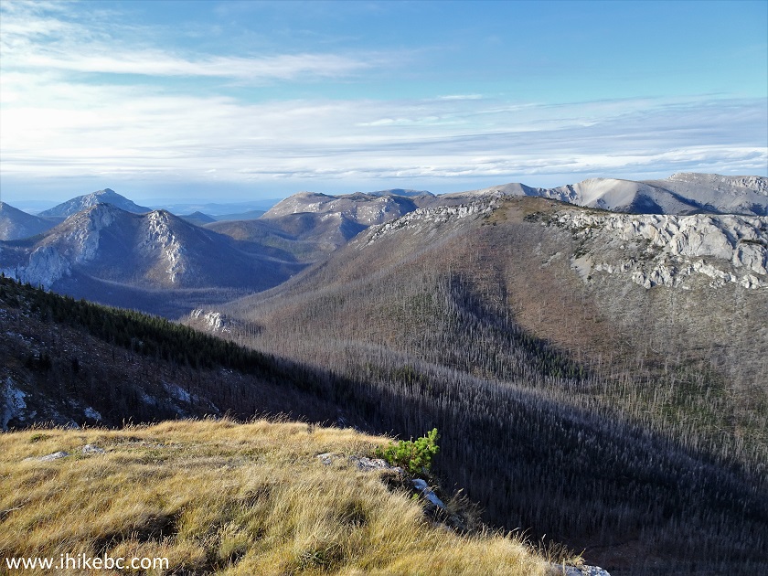

64. Now (almost) all together.
Here is our video of the views in this area.
65. Just a bit further, a large valley view to the left.
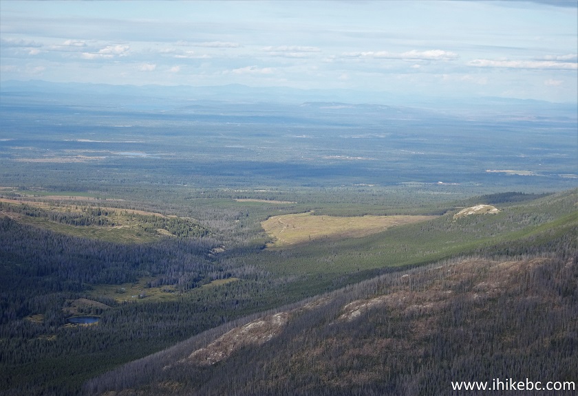
Valley View from Porcupine Creek Route Hike
66. We then continued the sub-alpine loop hike and returned back to the starting point seen in photo #48.
Porcupine Creek Route Hike British Columbia Canada
Just as we were about to start descending, we've noticed what appeared to be a bear a few hundred meters away. Sure enough, it was a bear eating something from a tree.
Here is our video of that bear.
More ihikebc videos are on our YouTube Channel.
Porcupine Creek Route is a decent hike with several very impressive views. Highly recommended.


|
 |
![]()
![]()
![]()
ihikebc.com Trip 232 - Porcupine Creek Route Hike (near Clinton BC) Page 2 of 2