![]()
![]()
![]()

Trip 156 - June 10, 2019 (Monday)
Embleton Mountain Lookout Hike
Near Kamloops BC
Location of Trailhead: Approximately 37 kilometers North of
Kamloops via Highway 5, Old Highway 5, Tod Mountain Road, and
Heffley-Louis Creek Road.
Liked: Lake views, fairly easy trail, shade in the forest, no bugs.
Of Note: There are numerous intersecting trails on Embleton Mountain, making it a somewhat confusing hiking environment. The actual lookout is overgrown. A good lake view area has very steep unbarricaded drop-offs. Cows may be present in the area. Hiking boots and poles are recommended.
Thompson Okanagan BC Backroad Mapbook (4th edition) Trailhead Coordinates: Page 28 (Barriere) G6.
Embleton Mountain is located close to Kamloops, and its trailhead is found by the road leading to Sun Peaks Resort, across Heffley Lake Recreation Area. There are many intersecting trails on Embleton Mountain, and the overall goal is to keep to the left while climbing higher, until you reach a lookout. Alas, the designated lookout is grossly overgrown, though it does feature a gazebo and two picnic tables. However, there are at least three "undesignated" lookouts nearby, one better than the other, providing very fine views of Heffley Lake and the surrounding area. Due to the overabundance of intersecting trails, it is not possible to give turn-to-turn directions to those lookouts. This is where a GPS with Backroad Mapbook software might prove quite handy. We will indicate GPS coordinates for those good lookouts, and, hopefully, you will be able to find them and get to enjoy very fine views. Embleton Mountain hike is easy-to-moderately challenging most of the time. That said, closer to the best lookout, the trail gets quite steep, and you would be glad to have hiking boots and poles, especially on the way down.
1. We are on Northbound on BC Highway 5, just over 18 km past a Husky gas station by Paul Lake Rd on the Northern edge of Kamloops, getting ready to turn right onto Old Highway 5. A sign indicates that Sun Peaks Resort is that way too.
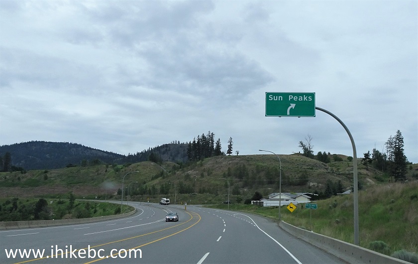
BC Highway 5 North at Old Highway 5 Turnoff near Kamloops
2. Having turned to the right, almost immediately (several hundred meters later) turn to the left in front of Heffley Creek Store and another Husky gas station onto Tod Mountain Road. The sign, again, indicates that this would lead you to Sun Peaks Resort.
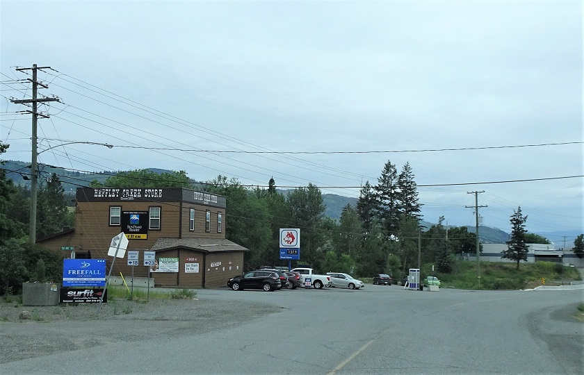
Old Highway 5 at Tod Mountain Road Turnoff near Kamloops BC Canada
3. Now on Tod Mountain Road. It would become Heffley-Louis Creek Road in a few kilometers. We would not reach Sun Peaks Resort, which is 32 kilometers from here - Embleton Mountain trailhead is only 18 kilometers further (about 37 kilometers from Kamloops).
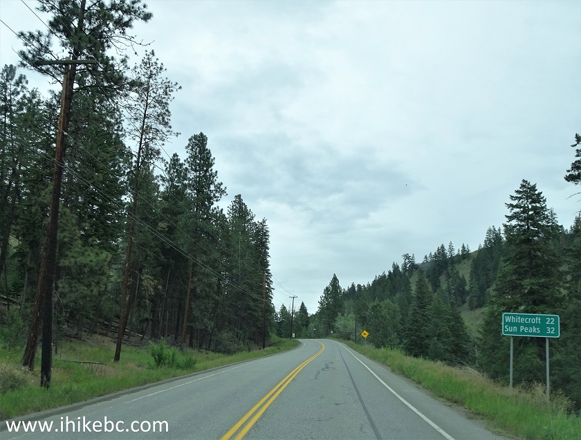
Tod Mountain Road by Kamloops British Columbia Canada
4. Once you reach Heffley Lake Recreation Area pictured below, get ready - Embleton Mountain trailhead is 300 meters later on the left side.
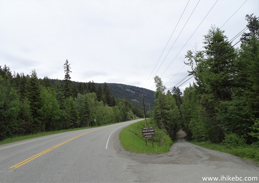
Heffley Lake Recreation Area Entrance on Heffley-Louis Creek Road near
Kamloops BC
5. And here is the turnoff from Heffley-Louis Creek Rd onto Embleton Mountain trailhead.
Heffley-Louis Creek Road near Embleton Mountain Trailhead
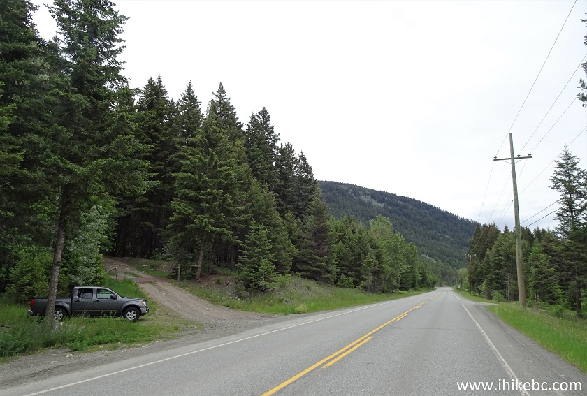
6. Looking at the trailhead from the road. There is limited parking available by the road. But, if you drive straight onto Embleton Mountain Road, which is rather rough, there is plenty of parking a few hundred meters further on. Coordinates for the trailhead: N 50⁰50.333' W 120⁰02.298'. Elevation: 968 meters.
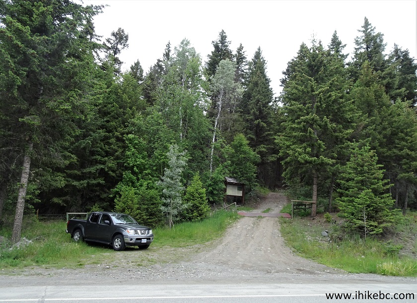
Embleton Mountain Trailhead near Kamloops BC
7. There is a big information board seen in the photo above. However, it's quite worn out, and its much better version is at that Embleton Mountain parking area (P2). You get to learn that the mountain was named after Tony Embleton, who helped to develop a network of trails on the mountain. There used to be a portable sawmill operating on Embleton Mountain, so the trails are the combination of the roads used by the sawmill, and developed hiking trails.
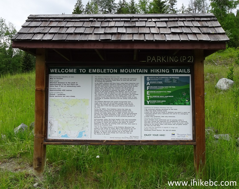
Embleton Mountain Information Stand near Kamloops British Columbia
Canada
8. Here is a close-up of the Embleton Mountain trails map. As you can see, quite a network. We've indicated with a red arrow the trailhead seen in photo #6. The white square shows another trailhead off Heffley-Louis Creek Road, but we did not see it, so who knows if it's still there. The yellow square shows where the official lookout (the overgrown one) is located. Climb up and keep to the left, and good things just might happen on this hike.
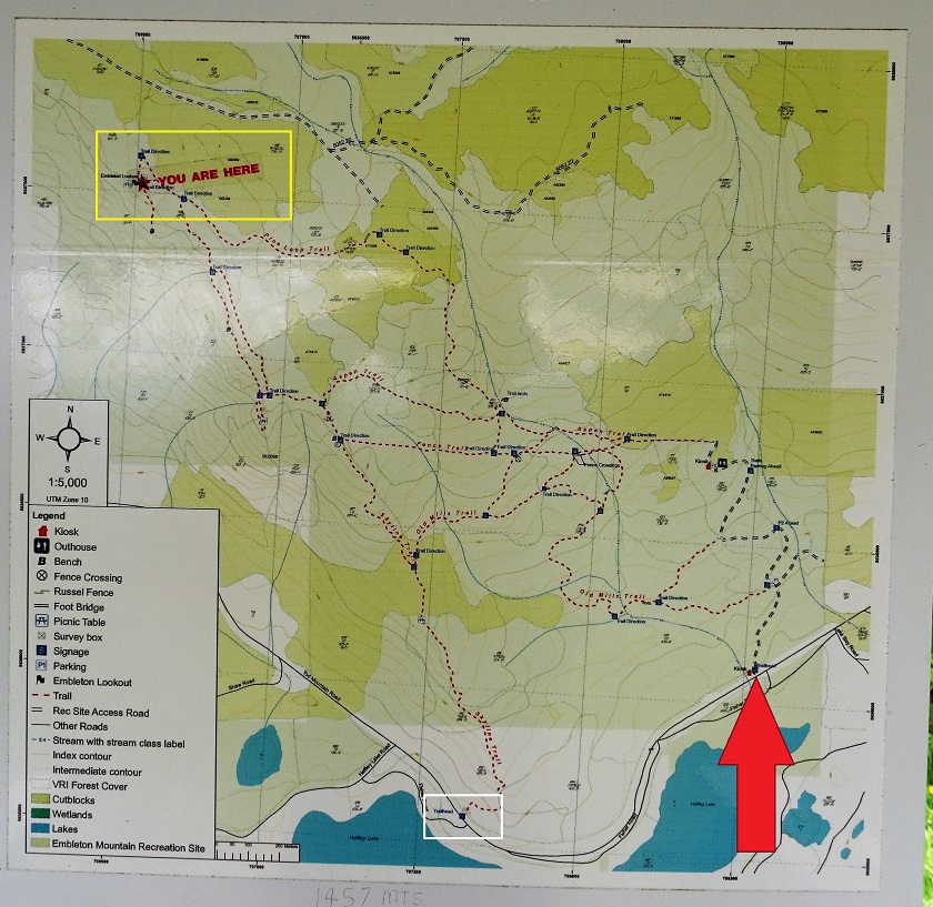
Kamloops Hiking - Embleton Mountain Trails Map
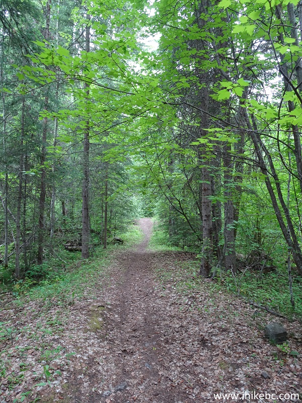
9. Proceeding from the parking area.
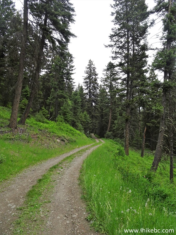
Hiking in Kamloops Area - Embleton Mountain
10. A few cows were grazing nearby. Watch your step.
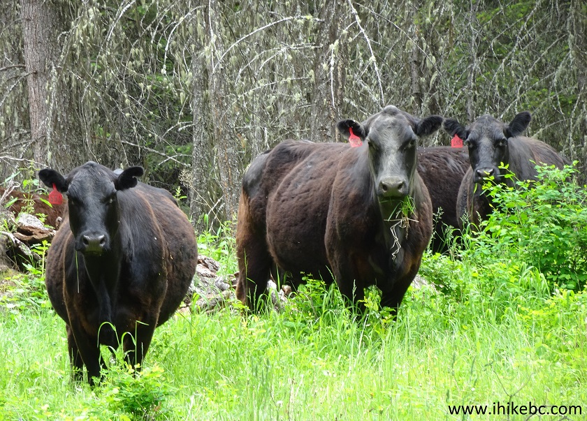
Cows on Embleton Mountain near Kamloops British Columbia
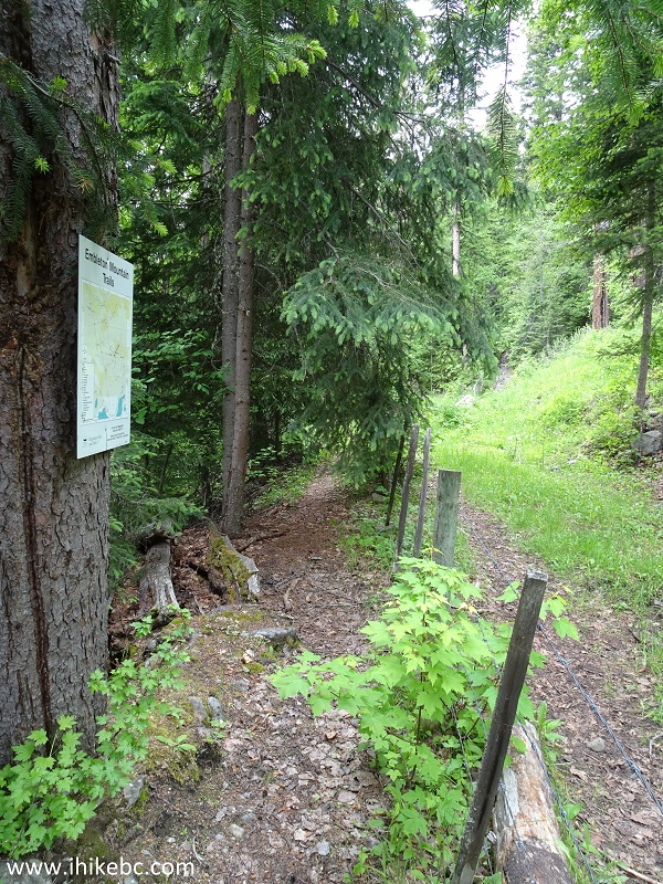
11. There are trail arrows here and there, and maps of the trail network are posted at key intersections.
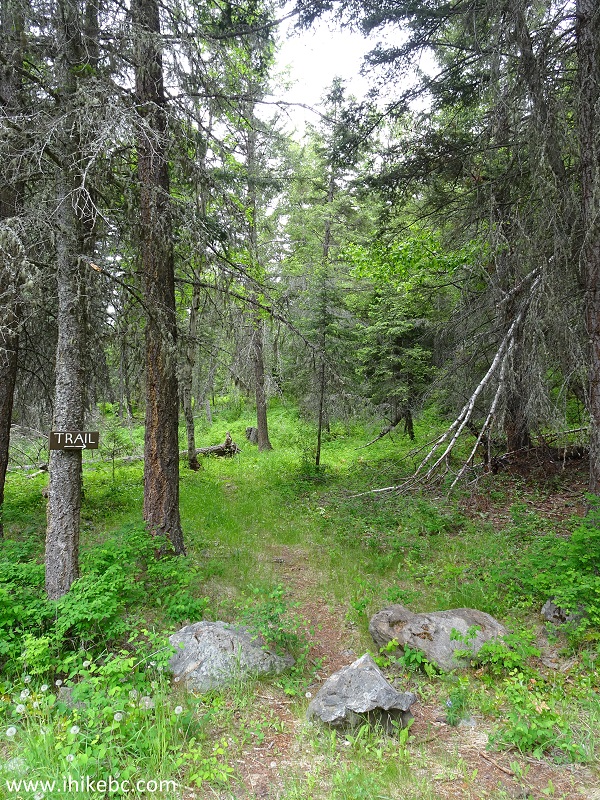
Embleton Mountain - Kamloops Hiking
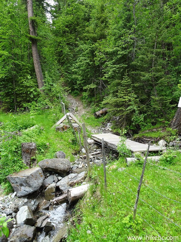
12. A neat footbridge on Embleton Mountain.
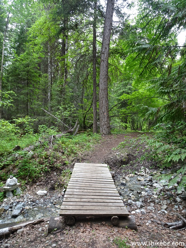
Embleton Mountain Hike in Kamloops BC Canada Area
13. This hike would be especially good to take when Kamloops is having one of those 30+ degrees days. Shade is in abundance on Embleton Mountain.
Kamloops Trail - Embleton Mountain Trail
14. Also in abundance is barbed wire fencing. Probably, to keep cows from falling off the mountain.
Hiking in BC - Embleton Mountain Trails Near Kamloops
15. At some point, there is this stone-hopping area.
Hiking in British Columbia - Embleton Mountain Trails by Kamloops
16. And here is how you go across the barbed wire fence at this location. Most other places have a neat ladder leading over the fence.

Hiking in Kamloops Area - Embleton Mountain Trail
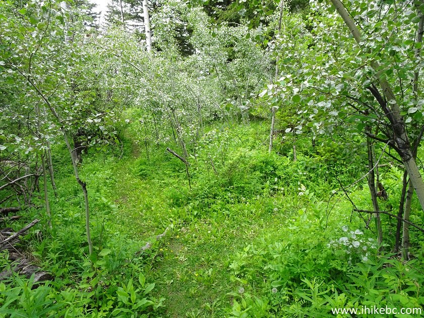
17. The trail after the fence. The first good viewpoint will appear shortly.
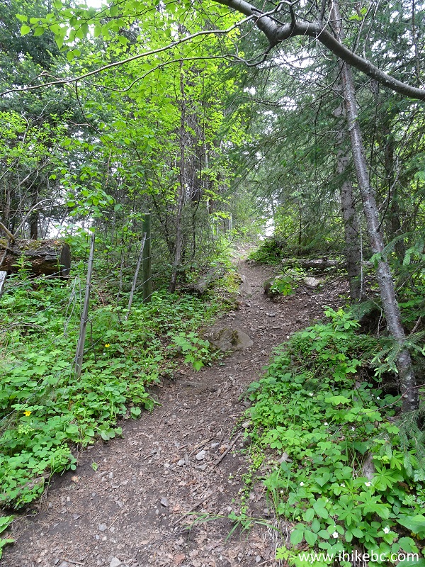
Embleton Mountain Hiking - Kamloops Hike BC Canada
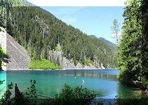
18. And here is the first viewpoint. That's Heffley Lake down there. Coordinates: N 50⁰50.726' W 120⁰03.408'. Elevation: 1,275 meters. There is a bench located by this viewpoint. It took us about 1.5 hours of hiking to get to this point, and our travelled distance was close to 4 kilometers. Your mileage and timing may vary, depending on which trails you take to get here.
Heffley Lake View from Embleton Mountain - Kamloops Hiking
19. A bit further, there is this split. Go to the left to reach the second viewpoint. Coordinates for the split: N 50⁰50.799' W 120⁰03.607'. Elevation: 1,295 meters. Also, this is where a most wonderful thing took place. While trying to figure out which way to go, we heard a very loud buzzing noise within a meter or so to our right. We thought it was a giant wasp, turned to look, and there, at our eye level, suspended in mid-air while flapping its wings, was a grey hummingbird staring at us. It did not wait for its picture to be taken, and took off.
Embleton Mountain - Hiking in British Columbia near Kamloops
20. Here is the second viewpoint, located several hundred meters from the split pictured above. Coordinates: N 50⁰50.751' W 120⁰03.618'. Elevation: 1,299 meters. There is a picnic table located by this viewpoint.
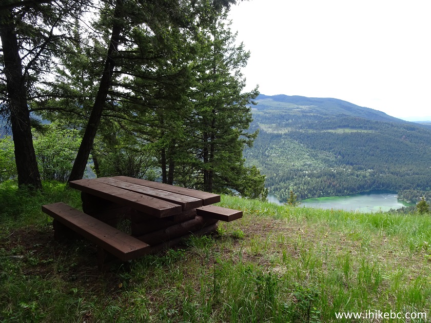
Picnic Table on Embleton Mountain near Kamloops BC
22. The view from the second viewpoint is very good, though not as panoramic as from the third and best viewpoint. However, reaching the third viewpoint requires tackling the steepest part of the trail, so the second viewpoint might be a good final destination.
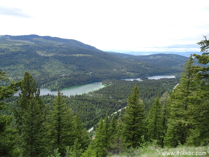
Heffley Lake near Kamloops BC Canada
22. Now, the real uphill hiking begins. It's short, but challenging, and is much steeper than it looks in the photo below.
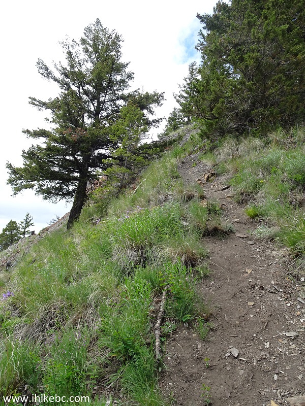
Kamloops BC Hiking - Embleton Mountain
23. This might be a better representation of how steep this part of Embleton Mountain is. We are looking to the left here.
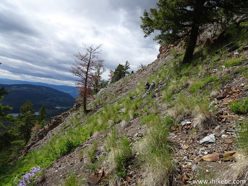
Hiking on Embleton Mountain near Kamloops BC
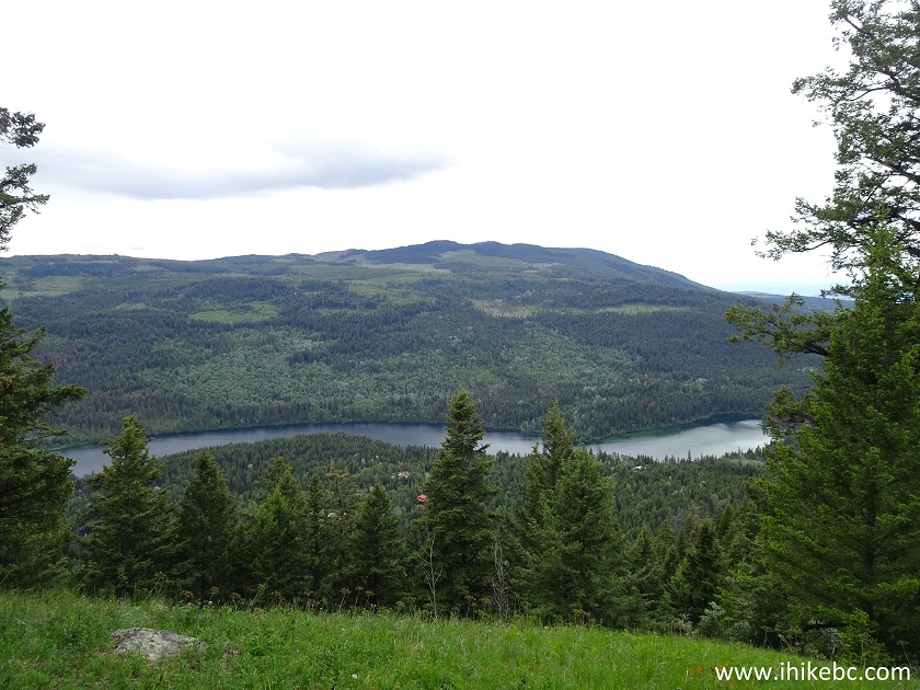
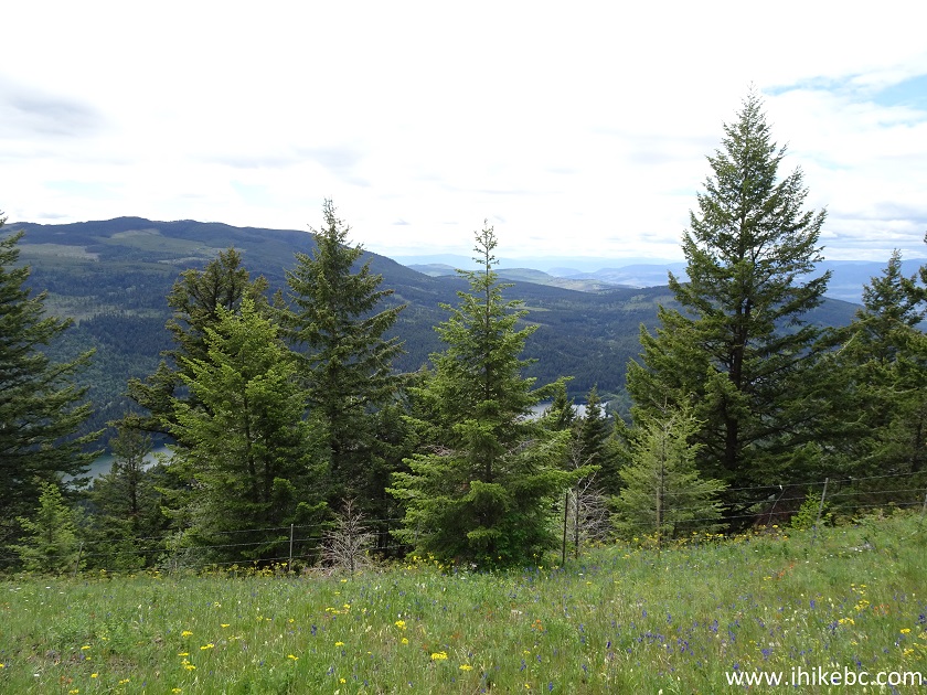
24-26. You reward is a very fine panoramic view of Heffley Lake and the surrounding area. Some road noise is present, just like at the first two viewpoints. Coordinates: N 50⁰50.920' W 120⁰03.716'. Elevation: 1,395 meters. We hiked for about 5 kilometers in 2 hours and 15 minutes to get here.
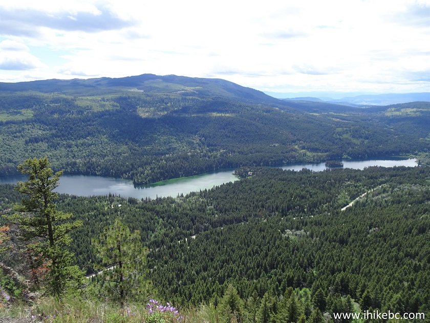
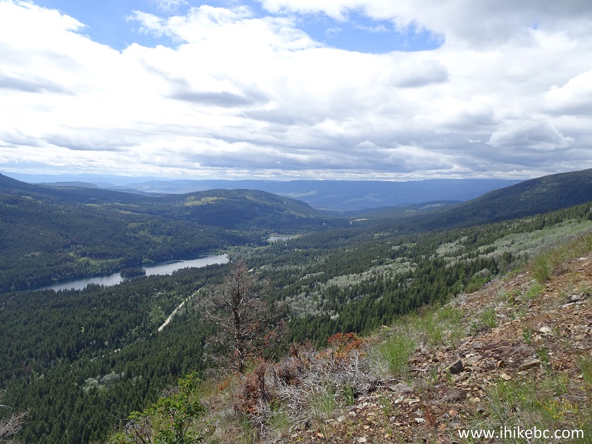
Kamloops Hiking - View from Embleton Mountain
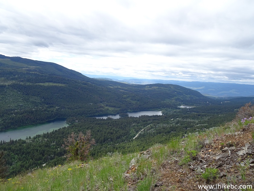
27. A panorama of the place.

Here is our video of the views from Embleton Mountain
More ihikebc videos are on our YouTube Channel.
28. WARNING - DANGEROUS AREA. Beware of steep unbarricaded drop-offs while admiring Heffley Lake from this viewpoint.
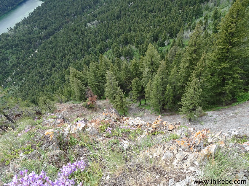
Steep drop-off at Embleton Mountain near Kamloops BC Canada
29. We then proceeded to the official lookout, hoping for an even better view.
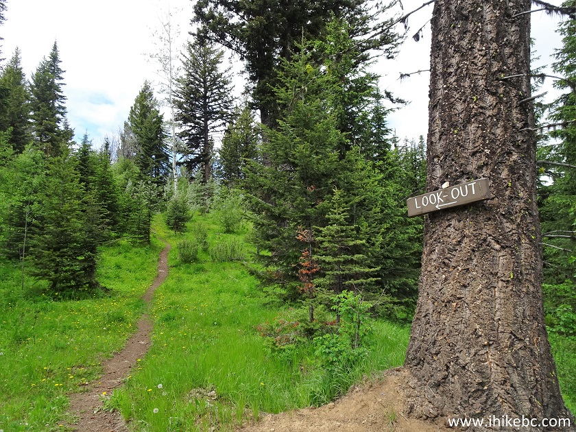
Embleton Mountain Hiking in Kamloops Area
30. We have reached the lookout shortly. There was a gazebo and two picnic tables present. Coordinates: N 50⁰51.150' W 120⁰03.955'. Elevation: 1,444 meters (476 meters elevation gain from the trailhead).
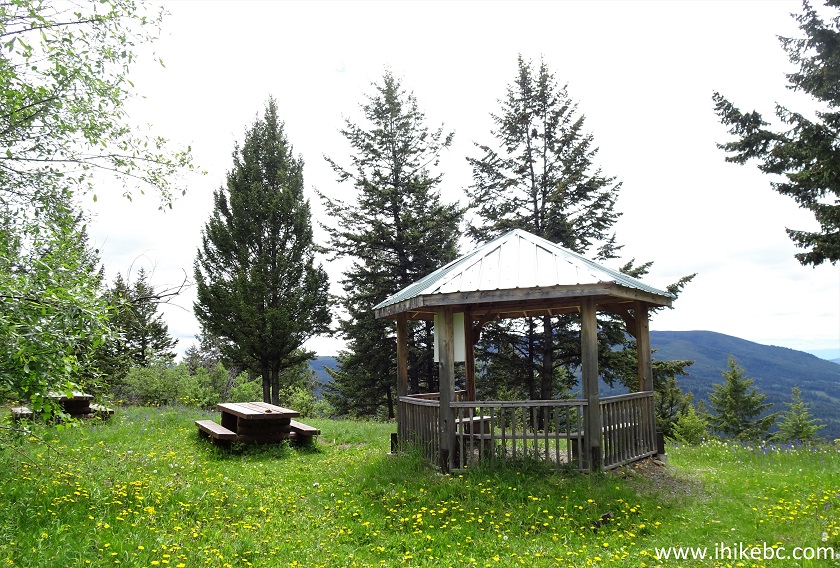
Gazebo and picnic tables at the official Embleton Mountain Lookout
31. But the viewpoint was badly overgrown.
Overgrown Viewpoint on Embleton Mountain near Kamloops BC Canada
Embleton Mountain hiking trails are fairly easy, and lead to several very impressive views of Heffley Lake and the surrounding area. Just watch out for those drop-offs. Highly recommended.


|
 |
![]()
![]()
![]()
ihikebc.com Trip 156 - Embleton Mountain Lookout Hike (Near Kamloops BC)